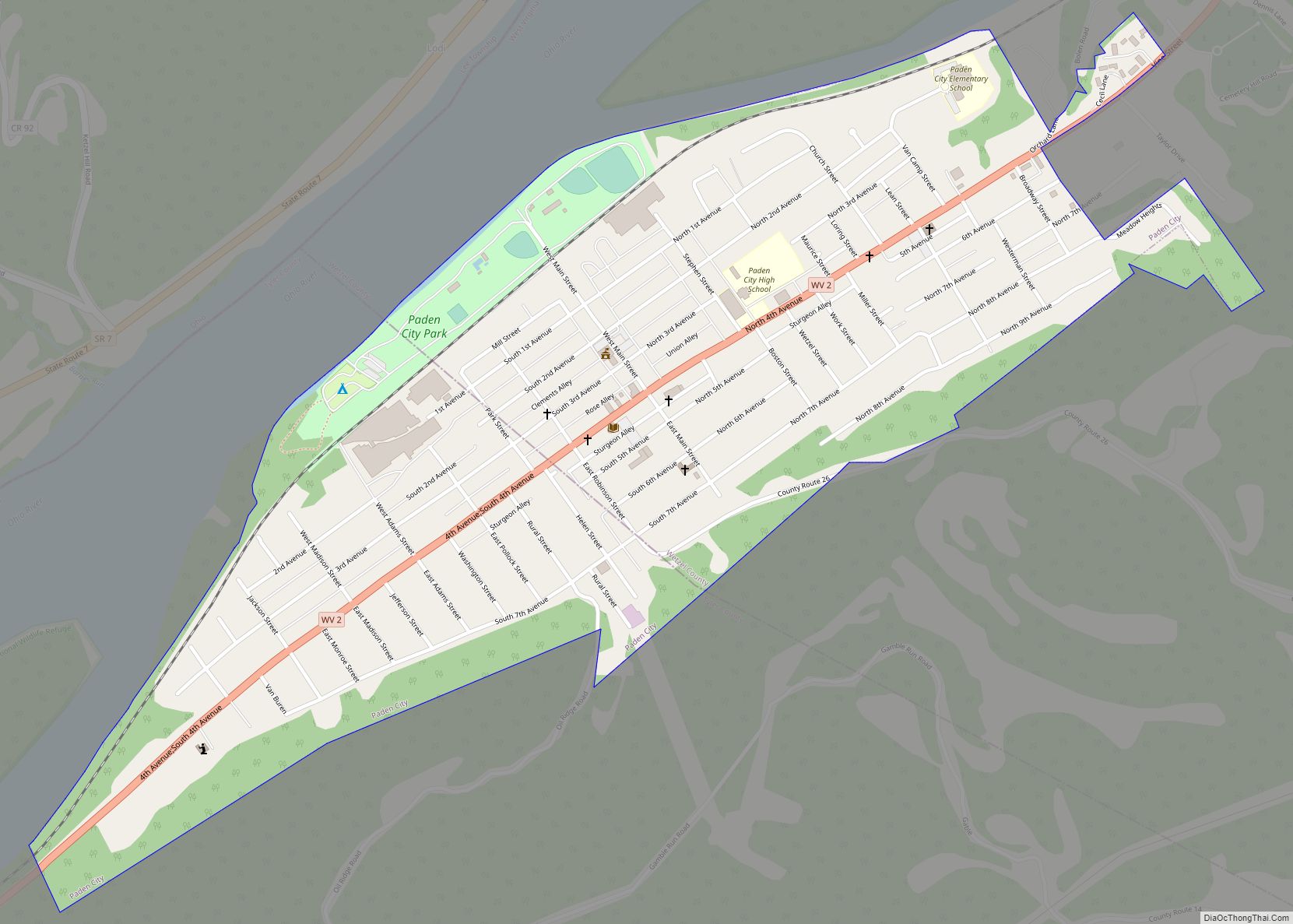
Paden City is a city in Tyler and Wetzel counties in the U.S. state of West Virginia, along the Ohio River. It was founded in 1902. The population was 2,550 at the 2020 census.
The town was named for Pennsylvania-born Obediah Paden (1755-1822), a local landowner. Nearby Paden Island and Paden Fork were also named for this individual, and the entire region, when owned by Paden, was known as Paden’s Bottom.
| Name: | Paden City city |
|---|---|
| LSAD Code: | 25 |
| LSAD Description: | city (suffix) |
| State: | West Virginia |
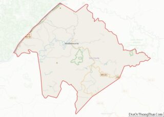
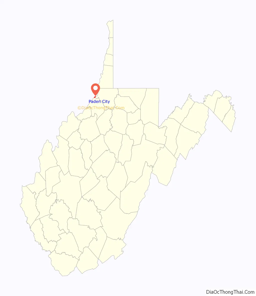
| County: | Tyler County, Wetzel County |
| Elevation: | 659 ft (201 m) |
| Total Area: | 0.84 sq mi (2.19 km²) |
| Land Area: | 0.84 sq mi (2.19 km²) |
| Water Area: | 0.00 sq mi (0.00 km²) |
| Total Population: | 2,550 |
| Population Density: | 2,764.50/sq mi (1,066.82/km²) |
| ZIP code: | 26159 |
| Area code: | 304 |
| FIPS code: | 5461636 |
| GNISfeature ID: | 1555291 |
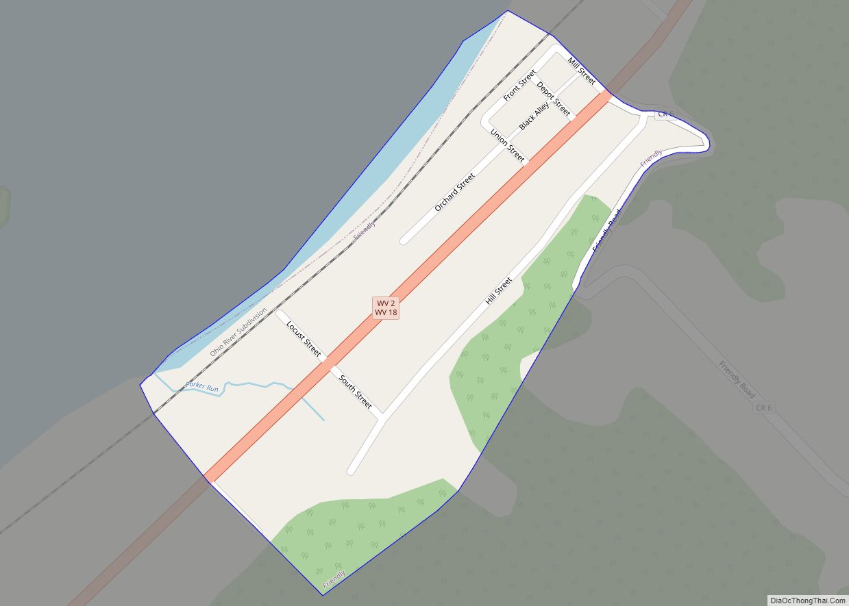
Online Interactive Map
Click on ![]() to view map in "full screen" mode.
to view map in "full screen" mode.
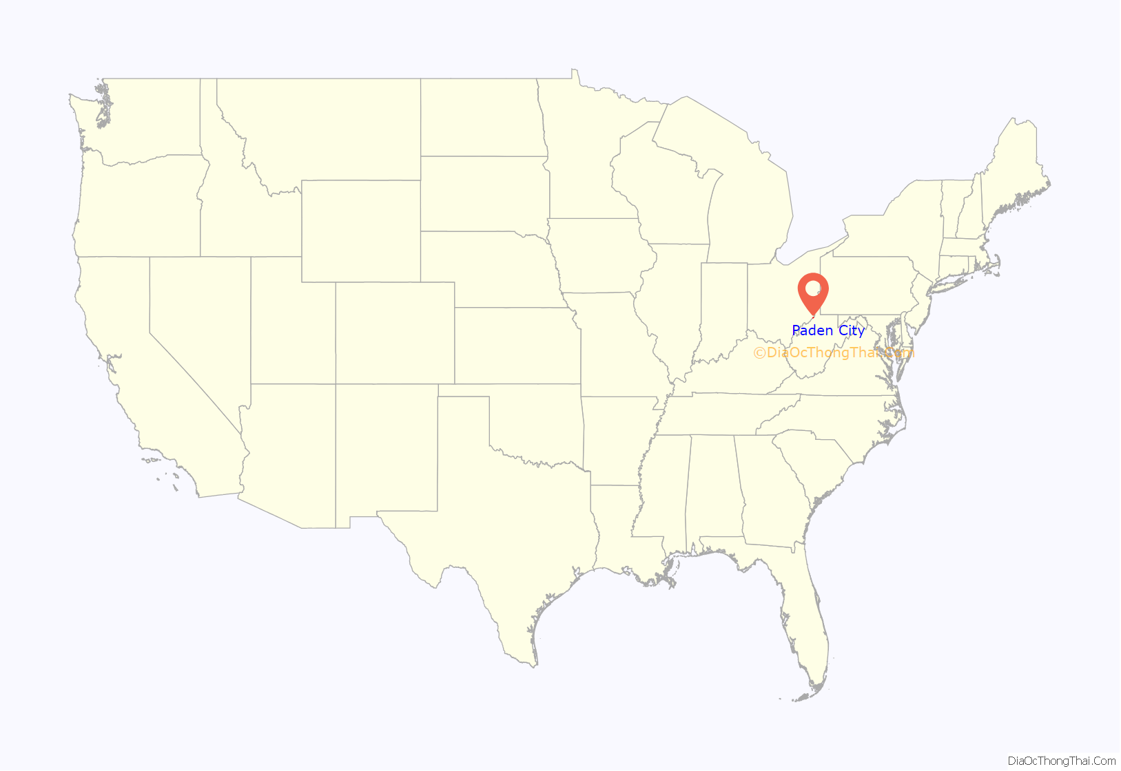
Paden City location map. Where is Paden City city?
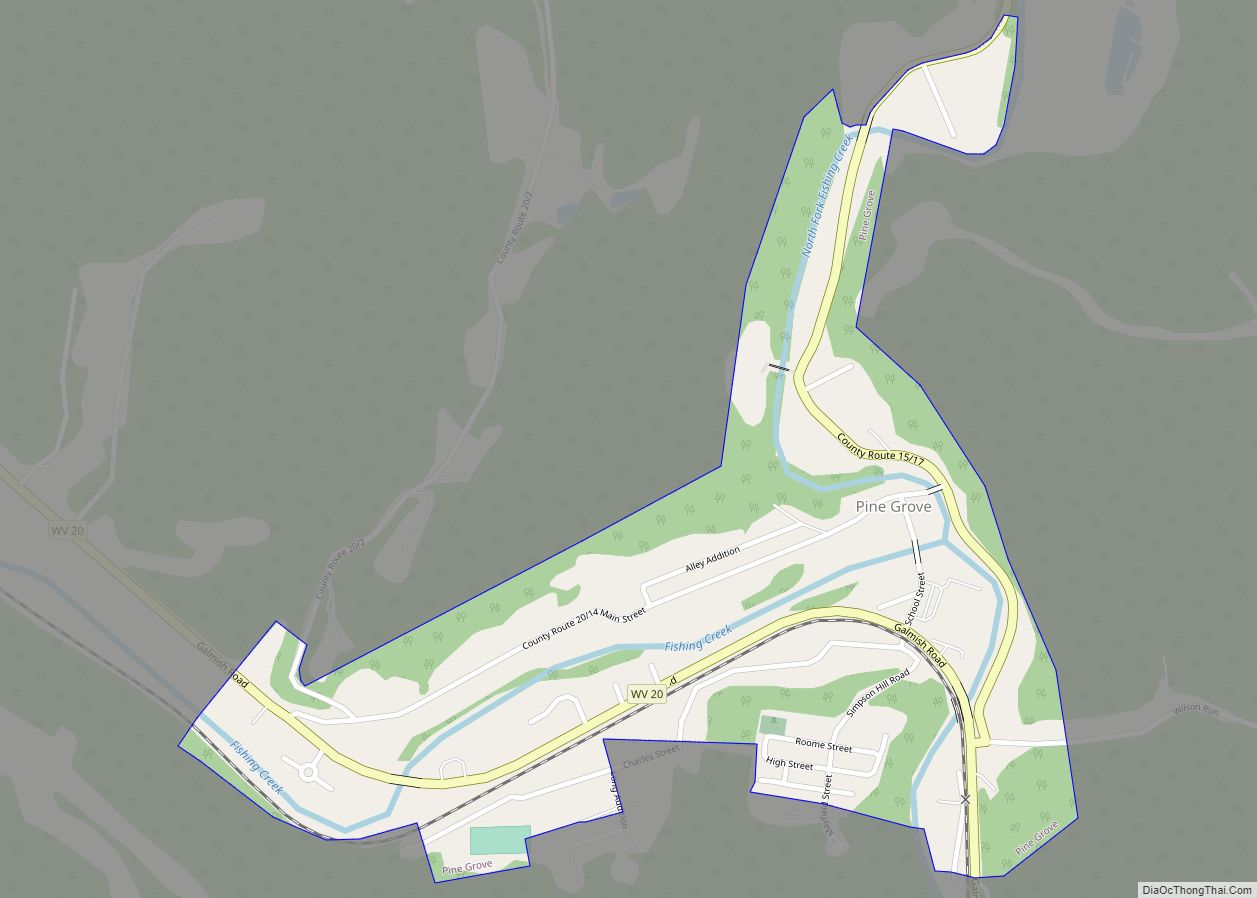
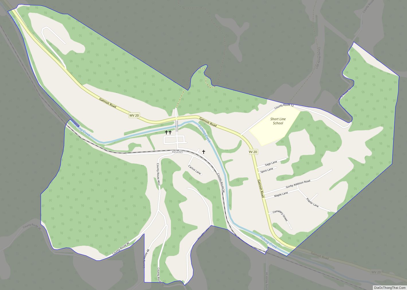
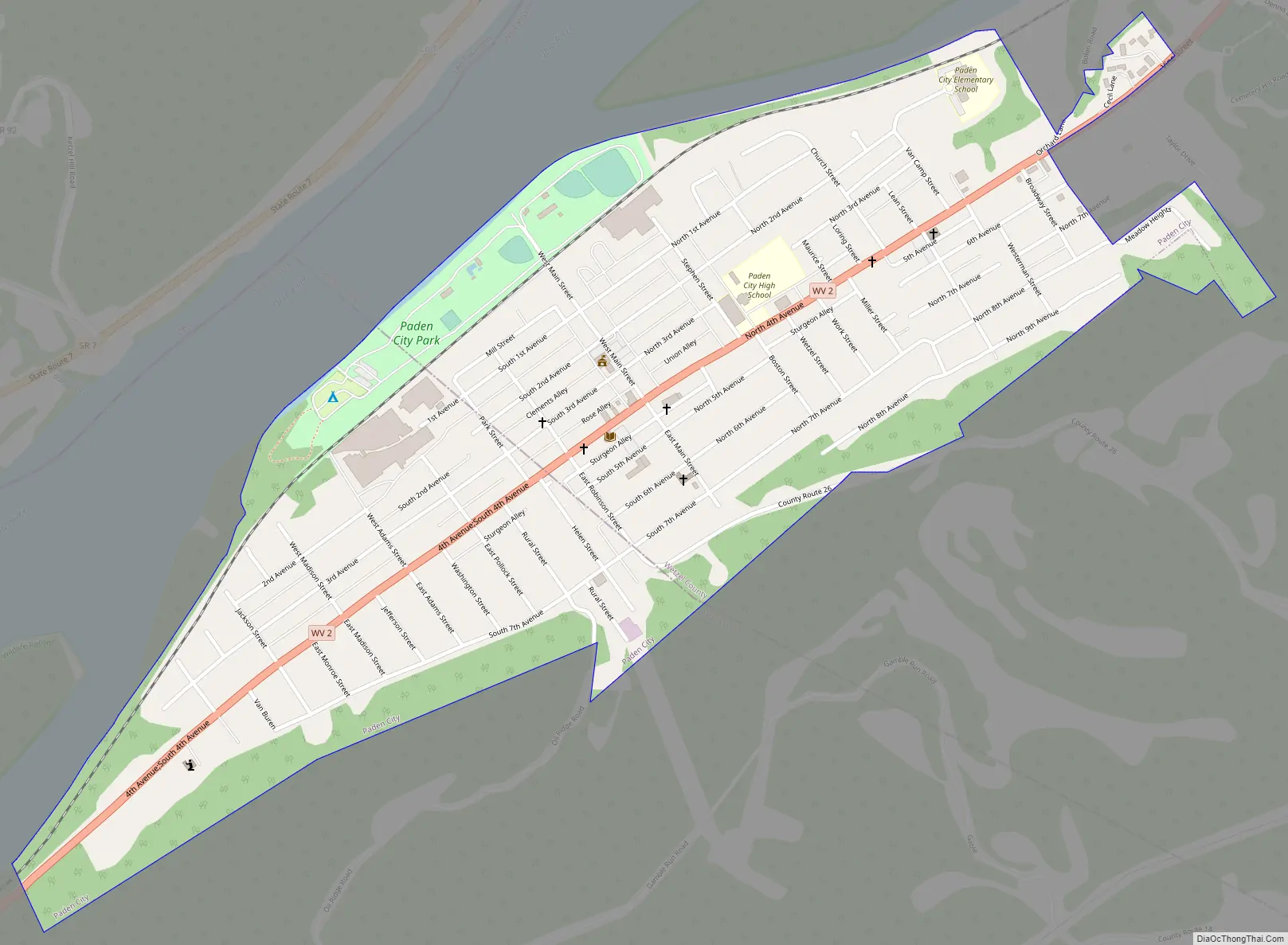
Paden City Road Map
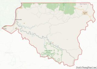
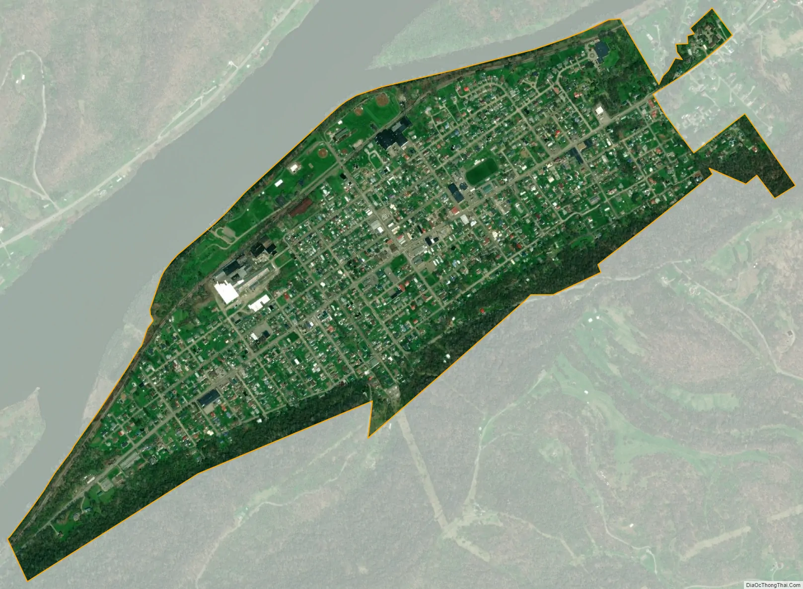
Paden City city Satellite Map
Geography
Paden City is located at 39°36′13″N 80°56′1″W / 39.60361°N 80.93361°W / 39.60361; -80.93361 (39.603571, -80.933683).
According to the United States Census Bureau, the city has a total area of 0.85 square miles (2.20 km), all land.
See also
Map of West Virginia State and its subdivision:- Barbour
- Berkeley
- Boone
- Braxton
- Brooke
- Cabell
- Calhoun
- Clay
- Doddridge
- Fayette
- Gilmer
- Grant
- Greenbrier
- Hampshire
- Hancock
- Hardy
- Harrison
- Jackson
- Jefferson
- Kanawha
- Lewis
- Lincoln
- Logan
- Marion
- Marshall
- Mason
- McDowell
- Mercer
- Mineral
- Mingo
- Monongalia
- Monroe
- Morgan
- Nicholas
- Ohio
- Pendleton
- Pleasants
- Pocahontas
- Preston
- Putnam
- Raleigh
- Randolph
- Ritchie
- Roane
- Summers
- Taylor
- Tucker
- Tyler
- Upshur
- Wayne
- Webster
- Wetzel
- Wirt
- Wood
- Wyoming
- Alabama
- Alaska
- Arizona
- Arkansas
- California
- Colorado
- Connecticut
- Delaware
- District of Columbia
- Florida
- Georgia
- Hawaii
- Idaho
- Illinois
- Indiana
- Iowa
- Kansas
- Kentucky
- Louisiana
- Maine
- Maryland
- Massachusetts
- Michigan
- Minnesota
- Mississippi
- Missouri
- Montana
- Nebraska
- Nevada
- New Hampshire
- New Jersey
- New Mexico
- New York
- North Carolina
- North Dakota
- Ohio
- Oklahoma
- Oregon
- Pennsylvania
- Rhode Island
- South Carolina
- South Dakota
- Tennessee
- Texas
- Utah
- Vermont
- Virginia
- Washington
- West Virginia
- Wisconsin
- Wyoming