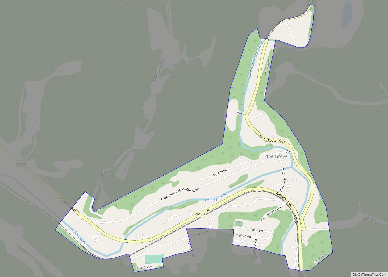
Pine Grove is a town in Wetzel County, West Virginia, United States. The population was 363 at the 2020 census. The community was named for a grove of pine trees near the original town site.
The town is one mile north of Dominion Energy’s large Hastings Extraction Station, which separates natural gas into various subproducts such as butane. The Hastings plant is unique in that there are traffic signals approximately 0.75 mile away from the plant in either direction to stop traffic in case of an emergency. Pine Grove is also home to Valley High School.
| Name: | Pine Grove town |
|---|---|
| LSAD Code: | 43 |
| LSAD Description: | town (suffix) |
| State: | West Virginia |
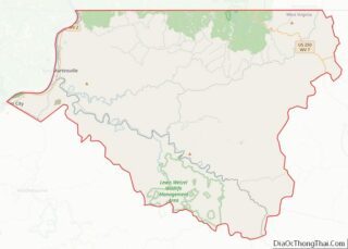
| County: | Wetzel County |
| Total Area: | 0.38 sq mi (0.98 km²) |
| Land Area: | 0.35 sq mi (0.91 km²) |
| Water Area: | 0.03 sq mi (0.07 km²) |
| Total Population: | 363 |
| Population Density: | 1,369.32/sq mi (528.64/km²) |
| FIPS code: | 5463892 |
Online Interactive Map
Click on ![]() to view map in "full screen" mode.
to view map in "full screen" mode.
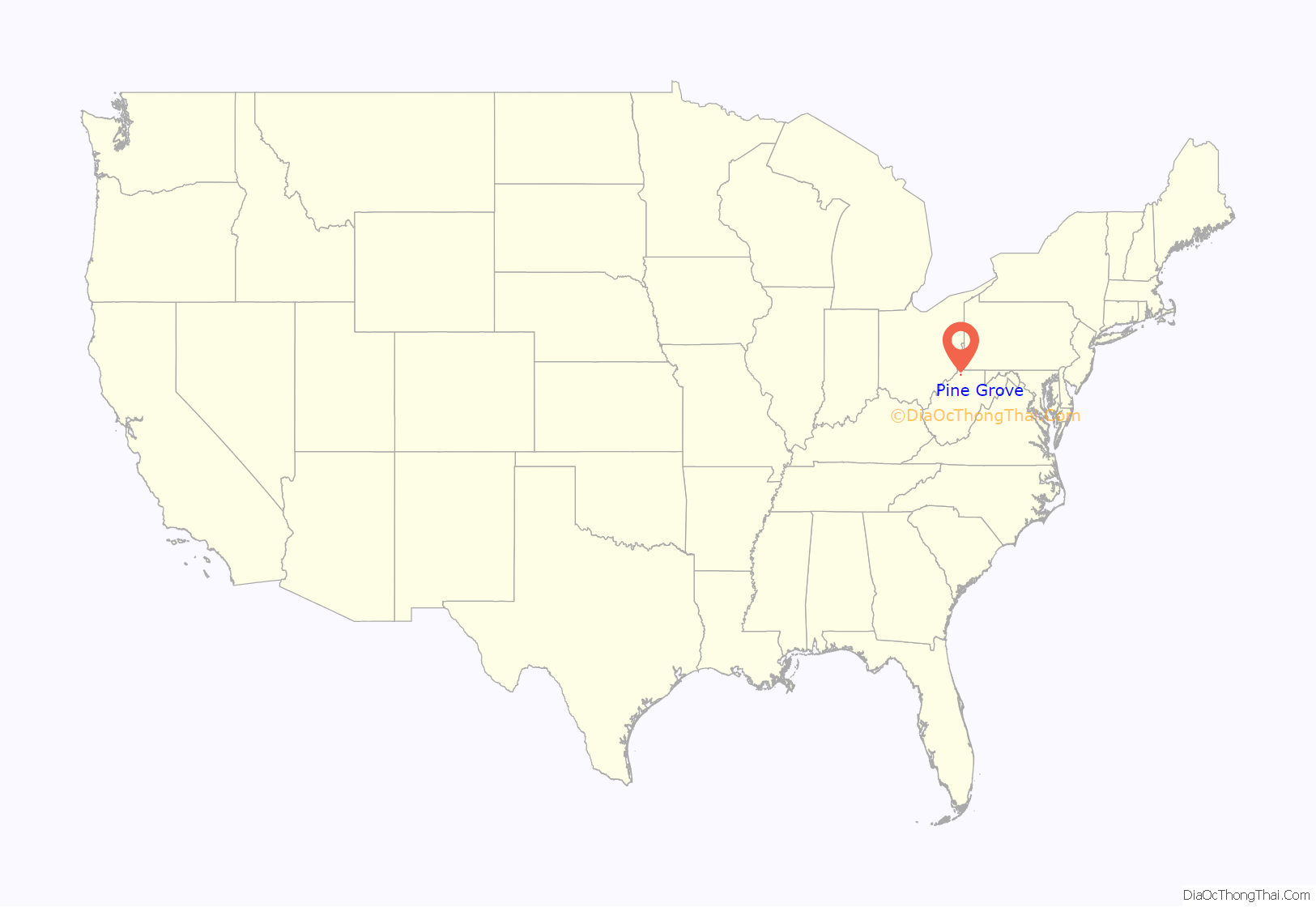
Pine Grove location map. Where is Pine Grove town?
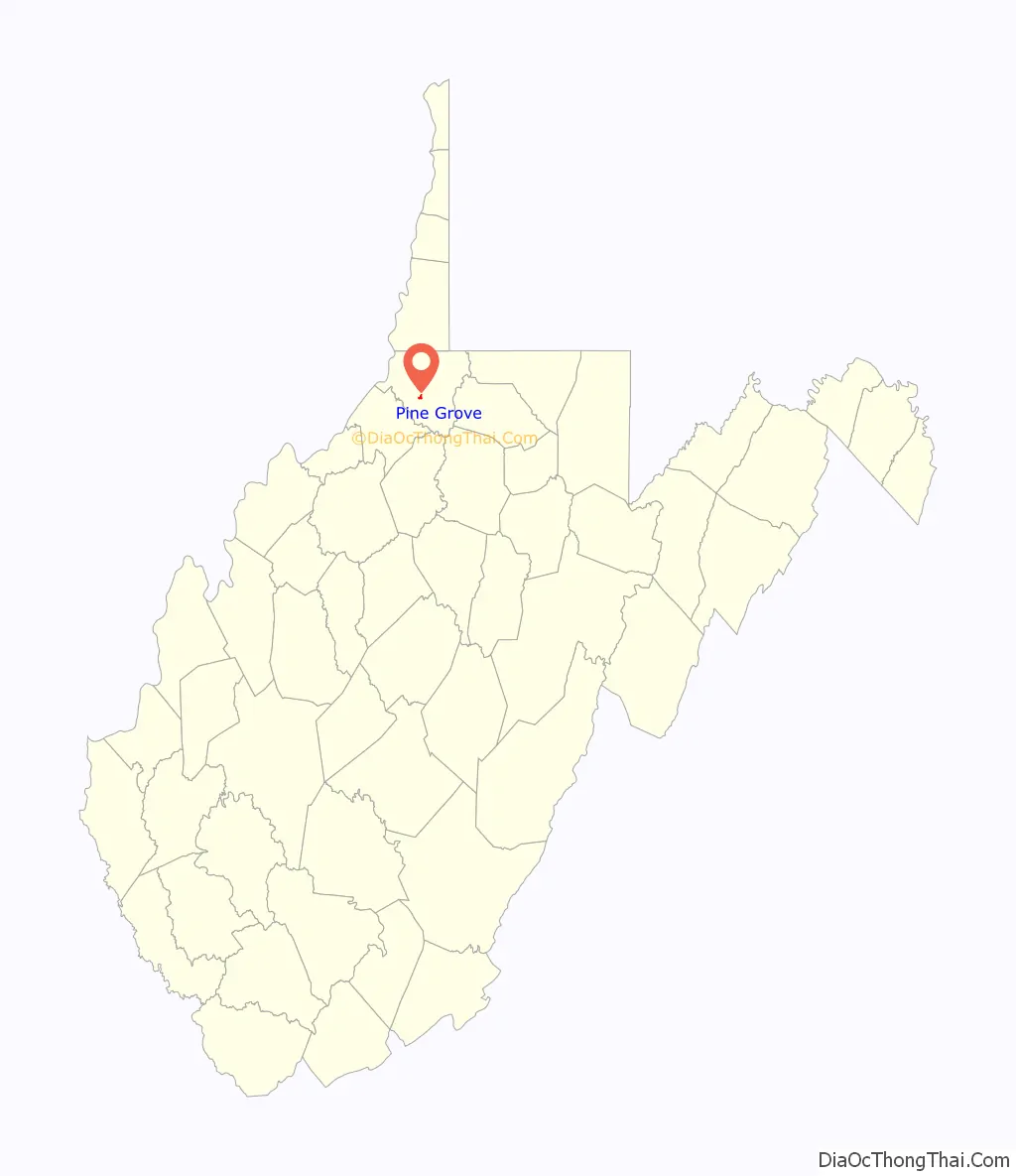
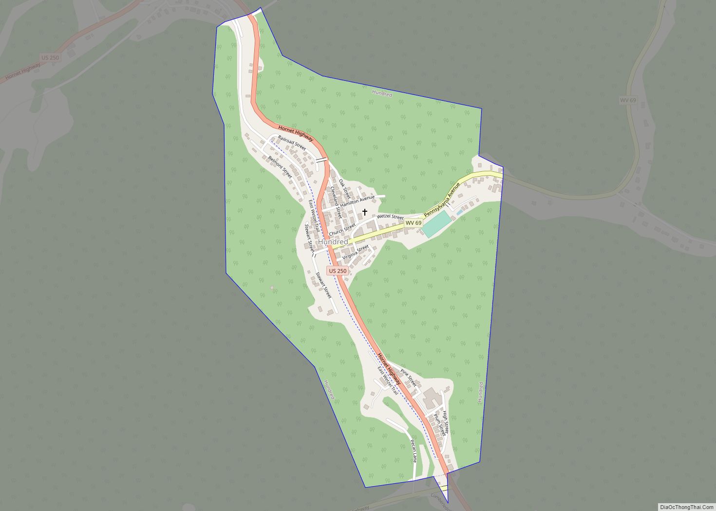
Pine Grove Road Map
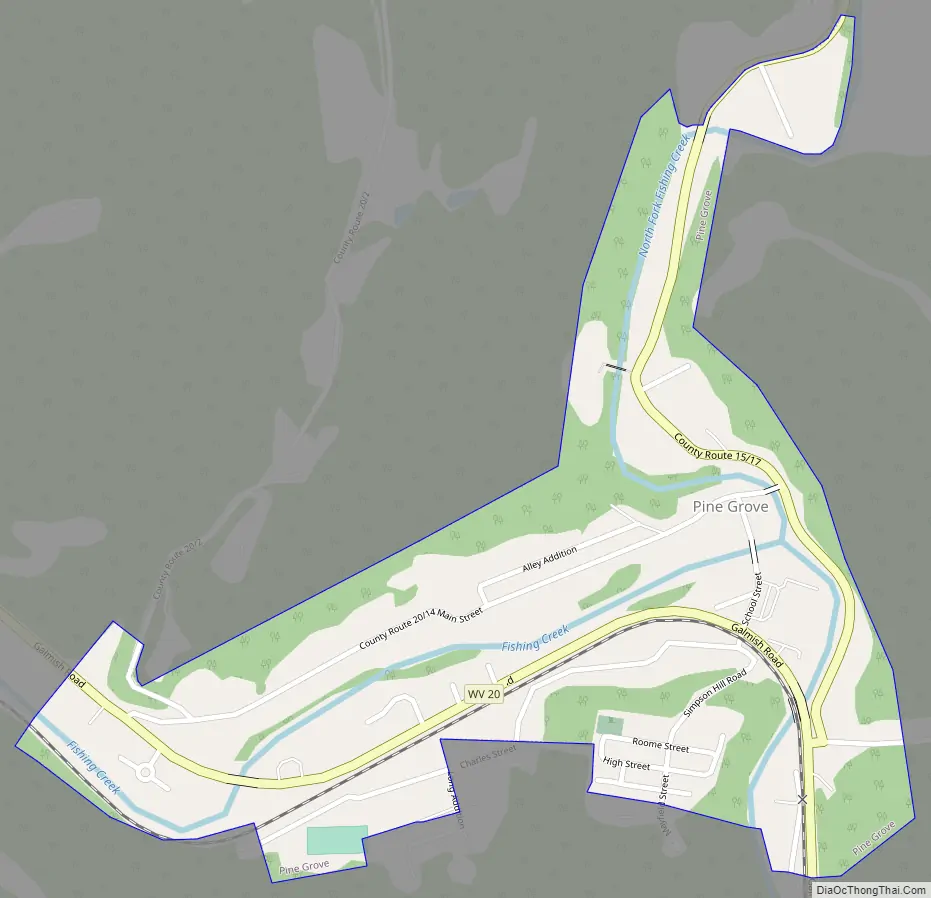
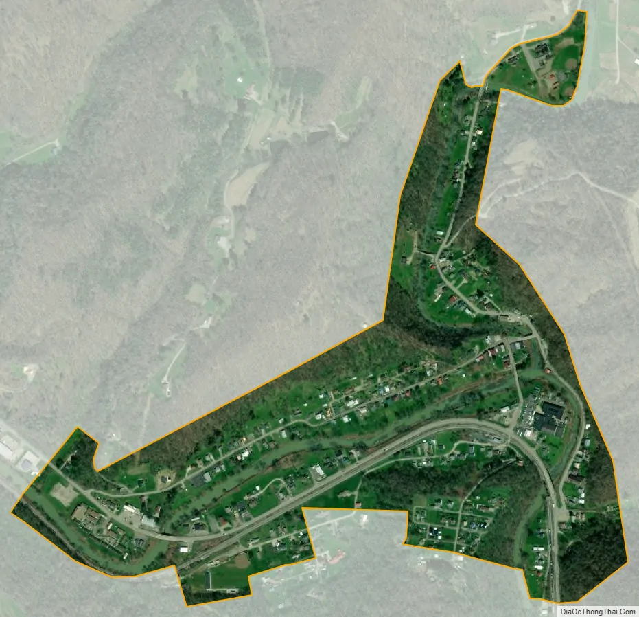
Pine Grove city Satellite Map
Geography
Pine Grove is located at 39°33′44″N 80°40′52″W / 39.56222°N 80.68111°W / 39.56222; -80.68111 (39.562255, -80.681154).
According to the United States Census Bureau, the town has a total area of 0.38 square miles (0.98 km), of which 0.35 square miles (0.91 km) is land and 0.03 square miles (0.08 km) is water.
See also
Map of West Virginia State and its subdivision:- Barbour
- Berkeley
- Boone
- Braxton
- Brooke
- Cabell
- Calhoun
- Clay
- Doddridge
- Fayette
- Gilmer
- Grant
- Greenbrier
- Hampshire
- Hancock
- Hardy
- Harrison
- Jackson
- Jefferson
- Kanawha
- Lewis
- Lincoln
- Logan
- Marion
- Marshall
- Mason
- McDowell
- Mercer
- Mineral
- Mingo
- Monongalia
- Monroe
- Morgan
- Nicholas
- Ohio
- Pendleton
- Pleasants
- Pocahontas
- Preston
- Putnam
- Raleigh
- Randolph
- Ritchie
- Roane
- Summers
- Taylor
- Tucker
- Tyler
- Upshur
- Wayne
- Webster
- Wetzel
- Wirt
- Wood
- Wyoming
- Alabama
- Alaska
- Arizona
- Arkansas
- California
- Colorado
- Connecticut
- Delaware
- District of Columbia
- Florida
- Georgia
- Hawaii
- Idaho
- Illinois
- Indiana
- Iowa
- Kansas
- Kentucky
- Louisiana
- Maine
- Maryland
- Massachusetts
- Michigan
- Minnesota
- Mississippi
- Missouri
- Montana
- Nebraska
- Nevada
- New Hampshire
- New Jersey
- New Mexico
- New York
- North Carolina
- North Dakota
- Ohio
- Oklahoma
- Oregon
- Pennsylvania
- Rhode Island
- South Carolina
- South Dakota
- Tennessee
- Texas
- Utah
- Vermont
- Virginia
- Washington
- West Virginia
- Wisconsin
- Wyoming