Racine is a census-designated place (CDP) in Boone County, West Virginia, United States. As of the 2010 census, its population was 256.
The community was named after Racine, Ohio, the native home of first settlers.
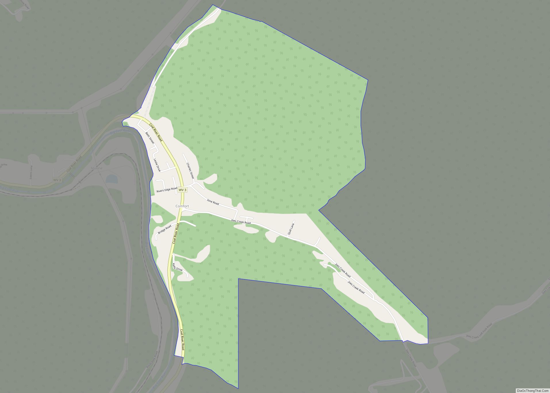
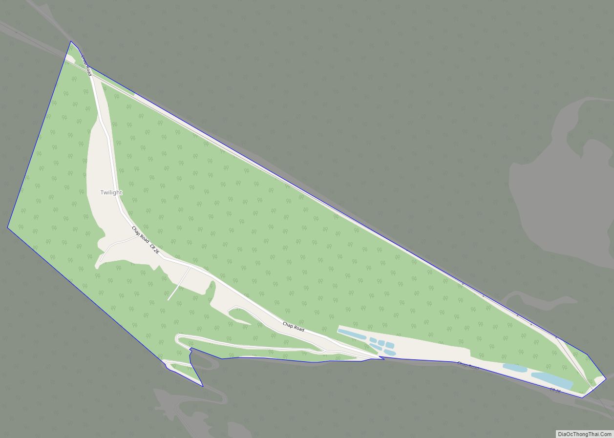
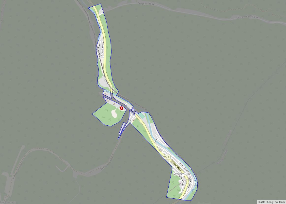
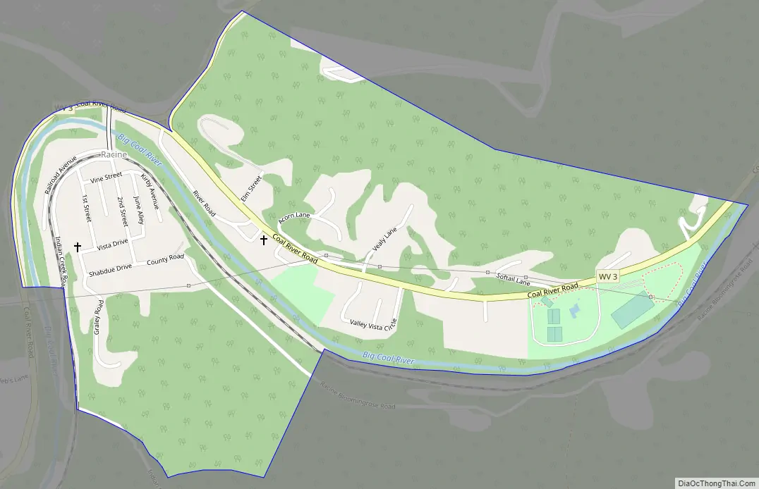
Racine is home to the Racine Volunteer Fire Department which covers 174 square miles (450 km) in its first response area. The John Slack Park is also located in Racine next to the Fire Department.
| Name: | Racine CDP |
|---|---|
| LSAD Code: | 57 |
| LSAD Description: | CDP (suffix) |
| State: | West Virginia |
| County: | Boone County |
| Total Area: | 0.512 sq mi (1.33 km²) |
| Land Area: | 0.479 sq mi (1.24 km²) |
| Water Area: | 0.033 sq mi (0.09 km²) |
| Total Population: | 256 |
| Population Density: | 500/sq mi (190/km²) |
| FIPS code: | 5466484 |
Online Interactive Map
Click on ![]() to view map in "full screen" mode.
to view map in "full screen" mode.
Racine location map. Where is Racine CDP?
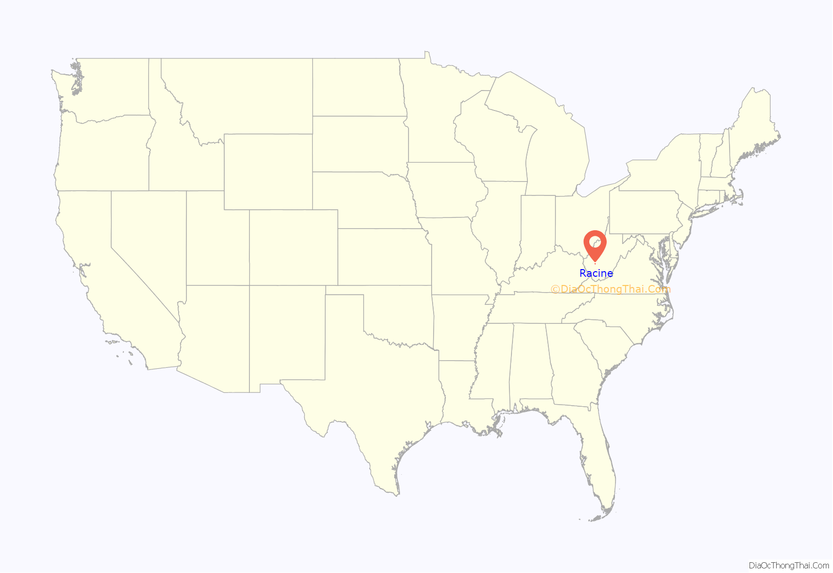
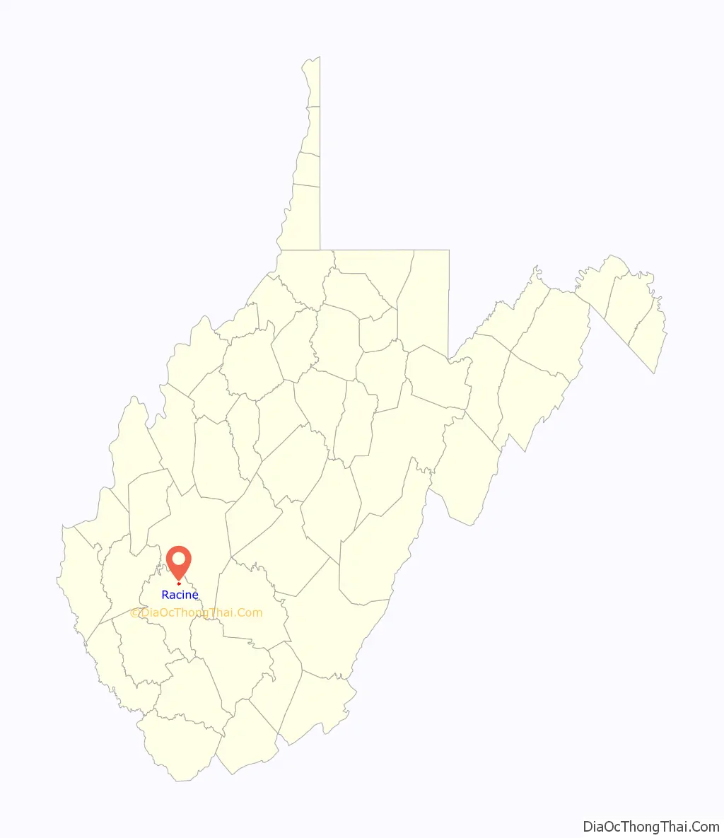
Racine Road Map
Racine city Satellite Map

See also
Map of West Virginia State and its subdivision:- Barbour
- Berkeley
- Boone
- Braxton
- Brooke
- Cabell
- Calhoun
- Clay
- Doddridge
- Fayette
- Gilmer
- Grant
- Greenbrier
- Hampshire
- Hancock
- Hardy
- Harrison
- Jackson
- Jefferson
- Kanawha
- Lewis
- Lincoln
- Logan
- Marion
- Marshall
- Mason
- McDowell
- Mercer
- Mineral
- Mingo
- Monongalia
- Monroe
- Morgan
- Nicholas
- Ohio
- Pendleton
- Pleasants
- Pocahontas
- Preston
- Putnam
- Raleigh
- Randolph
- Ritchie
- Roane
- Summers
- Taylor
- Tucker
- Tyler
- Upshur
- Wayne
- Webster
- Wetzel
- Wirt
- Wood
- Wyoming
- Alabama
- Alaska
- Arizona
- Arkansas
- California
- Colorado
- Connecticut
- Delaware
- District of Columbia
- Florida
- Georgia
- Hawaii
- Idaho
- Illinois
- Indiana
- Iowa
- Kansas
- Kentucky
- Louisiana
- Maine
- Maryland
- Massachusetts
- Michigan
- Minnesota
- Mississippi
- Missouri
- Montana
- Nebraska
- Nevada
- New Hampshire
- New Jersey
- New Mexico
- New York
- North Carolina
- North Dakota
- Ohio
- Oklahoma
- Oregon
- Pennsylvania
- Rhode Island
- South Carolina
- South Dakota
- Tennessee
- Texas
- Utah
- Vermont
- Virginia
- Washington
- West Virginia
- Wisconsin
- Wyoming