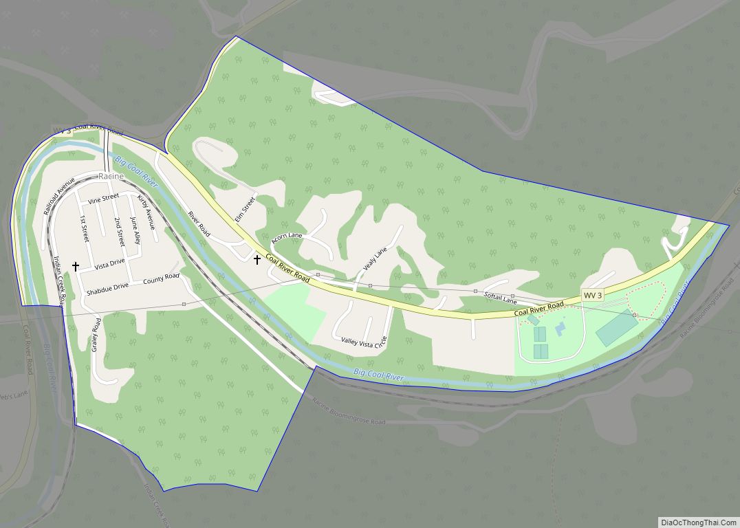
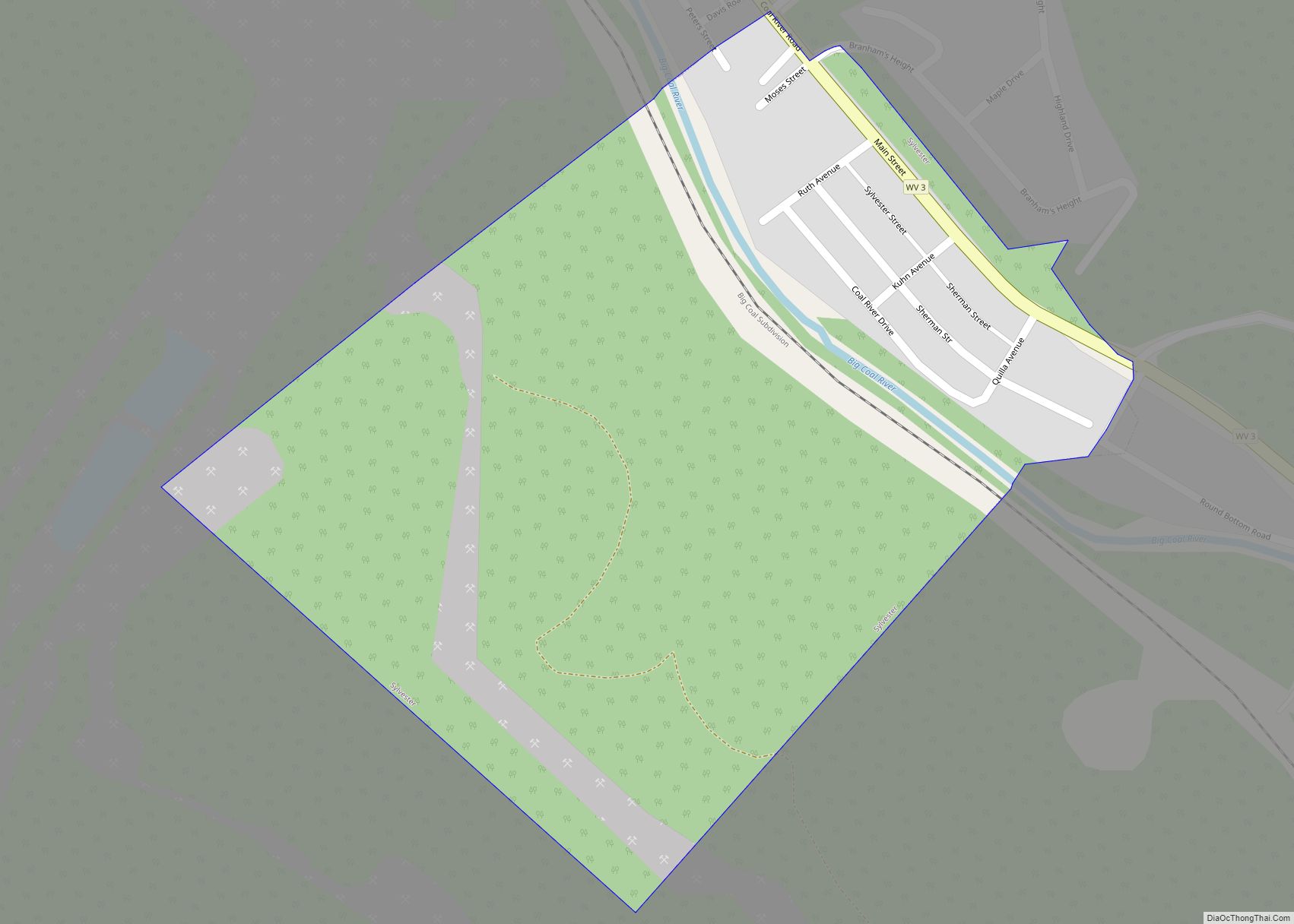
Sylvester is a town in Boone County, West Virginia, United States, along the Big Coal River. The population was 166 at the 2020 census. Sylvester was incorporated on April 11, 1952 by the Boone County Circuit Court. Sylvester bears the name of a family of settlers.
| Name: | Sylvester town |
|---|---|
| LSAD Code: | 43 |
| LSAD Description: | town (suffix) |
| State: | West Virginia |
| County: | Boone County |
| Elevation: | 863 ft (263 m) |
| Total Area: | 0.26 sq mi (0.67 km²) |
| Land Area: | 0.25 sq mi (0.65 km²) |
| Water Area: | 0.01 sq mi (0.01 km²) |
| Total Population: | 166 |
| Population Density: | 539.68/sq mi (208.27/km²) |
| ZIP code: | 25193 |
| Area code: | 304 |
| FIPS code: | 5478964 |
| GNISfeature ID: | 1555775 |
| Website: | local.wv.gov/Sylvester/ |
Online Interactive Map
Click on ![]() to view map in "full screen" mode.
to view map in "full screen" mode.
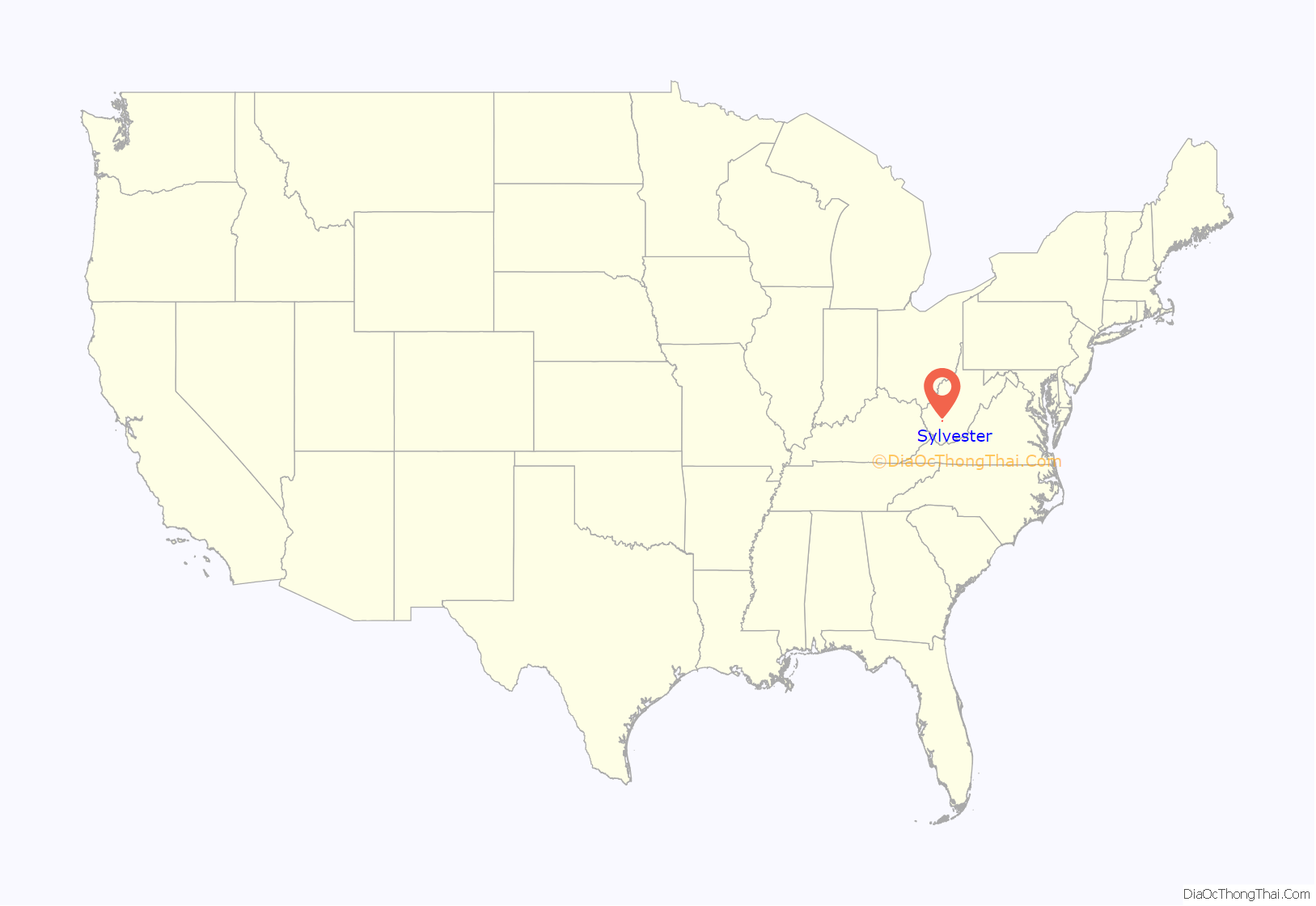
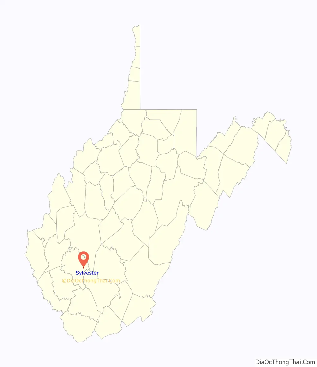
Sylvester location map. Where is Sylvester town?
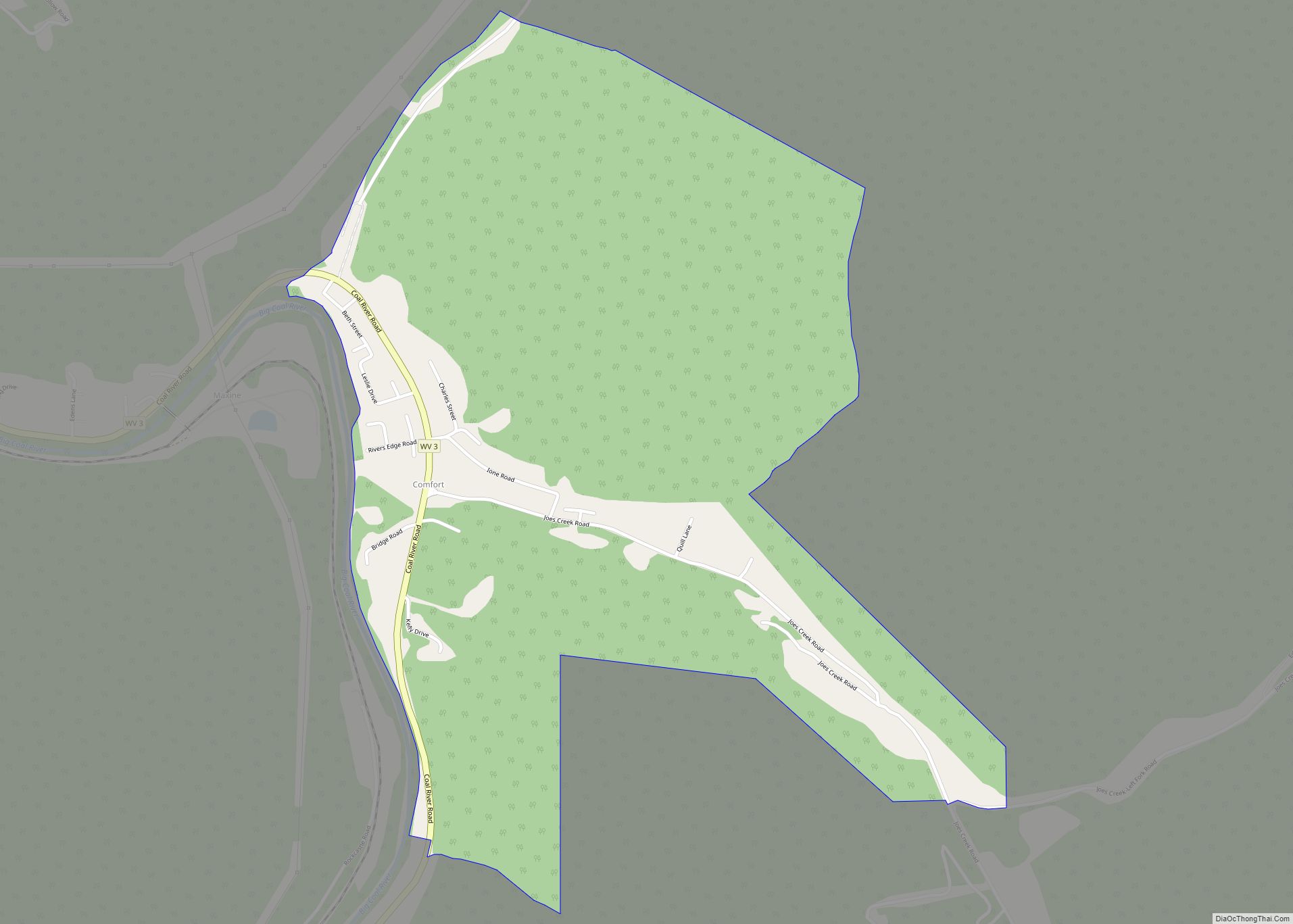
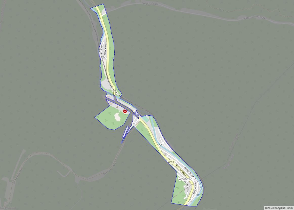
Sylvester Road Map
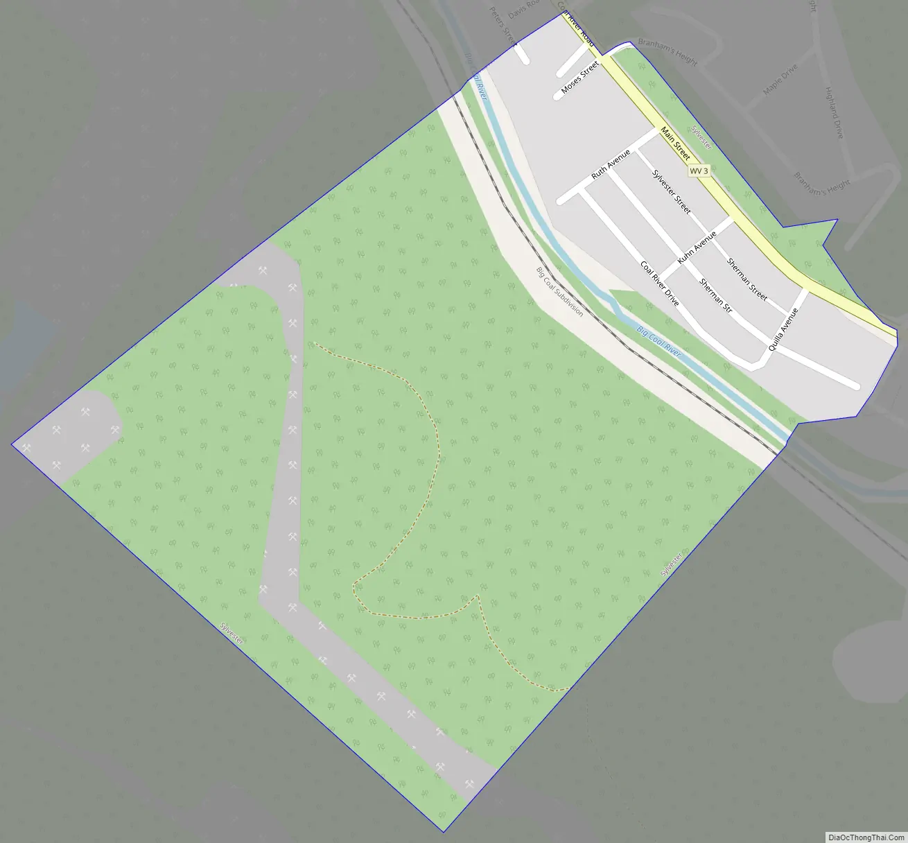
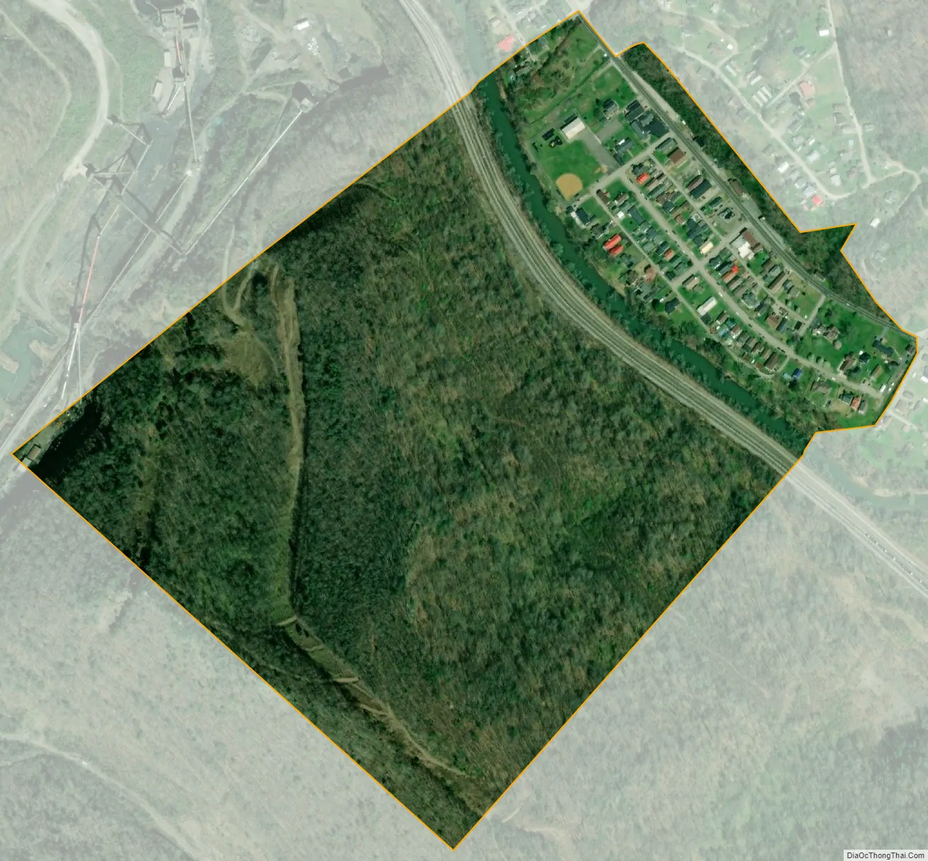
Sylvester city Satellite Map
Geography
Sylvester is located at 38°0′37″N 81°33′35″W / 38.01028°N 81.55972°W / 38.01028; -81.55972 (38.010370, -81.559626). The town’s municipal boundaries extend to both sides of the river, though its business district and residential areas lie primarily on the river’s eastern bank. The town of Whitesville lies just to the southeast, and the communities of Orgas and Seth lie just to the north. West Virginia Route 3 (Coal River Road) traverses Sylvester.
According to the United States Census Bureau, the town has a total area of 0.26 square miles (0.67 km), of which 0.25 square miles (0.65 km) is land and 0.01 square miles (0.03 km) is water.
See also
Map of West Virginia State and its subdivision:- Barbour
- Berkeley
- Boone
- Braxton
- Brooke
- Cabell
- Calhoun
- Clay
- Doddridge
- Fayette
- Gilmer
- Grant
- Greenbrier
- Hampshire
- Hancock
- Hardy
- Harrison
- Jackson
- Jefferson
- Kanawha
- Lewis
- Lincoln
- Logan
- Marion
- Marshall
- Mason
- McDowell
- Mercer
- Mineral
- Mingo
- Monongalia
- Monroe
- Morgan
- Nicholas
- Ohio
- Pendleton
- Pleasants
- Pocahontas
- Preston
- Putnam
- Raleigh
- Randolph
- Ritchie
- Roane
- Summers
- Taylor
- Tucker
- Tyler
- Upshur
- Wayne
- Webster
- Wetzel
- Wirt
- Wood
- Wyoming
- Alabama
- Alaska
- Arizona
- Arkansas
- California
- Colorado
- Connecticut
- Delaware
- District of Columbia
- Florida
- Georgia
- Hawaii
- Idaho
- Illinois
- Indiana
- Iowa
- Kansas
- Kentucky
- Louisiana
- Maine
- Maryland
- Massachusetts
- Michigan
- Minnesota
- Mississippi
- Missouri
- Montana
- Nebraska
- Nevada
- New Hampshire
- New Jersey
- New Mexico
- New York
- North Carolina
- North Dakota
- Ohio
- Oklahoma
- Oregon
- Pennsylvania
- Rhode Island
- South Carolina
- South Dakota
- Tennessee
- Texas
- Utah
- Vermont
- Virginia
- Washington
- West Virginia
- Wisconsin
- Wyoming