Wardensville is a town in Hardy County, West Virginia, United States. The population was 265 at the 2020 census. Originally named Trout Run, Wardensville was chartered in Virginia in 1832 and incorporated in West Virginia in 1879. Wardensville is located west of the Great North Mountain range, which separates it from the Shenandoah Valley. The town lies on the east bank of the Cacapon River at its confluence with Trout Run. The George Washington and Jefferson National Forests border the town to its east and south.
| Name: | Wardensville town |
|---|---|
| LSAD Code: | 43 |
| LSAD Description: | town (suffix) |
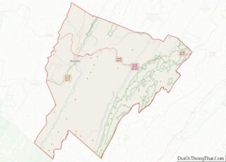
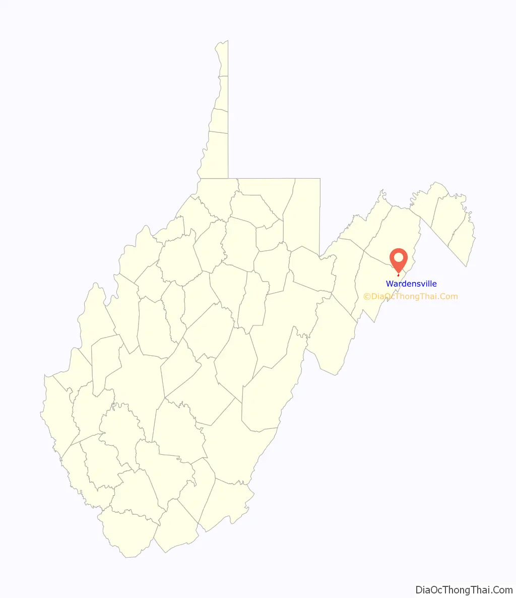
| State: | West Virginia |
| County: | Hardy County |
| Elevation: | 1,010 ft (308 m) |
| Total Area: | 0.33 sq mi (0.85 km²) |
| Land Area: | 0.32 sq mi (0.84 km²) |
| Water Area: | 0.01 sq mi (0.01 km²) |
| Total Population: | 265 |
| Population Density: | 796.30/sq mi (307.00/km²) |
| ZIP code: | 26851 |
| Area code: | 304 |
| FIPS code: | 5484580 |
| GNISfeature ID: | 1553382 |
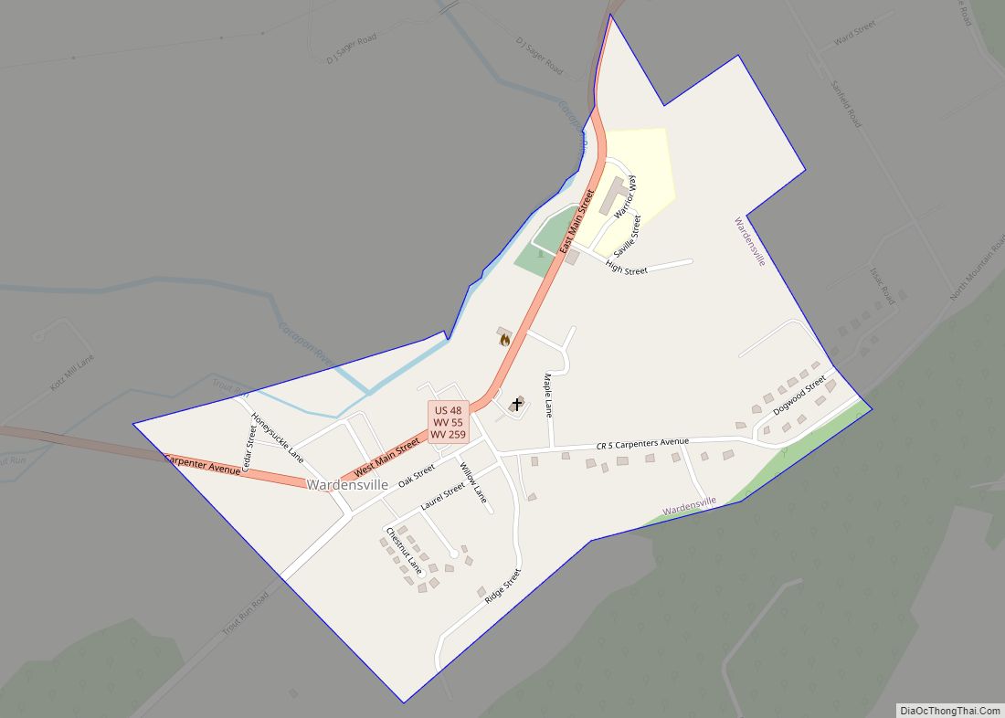
Online Interactive Map
Click on ![]() to view map in "full screen" mode.
to view map in "full screen" mode.
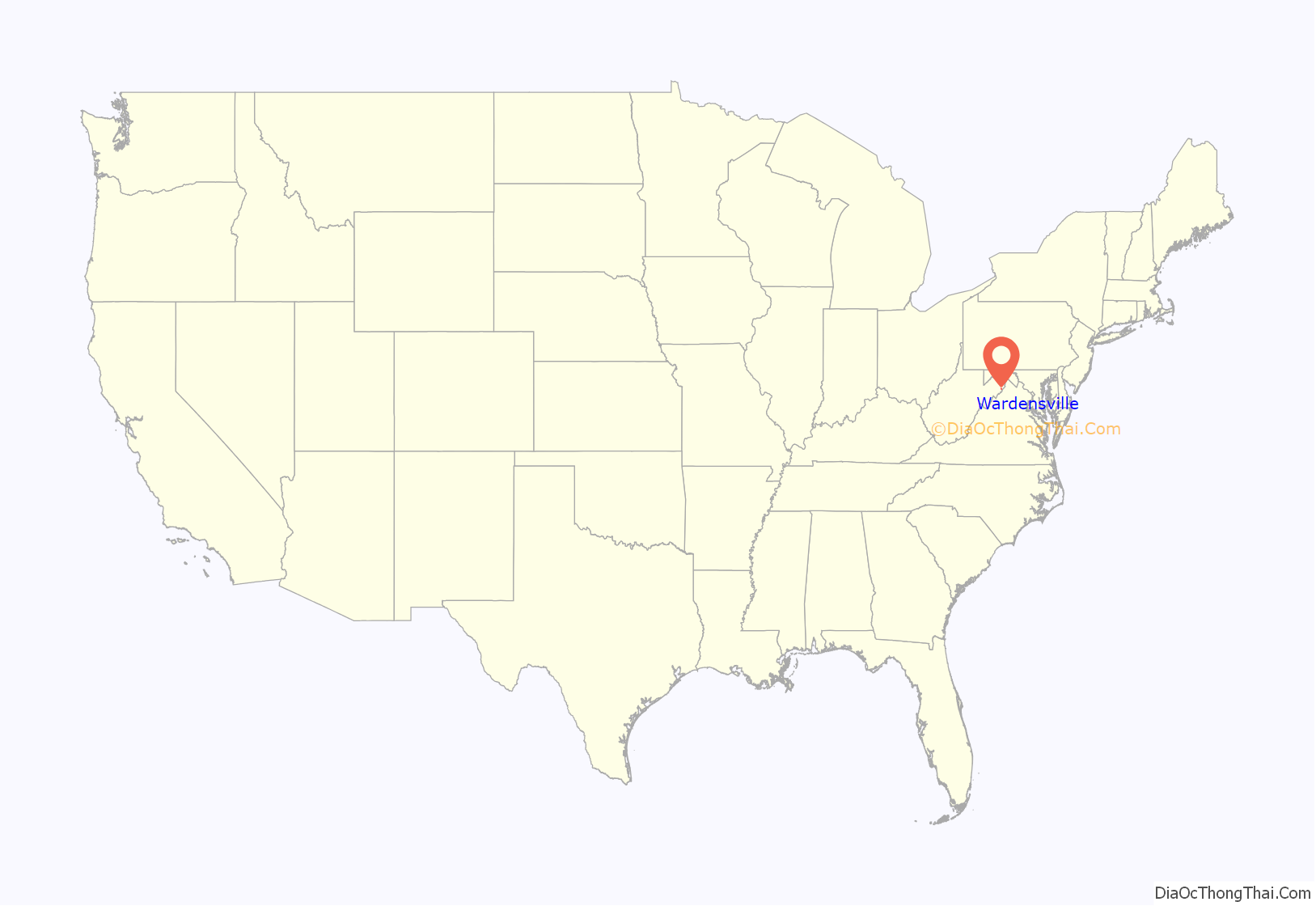
Wardensville location map. Where is Wardensville town?
History
The land which Wardensville occupies was originally part of the Northern Neck Proprietary, a 5 million acre tract granted by England’s King Charles II and formally established after the restoration of the English monarchy in 1660. In 1719, the land was inherited by Thomas Fairfax, 6th Lord Fairfax of Cameron who administered many of the land grants to the early European settlers who began arriving in the Capon Valley in the second quarter of the eighteenth century. William H. Warden is believed to be the first settler within the present town. He received a parcel of land from Thomas Fairfax, reportedly surveyed by George Washington, on November 11, 1749.
During the French and Indian War, hostilities between the English settlers and the Native American populations in the South Branch and Capon Valleys led to the construction of a string of fortified outposts including Fort Warden or “Warden’s Fort,” erected by William Warden at a place called Trout Run (later the town of Wardensville). According to historian Samuel Kercheval, the fort was attacked in 1758 when it was burned. Warden and a man only known by the name Mr. Taff did not survive the attack.
The town of Wardensville was established in 1832 when the Virginia General Assembly granted a charter declaring “that the town of Wardensville, in the county of Hardy, as the same has been heretofore laid off into lots, streets and alleys, or as the same may be hereafter further laid off and extended into lots, streets and alleys, shall be, and the same is hereby made a town corporate, to be known and distinguished by the name of Wardensville.” The first trustees of the town were James Scanting, Samuel Fry, John Pierce, Simon Switzer, and James W. Baker. The town was incorporated by the West Virginia Legislature in 1879.
In the 1820 United States Census, the population center of the United States was recorded as being about 3 miles northeast of the town.
Historic structures in the town include the Cline Blacksmith Shop/Town Jail, a stone structure on Main Street erected around 1830. Two generations of the Cline family operated a blacksmith shop in the structure until 1895. In the earl twentieth century, the structure was converted for use as a town jail. St. Peter’s Lutheran Church was founded in 1840 by Rev. John Hamilton and erected its first church on the site in 1870. After this building collapsed in 1934, the present stone church, designed by A. Hensel Fink in Gothic Revival style. The Old Presbyterian Church was constructed in the latter half of the nineteenth century and is a rare example of Italianate style in Wardensville. The Odd Fellows Hall was erected in 1856 on the southern edge of town near the intersection of Main Street and Trout Run Road.
Two properties near Wardensville are listed on the National Register of Historic Places: the Francis Kotz Farm and the Nicholas Switzer House.
Gallery
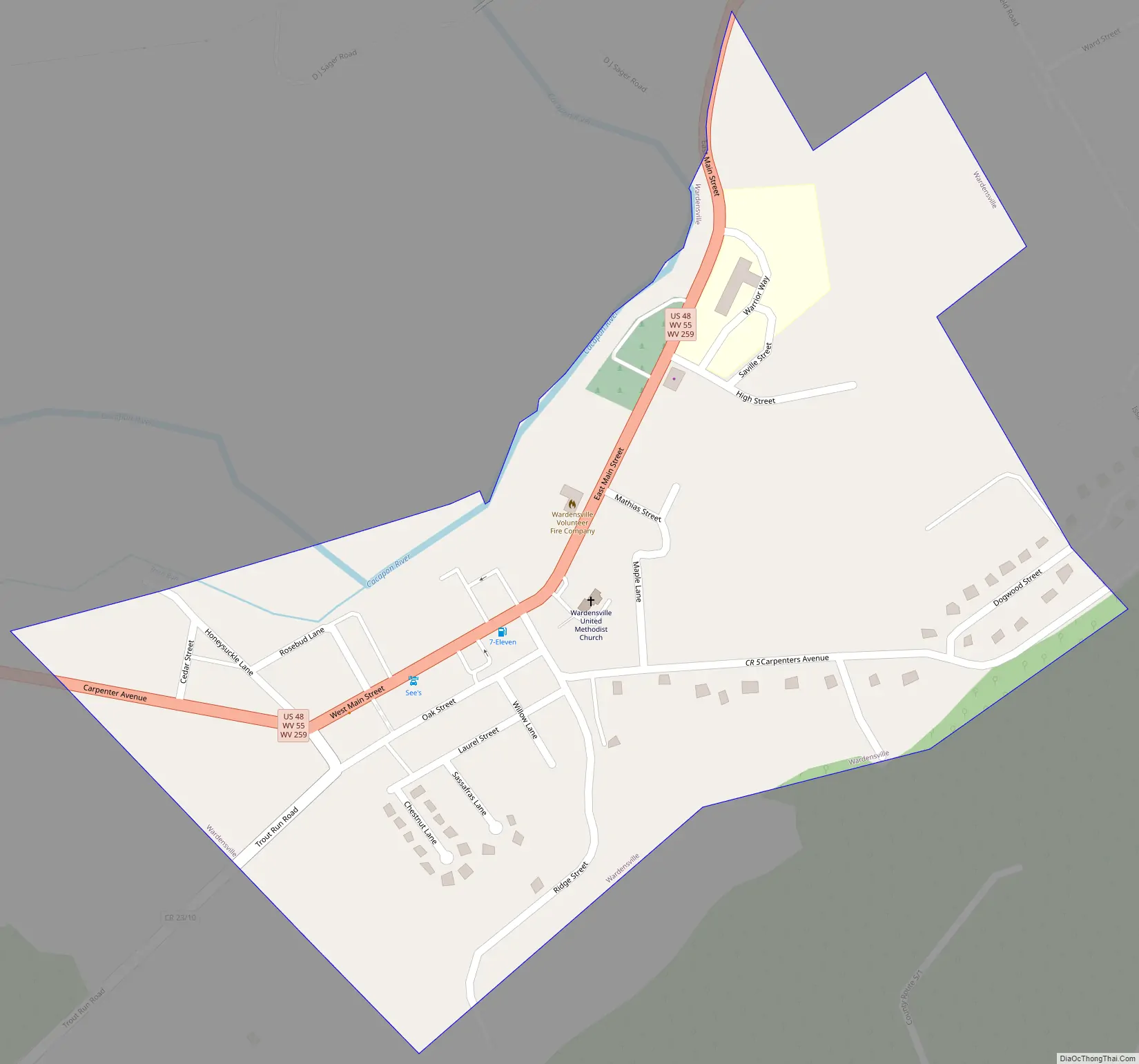
Wardensville Road Map
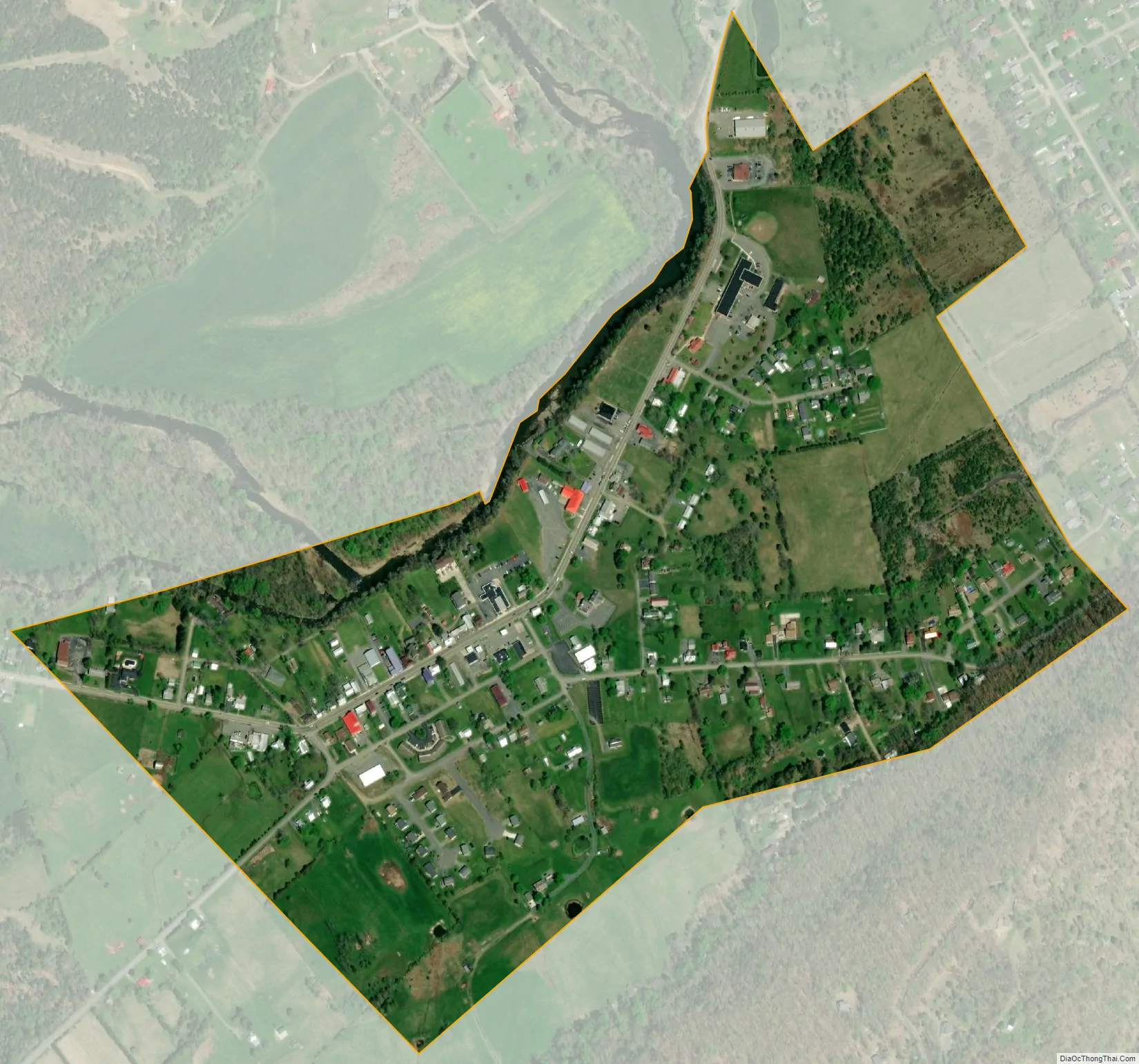
Wardensville city Satellite Map
Geography
Wardensville is located at 39°4′32″N 78°35′40″W / 39.07556°N 78.59444°W / 39.07556; -78.59444 (39.075573, -78.594534).
According to the United States Census Bureau, the town has a total area of 0.33 square miles (0.85 km), of which 0.32 square miles (0.83 km) is land and 0.01 square miles (0.03 km) is water.
A whitewater stretch of the Lost River flows just above the town from the southwest and once it reaches Wardensville is renamed the Cacapon River. The stream continues to flow northeasterly towards its eventual destination at the Potomac River.
See also
Map of West Virginia State and its subdivision:- Barbour
- Berkeley
- Boone
- Braxton
- Brooke
- Cabell
- Calhoun
- Clay
- Doddridge
- Fayette
- Gilmer
- Grant
- Greenbrier
- Hampshire
- Hancock
- Hardy
- Harrison
- Jackson
- Jefferson
- Kanawha
- Lewis
- Lincoln
- Logan
- Marion
- Marshall
- Mason
- McDowell
- Mercer
- Mineral
- Mingo
- Monongalia
- Monroe
- Morgan
- Nicholas
- Ohio
- Pendleton
- Pleasants
- Pocahontas
- Preston
- Putnam
- Raleigh
- Randolph
- Ritchie
- Roane
- Summers
- Taylor
- Tucker
- Tyler
- Upshur
- Wayne
- Webster
- Wetzel
- Wirt
- Wood
- Wyoming
- Alabama
- Alaska
- Arizona
- Arkansas
- California
- Colorado
- Connecticut
- Delaware
- District of Columbia
- Florida
- Georgia
- Hawaii
- Idaho
- Illinois
- Indiana
- Iowa
- Kansas
- Kentucky
- Louisiana
- Maine
- Maryland
- Massachusetts
- Michigan
- Minnesota
- Mississippi
- Missouri
- Montana
- Nebraska
- Nevada
- New Hampshire
- New Jersey
- New Mexico
- New York
- North Carolina
- North Dakota
- Ohio
- Oklahoma
- Oregon
- Pennsylvania
- Rhode Island
- South Carolina
- South Dakota
- Tennessee
- Texas
- Utah
- Vermont
- Virginia
- Washington
- West Virginia
- Wisconsin
- Wyoming