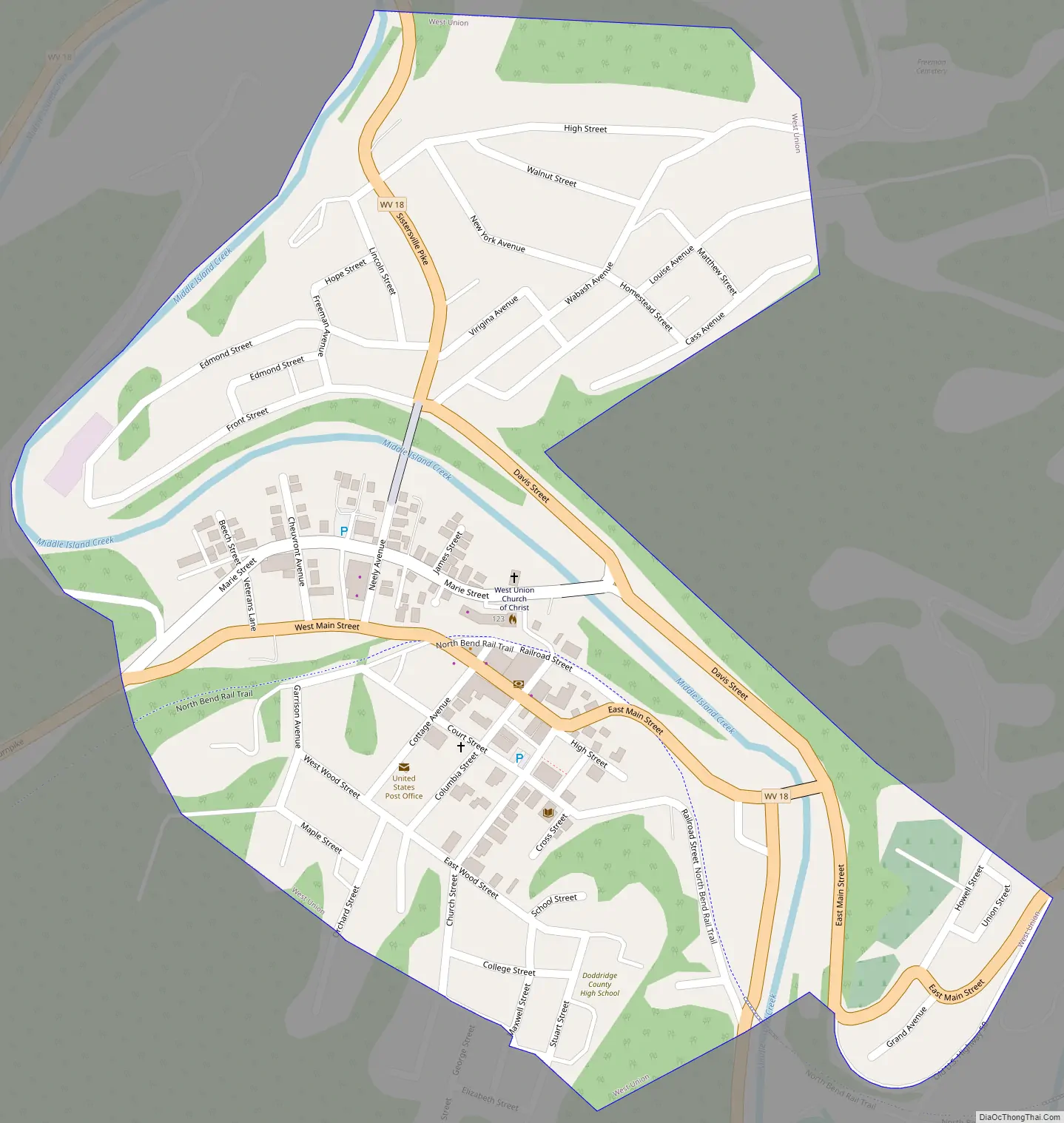
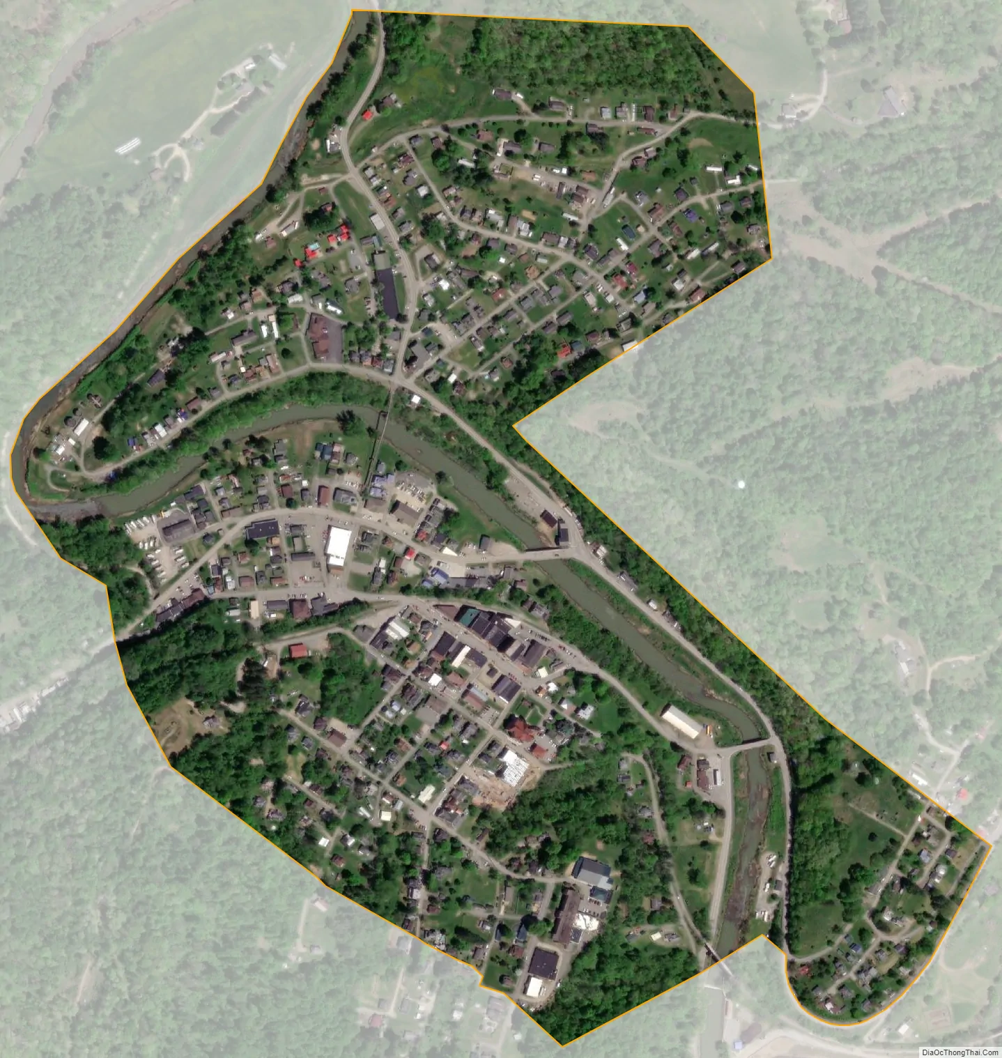
West Union, incorporated July 20, 1881, is a town in Doddridge County, West Virginia, United States. The population was 669 at the 2020 census. It is the county seat of Doddridge County. The town is located along Middle Island Creek at the junction of U.S. Route 50 and West Virginia Route 18; the North Bend Rail Trail also passes through the town.
| Name: | West Union town |
|---|---|
| LSAD Code: | 43 |
| LSAD Description: | town (suffix) |
| State: | West Virginia |
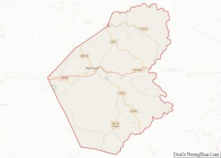
| County: | Doddridge County |
| Elevation: | 787 ft (240 m) |
| Total Area: | 0.38 sq mi (0.97 km²) |
| Land Area: | 0.36 sq mi (0.93 km²) |
| Water Area: | 0.01 sq mi (0.04 km²) |
| Total Population: | 669 |
| Population Density: | 2,219.44/sq mi (856.35/km²) |
| ZIP code: | 26456 |
| Area code: | 304 |
| FIPS code: | 5486116 |
| GNISfeature ID: | 1548944 |
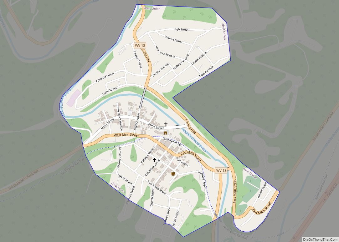
Online Interactive Map
Click on ![]() to view map in "full screen" mode.
to view map in "full screen" mode.
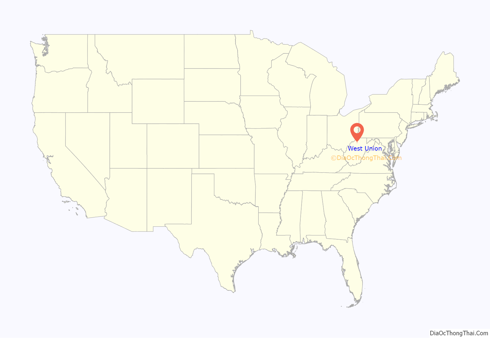
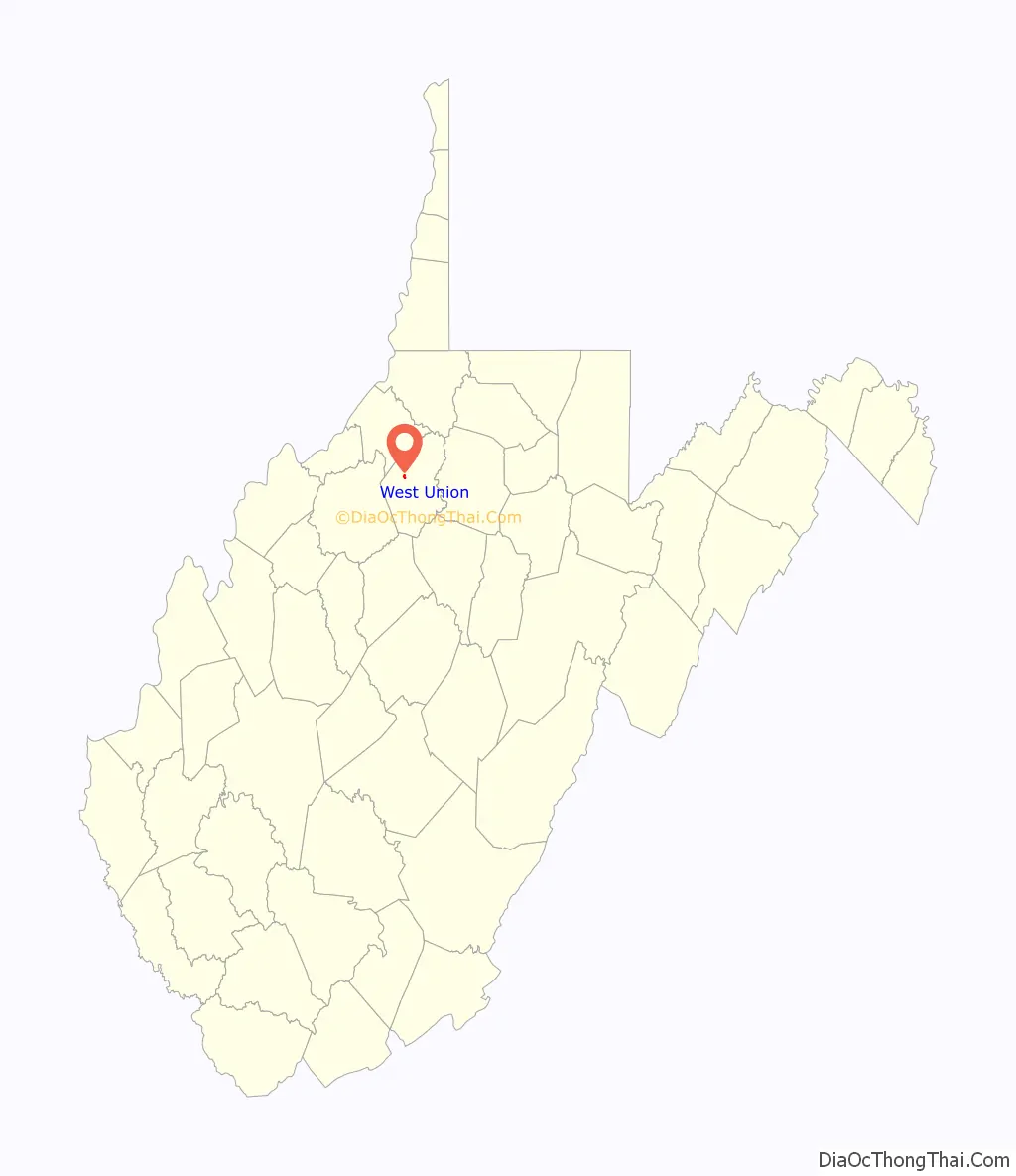
West Union location map. Where is West Union town?
History
18th and 19th centuries
The area was first settled in the late 1780s by James Caldwell, who owned 20,000 acres (81 km) of land that included present West Union. Caldwell sold this land to Nathan Davis, Jr (1772-1866) and his brothers about 1807. They in turn sold 16,000 acres (65 km) to Lewis Maxwell (1790-1862), a Virginia congressman.
The settlement was originally called Lewisport, but Davis later supposedly suggested the name of “West Union”, in deference to a proposed town of Union to be built on the eastern side of Middle Island Creek. (Union has disappeared, if it ever existed.) According to an early resident, A.A. Bee: “The first bridge across Middle Island Creek [at West Union] was of hewed logs with a center abutment of stones. In the great flood of 1835 it was washed away”. In 1842, a contract was awarded to the well-known civil engineer Claudius Crozet to build a new covered bridge at West Union, as part of a series of public works along the Northwestern Turnpike. Ephraim Bee (1802–1888), a local blacksmith (who was also a district officer, magistrate, state legislator, hotelier, and postmaster at various times) made all the bolts and bands for the West Union Covered Bridge which was completed in 1843.
On the night of March 27, 1858, a fire utterly devastated the town of West Union. At the time, many of the citizens were attending the U.S. court at Clarksburg, and so were not available for fire suppression efforts. The fire originated in an upper room of the residence of Lathrop Russell Charter. The flames spread quickly to other buildings: first, a large hotel and store room belonging to James A. Foley. Next came the residence of Ethelbert Bond and a storehouse belonging to Arthur Ingram. Other buildings followed and the next morning the entire settlement appeared a “mass of smoldering ruins”. The Parkersburg and Grafton branch of the Baltimore and Ohio Railroad had just been completed, however, and the town was able to revive economically and structurally fairly quickly.
Nearby Maxwell Ridge — named for the family of Congressman Maxwell — is said to have a cave that was used by the Underground Railroad in the years leading up to the Civil War.
West Union was home to Matthew M. Neely, grandfather of West Virginia’s 21st governor. Governor Matthew M. Neely, also a US Senator, was born in 1874 just south of the town.
West Union was incorporated on 20 July 1881.
20th century
Doddridge County’s oil and gas industry was a boon to West Union. By 1906, the Ideal Glass Factory opened to take advantage of the abundant gas. It was followed by the Doddridge County Window Glass Company. The two plants employed about 300 people. In later years a garment factory opened, but closed in the 1970s. A long-remembered flood devastated West Union in June 1950, destroying homes and businesses and killing 22 people throughout the county. (One casualty was the 107-year-old covered bridge.)
Today farming, timbering, oil and gas, and the business of county government and public education support the area, and many people commute to jobs in Salem, Clarksburg, and Parkersburg, or to the North Central Regional Jail in Greenwood.
The Lathrop Russell Charter House, Doddridge County Courthouse, Silas P. Smith Opera House, and W. Scott Stuart House are individually listed on the National Register of Historic Places. West Union is also home to two nationally recognized historic districts: West Union Downtown Historic District and West Union Residential Historic District.
West Union Road Map
West Union city Satellite Map
Geography
West Union is located at 39°17′44″N 80°46′33″W / 39.295594°N 80.775888°W / 39.295594; -80.775888 (39.295594, -80.775888).
According to the United States Census Bureau, the town has a total area of 0.38 square miles (0.98 km), of which 0.36 square miles (0.93 km) is land and 0.02 square miles (0.05 km) is water.
Climate
The climate in this area is characterized by hot, humid summers and generally mild to cool winters. According to the Köppen Climate Classification system, West Union has a humid subtropical climate, abbreviated “Cfa” on climate maps.
See also
Map of West Virginia State and its subdivision:- Barbour
- Berkeley
- Boone
- Braxton
- Brooke
- Cabell
- Calhoun
- Clay
- Doddridge
- Fayette
- Gilmer
- Grant
- Greenbrier
- Hampshire
- Hancock
- Hardy
- Harrison
- Jackson
- Jefferson
- Kanawha
- Lewis
- Lincoln
- Logan
- Marion
- Marshall
- Mason
- McDowell
- Mercer
- Mineral
- Mingo
- Monongalia
- Monroe
- Morgan
- Nicholas
- Ohio
- Pendleton
- Pleasants
- Pocahontas
- Preston
- Putnam
- Raleigh
- Randolph
- Ritchie
- Roane
- Summers
- Taylor
- Tucker
- Tyler
- Upshur
- Wayne
- Webster
- Wetzel
- Wirt
- Wood
- Wyoming
- Alabama
- Alaska
- Arizona
- Arkansas
- California
- Colorado
- Connecticut
- Delaware
- District of Columbia
- Florida
- Georgia
- Hawaii
- Idaho
- Illinois
- Indiana
- Iowa
- Kansas
- Kentucky
- Louisiana
- Maine
- Maryland
- Massachusetts
- Michigan
- Minnesota
- Mississippi
- Missouri
- Montana
- Nebraska
- Nevada
- New Hampshire
- New Jersey
- New Mexico
- New York
- North Carolina
- North Dakota
- Ohio
- Oklahoma
- Oregon
- Pennsylvania
- Rhode Island
- South Carolina
- South Dakota
- Tennessee
- Texas
- Utah
- Vermont
- Virginia
- Washington
- West Virginia
- Wisconsin
- Wyoming