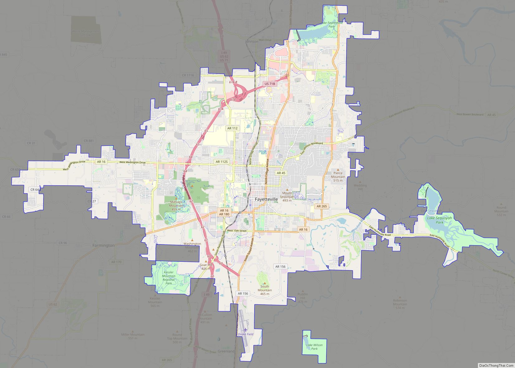
Johnson is a city in Washington County, Arkansas, United States. The community is located in the Ozark Mountains and is surrounded by valleys and natural springs. Early settlers took advantage of these natural features and formed an economy based on mining lime, the Johnson Mill and trout. Although a post office was opened in the community in 1887, Johnson did not incorporate until it required the development of a city government to provide utility services in 1961. Located between Fayetteville and Springdale in the heart of the rapidly growing Northwest Arkansas metropolitan statistical area, Johnson has been experiencing a population and building boom in recent years, as indicated by a 46% growth in population between the 2000 and 2010 censuses.
| Name: | Johnson city |
|---|---|
| LSAD Code: | 25 |
| LSAD Description: | city (suffix) |
| State: | Arkansas |
| County: | Washington County |
| Elevation: | 1,158 ft (353 m) |
| Land Area: | 3.61 sq mi (9.36 km²) |
| Water Area: | 0.03 sq mi (0.08 km²) |
| Population Density: | 998.89/sq mi (385.71/km²) |
| ZIP code: | 72762 |
| Area code: | 479 |
| FIPS code: | 0535500 |
| GNISfeature ID: | 2404807 |
| Website: | cityofjohnson.com |
Online Interactive Map
Click on ![]() to view map in "full screen" mode.
to view map in "full screen" mode.
Johnson location map. Where is Johnson city?
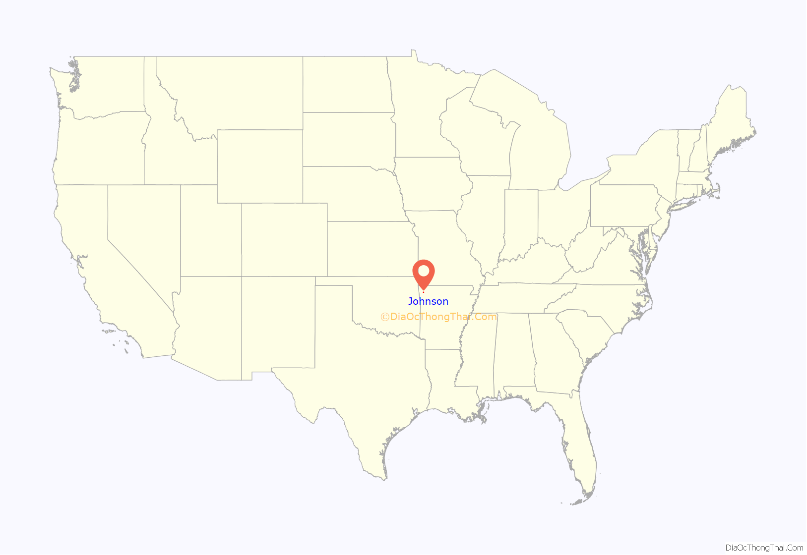
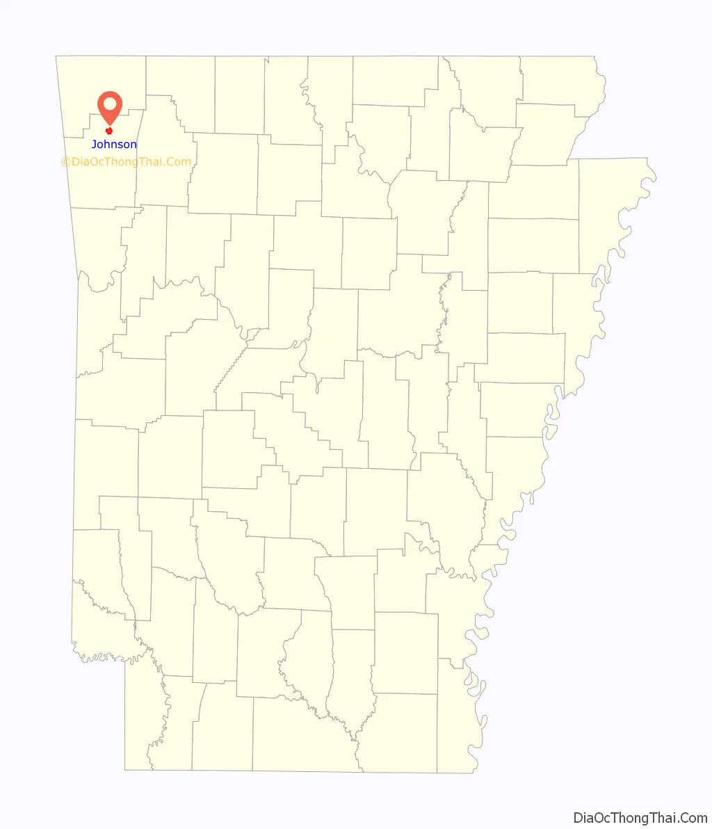
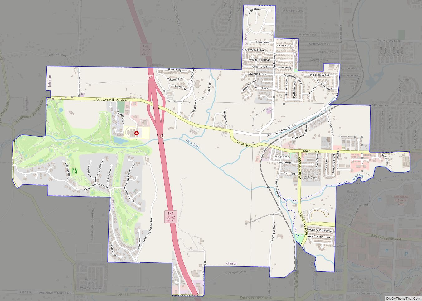
Johnson Road Map

Johnson city Satellite Map

Geography
Johnson is located between Fayetteville and Springdale. The town is located off Exit 69 on I-49 in Northwest Arkansas.
According to the United States Census Bureau, the city has a total area of 3.1 square miles (8.0 km), all land.
See also
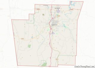
Map of Arkansas State and its subdivision:- Arkansas
- Ashley
- Baxter
- Benton
- Boone
- Bradley
- Calhoun
- Carroll
- Chicot
- Clark
- Clay
- Cleburne
- Cleveland
- Columbia
- Conway
- Craighead
- Crawford
- Crittenden
- Cross
- Dallas
- Desha
- Drew
- Faulkner
- Franklin
- Fulton
- Garland
- Grant
- Greene
- Hempstead
- Hot Spring
- Howard
- Independence
- Izard
- Jackson
- Jefferson
- Johnson
- Lafayette
- Lawrence
- Lee
- Lincoln
- Little River
- Logan
- Lonoke
- Madison
- Marion
- Miller
- Mississippi
- Monroe
- Montgomery
- Nevada
- Newton
- Ouachita
- Perry
- Phillips
- Pike
- Poinsett
- Polk
- Pope
- Prairie
- Pulaski
- Randolph
- Saint Francis
- Saline
- Scott
- Searcy
- Sebastian
- Sevier
- Sharp
- Stone
- Union
- Van Buren
- Washington
- White
- Woodruff
- Yell
- Alabama
- Alaska
- Arizona
- Arkansas
- California
- Colorado
- Connecticut
- Delaware
- District of Columbia
- Florida
- Georgia
- Hawaii
- Idaho
- Illinois
- Indiana
- Iowa
- Kansas
- Kentucky
- Louisiana
- Maine
- Maryland
- Massachusetts
- Michigan
- Minnesota
- Mississippi
- Missouri
- Montana
- Nebraska
- Nevada
- New Hampshire
- New Jersey
- New Mexico
- New York
- North Carolina
- North Dakota
- Ohio
- Oklahoma
- Oregon
- Pennsylvania
- Rhode Island
- South Carolina
- South Dakota
- Tennessee
- Texas
- Utah
- Vermont
- Virginia
- Washington
- West Virginia
- Wisconsin
- Wyoming