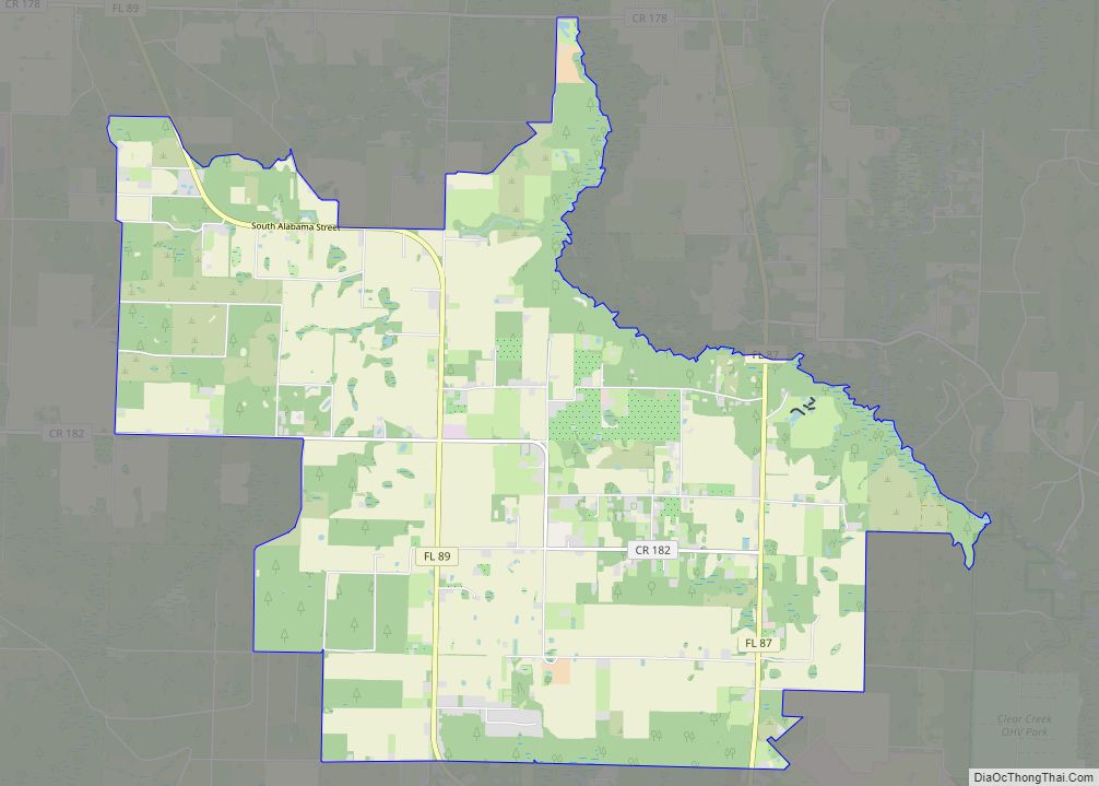
Bagdad is a census-designated place (CDP) in Santa Rosa County, Florida, United States. The population was 1,490 at the 2000 census. It is part of the Pensacola–Ferry Pass–Brent Metropolitan Statistical Area.
| Name: | Bagdad CDP |
|---|---|
| LSAD Code: | 57 |
| LSAD Description: | CDP (suffix) |
| State: | Florida |
| County: | Santa Rosa County |
| Elevation: | 13 ft (4 m) |
| Total Area: | 6.47 sq mi (16.75 km²) |
| Land Area: | 6.34 sq mi (16.43 km²) |
| Water Area: | 0.13 sq mi (0.32 km²) |
| Total Population: | 4,467 |
| Population Density: | 704.13/sq mi (271.88/km²) |
| ZIP code: | 32530 |
| Area code: | 850 |
| FIPS code: | 1202925 |
| GNISfeature ID: | 0278027 |
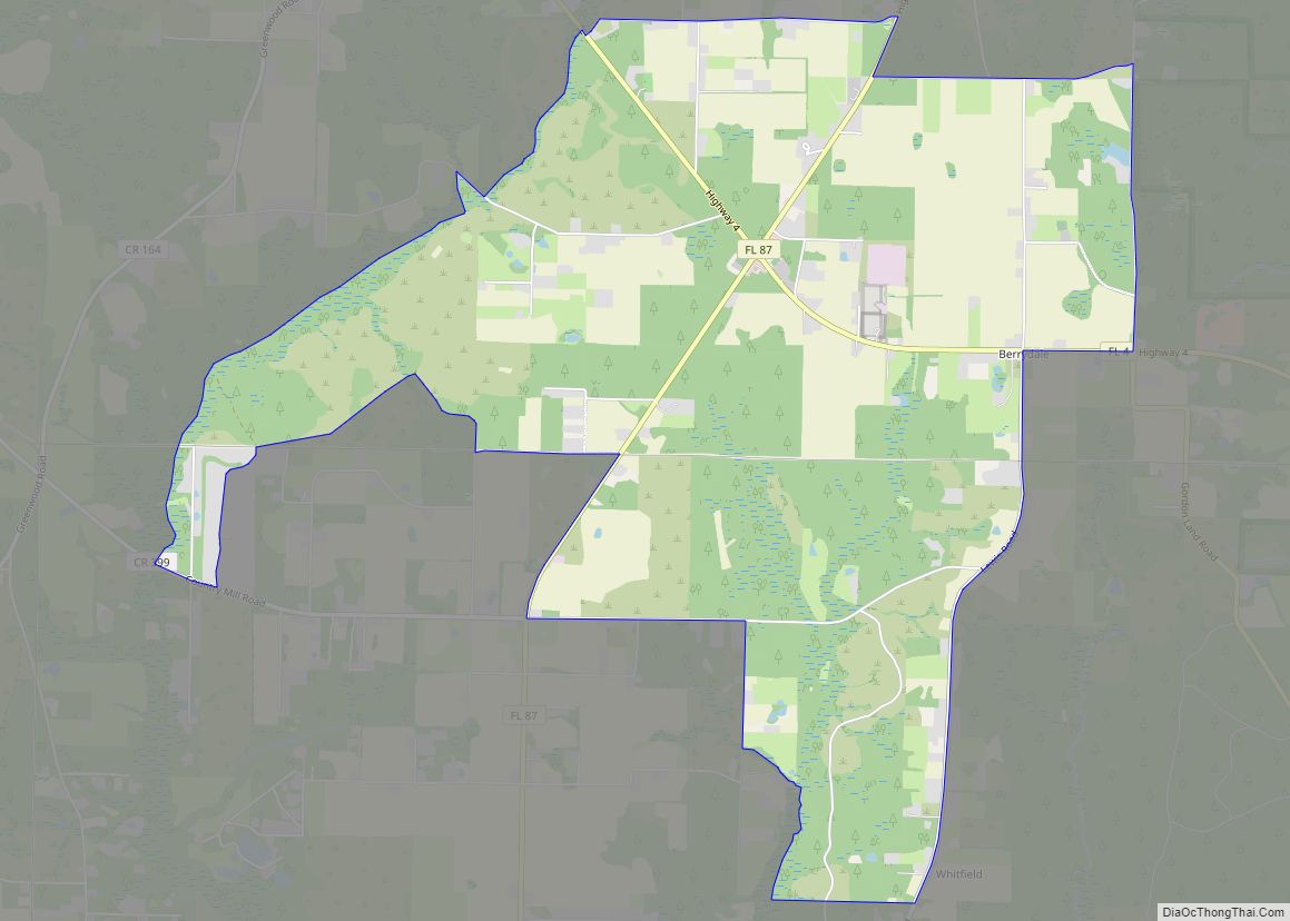
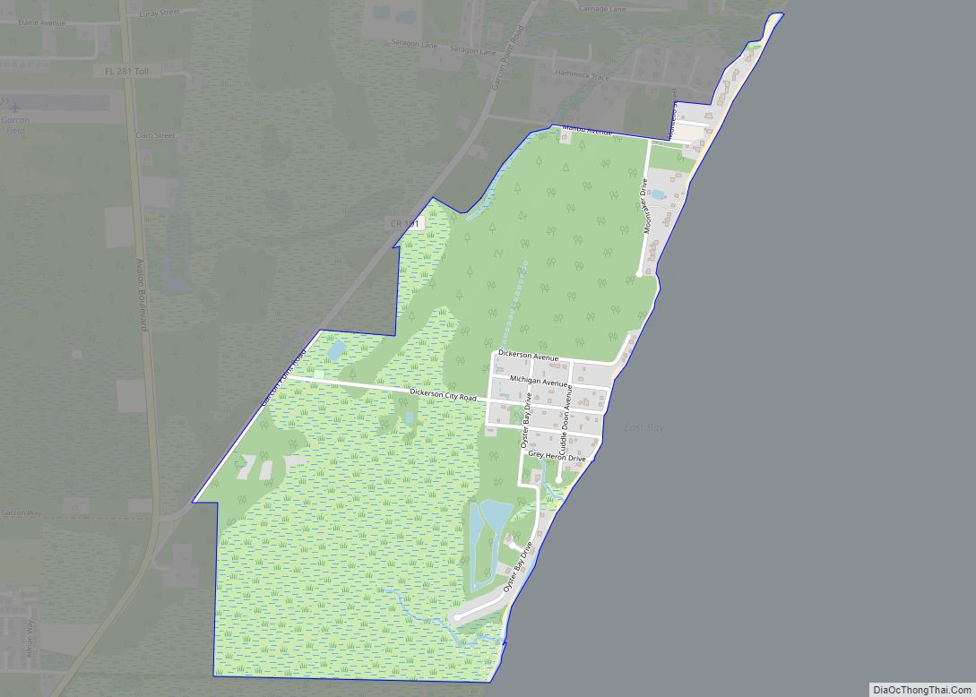
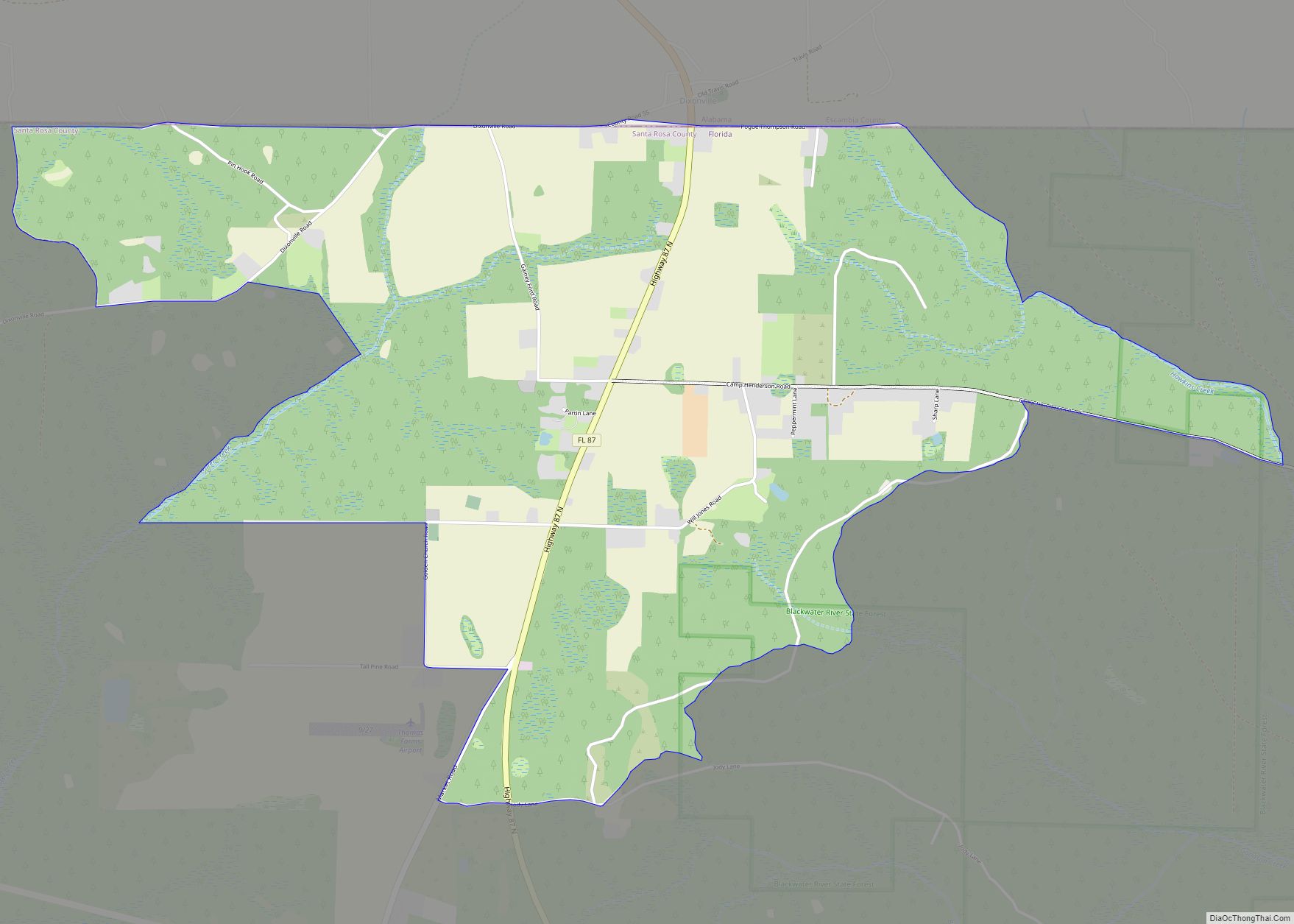
Online Interactive Map
Click on ![]() to view map in "full screen" mode.
to view map in "full screen" mode.
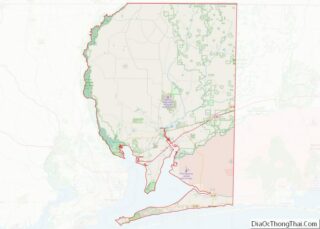
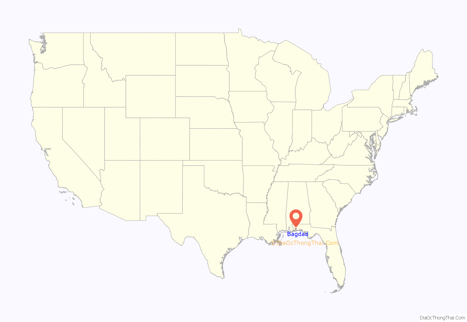
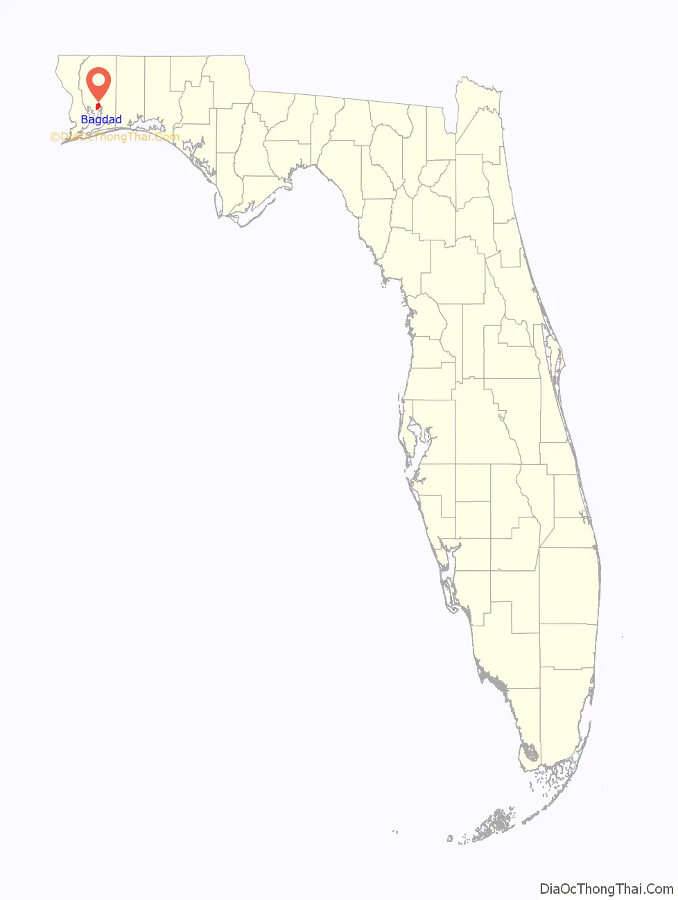
Bagdad location map. Where is Bagdad CDP?
History
Bagdad had its start in 1840 when a settler established a sawmill there. The community was named after Baghdad, Iraq. A post office called Bagdad has been in operation since 1887.
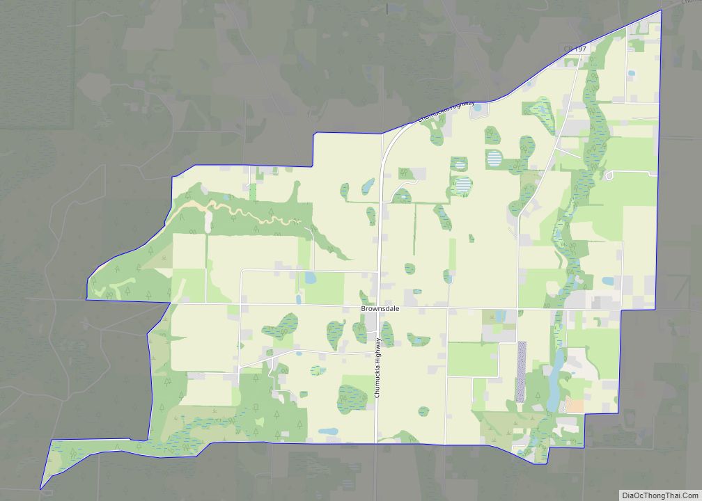
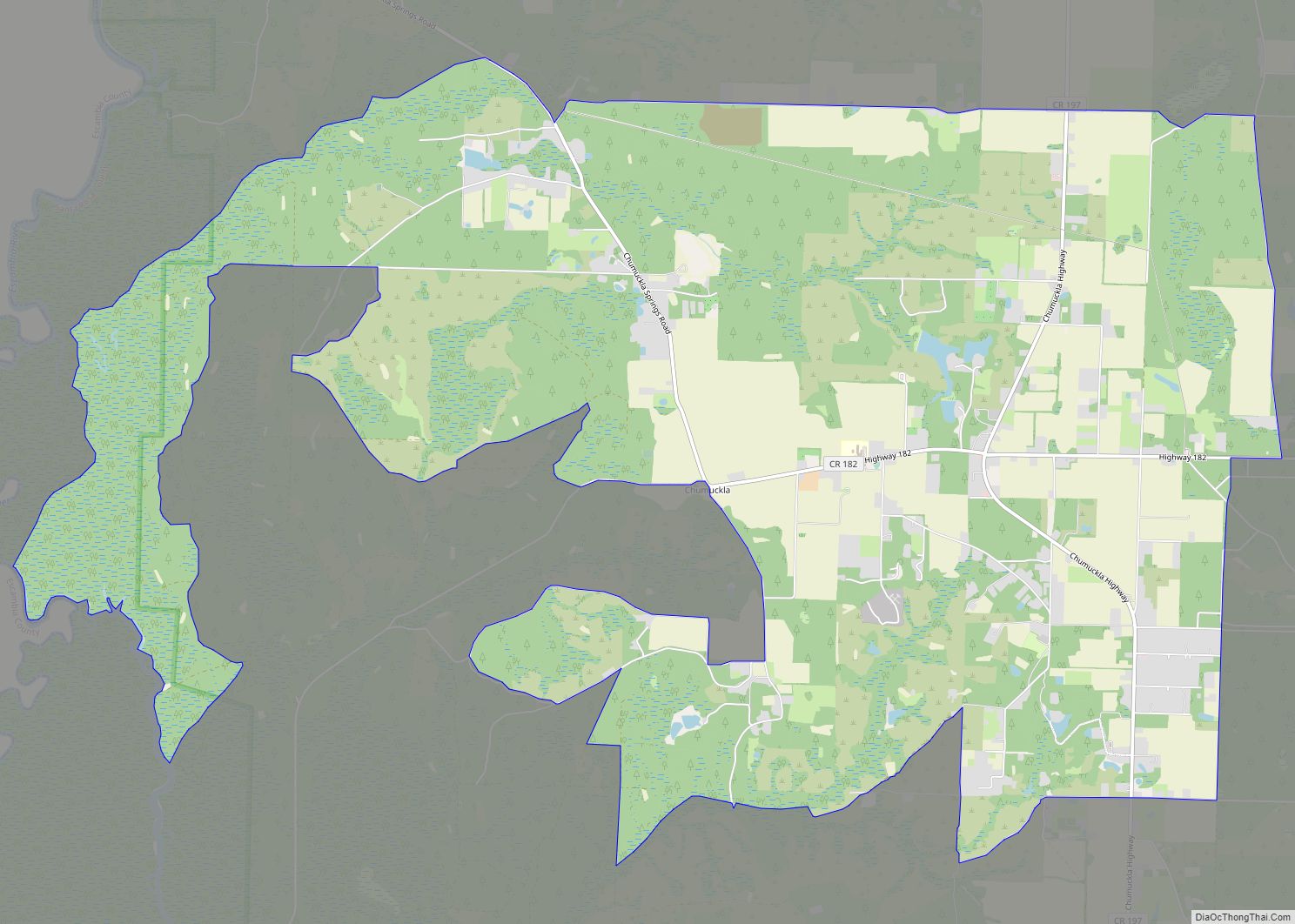
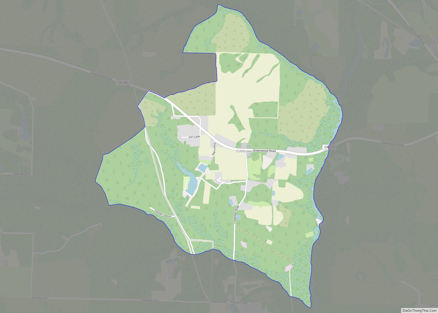
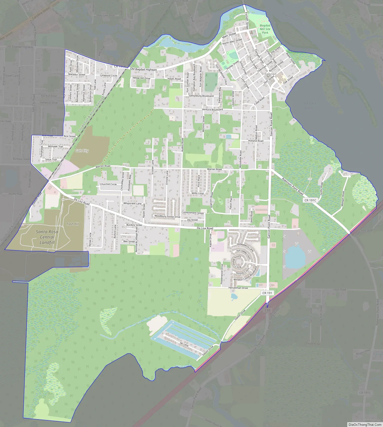
Bagdad Road Map
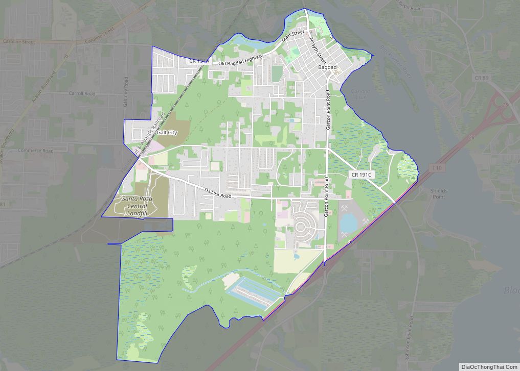
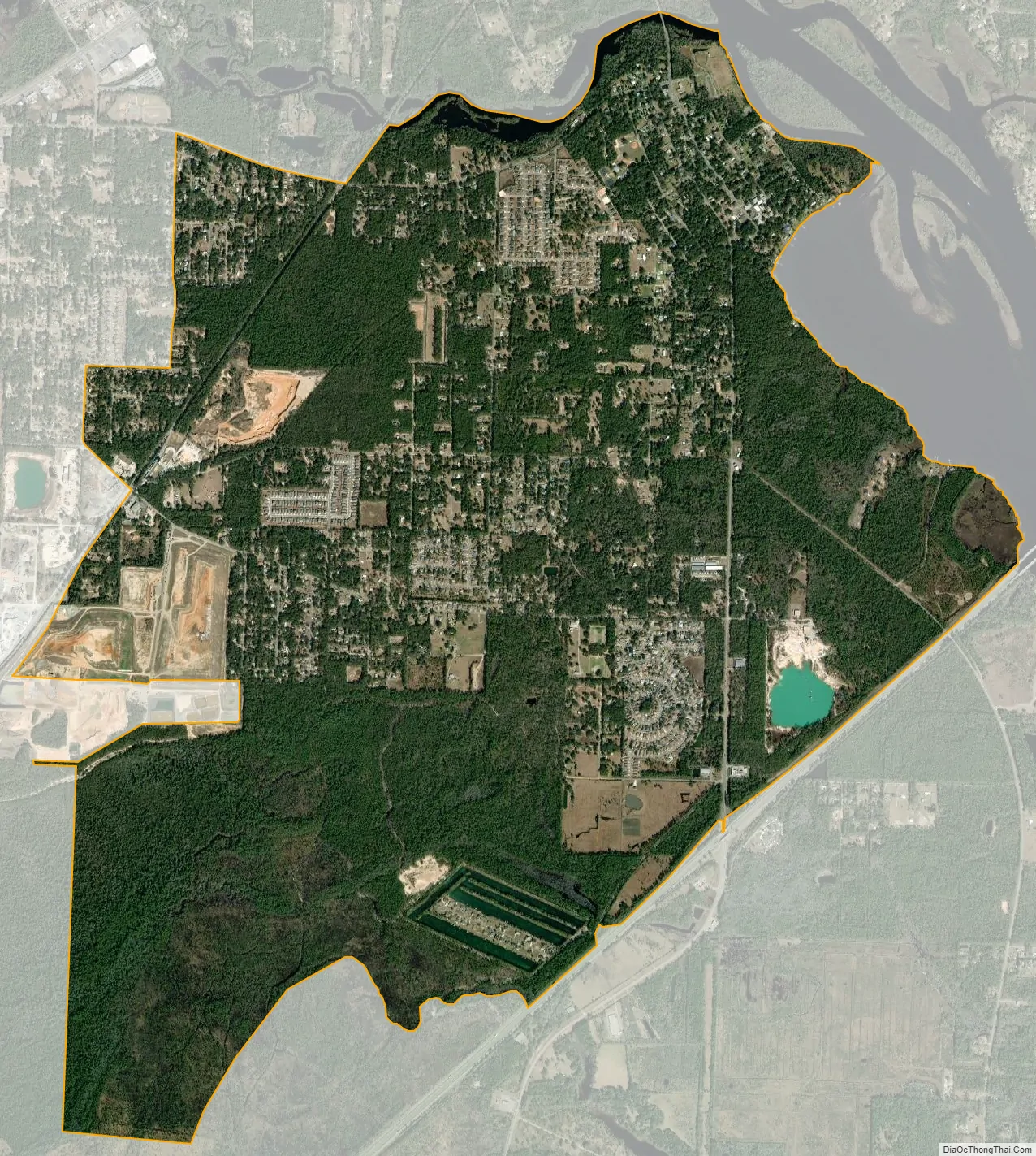
Bagdad city Satellite Map
Geography
Bagdad is located at 30°35′45″N 87°2′8″W / 30.59583°N 87.03556°W / 30.59583; -87.03556 (30.595790, -87.035622).
According to the United States Census Bureau, the CDP has a total area of 4.2 square miles (11 km), of which 3.5 square miles (9.1 km) is land and 0.7 square miles (1.8 km) (16.98%) is water.
The area was hard hit by Hurricane Dennis in 2005.
See also
Map of Florida State and its subdivision:- Alachua
- Baker
- Bay
- Bradford
- Brevard
- Broward
- Calhoun
- Charlotte
- Citrus
- Clay
- Collier
- Columbia
- Desoto
- Dixie
- Duval
- Escambia
- Flagler
- Franklin
- Gadsden
- Gilchrist
- Glades
- Gulf
- Hamilton
- Hardee
- Hendry
- Hernando
- Highlands
- Hillsborough
- Holmes
- Indian River
- Jackson
- Jefferson
- Lafayette
- Lake
- Lee
- Leon
- Levy
- Liberty
- Madison
- Manatee
- Marion
- Martin
- Miami-Dade
- Monroe
- Nassau
- Okaloosa
- Okeechobee
- Orange
- Osceola
- Palm Beach
- Pasco
- Pinellas
- Polk
- Putnam
- Saint Johns
- Saint Lucie
- Santa Rosa
- Sarasota
- Seminole
- Sumter
- Suwannee
- Taylor
- Union
- Volusia
- Wakulla
- Walton
- Washington
- Alabama
- Alaska
- Arizona
- Arkansas
- California
- Colorado
- Connecticut
- Delaware
- District of Columbia
- Florida
- Georgia
- Hawaii
- Idaho
- Illinois
- Indiana
- Iowa
- Kansas
- Kentucky
- Louisiana
- Maine
- Maryland
- Massachusetts
- Michigan
- Minnesota
- Mississippi
- Missouri
- Montana
- Nebraska
- Nevada
- New Hampshire
- New Jersey
- New Mexico
- New York
- North Carolina
- North Dakota
- Ohio
- Oklahoma
- Oregon
- Pennsylvania
- Rhode Island
- South Carolina
- South Dakota
- Tennessee
- Texas
- Utah
- Vermont
- Virginia
- Washington
- West Virginia
- Wisconsin
- Wyoming