Bradley Junction (also known as Bradley) is an unincorporated community and census-designated place in southwestern Polk County, Florida, United States. Its population was 542 as of the 2020 census.
| Name: | Bradley Junction CDP |
|---|---|
| LSAD Code: | 57 |
| LSAD Description: | CDP (suffix) |
| State: | Florida |
| County: | Polk County |
| Elevation: | 138 ft (42 m) |
| Total Area: | 2.15 sq mi (5.57 km²) |
| Land Area: | 2.11 sq mi (5.46 km²) |
| Water Area: | 0.04 sq mi (0.11 km²) |
| Total Population: | 542 |
| Population Density: | 257.12/sq mi (99.25/km²) |
| ZIP code: | 33835 |
| Area code: | 863 |
| FIPS code: | 1208125 |
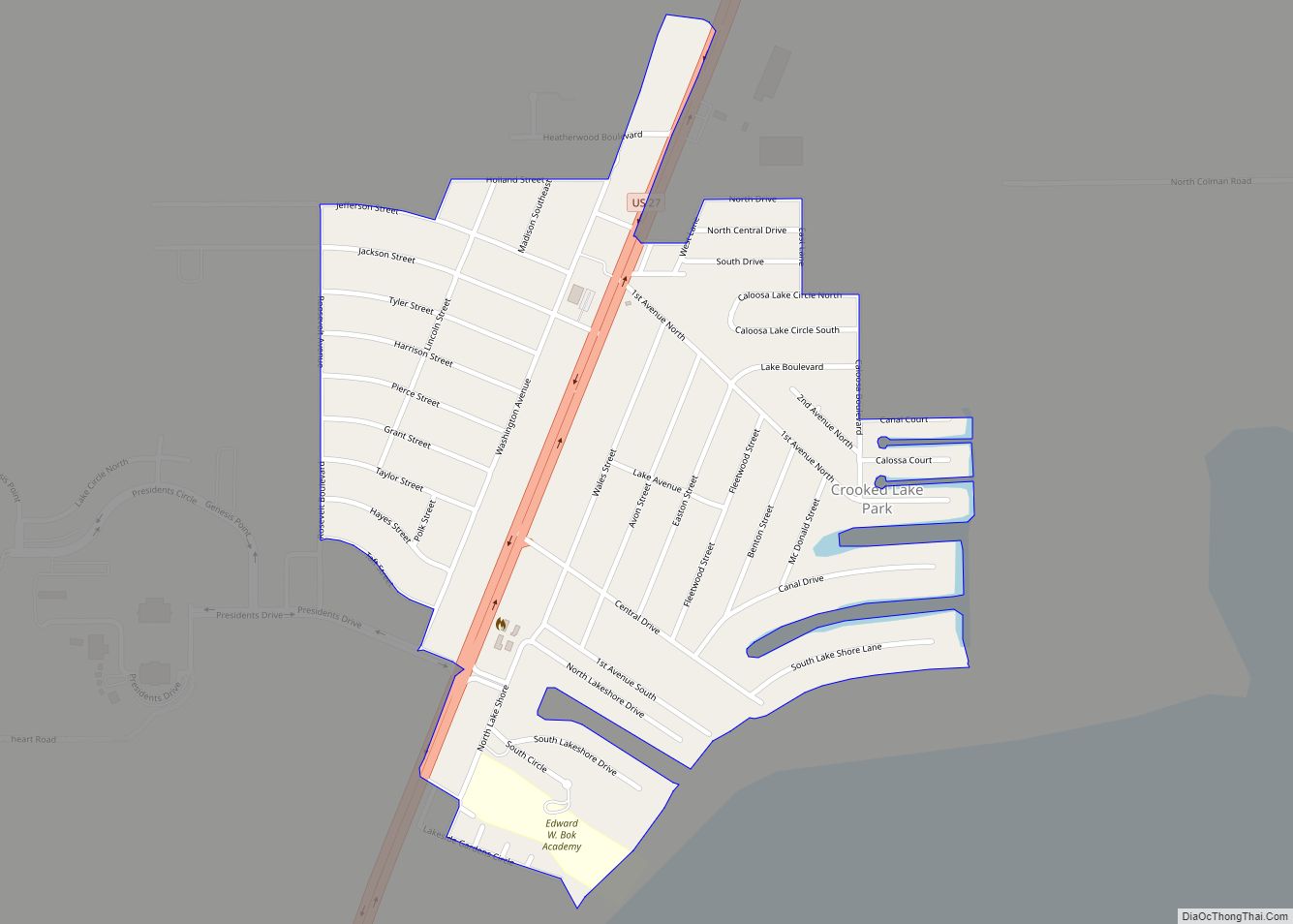
Online Interactive Map
Click on ![]() to view map in "full screen" mode.
to view map in "full screen" mode.
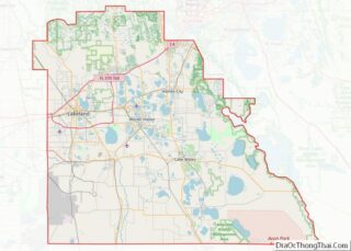
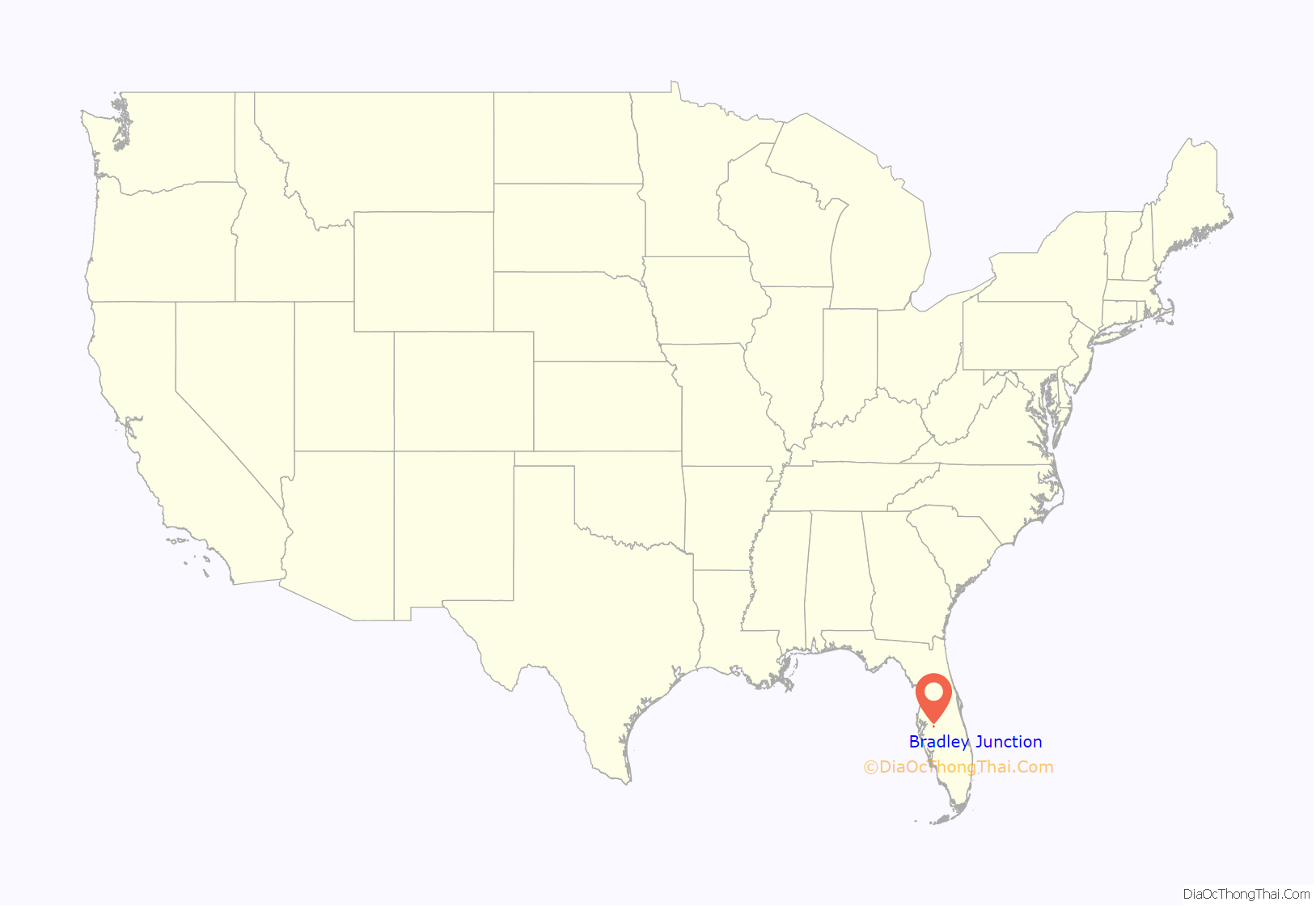
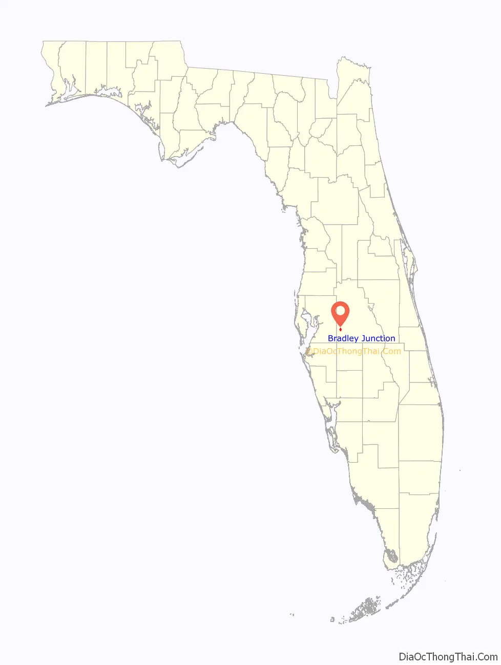
Bradley Junction location map. Where is Bradley Junction CDP?
History
Bradley Junction is named for the railroad junction located in the community, which was historically the junction between the Seaboard Air Line Railroad (the east-west track) and the Charlotte Harbor and Northern Railway (the north-south track). The junction itself is named after phosphate mining company executive Peter B. Bradley, who chartered the Charlotte Harbor and Northern Railway in 1905. The railroad junction still exists today and both lines are now owned by CSX Transportation. In the mid 1990s, the Florida Gulf Coast Railroad Museum (now the Florida Railroad Museum) moved the railroad station from Bradley Junction to Parrish. The depot was then consumed by a fire soon after the move.
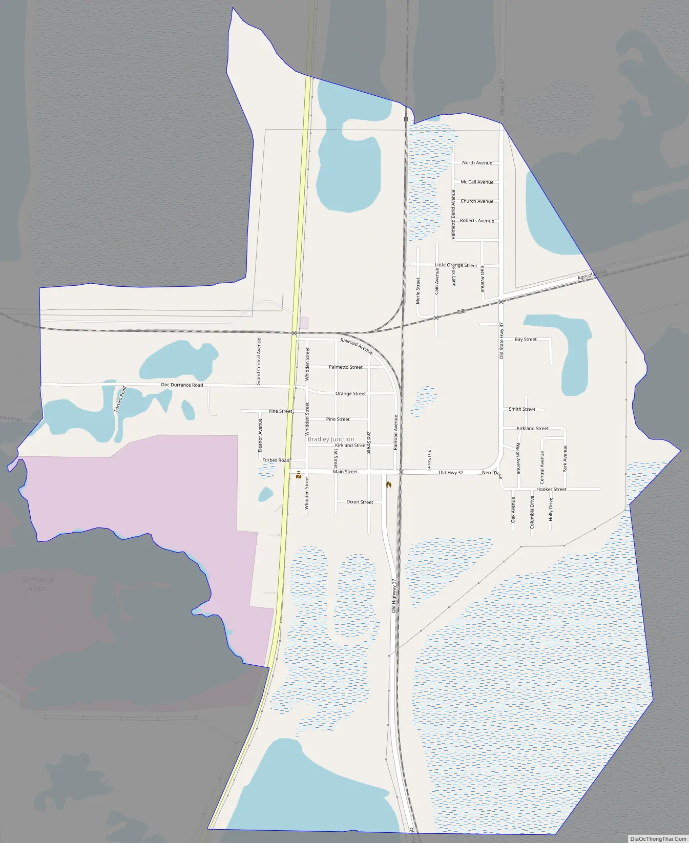
Bradley Junction Road Map
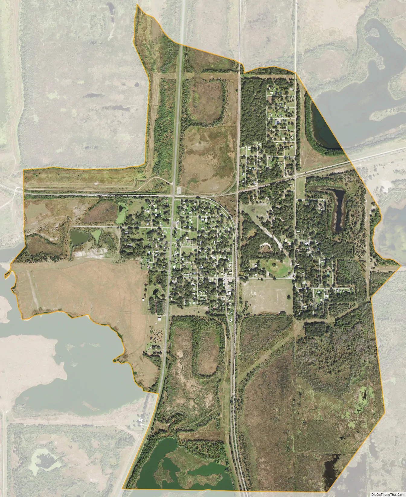
Bradley Junction city Satellite Map
Geography
Bradley Junction is located at 27.795 degrees north, 81.98056 degrees west (27.795, -81.98056). The elevation for the community is 135 feet above sea level.
See also
Map of Florida State and its subdivision:- Alachua
- Baker
- Bay
- Bradford
- Brevard
- Broward
- Calhoun
- Charlotte
- Citrus
- Clay
- Collier
- Columbia
- Desoto
- Dixie
- Duval
- Escambia
- Flagler
- Franklin
- Gadsden
- Gilchrist
- Glades
- Gulf
- Hamilton
- Hardee
- Hendry
- Hernando
- Highlands
- Hillsborough
- Holmes
- Indian River
- Jackson
- Jefferson
- Lafayette
- Lake
- Lee
- Leon
- Levy
- Liberty
- Madison
- Manatee
- Marion
- Martin
- Miami-Dade
- Monroe
- Nassau
- Okaloosa
- Okeechobee
- Orange
- Osceola
- Palm Beach
- Pasco
- Pinellas
- Polk
- Putnam
- Saint Johns
- Saint Lucie
- Santa Rosa
- Sarasota
- Seminole
- Sumter
- Suwannee
- Taylor
- Union
- Volusia
- Wakulla
- Walton
- Washington
- Alabama
- Alaska
- Arizona
- Arkansas
- California
- Colorado
- Connecticut
- Delaware
- District of Columbia
- Florida
- Georgia
- Hawaii
- Idaho
- Illinois
- Indiana
- Iowa
- Kansas
- Kentucky
- Louisiana
- Maine
- Maryland
- Massachusetts
- Michigan
- Minnesota
- Mississippi
- Missouri
- Montana
- Nebraska
- Nevada
- New Hampshire
- New Jersey
- New Mexico
- New York
- North Carolina
- North Dakota
- Ohio
- Oklahoma
- Oregon
- Pennsylvania
- Rhode Island
- South Carolina
- South Dakota
- Tennessee
- Texas
- Utah
- Vermont
- Virginia
- Washington
- West Virginia
- Wisconsin
- Wyoming