Fleming Island is an unincorporated community and census-designated place (CDP) in Clay County, Florida, United States. It is located 21 miles (34 km) southwest of downtown Jacksonville, on the western side of the St. Johns River, off US 17. As of the 2010 census the Fleming Island CDP had a population of 27,126. Fleming Island’s ZIP code became 32003 in 2004, giving it a different code from Orange Park, the incorporated town to the north.
| Name: | Fleming Island CDP |
|---|---|
| LSAD Code: | 57 |
| LSAD Description: | CDP (suffix) |
| State: | Florida |
| County: | Clay County |
| Total Area: | 23.12 sq mi (59.89 km²) |
| Land Area: | 15.84 sq mi (41.02 km²) |
| Water Area: | 7.29 sq mi (18.87 km²) |
| Total Population: | 29,142 |
| Population Density: | 1,840.01/sq mi (710.42/km²) |
| ZIP code: | 32003 |
| FIPS code: | 1222660 |
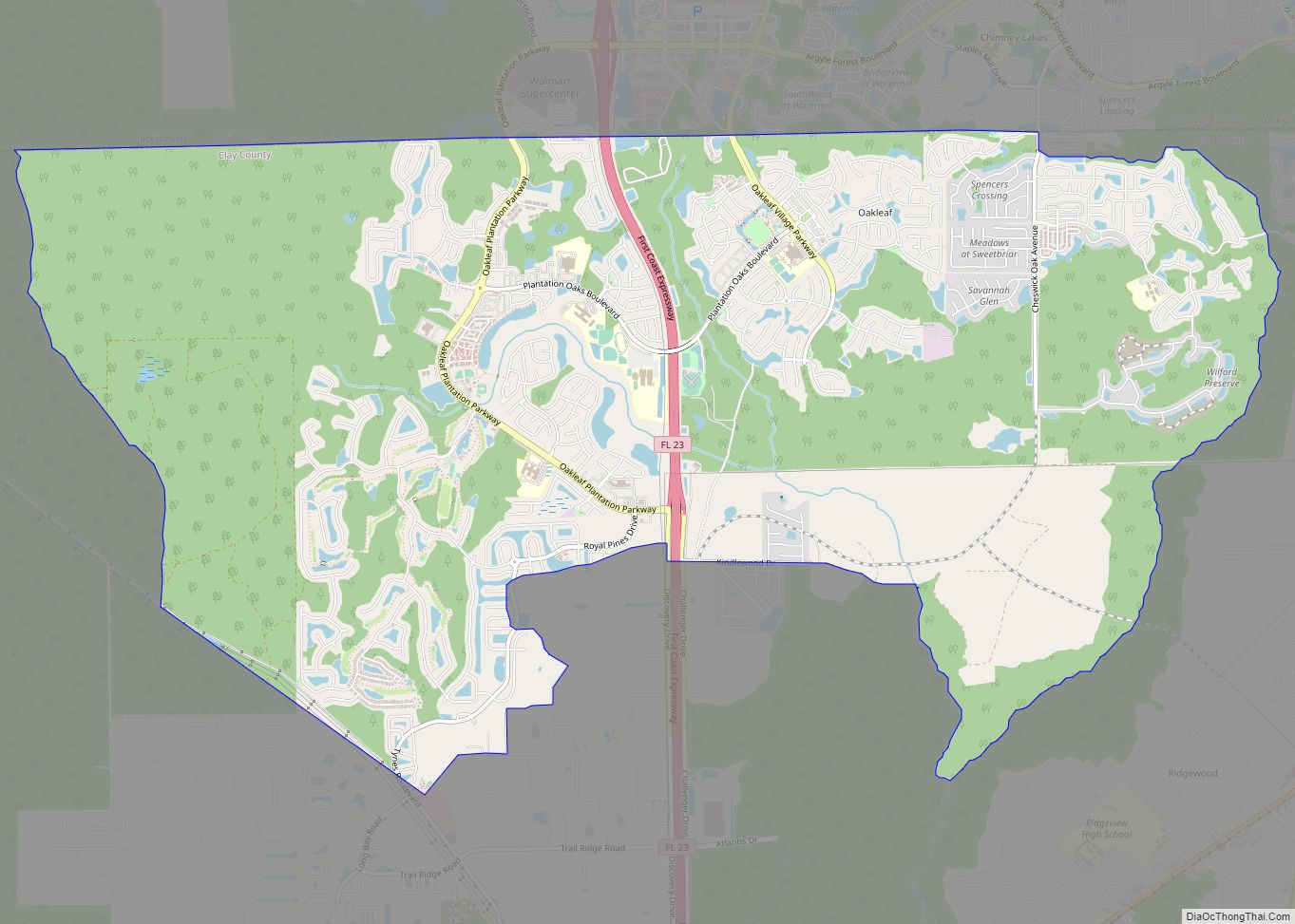
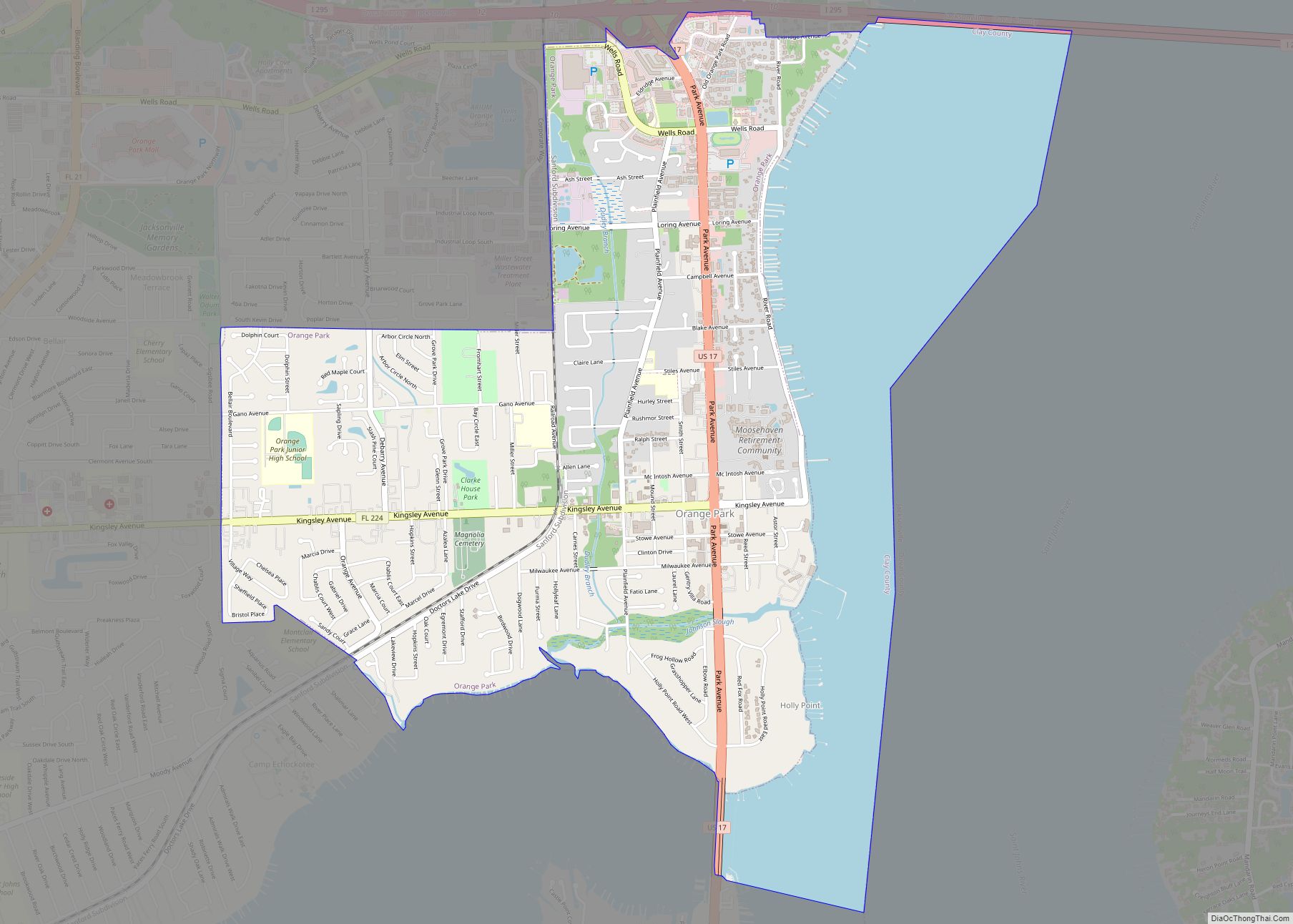
Online Interactive Map
Click on ![]() to view map in "full screen" mode.
to view map in "full screen" mode.
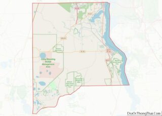
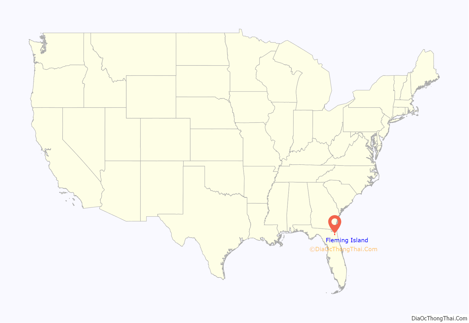
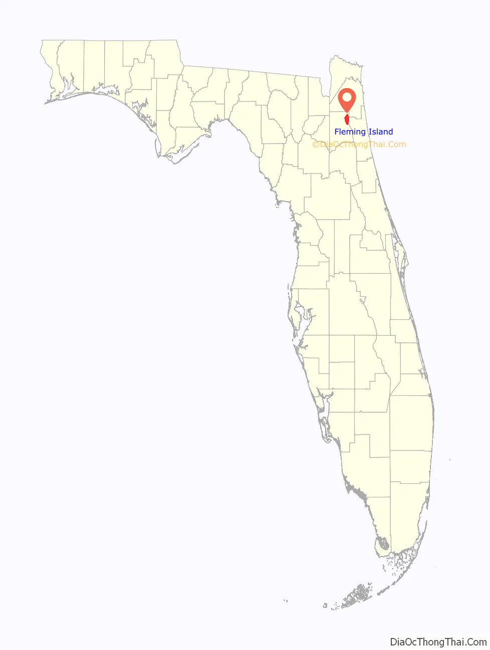
Fleming Island location map. Where is Fleming Island CDP?
History
Fleming Island was an area of Florida settled by Irish immigrant, George Fleming (1760-1821), who received a 1,000-acre land grant from the Spanish governor of East Florida for his military service. George Fleming built a plantation in 1790 and it was named Hibernia Plantation (in what is now Hibernia, Florida), after the Latin word for Ireland. When he died in 1821, the plantation was left to his son, Col. Lewis Michael Fleming (1798-1862).
In 1942, when the area was undeveloped, the U.S. Navy constructed four asphalt runways on the site and established a Naval Outlying Field designated as NOLF Fleming Island, an auxiliary airfield to Naval Air Station Jacksonville. The Navy abandoned the auxiliary airfield in the 1960s, its runways too short to accommodate the jet aircraft then in operation at nearby NAS Jacksonville and NAS Cecil Field, and in the late 1990s the decaying runways were demolished to make way for current residential development.
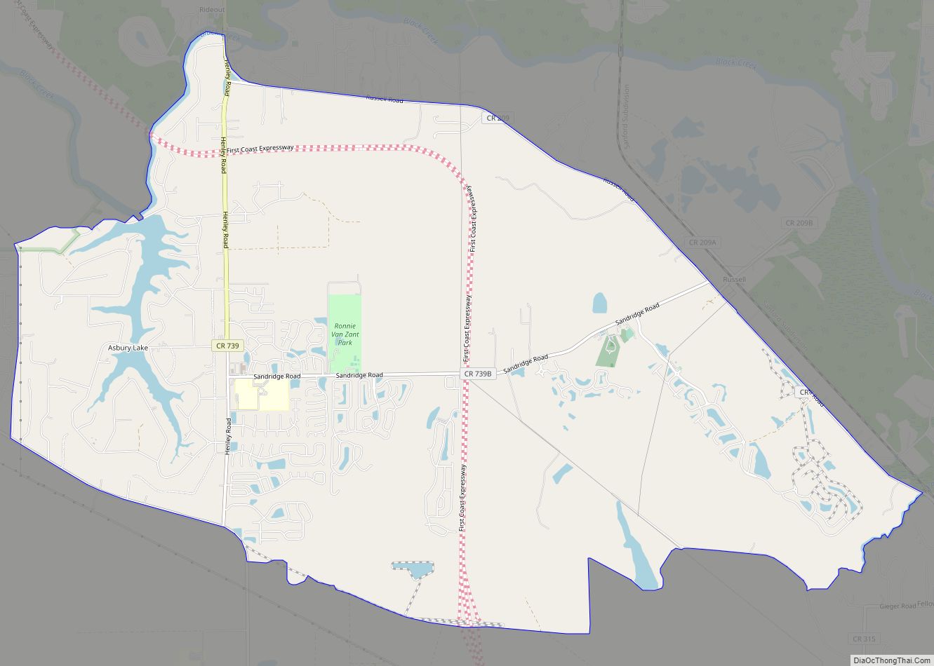
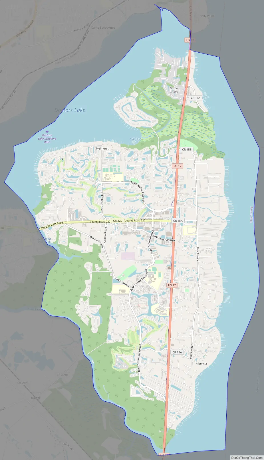
Fleming Island Road Map
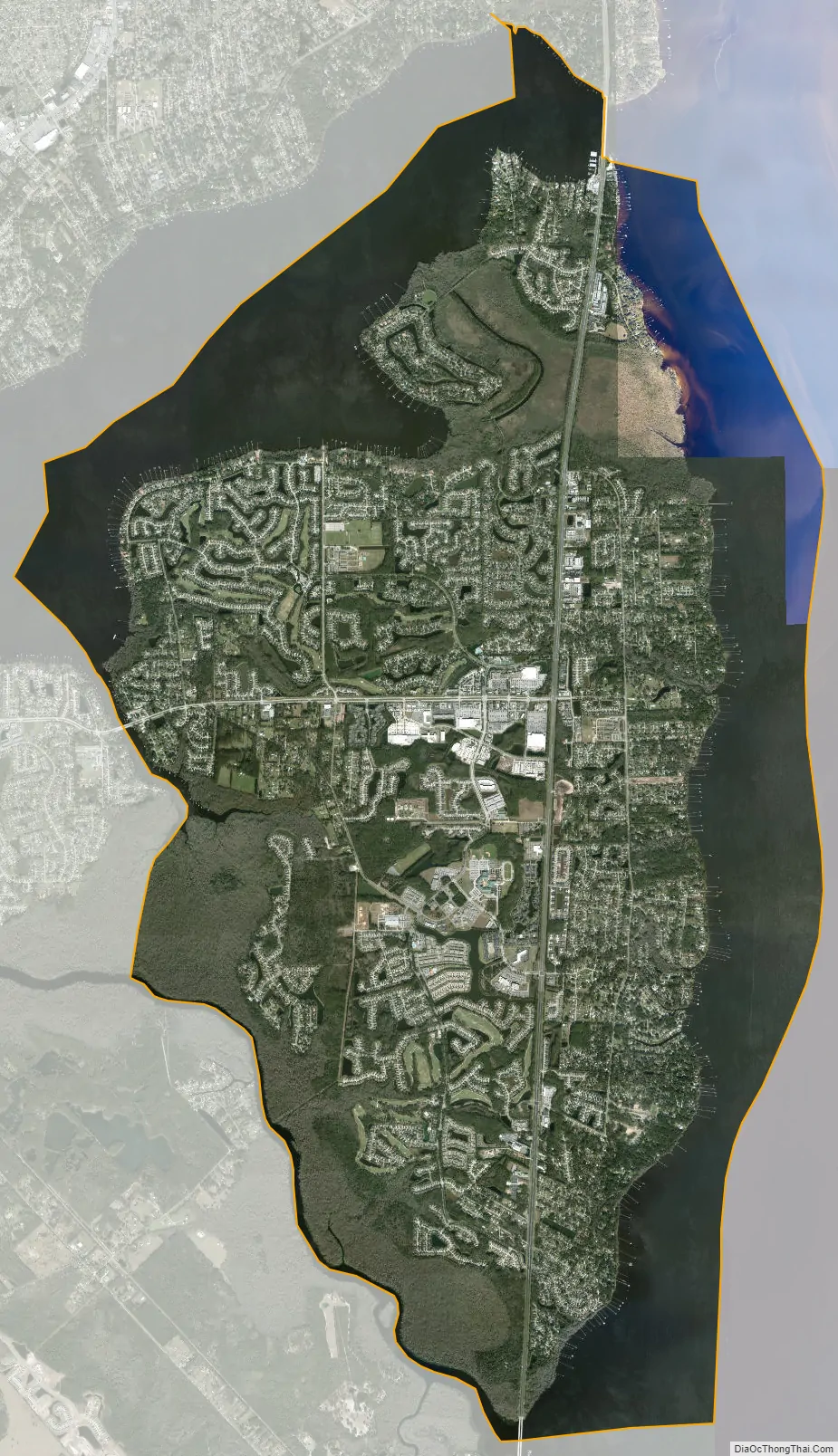
Fleming Island city Satellite Map
Geography
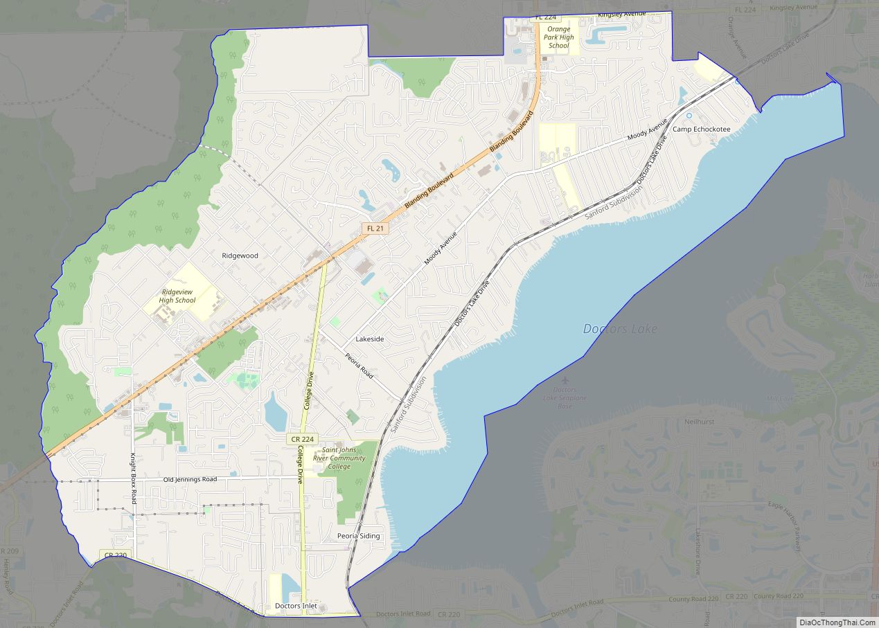
The Fleming Island CDP is located in northeastern Clay County, sharing its northern border with the southern town limits of Orange Park. To the northwest is the CDP of Lakeside. To the northeast is a portion of the city of Jacksonville, and due east is Fruit Cove in St. Johns County on the other side of the St. Johns River.
According to the U.S. Census Bureau, the Fleming Island CDP has a total area of 23.1 square miles (59.9 km), of which 15.8 square miles (41.0 km) is land and 7.3 square miles (18.9 km), or 31.56%, is water. Fleming Island is bordered by water or wetlands on all sides: the St. Johns River to the east, Doctors Lake to the north, Black Creek to the south and Swimming Pen Creek to the west. There are wetlands from Swimming Pen Creek to Black Creek that are not navigable. Some locals favor opening this to Black Creek but so far, the St. Johns Water Management District has not pursued the idea of doing this.
See also
Map of Florida State and its subdivision:- Alachua
- Baker
- Bay
- Bradford
- Brevard
- Broward
- Calhoun
- Charlotte
- Citrus
- Clay
- Collier
- Columbia
- Desoto
- Dixie
- Duval
- Escambia
- Flagler
- Franklin
- Gadsden
- Gilchrist
- Glades
- Gulf
- Hamilton
- Hardee
- Hendry
- Hernando
- Highlands
- Hillsborough
- Holmes
- Indian River
- Jackson
- Jefferson
- Lafayette
- Lake
- Lee
- Leon
- Levy
- Liberty
- Madison
- Manatee
- Marion
- Martin
- Miami-Dade
- Monroe
- Nassau
- Okaloosa
- Okeechobee
- Orange
- Osceola
- Palm Beach
- Pasco
- Pinellas
- Polk
- Putnam
- Saint Johns
- Saint Lucie
- Santa Rosa
- Sarasota
- Seminole
- Sumter
- Suwannee
- Taylor
- Union
- Volusia
- Wakulla
- Walton
- Washington
- Alabama
- Alaska
- Arizona
- Arkansas
- California
- Colorado
- Connecticut
- Delaware
- District of Columbia
- Florida
- Georgia
- Hawaii
- Idaho
- Illinois
- Indiana
- Iowa
- Kansas
- Kentucky
- Louisiana
- Maine
- Maryland
- Massachusetts
- Michigan
- Minnesota
- Mississippi
- Missouri
- Montana
- Nebraska
- Nevada
- New Hampshire
- New Jersey
- New Mexico
- New York
- North Carolina
- North Dakota
- Ohio
- Oklahoma
- Oregon
- Pennsylvania
- Rhode Island
- South Carolina
- South Dakota
- Tennessee
- Texas
- Utah
- Vermont
- Virginia
- Washington
- West Virginia
- Wisconsin
- Wyoming