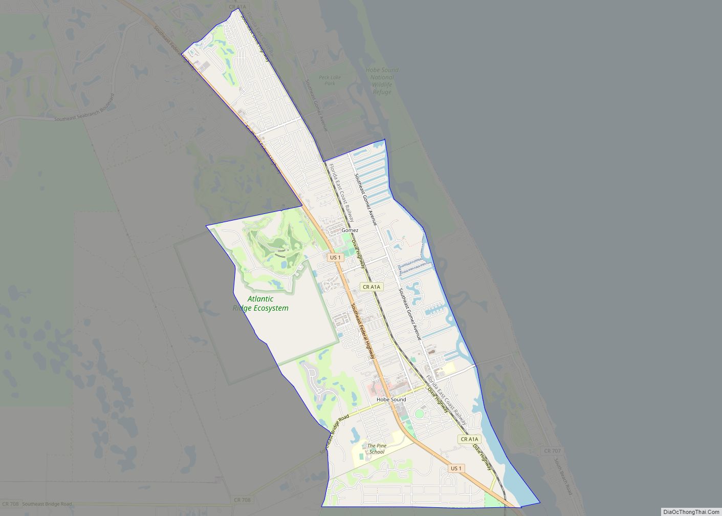
Hobe Sound is an unincorporated area and census-designated place (CDP) in Martin County, Florida, United States, located along Florida’s Treasure Coast. The population was 13,163 at the 2020 census, up from 11,521 in 2010.
| Name: | Hobe Sound CDP |
|---|---|
| LSAD Code: | 57 |
| LSAD Description: | CDP (suffix) |
| State: | Florida |
| County: | Martin County |
| Elevation: | 20 ft (6 m) |
| Total Area: | 7.72 sq mi (20.00 km²) |
| Land Area: | 7.11 sq mi (18.41 km²) |
| Water Area: | 0.61 sq mi (1.59 km²) |
| Total Population: | 13,163 |
| Population Density: | 1,852.4/sq mi (715.2/km²) |
| Area code: | 772 |
| FIPS code: | 1230975 |
| GNISfeature ID: | 0284064 |
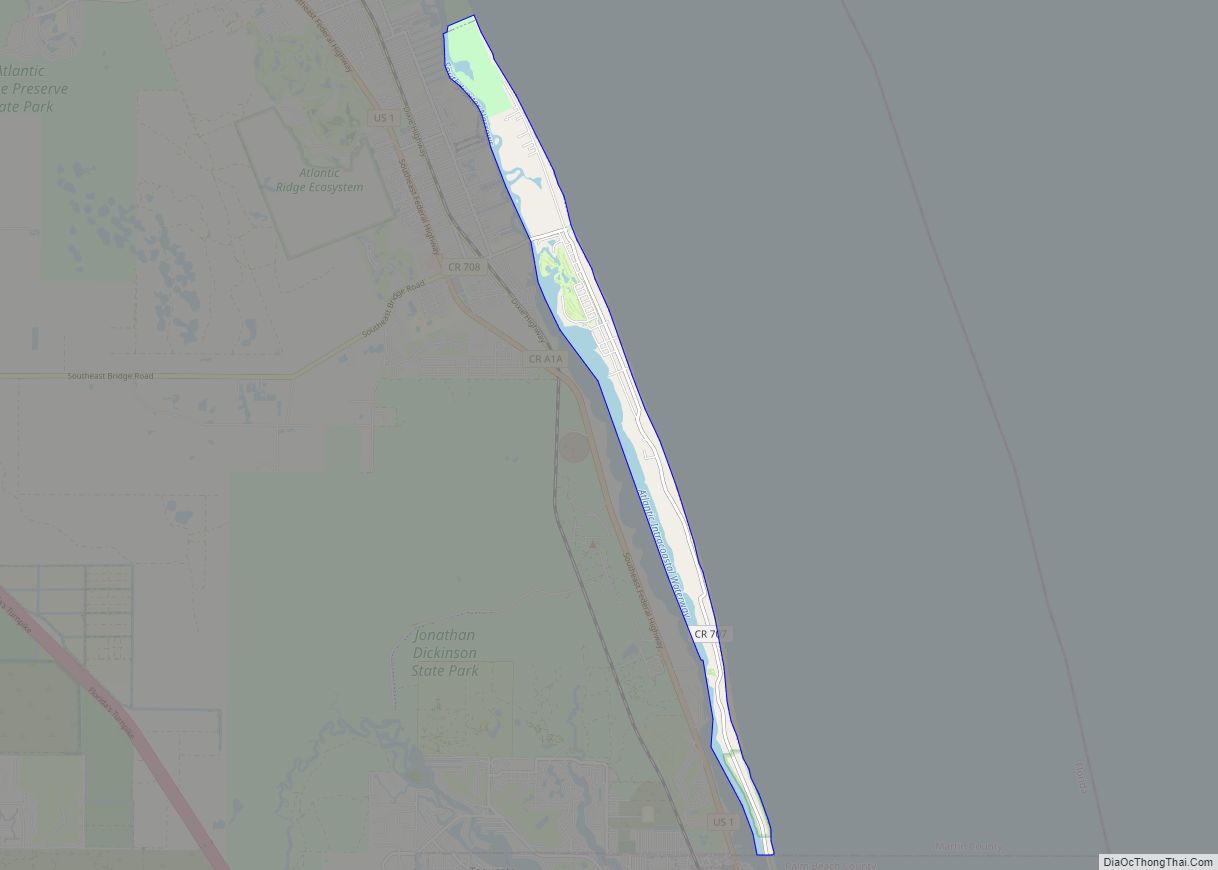
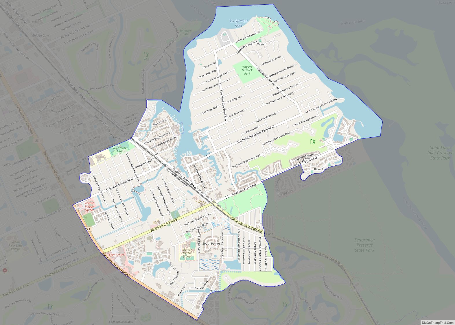
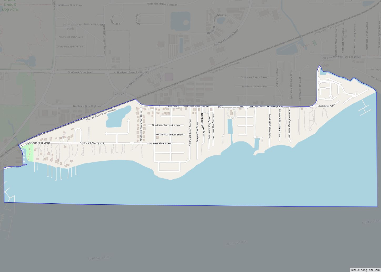
Online Interactive Map
Click on ![]() to view map in "full screen" mode.
to view map in "full screen" mode.
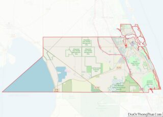
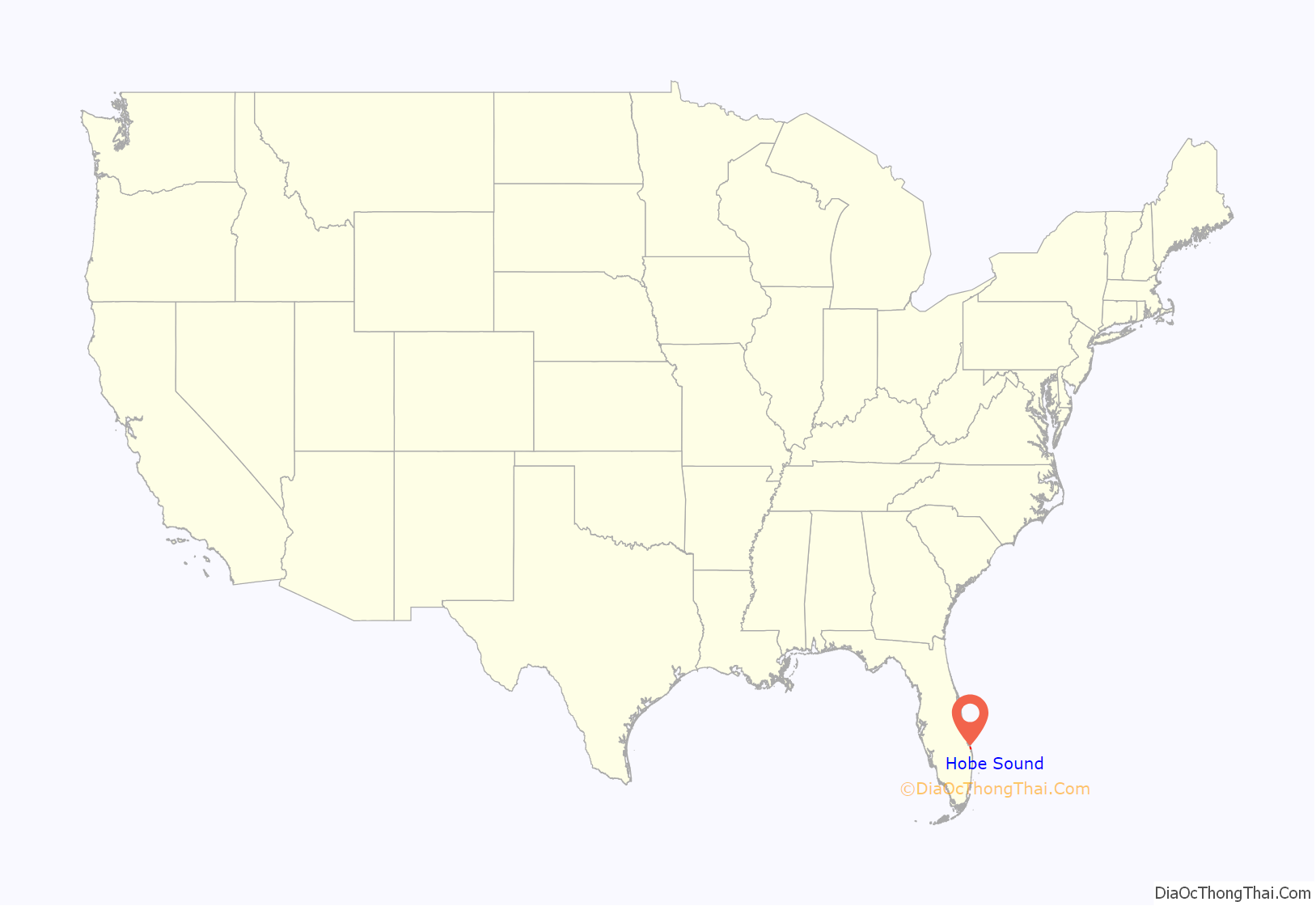
Hobe Sound location map. Where is Hobe Sound CDP?
History
Hobe Sound is the anglicized form of the name of a village of the Jaega, a Native American group that lived in the area before European settlement. The Spanish recorded the village name as “Jobe” or “Jove” [ˈxoβe]. Jonathan Dickinson, whose party was shipwrecked near the town in 1696, spelled the name of the village “Hoe-bey”.
Parts of Hobe Sound were included in the 12,000-acre (49 km) Gomez grant given by Spain to Don Eusebio in 1815. In 1821, Gomez sold 8,000 acres (32 km), including Jupiter Island, to Joseph Delespine for $1 per acre.
Shortly after the turn of the 20th century, Henry Flagler built his railroad along the east coast of Florida, passing through Hobe Sound. This gradually created many opportunities including jobs, the birth of tourism, and other related industries.
During the land boom of the 1920s elaborate plans were announced for Hobe Sound by the Olympia Improvement Corporation. Their goal was to create a town, in Greek style, where motion pictures could be produced. Street names bore such names as Zeus, Saturn, Mercury, Mars, Olympus, Venus, Pluto and Athena. For a brief time Hobe Sound was renamed “Picture City” and plans were presented for a movie picture production center. The boom collapsed after the 1928 Okeechobee hurricane, and the original name was restored. Street names remained, however, as did the cement streetlights along Dixie Highway.
In 1924, the building which soon would become the new schoolhouse in Hobe Sound was constructed. The Martin County Board of Public Instruction secured the use of the new school building from the Picture City Corporation in 1925, and in October of that year, the Olympia School opened. The school was designated the “Picture City School” of Martin County. It remained in use as a school until 1962.
Other mementos of the past are gone, including the ice plant, which was south of Bridge Road; the old train station, which now, refurbished and relocated west of Hobe Sound, serves as an office building for Becker Groves; and the Texaco station east of the Winn-Dixie plaza, which no longer supplies gasoline but continues to serve the community with car rentals and a livery service, operated by its founding family.
Hobe Sound is positioned at the southern end of environmentally-sensitive Martin (named after Governor Martin) County. It has been stated that at Hobe Sound’s front door lies the Gold Coast and that at her back door lies the Treasure Coast. Thus, Hobe Sound can lend to both while retaining its proud heritage and unique personality. Hobe Sound’s proximity to the coast affords immediate access to the Atlantic Ocean and the deep-channeled Intracoastal Waterway, a 1,200-mile (1,900 km) water route that provides a sheltered passage for boats along the eastern seaboard.
Another significant historical association possessed by Hobe Sound is the brief stay there of former Defense Secretary James Forrestal in 1949 between his resignation from that post and his death.
Around 1:30 a.m. on March 14, 1997, President Bill Clinton fell on the steps and twisted his knee at golfer Greg Norman’s 80-acre oceanside estate in Hobe Sound. Clinton was staying there to play in a golf tournament sponsored by Norman.
Hobe Sound is a predominantly wealthy community whose residents have included such celebrities and other prominent persons as “Tiger” Woods, Alan Jackson, Celine Dion, Burt Reynolds, and Marion Margery Scranton, among others. Over the decades, it was home or a winter home for wealthy businessman and industrialists, politicians, and sports and entertainment celebrities.
Police protection for Hobe Sound is provided by the Martin County Sheriff’s Department. The Martin County Fire Rescue Department provides modern fire, rescue, as well as EMS Services. State-of-the-art inter-facility EMS services are also provided by the Martin Health System.
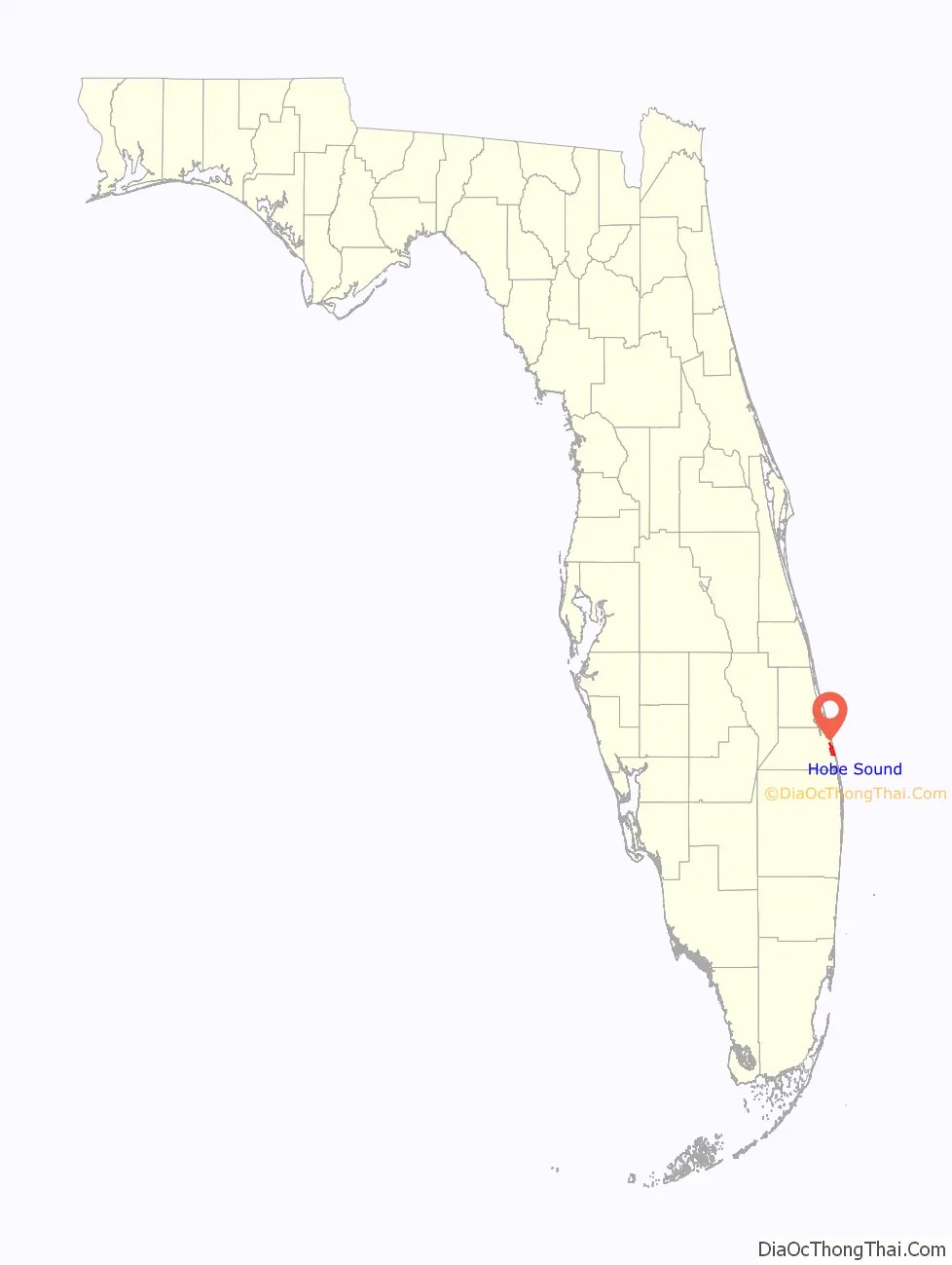
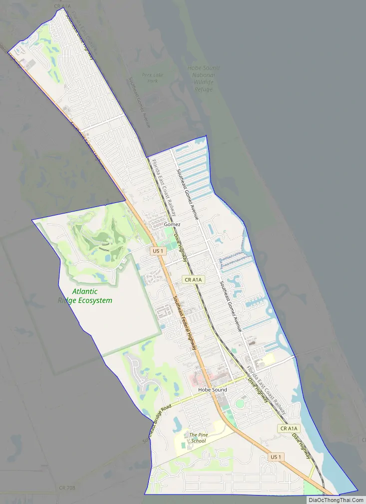
Hobe Sound Road Map
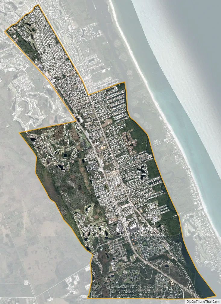
Hobe Sound city Satellite Map
Geography
Hobe Sound is located in southeastern Martin County at 27°04′36″N 80°08′31″W / 27.076737°N 80.142076°W / 27.076737; -80.142076. It is an exurban area near the Atlantic Ocean, approximately 25 miles (40 km) north of West Palm Beach and 12 miles (19 km) southeast of Stuart. It stretches along the coast between Port Salerno to the north and Jonathan Dickinson State Park to the south. To the east, across South Jupiter Narrows, is Jupiter Island. Hobe Sound Public Beach, within the town of Jupiter Island, is one of Martin County’s four guarded beaches.
See also
Map of Florida State and its subdivision:- Alachua
- Baker
- Bay
- Bradford
- Brevard
- Broward
- Calhoun
- Charlotte
- Citrus
- Clay
- Collier
- Columbia
- Desoto
- Dixie
- Duval
- Escambia
- Flagler
- Franklin
- Gadsden
- Gilchrist
- Glades
- Gulf
- Hamilton
- Hardee
- Hendry
- Hernando
- Highlands
- Hillsborough
- Holmes
- Indian River
- Jackson
- Jefferson
- Lafayette
- Lake
- Lee
- Leon
- Levy
- Liberty
- Madison
- Manatee
- Marion
- Martin
- Miami-Dade
- Monroe
- Nassau
- Okaloosa
- Okeechobee
- Orange
- Osceola
- Palm Beach
- Pasco
- Pinellas
- Polk
- Putnam
- Saint Johns
- Saint Lucie
- Santa Rosa
- Sarasota
- Seminole
- Sumter
- Suwannee
- Taylor
- Union
- Volusia
- Wakulla
- Walton
- Washington
- Alabama
- Alaska
- Arizona
- Arkansas
- California
- Colorado
- Connecticut
- Delaware
- District of Columbia
- Florida
- Georgia
- Hawaii
- Idaho
- Illinois
- Indiana
- Iowa
- Kansas
- Kentucky
- Louisiana
- Maine
- Maryland
- Massachusetts
- Michigan
- Minnesota
- Mississippi
- Missouri
- Montana
- Nebraska
- Nevada
- New Hampshire
- New Jersey
- New Mexico
- New York
- North Carolina
- North Dakota
- Ohio
- Oklahoma
- Oregon
- Pennsylvania
- Rhode Island
- South Carolina
- South Dakota
- Tennessee
- Texas
- Utah
- Vermont
- Virginia
- Washington
- West Virginia
- Wisconsin
- Wyoming