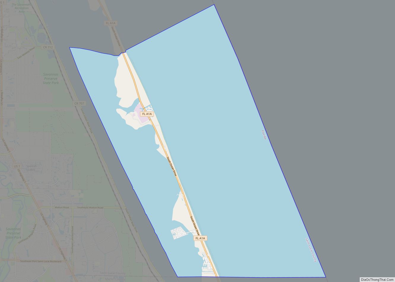
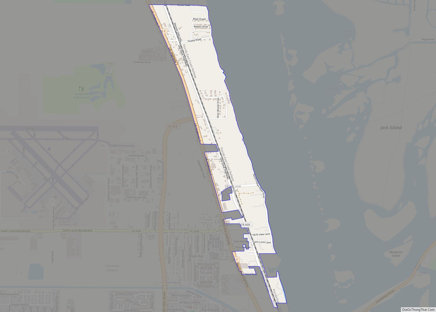
Hutchinson Island South is a census-designated place (CDP) on the barrier island of Hutchinson Island in St. Lucie County, Florida, United States. The South in its name refers to its location in the southern part of St. Lucie County, as it is actually in the central part of the island as a whole. The population was 4,846 at the 2000 census. It is part of the Port St. Lucie Metropolitan Statistical Area. Its mail is delivered from Jensen Beach 34957 in nearby Martin County. The Jensen Beach post office has a postal contract substation known as Hutchinson Beach located at 11007 South Ocean Drive, but it offers only post office boxes and counter services.
| Name: | Hutchinson Island South CDP |
|---|---|
| LSAD Code: | 57 |
| LSAD Description: | CDP (suffix) |
| State: | Florida |
| County: | St. Lucie County |
| Total Area: | 48.09 sq mi (124.56 km²) |
| Land Area: | 4.31 sq mi (11.15 km²) |
| Water Area: | 43.79 sq mi (113.41 km²) |
| Total Population: | 4,988 |
| Population Density: | 1,158.38/sq mi (447.25/km²) |
| FIPS code: | 1232993 |
Online Interactive Map
Click on ![]() to view map in "full screen" mode.
to view map in "full screen" mode.
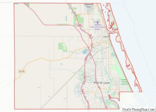
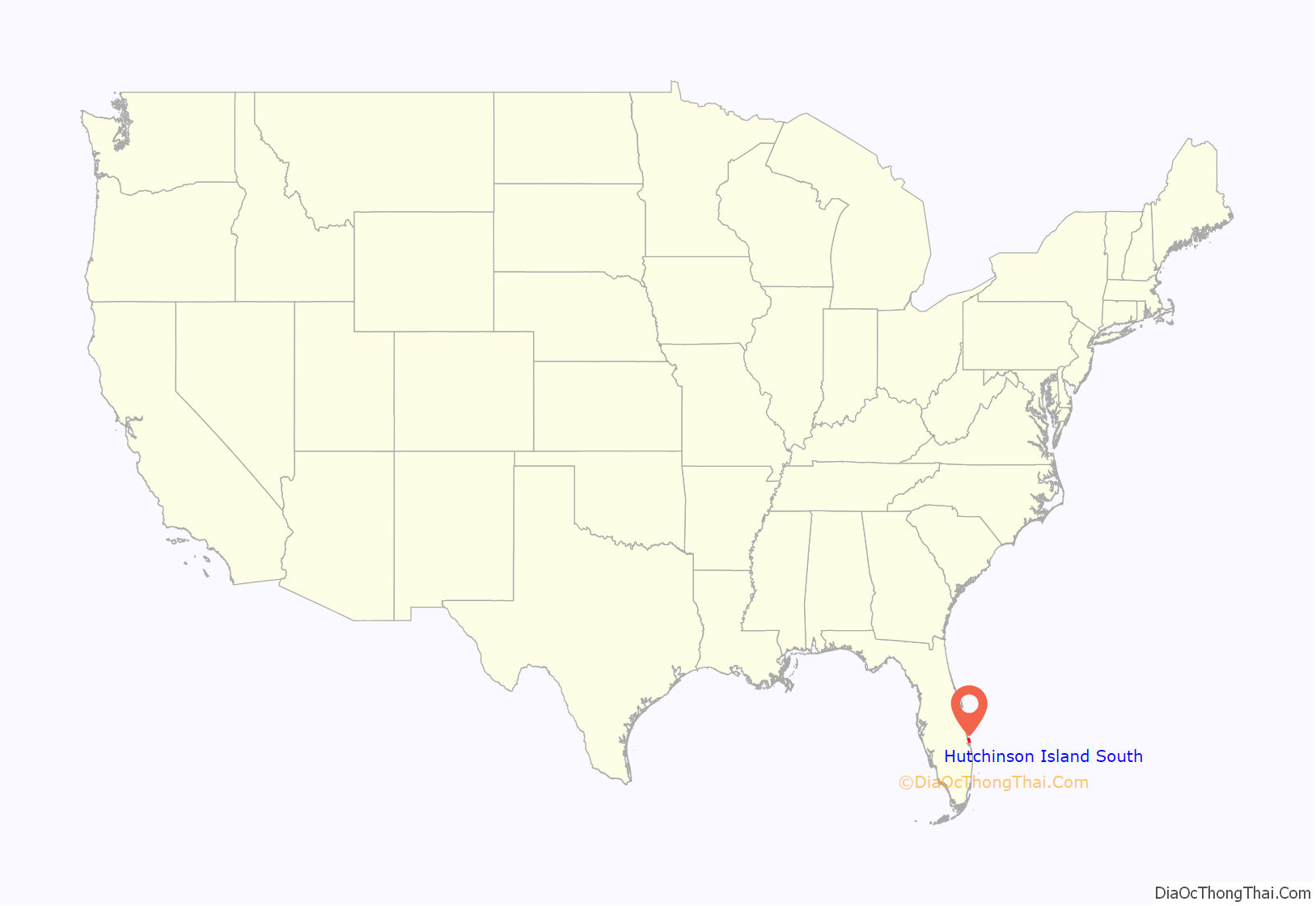
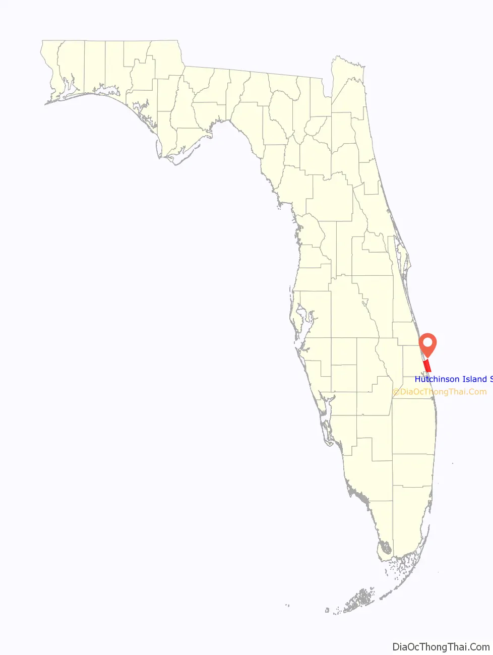
Hutchinson Island South location map. Where is Hutchinson Island South CDP?
Hutchinson Island South Road Map
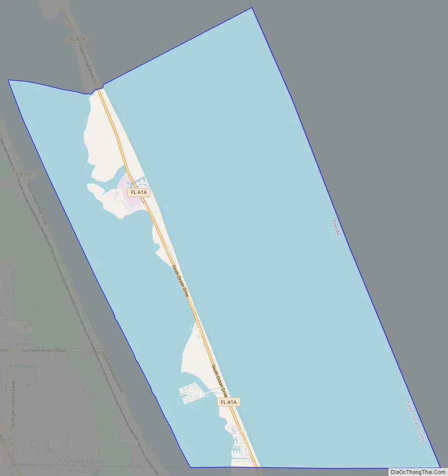
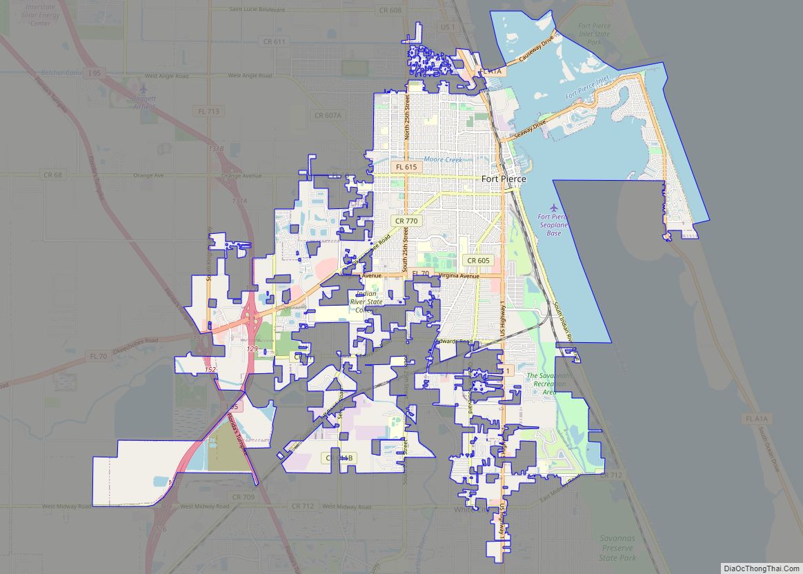
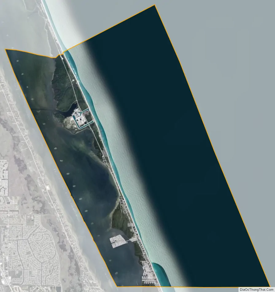
Hutchinson Island South city Satellite Map
Geography
Hutchinson Island South is located at 27°17′11″N 80°13′14″W / 27.28639°N 80.22056°W / 27.28639; -80.22056 (27.286391, -80.220669).
According to the United States Census Bureau, the CDP has a total area of 48.1 square miles (125 km), of which 4.5 square miles (12 km) is land and 43.6 square miles (113 km) (90.62%) is water.
See also
Map of Florida State and its subdivision:- Alachua
- Baker
- Bay
- Bradford
- Brevard
- Broward
- Calhoun
- Charlotte
- Citrus
- Clay
- Collier
- Columbia
- Desoto
- Dixie
- Duval
- Escambia
- Flagler
- Franklin
- Gadsden
- Gilchrist
- Glades
- Gulf
- Hamilton
- Hardee
- Hendry
- Hernando
- Highlands
- Hillsborough
- Holmes
- Indian River
- Jackson
- Jefferson
- Lafayette
- Lake
- Lee
- Leon
- Levy
- Liberty
- Madison
- Manatee
- Marion
- Martin
- Miami-Dade
- Monroe
- Nassau
- Okaloosa
- Okeechobee
- Orange
- Osceola
- Palm Beach
- Pasco
- Pinellas
- Polk
- Putnam
- Saint Johns
- Saint Lucie
- Santa Rosa
- Sarasota
- Seminole
- Sumter
- Suwannee
- Taylor
- Union
- Volusia
- Wakulla
- Walton
- Washington
- Alabama
- Alaska
- Arizona
- Arkansas
- California
- Colorado
- Connecticut
- Delaware
- District of Columbia
- Florida
- Georgia
- Hawaii
- Idaho
- Illinois
- Indiana
- Iowa
- Kansas
- Kentucky
- Louisiana
- Maine
- Maryland
- Massachusetts
- Michigan
- Minnesota
- Mississippi
- Missouri
- Montana
- Nebraska
- Nevada
- New Hampshire
- New Jersey
- New Mexico
- New York
- North Carolina
- North Dakota
- Ohio
- Oklahoma
- Oregon
- Pennsylvania
- Rhode Island
- South Carolina
- South Dakota
- Tennessee
- Texas
- Utah
- Vermont
- Virginia
- Washington
- West Virginia
- Wisconsin
- Wyoming