Jacob City is a city in Jackson County, Florida, United States. The population was 243 at the 2020 census.
| Name: | Jacob City city |
|---|---|
| LSAD Code: | 25 |
| LSAD Description: | city (suffix) |
| State: | Florida |
| County: | Jackson County |
| Elevation: | 135 ft (41 m) |
| Total Area: | 3.22 sq mi (8.35 km²) |
| Land Area: | 3.05 sq mi (7.89 km²) |
| Water Area: | 0.18 sq mi (0.46 km²) |
| Total Population: | 243 |
| Population Density: | 71.22/sq mi (27.50/km²) |
| Area code: | 850 |
| FIPS code: | 1235200 |
| Website: | www.jacobcityfl.org |
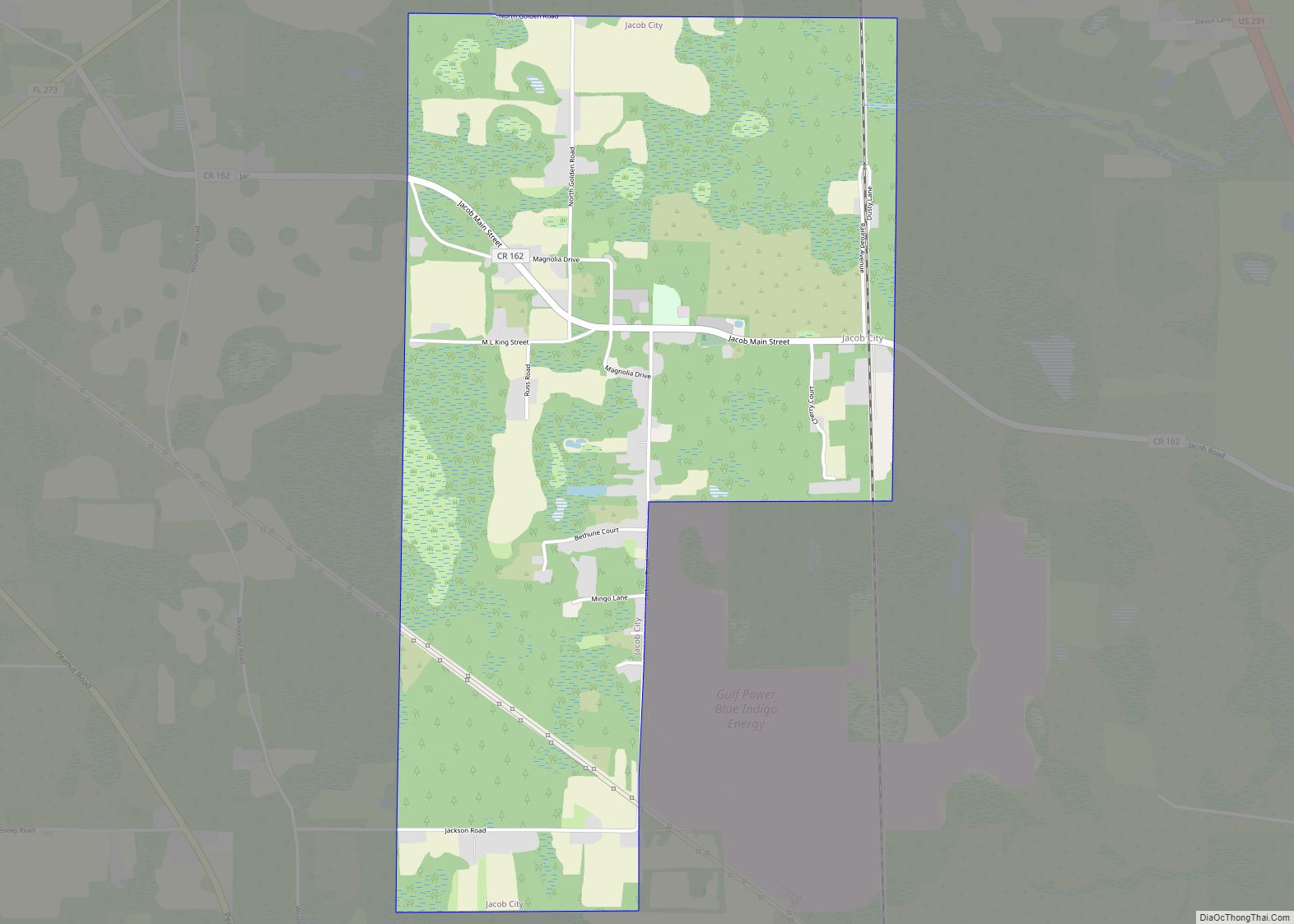
Online Interactive Map
Click on ![]() to view map in "full screen" mode.
to view map in "full screen" mode.
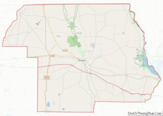
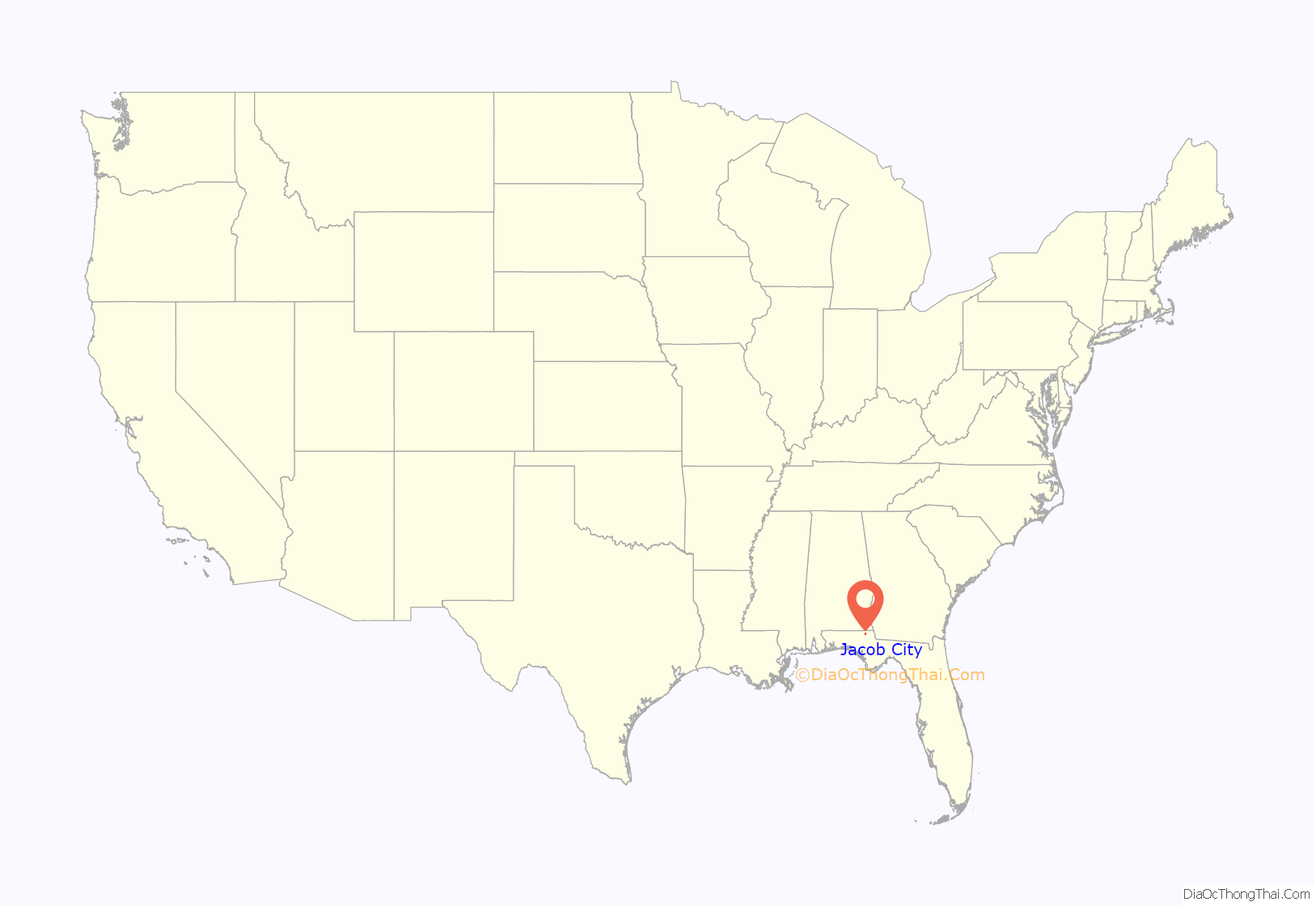
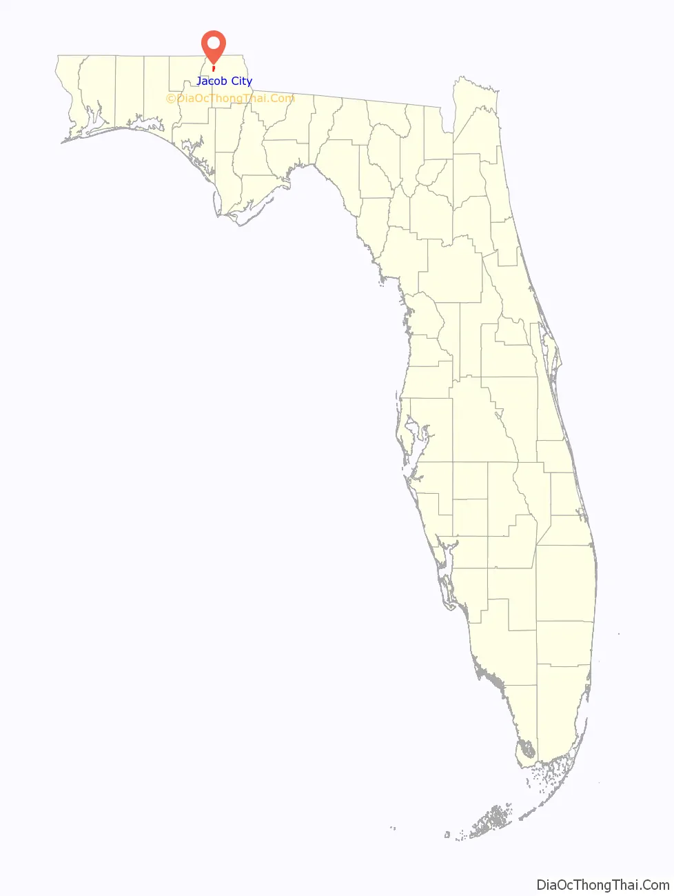
Jacob City location map. Where is Jacob City city?
History
Jacob City’s history begins in the early 19th century, when many former slaves moved from Webbville to isolate themselves from harassment from the white people there, most of whose residents moved to Marianna in 1882. Webbville no longer exists, but was located around the current location of U.S. 231 and State Road 73. Marianna was known as the rich man’s town and no Black people were welcome. The first known settlement of Jacob City was by a white man named Jacob Jones, who accepted Black people to be housed on his property. That is where Jacob City got its name, as they would tell their friends, “Let’s go to Jacob’s.” As Black people arrived to escape oppression, they moved farther down and made horse wagon trails into dirt roads, forming a small community.
By the mid-19th century, the small town of Jacob was Jackson County’s first Black community. Black people started their own store, but the owner was murdered and the store was never re-opened. By the late 19th century, St. Mary Missionary Baptist Church was built on what is now Main Street. It is commemorated by a Jacob City historical marker. By the early 20th century, Jacob’s dirt roads were improved and its population rose, but the poverty level was high due to the lack of education, as there was no school for Black children.
St. Mary’s Church provided a school, but many of its students never made it past seventh grade because they had to help with farm work at home with their parents. In 1953, St. Paul’s school was established near Campbellton as an elementary and high school where Jacob children could get a better education. The Campbellton school lasted until 1972. In the late 20th century, Jacob modernized and joined the Florida League of Cities. In 1984, Jacob became Jacob City and built a town hall.
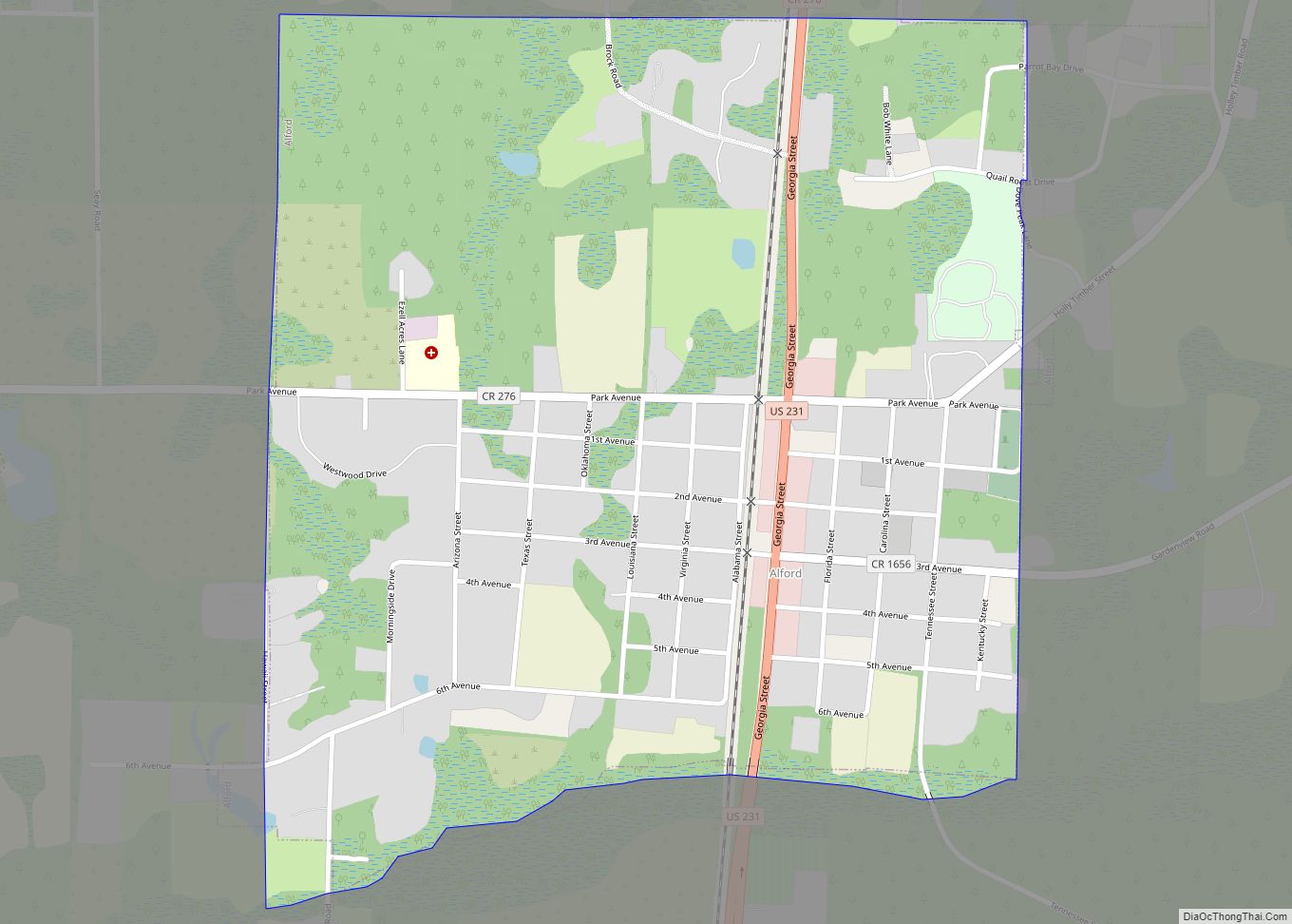
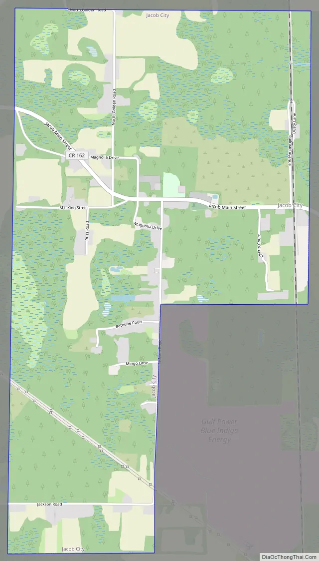
Jacob City Road Map
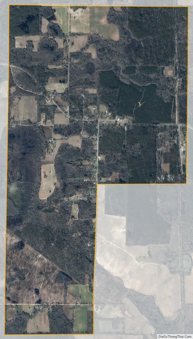
Jacob City city Satellite Map
Geography
Jacob City is located at 30°53′40″N 85°24′35″W / 30.89444°N 85.40972°W / 30.89444; -85.40972 (30.894334, –85.409802).
According to the United States Census Bureau, the city has a total area of 3.2 square miles (8.3 km), of which 3.1 square miles (8.0 km) is land and 0.1 square miles (0.26 km) (4.02%) is water.
Climate
See also
Map of Florida State and its subdivision:- Alachua
- Baker
- Bay
- Bradford
- Brevard
- Broward
- Calhoun
- Charlotte
- Citrus
- Clay
- Collier
- Columbia
- Desoto
- Dixie
- Duval
- Escambia
- Flagler
- Franklin
- Gadsden
- Gilchrist
- Glades
- Gulf
- Hamilton
- Hardee
- Hendry
- Hernando
- Highlands
- Hillsborough
- Holmes
- Indian River
- Jackson
- Jefferson
- Lafayette
- Lake
- Lee
- Leon
- Levy
- Liberty
- Madison
- Manatee
- Marion
- Martin
- Miami-Dade
- Monroe
- Nassau
- Okaloosa
- Okeechobee
- Orange
- Osceola
- Palm Beach
- Pasco
- Pinellas
- Polk
- Putnam
- Saint Johns
- Saint Lucie
- Santa Rosa
- Sarasota
- Seminole
- Sumter
- Suwannee
- Taylor
- Union
- Volusia
- Wakulla
- Walton
- Washington
- Alabama
- Alaska
- Arizona
- Arkansas
- California
- Colorado
- Connecticut
- Delaware
- District of Columbia
- Florida
- Georgia
- Hawaii
- Idaho
- Illinois
- Indiana
- Iowa
- Kansas
- Kentucky
- Louisiana
- Maine
- Maryland
- Massachusetts
- Michigan
- Minnesota
- Mississippi
- Missouri
- Montana
- Nebraska
- Nevada
- New Hampshire
- New Jersey
- New Mexico
- New York
- North Carolina
- North Dakota
- Ohio
- Oklahoma
- Oregon
- Pennsylvania
- Rhode Island
- South Carolina
- South Dakota
- Tennessee
- Texas
- Utah
- Vermont
- Virginia
- Washington
- West Virginia
- Wisconsin
- Wyoming