Cottondale is a town in Jackson County, Florida, United States. The population was 933 at the 2010 census, up from 869 at the 2000 census.
Cottondale has a police force of four to five sworn officers; the police chief is Willam Watford. Cottondale High School is located there.
The town was one of several Florida Panhandle communities devastated by Hurricane Michael in 2018.
| Name: | Cottondale town |
|---|---|
| LSAD Code: | 43 |
| LSAD Description: | town (suffix) |
| State: | Florida |
| County: | Jackson County |
| Elevation: | 131 ft (40 m) |
| Total Area: | 3.41 sq mi (8.84 km²) |
| Land Area: | 3.27 sq mi (8.47 km²) |
| Water Area: | 0.14 sq mi (0.37 km²) |
| Total Population: | 848 |
| Population Density: | 259.41/sq mi (100.16/km²) |
| ZIP code: | 32431 |
| Area code: | 850 |
| FIPS code: | 1214850 |
| GNISfeature ID: | 0280886 |
| Website: | www.cityofcottondale.net |
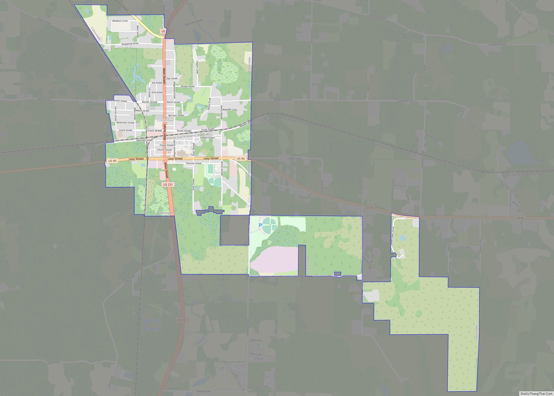
Online Interactive Map
Click on ![]() to view map in "full screen" mode.
to view map in "full screen" mode.
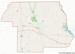
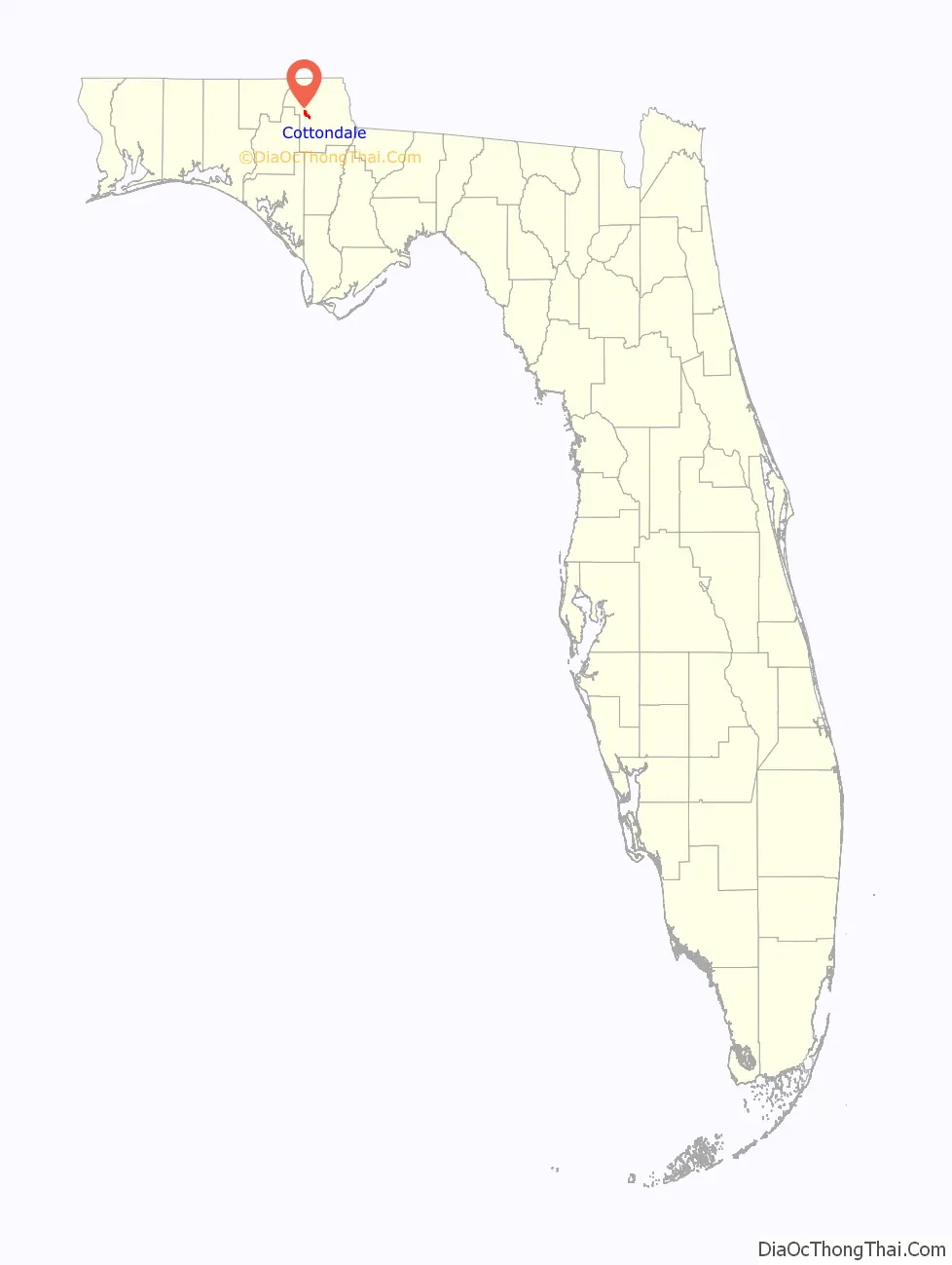
Cottondale location map. Where is Cottondale town?

Cottondale Road Map
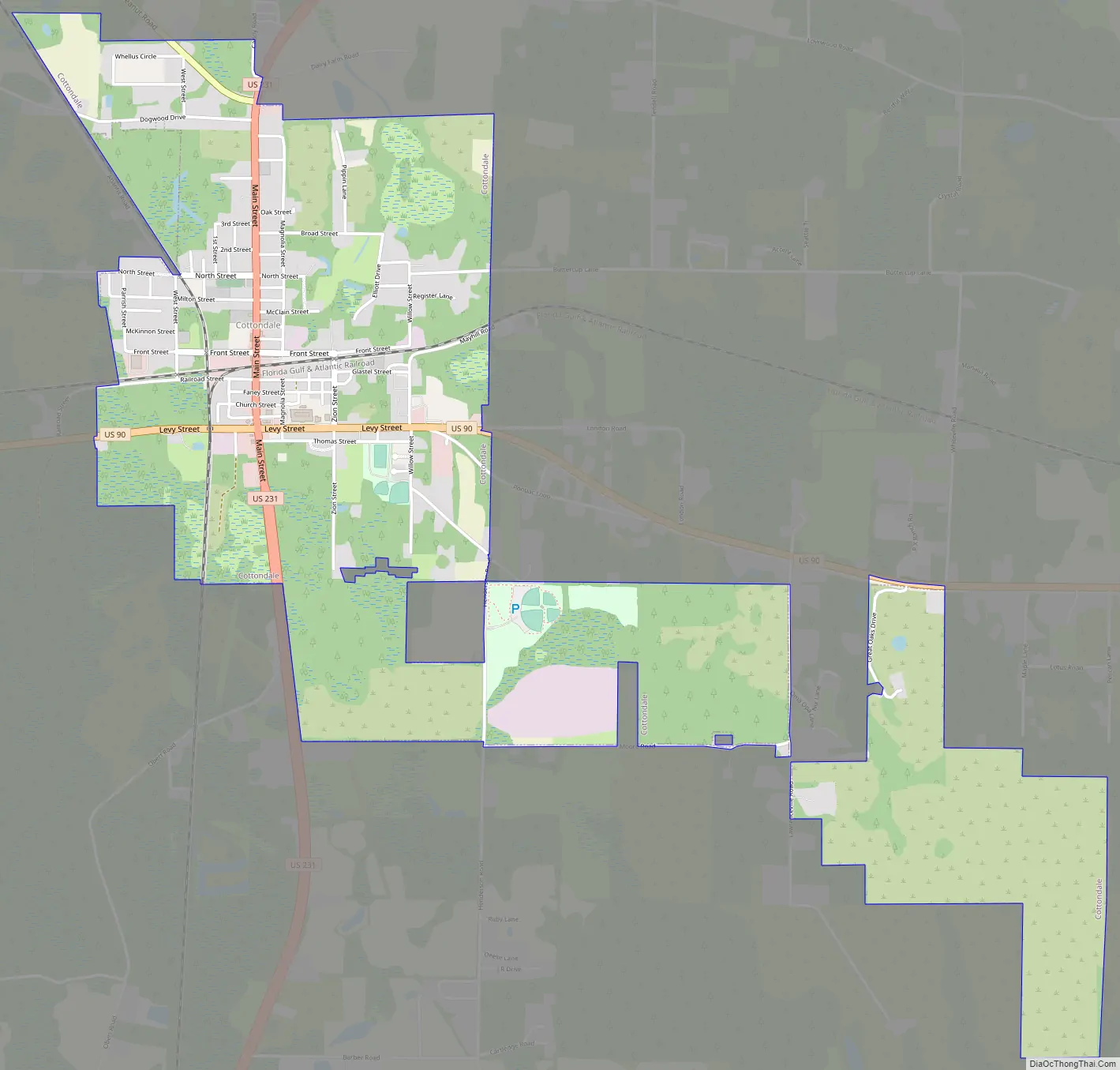
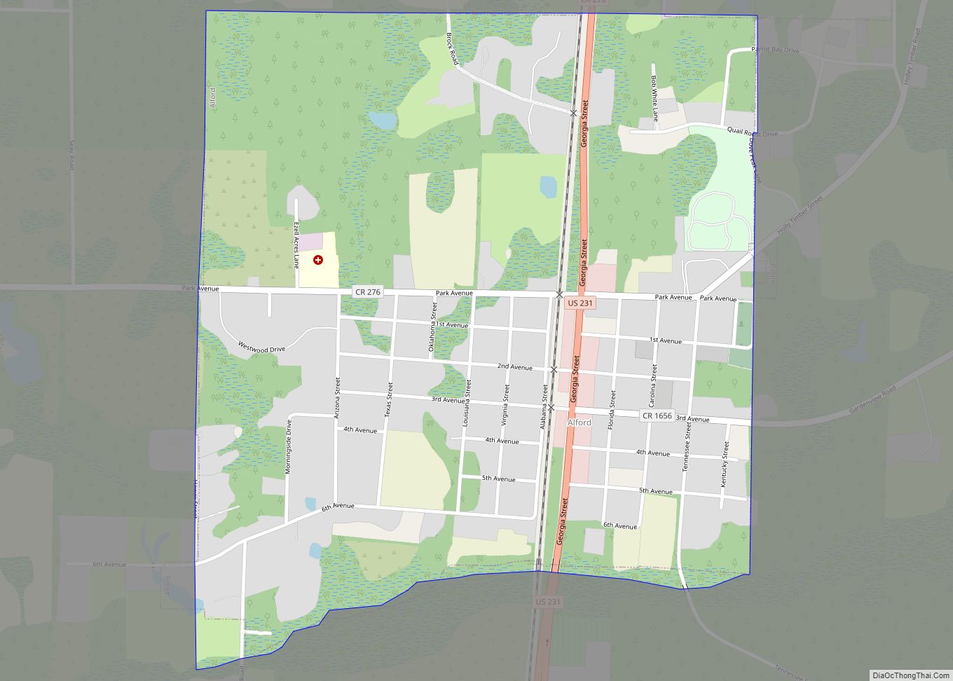
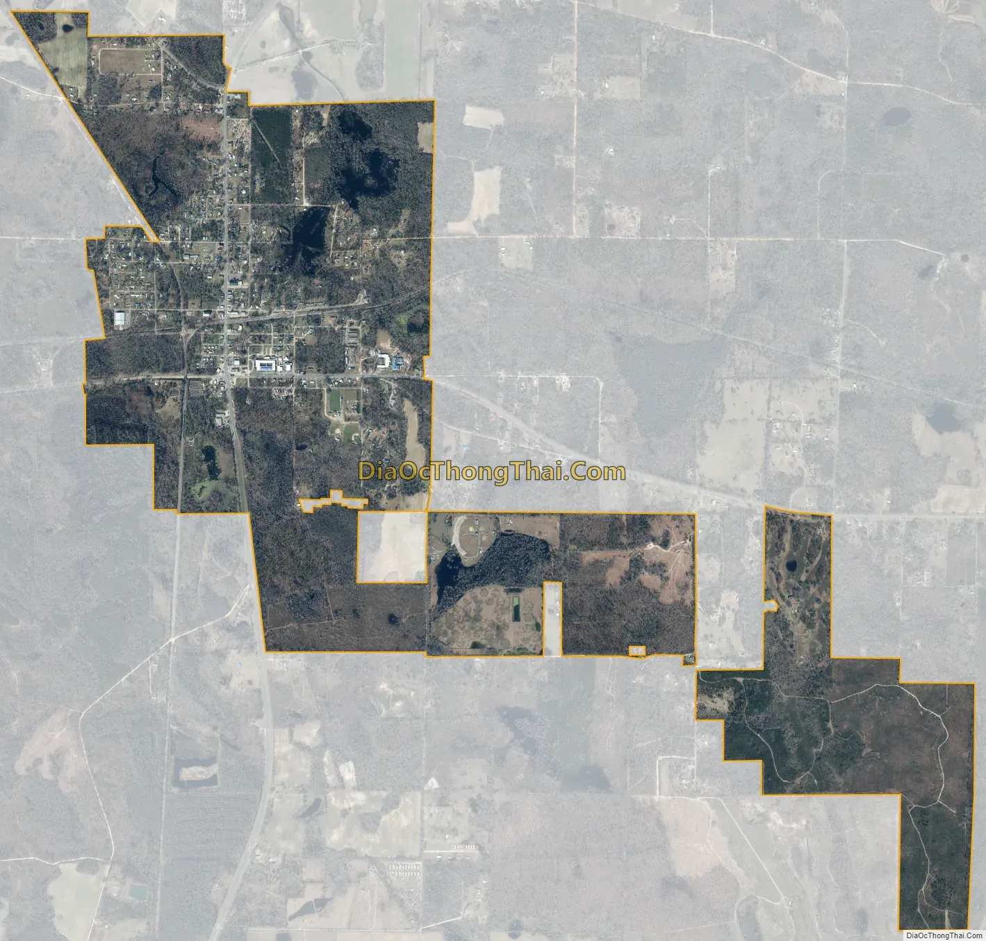
Cottondale city Satellite Map
Geography
Cottondale is located in western Jackson County at 30°47′49″N 85°22′34″W / 30.79694°N 85.37611°W / 30.79694; -85.37611 (30.796810, –85.376031). U.S. Route 90 passes through the south side of town on Levy Street. US-90 leads east 9 miles (14 km) to Marianna, the Jackson county seat, and west 10 miles (16 km) to Chipley. U.S. Route 231 runs through the center of Cottondale as Main Street, leading north 31 miles (50 km) to Dothan, Alabama, and south 51 miles (82 km) to Panama City. US-231 crosses Interstate 10 3 miles (5 km) south of Cottondale; I-10 leads east 72 miles (116 km) to Tallahassee and west 120 miles (190 km) to Pensacola.
According to the United States Census Bureau, the town has a total area of 3.5 square miles (9.0 km), of which 3.3 square miles (8.6 km) are land and 0.1 square miles (0.3 km), or 3.87%, are water.
See also
Map of Florida State and its subdivision:- Alachua
- Baker
- Bay
- Bradford
- Brevard
- Broward
- Calhoun
- Charlotte
- Citrus
- Clay
- Collier
- Columbia
- Desoto
- Dixie
- Duval
- Escambia
- Flagler
- Franklin
- Gadsden
- Gilchrist
- Glades
- Gulf
- Hamilton
- Hardee
- Hendry
- Hernando
- Highlands
- Hillsborough
- Holmes
- Indian River
- Jackson
- Jefferson
- Lafayette
- Lake
- Lee
- Leon
- Levy
- Liberty
- Madison
- Manatee
- Marion
- Martin
- Miami-Dade
- Monroe
- Nassau
- Okaloosa
- Okeechobee
- Orange
- Osceola
- Palm Beach
- Pasco
- Pinellas
- Polk
- Putnam
- Saint Johns
- Saint Lucie
- Santa Rosa
- Sarasota
- Seminole
- Sumter
- Suwannee
- Taylor
- Union
- Volusia
- Wakulla
- Walton
- Washington
- Alabama
- Alaska
- Arizona
- Arkansas
- California
- Colorado
- Connecticut
- Delaware
- District of Columbia
- Florida
- Georgia
- Hawaii
- Idaho
- Illinois
- Indiana
- Iowa
- Kansas
- Kentucky
- Louisiana
- Maine
- Maryland
- Massachusetts
- Michigan
- Minnesota
- Mississippi
- Missouri
- Montana
- Nebraska
- Nevada
- New Hampshire
- New Jersey
- New Mexico
- New York
- North Carolina
- North Dakota
- Ohio
- Oklahoma
- Oregon
- Pennsylvania
- Rhode Island
- South Carolina
- South Dakota
- Tennessee
- Texas
- Utah
- Vermont
- Virginia
- Washington
- West Virginia
- Wisconsin
- Wyoming