Key Colony Beach is a municipality in the middle of the Florida Keys, Monroe County, Florida, United States. The population was 790 at the 2020 census.
| Name: | Key Colony Beach city |
|---|---|
| LSAD Code: | 25 |
| LSAD Description: | city (suffix) |
| State: | Florida |
| County: | Monroe County |
| Elevation: | 3 ft (1 m) |
| Total Area: | 0.65 sq mi (1.68 km²) |
| Land Area: | 0.44 sq mi (1.14 km²) |
| Water Area: | 0.21 sq mi (0.54 km²) |
| Total Population: | 790 |
| Population Density: | 1,795.45/sq mi (693.21/km²) |
| ZIP code: | 33051 |
| Area code: | 305 |
| FIPS code: | 1236325 |
| GNISfeature ID: | 0285076 |
| Website: | www.keycolonybeach.net |
Online Interactive Map
Click on ![]() to view map in "full screen" mode.
to view map in "full screen" mode.
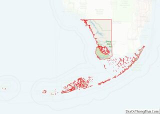
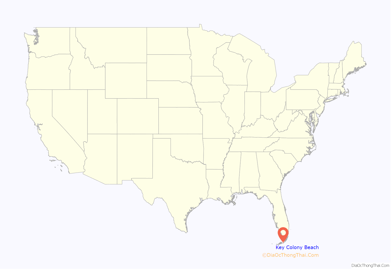
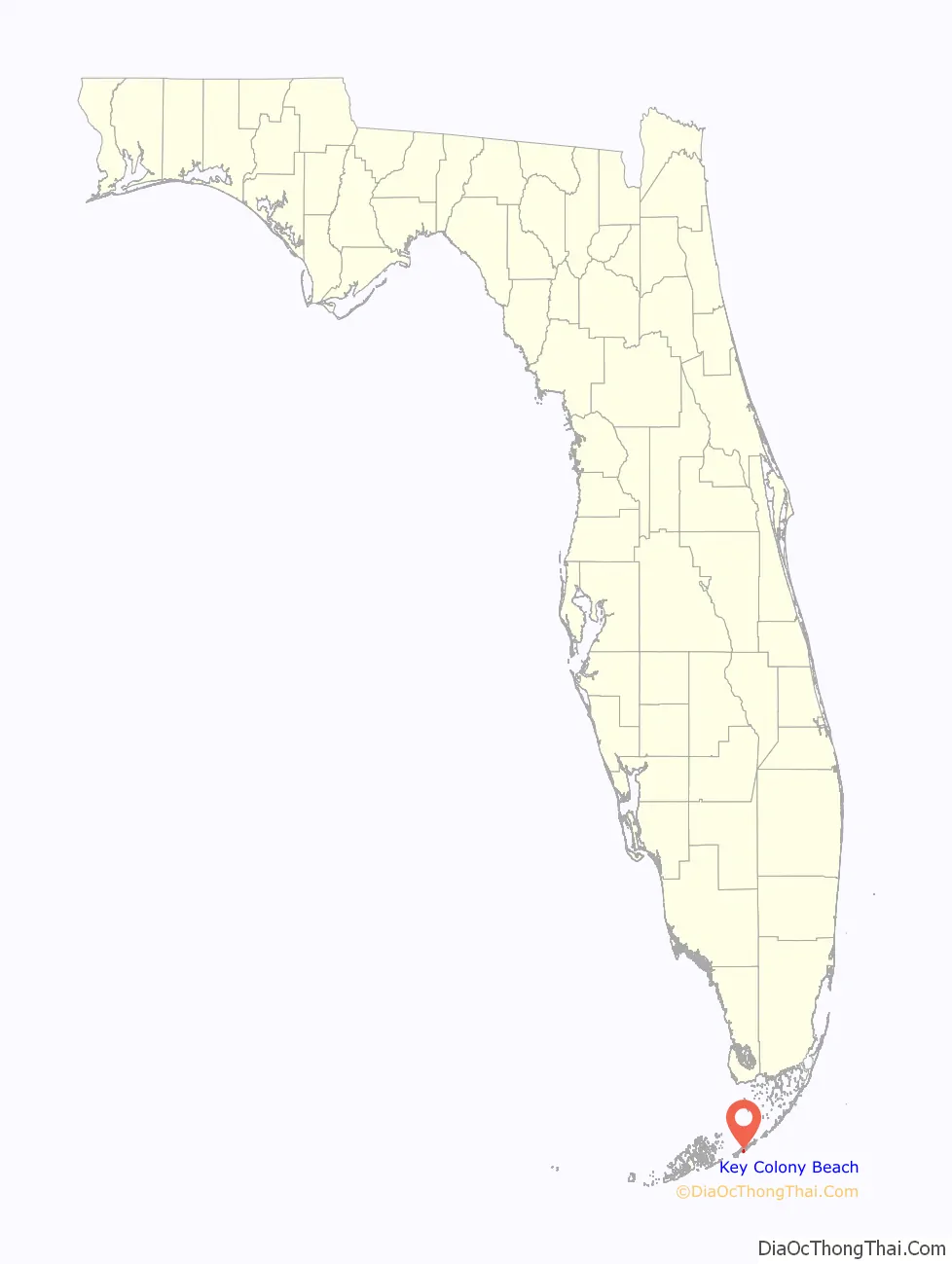
Key Colony Beach location map. Where is Key Colony Beach city?
History
Before the early 1950s, Shelter Key (on which most of Key Colony Beach is located) was a 97-acre (39-hectare) low-lying island. Then, Phil Sadowski began dredging around the island, adding to its size and increasing its height to 6 feet (1.8 m) above mean sea level, and later built developments on the island.
Around 1956–1957, residents of nearby Marathon began discussing incorporating the entire area. Sadowski was not keen on having his development swallowed up into Marathon, so he began the process of incorporating the island into its own city. The Florida Legislature passed legislation in June 1957 allowing incorporation, which local residents passed unanimously in September, thus creating today’s Key Colony Beach.
Incorporation became a blessing in 1960, when much of the city was destroyed by Hurricane Donna. As a separately incorporated city, Key Colony Beach received its own federal grant to rebuild; nearby Marathon (not yet incorporated) had to settle for a portion of the grant given to Monroe County. However, the storm (and then the takeover of Cuba by Fidel Castro) depressed real estate prices, and it took several years to for prices to stabilize.
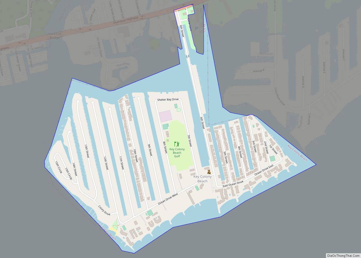
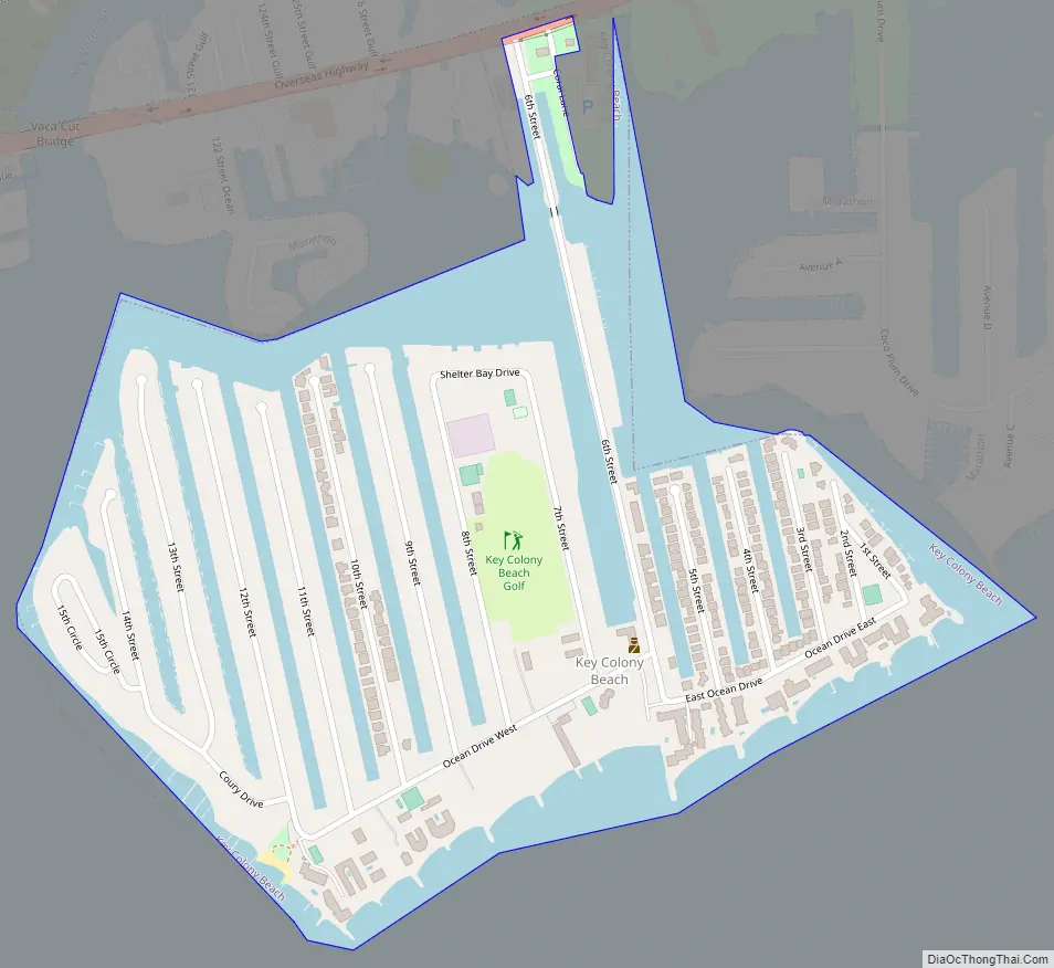
Key Colony Beach Road Map
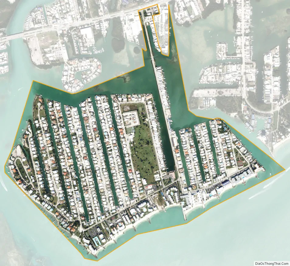
Key Colony Beach city Satellite Map
Geography
Key Colony Beach is located at 24°43′28″N 81°1′5″W / 24.72444°N 81.01806°W / 24.72444; -81.01806 (24.724515, –81.017928). Most of the city is located on an island formerly known as Shelter Key; a small part of the city is on Fat Deer Key, where the Sadowski Causeway, the only road entering the city, connects to U.S. 1 (the Overseas Highway) and the city of Marathon, on the east side of the city. Marathon lies to the northwest, north, and northeast of Key Colony Beach, while the Atlantic Ocean is to the south.
Along the Sadowski Causeway are some charter fishing boats and a dockside restaurant called Sparky’s Landing. At the south end of the causeway, West Ocean Drive branches off first to the right and East Ocean Drive soon after branches to the left. On West Ocean Drive is the police station, along with the post office and town hall. In the same vicinity is a small park with a fountain and a gazebo. The entire ocean-facing side of West Ocean Drive is lined by various condominium complexes, while the side facing Marathon houses the Key Colony Inn and a par-3 golf course. Starting at the far end of East Ocean Drive, streets are numbered one to fifteen east to west, and run from south to north toward Shelter Bay. The most notable buildings along East Ocean Drive are the Key Colony Beach Motel and the Key Colony Beach Club. At the tip of West Ocean Drive is Sunset Park, the place closest to where a woman was fatally struck by a spotted eagle ray. Many news reports were recorded from this park overlooking the shallows where the Vaca Cut meets the Atlantic Ocean.
According to the United States Census Bureau, the city has a total area of 0.65 square miles (1.7 km), of which 0.44 square miles (1.1 km) are land and 0.21 square miles (0.54 km), or 32.20%, are water.
See also
Map of Florida State and its subdivision:- Alachua
- Baker
- Bay
- Bradford
- Brevard
- Broward
- Calhoun
- Charlotte
- Citrus
- Clay
- Collier
- Columbia
- Desoto
- Dixie
- Duval
- Escambia
- Flagler
- Franklin
- Gadsden
- Gilchrist
- Glades
- Gulf
- Hamilton
- Hardee
- Hendry
- Hernando
- Highlands
- Hillsborough
- Holmes
- Indian River
- Jackson
- Jefferson
- Lafayette
- Lake
- Lee
- Leon
- Levy
- Liberty
- Madison
- Manatee
- Marion
- Martin
- Miami-Dade
- Monroe
- Nassau
- Okaloosa
- Okeechobee
- Orange
- Osceola
- Palm Beach
- Pasco
- Pinellas
- Polk
- Putnam
- Saint Johns
- Saint Lucie
- Santa Rosa
- Sarasota
- Seminole
- Sumter
- Suwannee
- Taylor
- Union
- Volusia
- Wakulla
- Walton
- Washington
- Alabama
- Alaska
- Arizona
- Arkansas
- California
- Colorado
- Connecticut
- Delaware
- District of Columbia
- Florida
- Georgia
- Hawaii
- Idaho
- Illinois
- Indiana
- Iowa
- Kansas
- Kentucky
- Louisiana
- Maine
- Maryland
- Massachusetts
- Michigan
- Minnesota
- Mississippi
- Missouri
- Montana
- Nebraska
- Nevada
- New Hampshire
- New Jersey
- New Mexico
- New York
- North Carolina
- North Dakota
- Ohio
- Oklahoma
- Oregon
- Pennsylvania
- Rhode Island
- South Carolina
- South Dakota
- Tennessee
- Texas
- Utah
- Vermont
- Virginia
- Washington
- West Virginia
- Wisconsin
- Wyoming