Lake Placid is a town in Highlands County, Florida, United States. As of the 2010 census the population was 2,223 and in 2018 the estimated population was 2,439. It is part of the Sebring Metropolitan Statistical Area.
The town has two nicknames: “Town of Murals” and “The Caladium Capital of the World”. Lake Placid has 47 murals painted on buildings throughout the town, and 98 percent of the world’s caladium bulbs come from Lake Placid. There are 14 caladium farms, spanning 1,200 acres, and these plants have been grown in the area since the 1940s. In 2013, Reader’s Digest named Lake Placid America’s Most Interesting Town.
The town is home to the Lake Placid Tower, a closed concrete block observation tower that is 240 feet (73 m) tall according to early sources or 270 feet (82 m) tall according to late sources. However, government sources exclude a 270-foot height, allowing only a 240-foot height.
| Name: | Lake Placid town |
|---|---|
| LSAD Code: | 43 |
| LSAD Description: | town (suffix) |
| State: | Florida |
| County: | Highlands County |
| Total Area: | 4.71 sq mi (12.21 km²) |
| Land Area: | 4.66 sq mi (12.07 km²) |
| Water Area: | 0.05 sq mi (0.13 km²) 1.4% |
| Total Population: | 2,360 |
| Population Density: | 506.22/sq mi (195.47/km²) |
| Area code: | 863 |
| FIPS code: | 1238625 |
| GNISfeature ID: | 285272 |
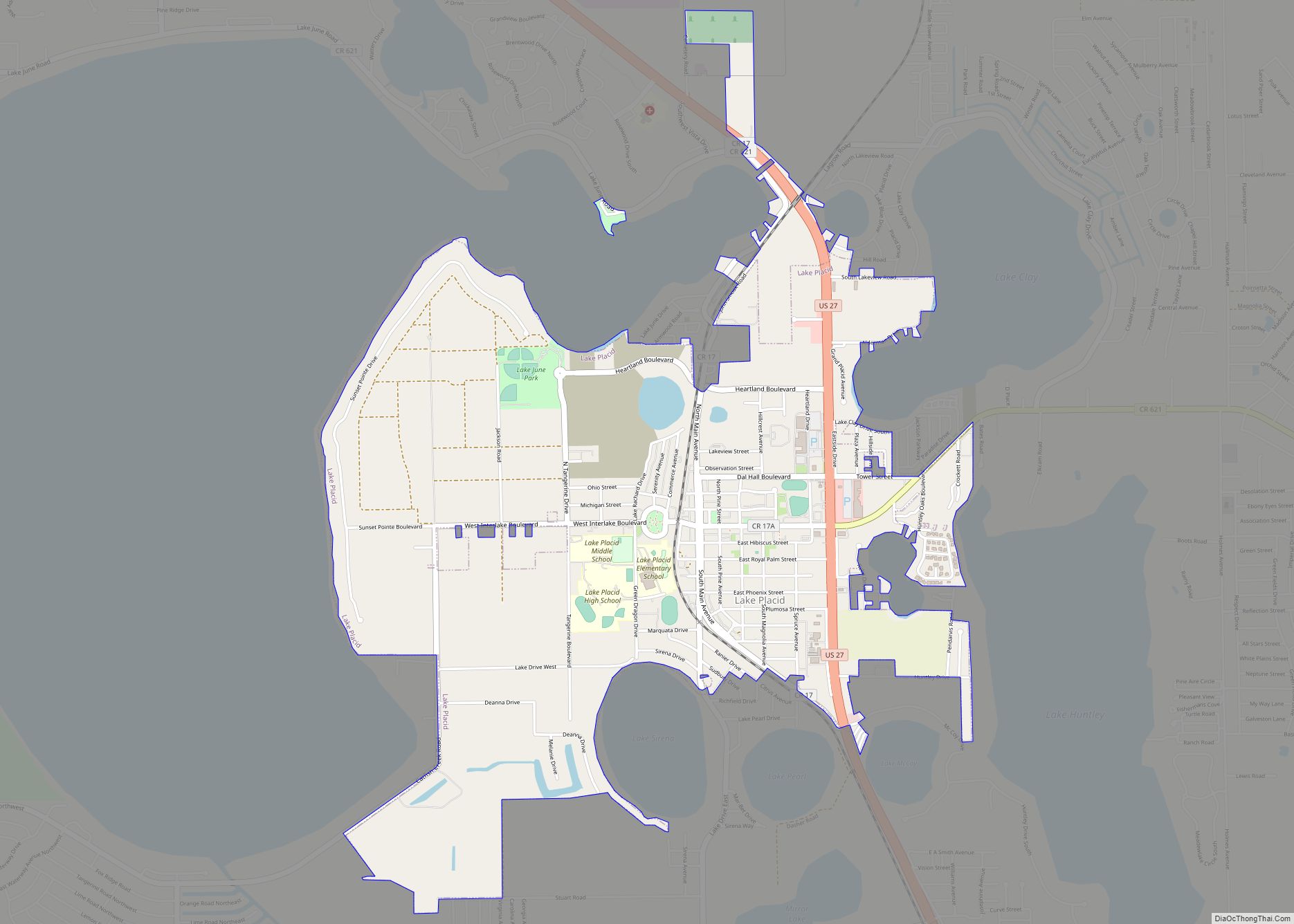
Online Interactive Map
Click on ![]() to view map in "full screen" mode.
to view map in "full screen" mode.
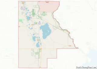
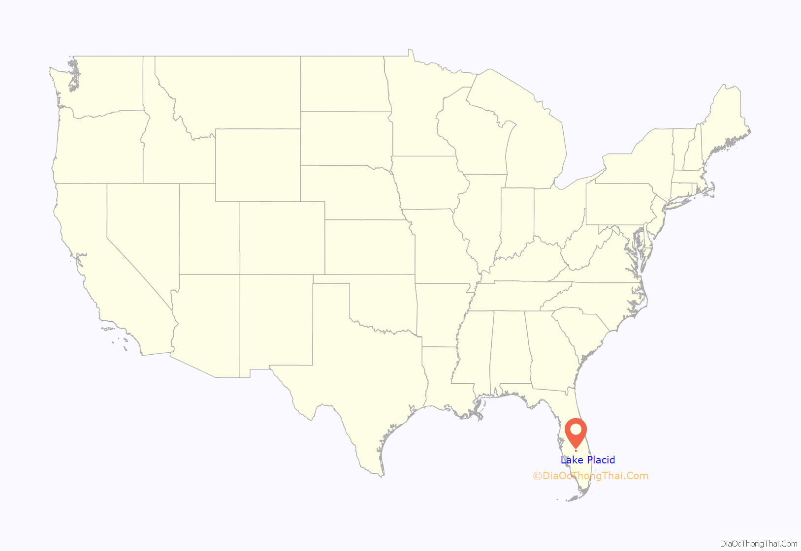
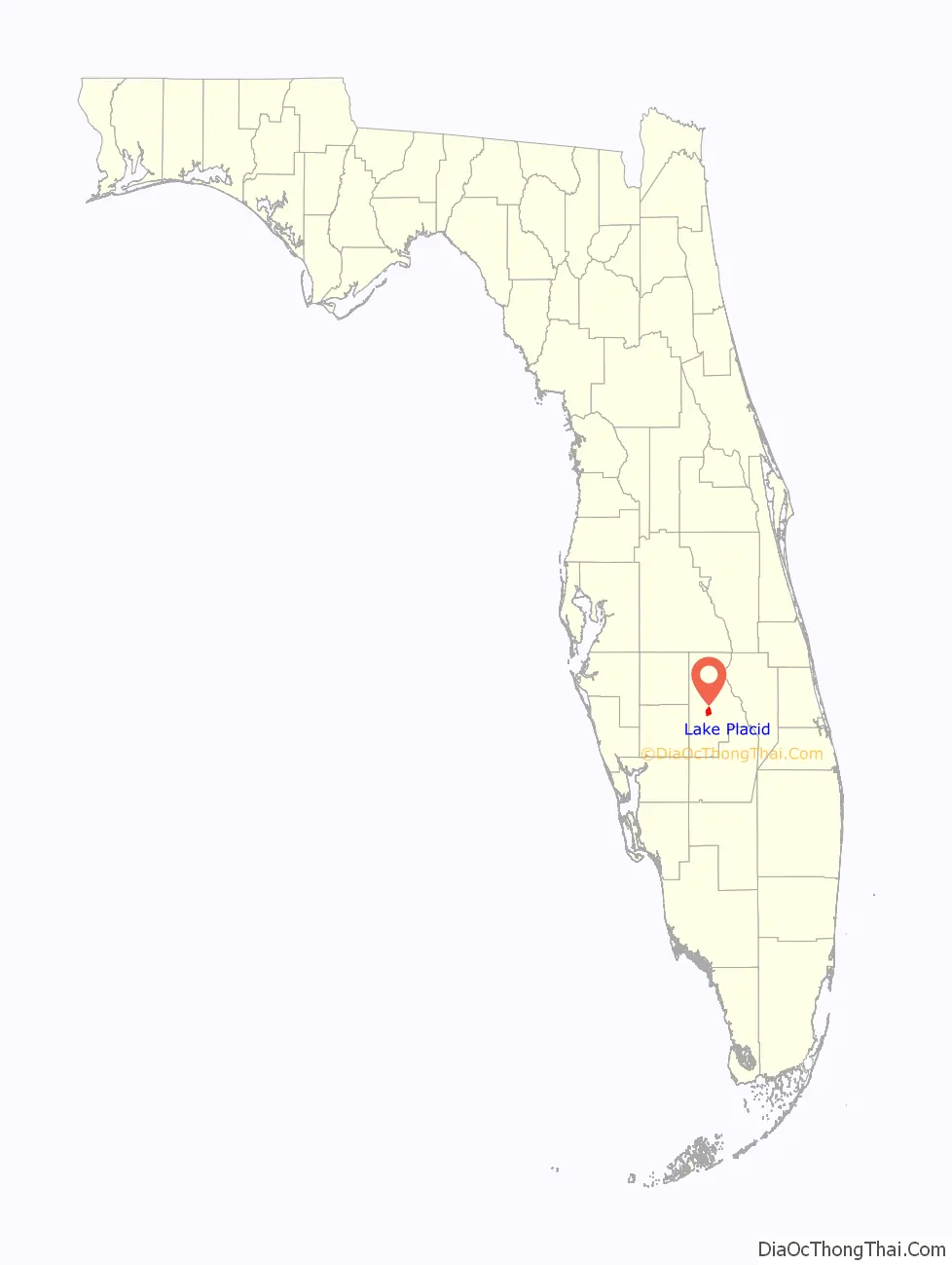
Lake Placid location map. Where is Lake Placid town?
History
Lake Placid, which was formerly called “Lake Stearns”, was chartered on December 1, 1925. Dr. Melvil Dewey, the inventor of the Dewey Decimal System, and the founder of the Lake Placid Club in Lake Placid, New York, proposed that Lake Stearns change its name to “Lake Placid”. On April 29, 1927, the Lake Stearns Commissioners accepted Dr. Dewey’s proposal. Subsequently, they submitted a request to the Florida State Legislature. On June 6, 1927, the community was chartered as the town of Lake Placid.
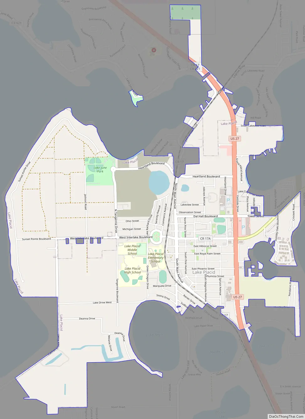
Lake Placid Road Map
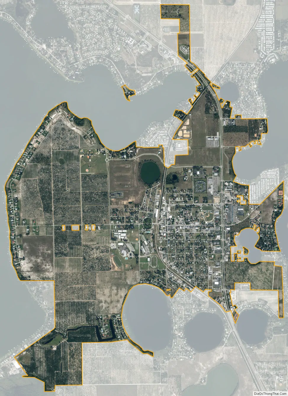
Lake Placid city Satellite Map
Geography
Lake Placid is located in central Highlands County at 27°17′42.9″N 81°22′21.5″W / 27.295250°N 81.372639°W / 27.295250; -81.372639 (27.29525, –81.37263). U.S. Route 27 passes through the town, leading north 16 miles (26 km) to Sebring, the county seat, and south 58 miles (93 km) to Clewiston.
According to the United States Census Bureau, Lake Placid has a total area of 3.650 square miles (9.45 km), of which 3.599 square miles (9.32 km) are land and 0.051 square miles (0.13 km), or 1.4%, are water.
See also
Map of Florida State and its subdivision:- Alachua
- Baker
- Bay
- Bradford
- Brevard
- Broward
- Calhoun
- Charlotte
- Citrus
- Clay
- Collier
- Columbia
- Desoto
- Dixie
- Duval
- Escambia
- Flagler
- Franklin
- Gadsden
- Gilchrist
- Glades
- Gulf
- Hamilton
- Hardee
- Hendry
- Hernando
- Highlands
- Hillsborough
- Holmes
- Indian River
- Jackson
- Jefferson
- Lafayette
- Lake
- Lee
- Leon
- Levy
- Liberty
- Madison
- Manatee
- Marion
- Martin
- Miami-Dade
- Monroe
- Nassau
- Okaloosa
- Okeechobee
- Orange
- Osceola
- Palm Beach
- Pasco
- Pinellas
- Polk
- Putnam
- Saint Johns
- Saint Lucie
- Santa Rosa
- Sarasota
- Seminole
- Sumter
- Suwannee
- Taylor
- Union
- Volusia
- Wakulla
- Walton
- Washington
- Alabama
- Alaska
- Arizona
- Arkansas
- California
- Colorado
- Connecticut
- Delaware
- District of Columbia
- Florida
- Georgia
- Hawaii
- Idaho
- Illinois
- Indiana
- Iowa
- Kansas
- Kentucky
- Louisiana
- Maine
- Maryland
- Massachusetts
- Michigan
- Minnesota
- Mississippi
- Missouri
- Montana
- Nebraska
- Nevada
- New Hampshire
- New Jersey
- New Mexico
- New York
- North Carolina
- North Dakota
- Ohio
- Oklahoma
- Oregon
- Pennsylvania
- Rhode Island
- South Carolina
- South Dakota
- Tennessee
- Texas
- Utah
- Vermont
- Virginia
- Washington
- West Virginia
- Wisconsin
- Wyoming