Monticello (/ˌmɒntɪˈsɛloʊ/ (listen) MON-tiss-EL-oh) is the only city and the county seat of Jefferson County, Florida, United States. The population was 2,506 at the 2010 census. The city is named after Monticello, the estate of the county’s namesake, Thomas Jefferson, on which the Jefferson County Courthouse (Monticello, Florida) was modeled.
Monticello is home to Indian mounds and many historic buildings, including the Perkins Opera House and Monticello Old Jail Museum.
| Name: | Monticello city |
|---|---|
| LSAD Code: | 25 |
| LSAD Description: | city (suffix) |
| State: | Florida |
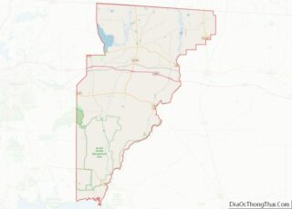
| County: | Jefferson County |
| Elevation: | 233 ft (71 m) |
| Total Area: | 4.01 sq mi (10.39 km²) |
| Land Area: | 4.01 sq mi (10.39 km²) |
| Water Area: | 0.00 sq mi (0.00 km²) |
| Total Population: | 2,589 |
| Population Density: | 645.31/sq mi (249.17/km²) |
| ZIP code: | 32344-32345 |
| Area code: | 850 |
| FIPS code: | 1246500 |
| GNISfeature ID: | 0287080 |
| Website: | www.cityofmonticello.us |
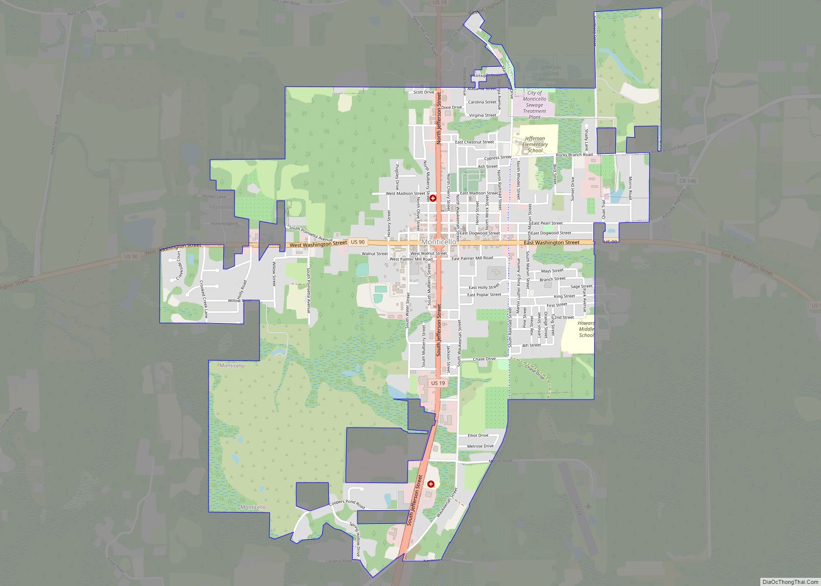
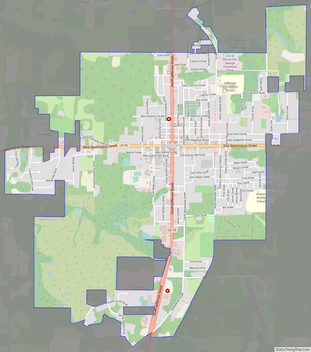
Online Interactive Map
Click on ![]() to view map in "full screen" mode.
to view map in "full screen" mode.
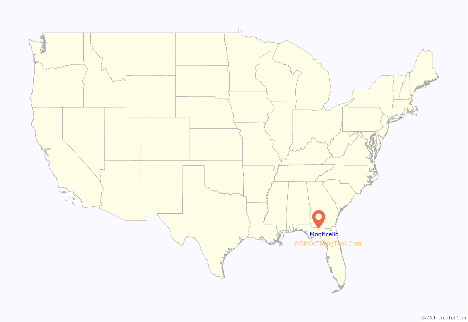
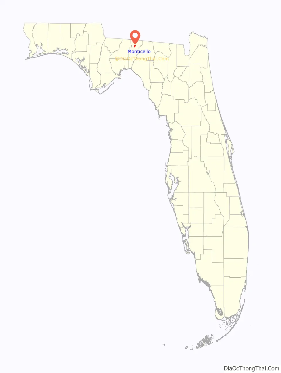
Monticello location map. Where is Monticello city?
History
James Patton Anderson, commander of the 1st Florida Infantry Regiment during the American Civil War, lived in Monticello.
The Perkins Opera House is a 19th-century mercantile building that was adapted for use as a theater. It hosts regular musical performances, as well as theater productions and musicals. The first floor ballroom also holds receptions on a regular basis.
Historic sites
- Bethel School
- Christ Episcopal Church
- Denham-Lacy House
- Jefferson County Courthouse (Florida)
- Letchworth Mounds
- Lyndhurst Plantation
- Monticello High School (Florida)
- Monticello Historic District
- Monticello Old Jail Museum
- Palmer House
- Palmer-Perkins House
- Perkins Opera House
- Wirick-Simmons House
Monticello Road Map
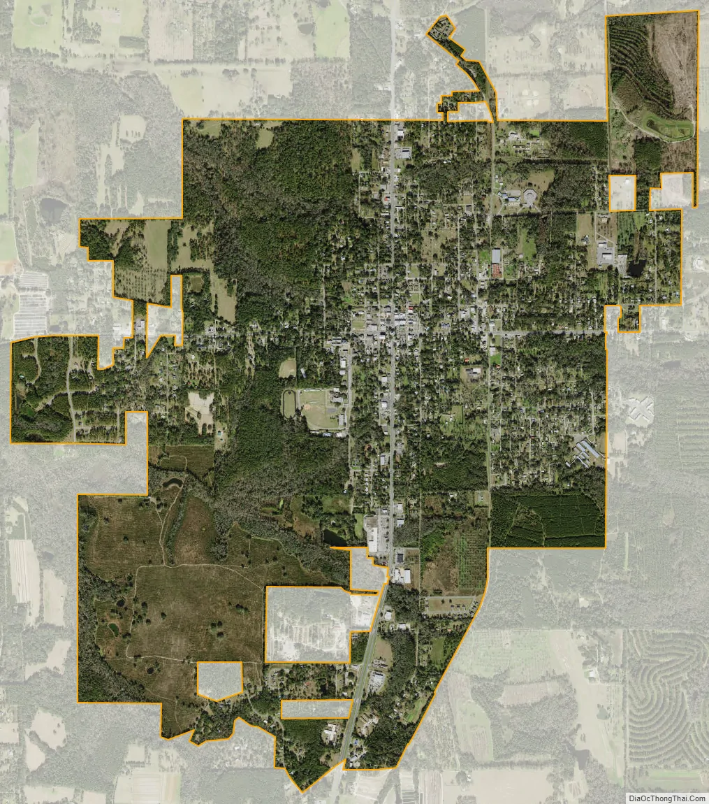
Monticello city Satellite Map
Geography
Monticello is located in northern Jefferson County at 30°32′41″N 83°52′02″W / 30.544612°N 83.867321°W / 30.544612; -83.867321. U.S. Route 90 runs through the center of the city as Washington Street, leading east 16 miles (26 km) to Greenville and west 26 miles (42 km) to Tallahassee. U.S. Route 19 passes through the city center on Jefferson Street, leading south 10 miles (16 km) to Capps and north 22 miles (35 km) to Thomasville, Georgia. The two highways meet in the center of Monticello at Courthouse Circle, which surrounds the Jefferson County Courthouse. US-19 leads south from the courthouse 5 miles (8 km) to Interstate 10 at Exit 225. I-10 leads west 25 miles (40 km) to Tallahassee and east 82 miles (132 km) to Lake City.
According to the United States Census Bureau, the city has a total area of 4.0 square miles (10.3 km), all land.
See also
Map of Florida State and its subdivision:- Alachua
- Baker
- Bay
- Bradford
- Brevard
- Broward
- Calhoun
- Charlotte
- Citrus
- Clay
- Collier
- Columbia
- Desoto
- Dixie
- Duval
- Escambia
- Flagler
- Franklin
- Gadsden
- Gilchrist
- Glades
- Gulf
- Hamilton
- Hardee
- Hendry
- Hernando
- Highlands
- Hillsborough
- Holmes
- Indian River
- Jackson
- Jefferson
- Lafayette
- Lake
- Lee
- Leon
- Levy
- Liberty
- Madison
- Manatee
- Marion
- Martin
- Miami-Dade
- Monroe
- Nassau
- Okaloosa
- Okeechobee
- Orange
- Osceola
- Palm Beach
- Pasco
- Pinellas
- Polk
- Putnam
- Saint Johns
- Saint Lucie
- Santa Rosa
- Sarasota
- Seminole
- Sumter
- Suwannee
- Taylor
- Union
- Volusia
- Wakulla
- Walton
- Washington
- Alabama
- Alaska
- Arizona
- Arkansas
- California
- Colorado
- Connecticut
- Delaware
- District of Columbia
- Florida
- Georgia
- Hawaii
- Idaho
- Illinois
- Indiana
- Iowa
- Kansas
- Kentucky
- Louisiana
- Maine
- Maryland
- Massachusetts
- Michigan
- Minnesota
- Mississippi
- Missouri
- Montana
- Nebraska
- Nevada
- New Hampshire
- New Jersey
- New Mexico
- New York
- North Carolina
- North Dakota
- Ohio
- Oklahoma
- Oregon
- Pennsylvania
- Rhode Island
- South Carolina
- South Dakota
- Tennessee
- Texas
- Utah
- Vermont
- Virginia
- Washington
- West Virginia
- Wisconsin
- Wyoming