Coordinates: 30°10′N 81°50′W / 30.167°N 81.833°W / 30.167; -81.833 Oakleaf Plantation is a planned community in the Jacksonville area located mostly in unincorporated Clay County and partially within the Jacksonville city limits (Duval County). The Clay County portion is a census-designated place, with a 2010 population of 20,315. As of 2020, the population has risen to 28,153.
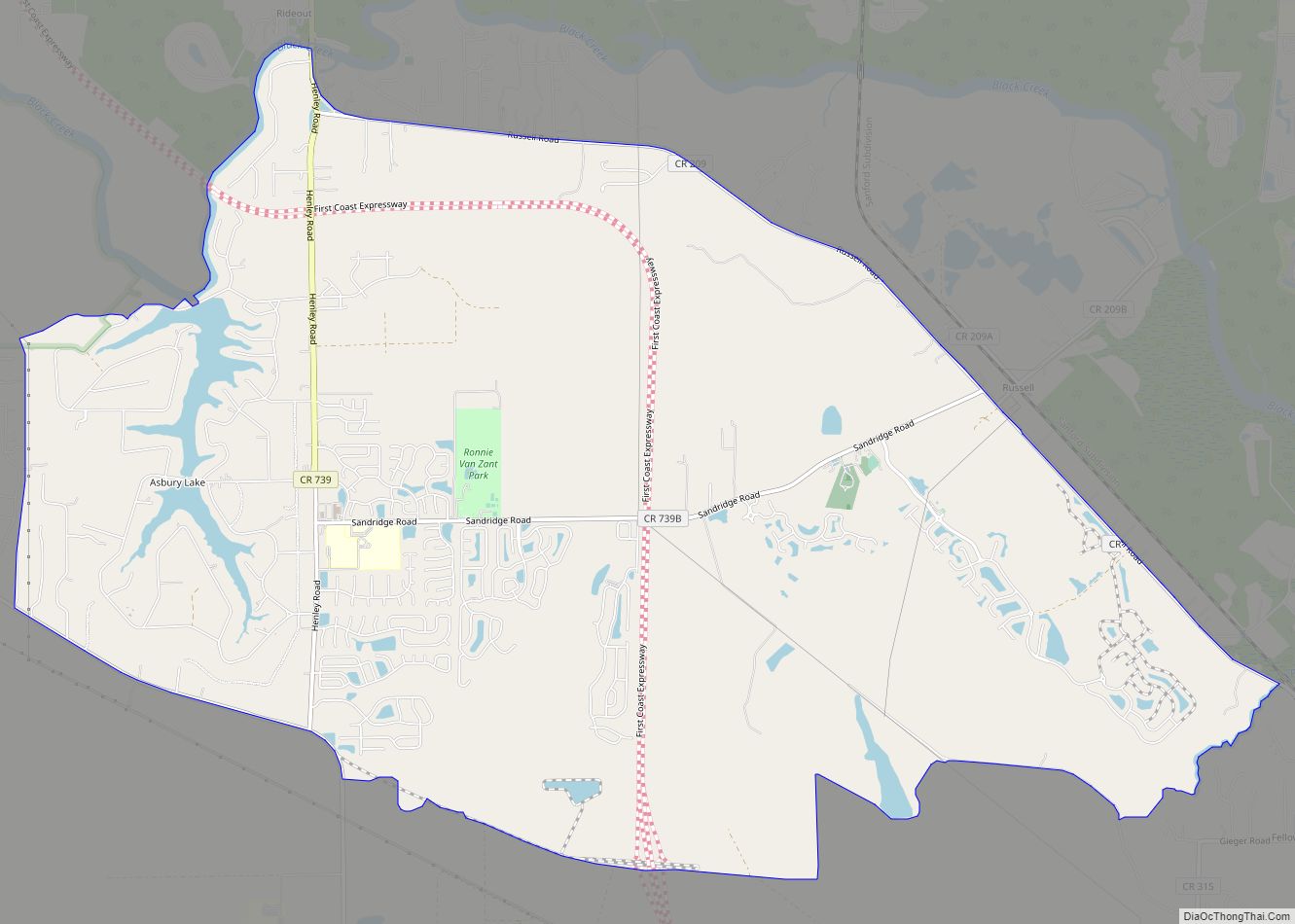
State Road 23 (First Coast Expressway), Jacksonville’s future outer beltway, runs north–south through the center of OakLeaf Plantation. Argyle Forest Boulevard runs east to State Road 21 (Blanding Boulevard) in the Jacksonville neighborhood of Argyle Forest.
Oakleaf High School, Oakleaf Junior High School, Oakleaf Village Elementary School, Plantation Oaks Elementary School and Discovery Oaks Elementary School are located within the community and are all part of the Clay County School District.
The U.S. Navy’s Branan Field was formerly located in the east part of the community, centered on Oakleaf Village Elementary School.
| Name: | Oakleaf Plantation CDP |
|---|---|
| LSAD Code: | 57 |
| LSAD Description: | CDP (suffix) |
| State: | Florida |
| County: | Clay County |
| FIPS code: | 1250630 |
Online Interactive Map
Click on ![]() to view map in "full screen" mode.
to view map in "full screen" mode.
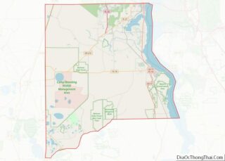
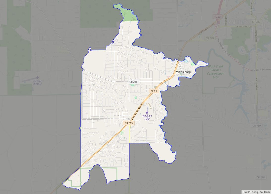
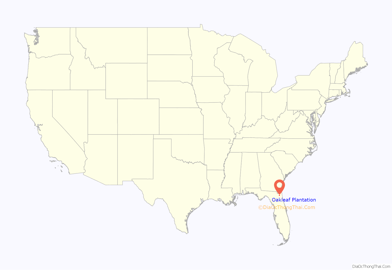
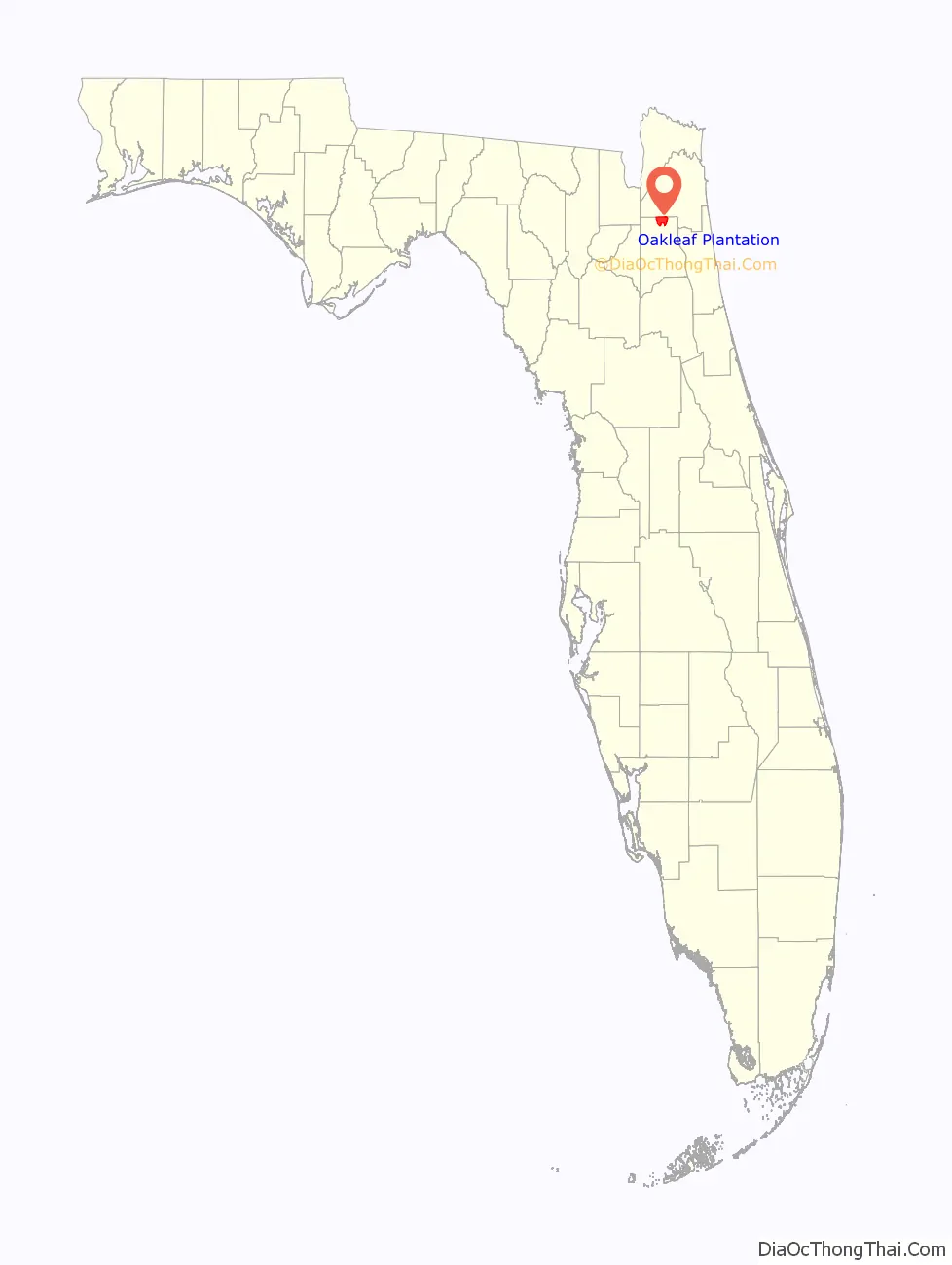
Oakleaf Plantation location map. Where is Oakleaf Plantation CDP?
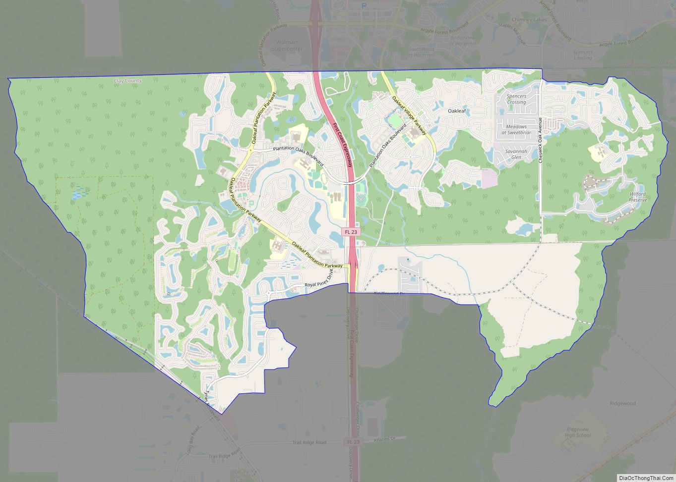
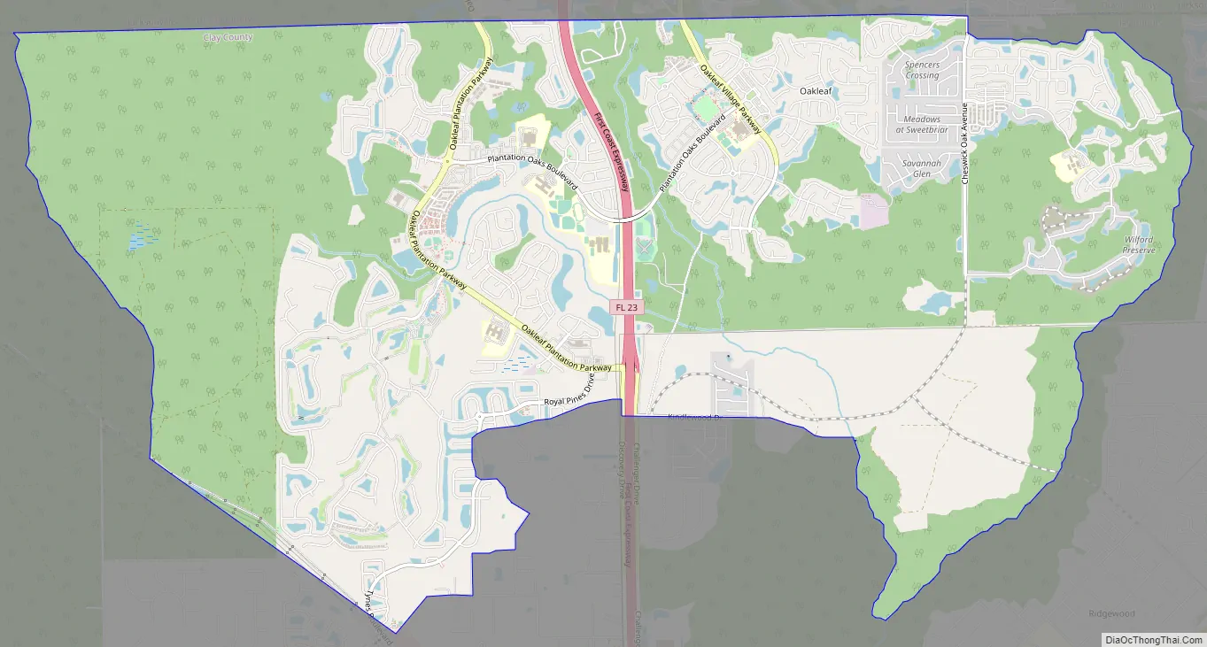
Oakleaf Plantation Road Map
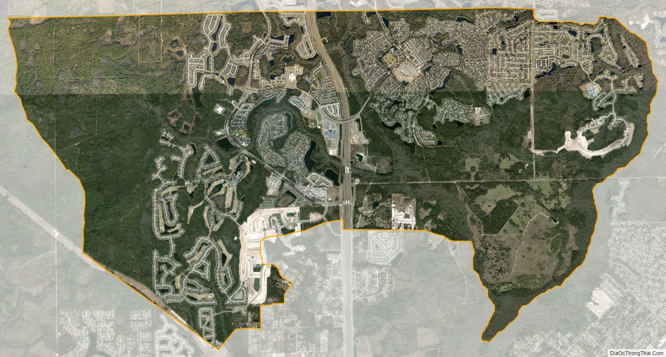
Oakleaf Plantation city Satellite Map
See also
Map of Florida State and its subdivision:- Alachua
- Baker
- Bay
- Bradford
- Brevard
- Broward
- Calhoun
- Charlotte
- Citrus
- Clay
- Collier
- Columbia
- Desoto
- Dixie
- Duval
- Escambia
- Flagler
- Franklin
- Gadsden
- Gilchrist
- Glades
- Gulf
- Hamilton
- Hardee
- Hendry
- Hernando
- Highlands
- Hillsborough
- Holmes
- Indian River
- Jackson
- Jefferson
- Lafayette
- Lake
- Lee
- Leon
- Levy
- Liberty
- Madison
- Manatee
- Marion
- Martin
- Miami-Dade
- Monroe
- Nassau
- Okaloosa
- Okeechobee
- Orange
- Osceola
- Palm Beach
- Pasco
- Pinellas
- Polk
- Putnam
- Saint Johns
- Saint Lucie
- Santa Rosa
- Sarasota
- Seminole
- Sumter
- Suwannee
- Taylor
- Union
- Volusia
- Wakulla
- Walton
- Washington
- Alabama
- Alaska
- Arizona
- Arkansas
- California
- Colorado
- Connecticut
- Delaware
- District of Columbia
- Florida
- Georgia
- Hawaii
- Idaho
- Illinois
- Indiana
- Iowa
- Kansas
- Kentucky
- Louisiana
- Maine
- Maryland
- Massachusetts
- Michigan
- Minnesota
- Mississippi
- Missouri
- Montana
- Nebraska
- Nevada
- New Hampshire
- New Jersey
- New Mexico
- New York
- North Carolina
- North Dakota
- Ohio
- Oklahoma
- Oregon
- Pennsylvania
- Rhode Island
- South Carolina
- South Dakota
- Tennessee
- Texas
- Utah
- Vermont
- Virginia
- Washington
- West Virginia
- Wisconsin
- Wyoming