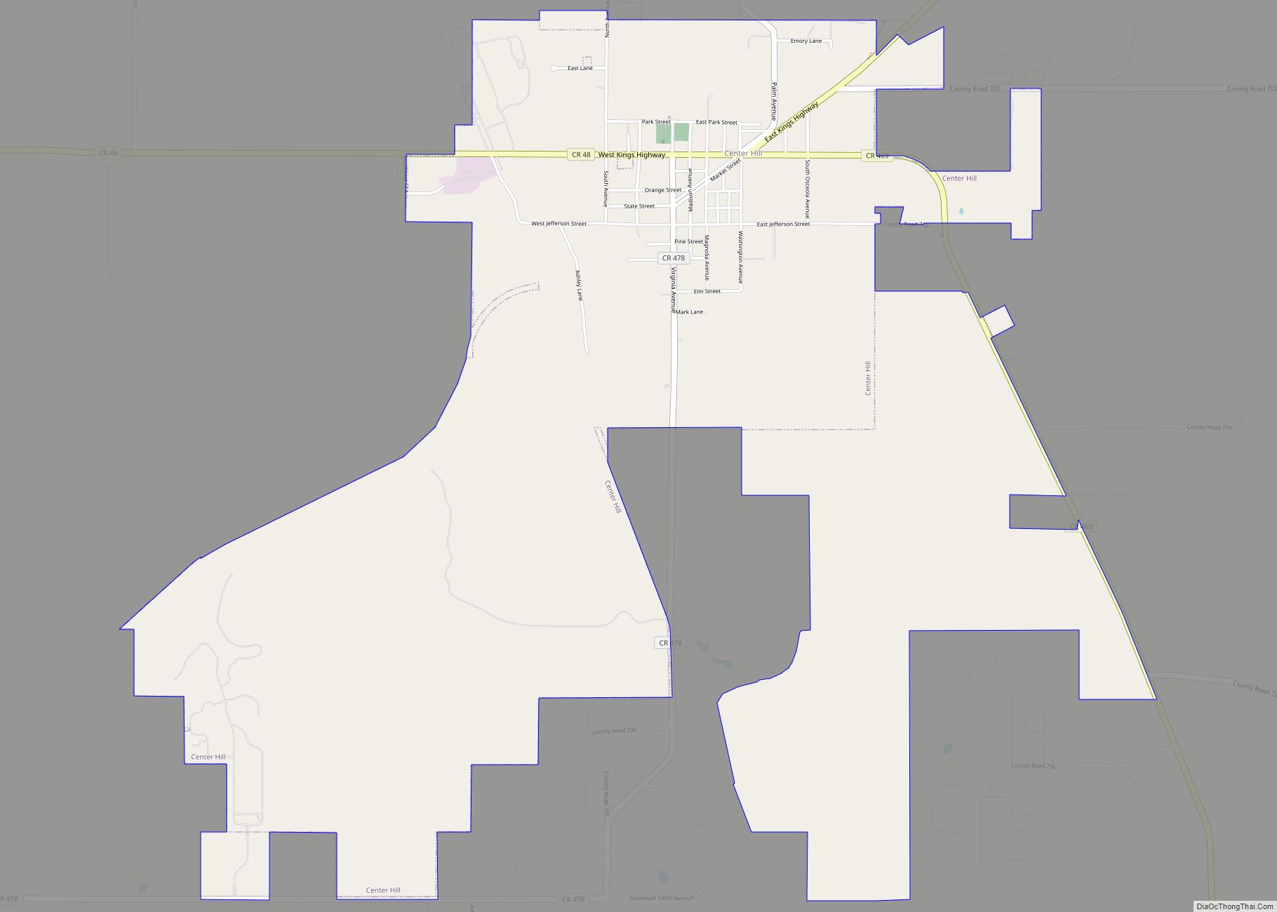
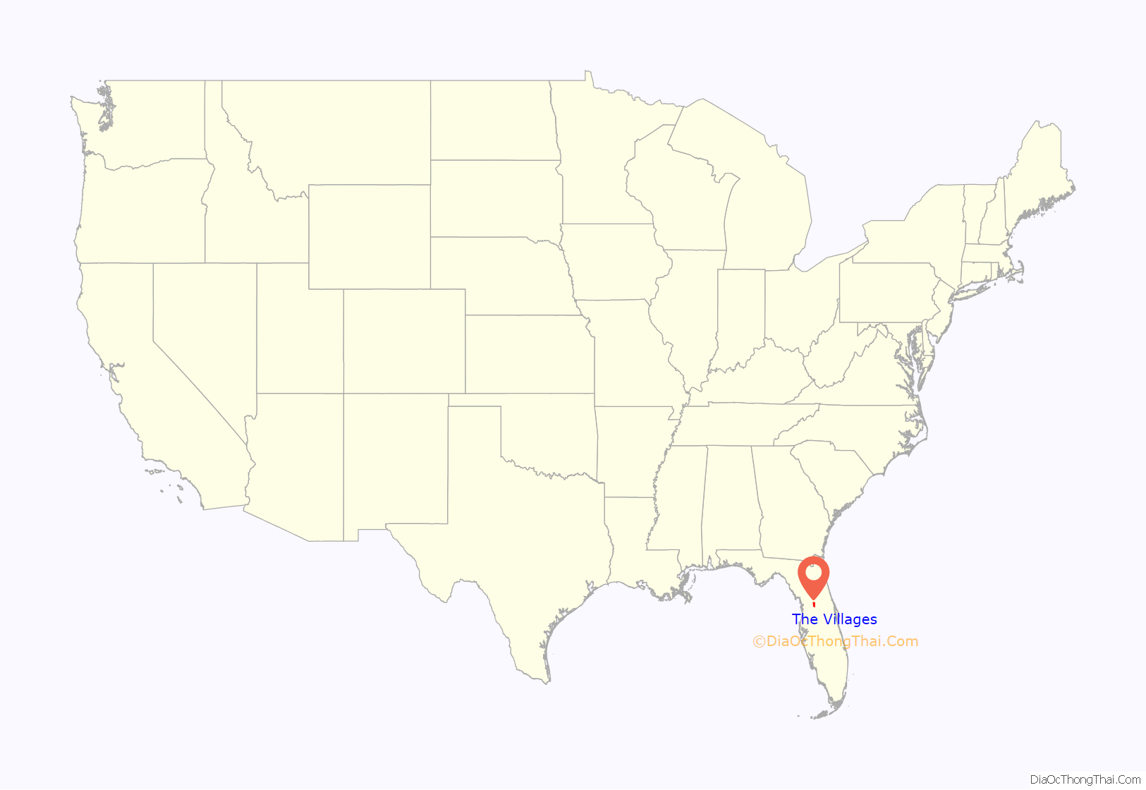
The Villages is a census-designated place (CDP) in Sumter and Marion counties, Florida, United States. It shares its name with a broader master-planned age-restricted community that spreads into portions of Lake County. The overall development lies in central Florida, approximately 20 miles (32 km) south of Ocala and approximately 45 miles (72 km) northwest of Orlando. As of the 2020 census, the population of the CDP was 79,077.
The Villages covers an area of approximately 32 square miles, an area larger than Manhattan, and is expanding mainly to the south of the current community. It is made up of 17 special purpose community development districts (CDD), which are controlled by a board of supervisors (BoS), five individuals elected by the landowners of the district. H. Gary Morse, the original owner’s son, transferred most direct ownership in the company to his three children in 2006; Morse died in 2014.
The community is the center of The Villages metropolitan area, which consists of all of Sumter County and is included in the Orlando–Lakeland–Deltona combined statistical area; and Marion County is included in the Ocala, Florida Metropolitan Statistical Area. Between 2010 and 2020, The Villages metropolitan area was the fastest-growing metro area in the United States, growing 39 percent, from about 93,000 in 2010 to 130,000 in 2020.
| Name: | The Villages CDP |
|---|---|
| LSAD Code: | 57 |
| LSAD Description: | CDP (suffix) |
| State: | Florida |
| County: | Marion County, Sumter County |
| Elevation: | 52 ft (16 m) |
| Total Area: | 33.95 sq mi (87.94 km²) |
| Land Area: | 32.65 sq mi (84.57 km²) |
| Water Area: | 1.30 sq mi (3.37 km²) |
| Total Population: | 79,077 |
| Population Density: | 2,421.89/sq mi (935.08/km²) |
| Area code: | 352 |
| FIPS code: | 1271625 |
| GNISfeature ID: | 2402925 |
| Website: | thevillages.com |
Online Interactive Map
Click on ![]() to view map in "full screen" mode.
to view map in "full screen" mode.
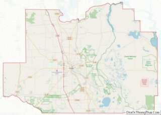
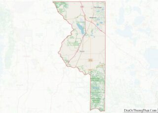
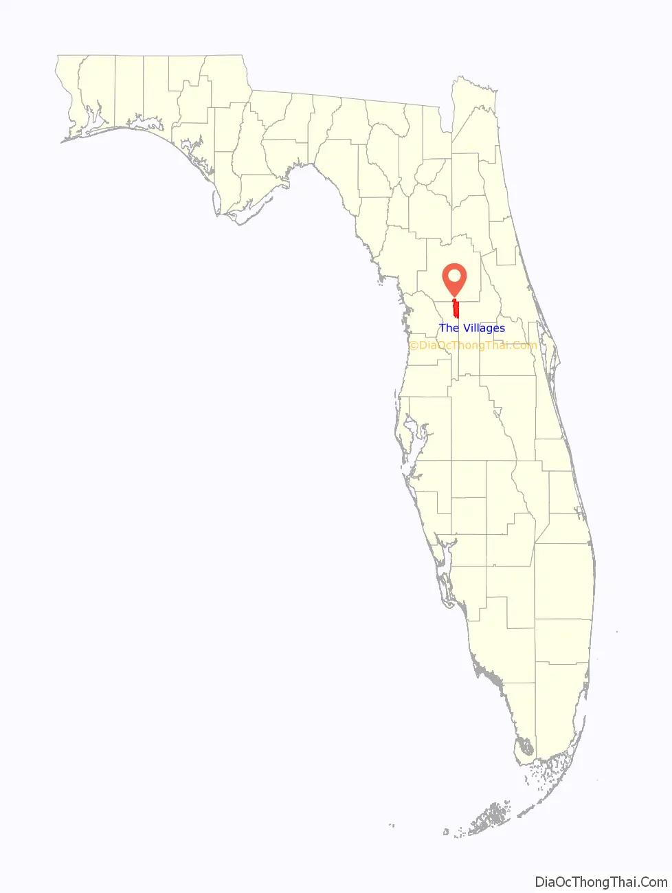
The Villages location map. Where is The Villages CDP?
History
Harold Schwartz, a Michigan businessman, began selling land tracts via mail order in The Villages area in the 1960s. He and his business partner, Al Tarrson, were forced to close this aspect of the business following the implementation of a 1968 federal law banning real estate sales by mail order.
Stuck with considerable portions of Florida land, in the early 1970s, Schwartz and Tarrson began the development of a mobile home park, Orange Blossom Gardens, in the northwestern corner of Lake County. By the early 1980s, the community had sold only 400 units. Schwartz bought out Tarrson’s interest in improving the business and brought his son, H. Gary Morse, on board in 1983.
Morse noted that the thriving retirement communities (such as Del Webb’s Sun City developments) offered numerous well-maintained amenities to the residents. They also had diverse and nearby commercial development. Morse began to upgrade the development significantly. Their sales improved in the mid-1980s. Schwartz began to buy large tracts of land in nearby Sumter and Marion counties for future expansion. In 1992, Morse officially changed the overall development name to The Villages. The development is still controlled in all significant aspects by descendants of Schwartz and Morse.
By the early 1990s, The Villages had more than 8,000 residents, three golf courses, the first Winn Dixie supermarket opened, just four restaurants, and nightly dances were held in a tent.
Expansion
In January 2017, the Holding Company of the Villages announced the purchase of 8,000 acres of land south of Florida State Road 44 in and around the villages of Southern Oaks and Fenney. In the spring of 2017, The Villages announced a planned acquisition of 2,600 acres north and south of County Road 470 along the east side of Florida’s Turnpike for future development. The deal has passed due diligence by the Leesburg City Commission, and zoning ordinance changes were approved by the Leesburg Planning Commission (with the city commission giving final approval). The initial plans call for the building of approximately 4,500 homes with some commercial development also being planned.
According to data from RCLCO Real Estate, the Holding Company of the Villages sold 2,231 homes in 2017, a 13% increase over 2016. The Villages was the top-selling master-planned community in the United States in 2017 and one of only four communities to sell more than 1,000 homes.
The Villages also claimed the title of the best-selling master-planned community of the decade, with 24,440 new home sales from 2010 through 2019.
In January 2022, RCLCO Real Estate Advisors named The Villages the top-selling planned community for the ninth consecutive year, with 4,004 new homes sold in 2021, an increase of 63 percent over 2020.
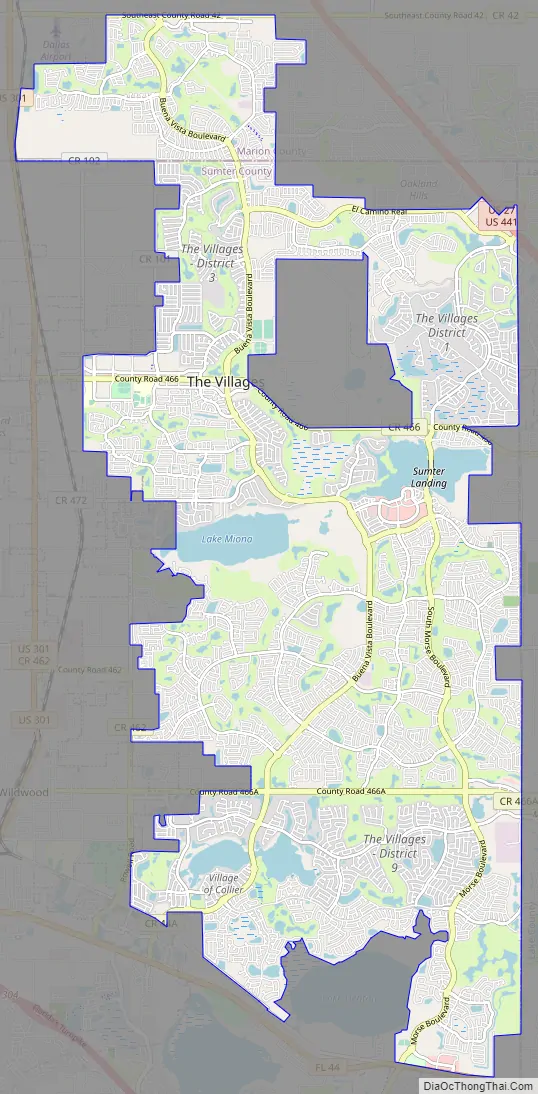
The Villages Road Map
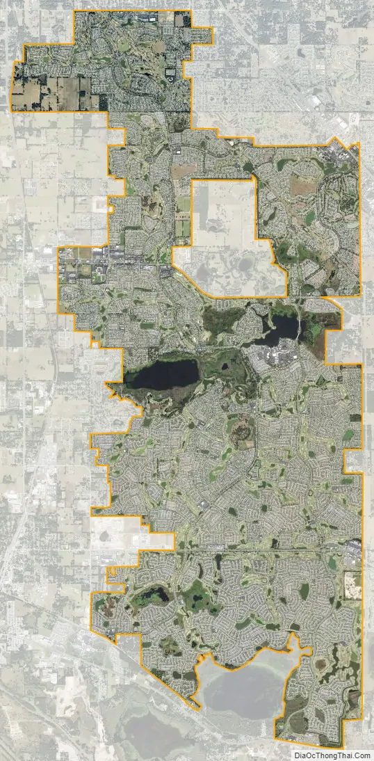
The Villages city Satellite Map
Geography
According to the United States Census Bureau, as of 2022, the CDP has a total area of 34.0 square miles (88 km), of which 32.7 square miles (85 km) are land and 1.3 square miles (3.4 km), or 3.83%, are water. The Villages is located approximately 55 miles (89 km) northwest of Orlando and 80 miles (130 km) northeast of Tampa. It is bordered to the west and south by the city of Wildwood in Sumter County and to the east by the town of Lady Lake and city of Fruitland Park in Lake County.
As of 2018, The Villages has approximately 750 miles (1,210 km) of mostly private roads.
According to The Villages website, north of Florida State Road 44, there is approximately 37 square miles (96 km) of land. From SR 44 to CR 470 there is approximately 20 square miles (52 km) of land. Currently under development and/or complete, there is a combined total land area of approximately 57 square miles (150 km), or over 36,000 acres of land.
See also
Map of Florida State and its subdivision:- Alachua
- Baker
- Bay
- Bradford
- Brevard
- Broward
- Calhoun
- Charlotte
- Citrus
- Clay
- Collier
- Columbia
- Desoto
- Dixie
- Duval
- Escambia
- Flagler
- Franklin
- Gadsden
- Gilchrist
- Glades
- Gulf
- Hamilton
- Hardee
- Hendry
- Hernando
- Highlands
- Hillsborough
- Holmes
- Indian River
- Jackson
- Jefferson
- Lafayette
- Lake
- Lee
- Leon
- Levy
- Liberty
- Madison
- Manatee
- Marion
- Martin
- Miami-Dade
- Monroe
- Nassau
- Okaloosa
- Okeechobee
- Orange
- Osceola
- Palm Beach
- Pasco
- Pinellas
- Polk
- Putnam
- Saint Johns
- Saint Lucie
- Santa Rosa
- Sarasota
- Seminole
- Sumter
- Suwannee
- Taylor
- Union
- Volusia
- Wakulla
- Walton
- Washington
- Alabama
- Alaska
- Arizona
- Arkansas
- California
- Colorado
- Connecticut
- Delaware
- District of Columbia
- Florida
- Georgia
- Hawaii
- Idaho
- Illinois
- Indiana
- Iowa
- Kansas
- Kentucky
- Louisiana
- Maine
- Maryland
- Massachusetts
- Michigan
- Minnesota
- Mississippi
- Missouri
- Montana
- Nebraska
- Nevada
- New Hampshire
- New Jersey
- New Mexico
- New York
- North Carolina
- North Dakota
- Ohio
- Oklahoma
- Oregon
- Pennsylvania
- Rhode Island
- South Carolina
- South Dakota
- Tennessee
- Texas
- Utah
- Vermont
- Virginia
- Washington
- West Virginia
- Wisconsin
- Wyoming