Pine Island is an unincorporated community and census-designated place (CDP) in Hernando County, Florida, United States. The population was 64 at the 2010 census, unchanged from the 2000 census.
| Name: | Pine Island CDP |
|---|---|
| LSAD Code: | 57 |
| LSAD Description: | CDP (suffix) |
| State: | Florida |
| County: | Hernando County |
| Elevation: | 3 ft (1 m) |
| Total Area: | 0.08 sq mi (0.20 km²) |
| Land Area: | 0.06 sq mi (0.17 km²) |
| Water Area: | 0.01 sq mi (0.04 km²) |
| Total Population: | 62 |
| Population Density: | 968.75/sq mi (374.61/km²) |
| FIPS code: | 1256840 |
| GNISfeature ID: | 0295537 |
Online Interactive Map
Click on ![]() to view map in "full screen" mode.
to view map in "full screen" mode.
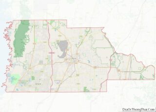
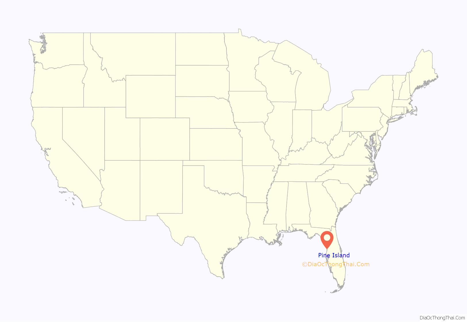
Pine Island location map. Where is Pine Island CDP?
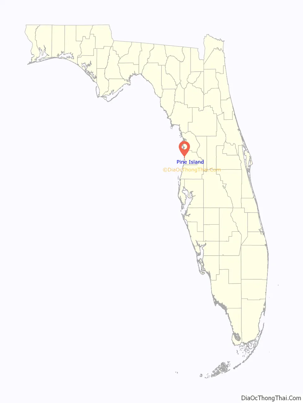
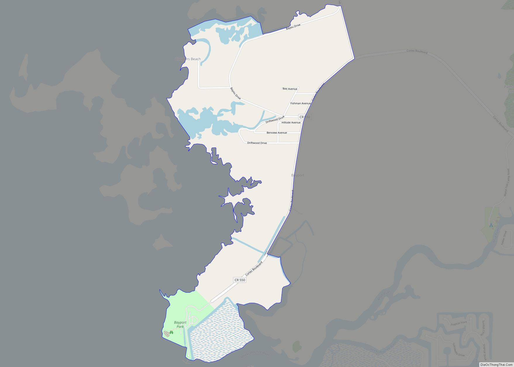
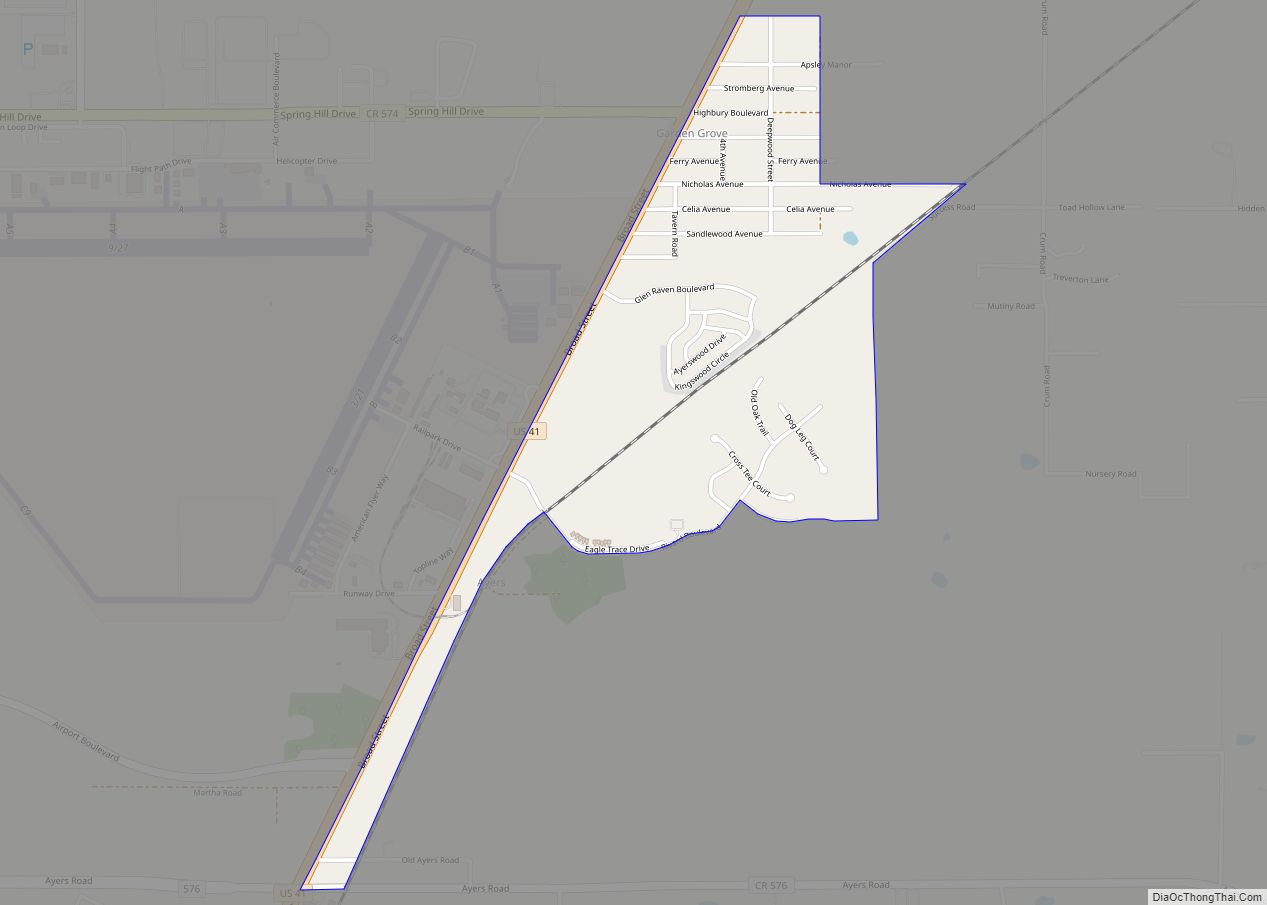
Pine Island Road Map
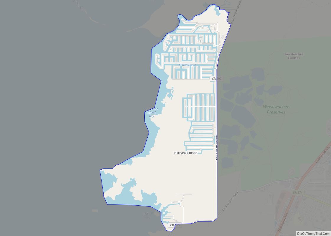
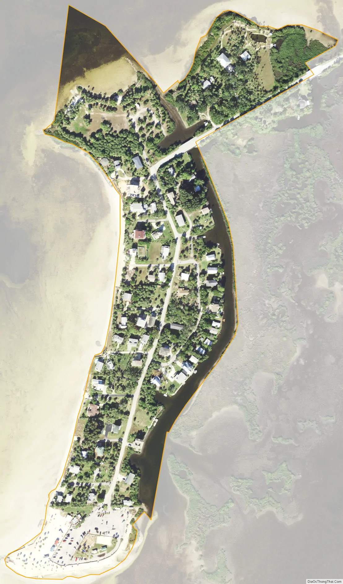
Pine Island city Satellite Map
Geography
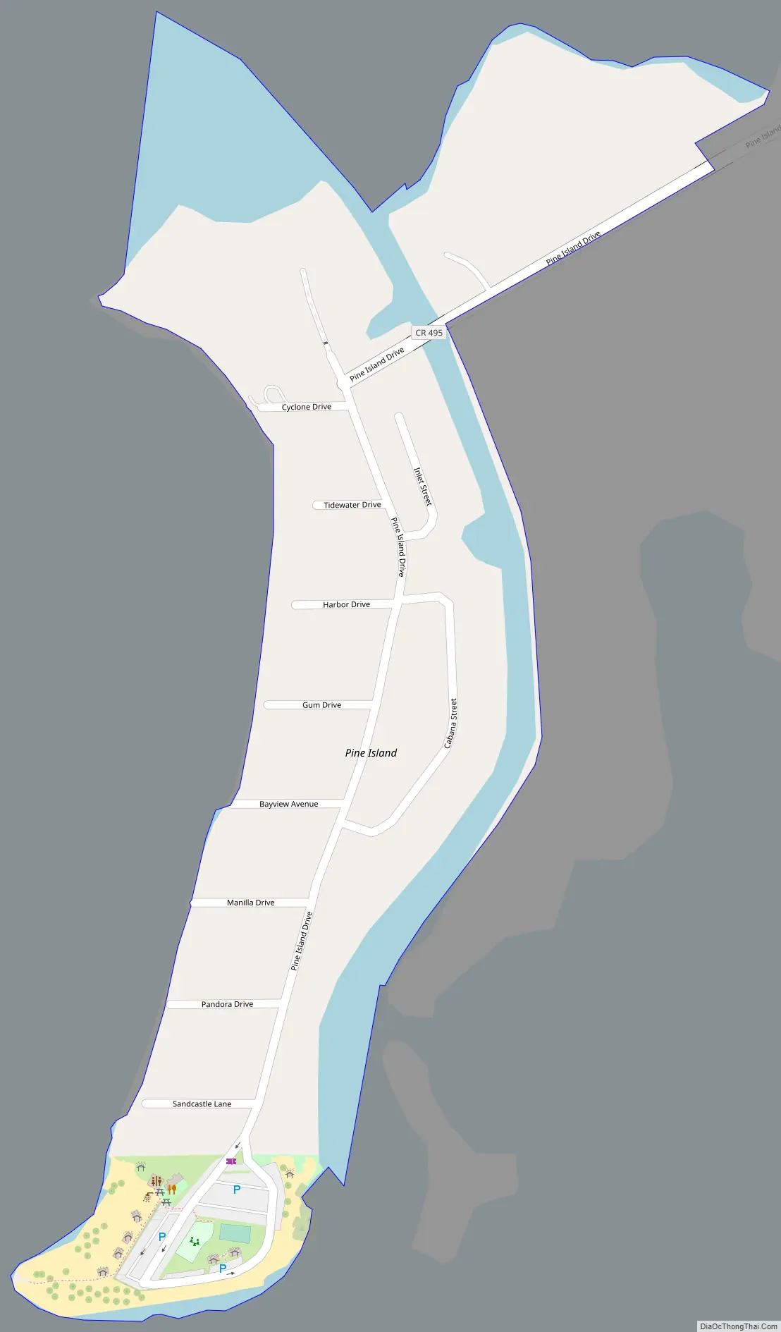
Pine Island is located in western Hernando County at 28°34′19″N 82°39′19″W / 28.571978°N 82.655173°W / 28.571978; -82.655173, on the island of the same name on the Gulf of Mexico. It forms the northern edge of Rock Island Bay, which lies between Pine Island and Bayport. Pine Island Drive is the sole road access to the Pine Island community; via Pine Island Drive and Cortez Boulevard it is 7 miles (11 km) southeast to U.S. Route 19 and State Road 50 at Weeki Wachee.
According to the United States Census Bureau, the CDP has a total area of 0.1 square miles (0.26 km), all land.
Pine Island Park (also known as Alfred McKethan Park) is a 3-acre (12,000 m) area on the Gulf of Mexico at 10800 Pine Island Drive that includes a swimming beach and swimming area, picnic tables, shelters, barbecue grills, observation point, volleyball court, playground and concession stand.
See also
Map of Florida State and its subdivision:- Alachua
- Baker
- Bay
- Bradford
- Brevard
- Broward
- Calhoun
- Charlotte
- Citrus
- Clay
- Collier
- Columbia
- Desoto
- Dixie
- Duval
- Escambia
- Flagler
- Franklin
- Gadsden
- Gilchrist
- Glades
- Gulf
- Hamilton
- Hardee
- Hendry
- Hernando
- Highlands
- Hillsborough
- Holmes
- Indian River
- Jackson
- Jefferson
- Lafayette
- Lake
- Lee
- Leon
- Levy
- Liberty
- Madison
- Manatee
- Marion
- Martin
- Miami-Dade
- Monroe
- Nassau
- Okaloosa
- Okeechobee
- Orange
- Osceola
- Palm Beach
- Pasco
- Pinellas
- Polk
- Putnam
- Saint Johns
- Saint Lucie
- Santa Rosa
- Sarasota
- Seminole
- Sumter
- Suwannee
- Taylor
- Union
- Volusia
- Wakulla
- Walton
- Washington
- Alabama
- Alaska
- Arizona
- Arkansas
- California
- Colorado
- Connecticut
- Delaware
- District of Columbia
- Florida
- Georgia
- Hawaii
- Idaho
- Illinois
- Indiana
- Iowa
- Kansas
- Kentucky
- Louisiana
- Maine
- Maryland
- Massachusetts
- Michigan
- Minnesota
- Mississippi
- Missouri
- Montana
- Nebraska
- Nevada
- New Hampshire
- New Jersey
- New Mexico
- New York
- North Carolina
- North Dakota
- Ohio
- Oklahoma
- Oregon
- Pennsylvania
- Rhode Island
- South Carolina
- South Dakota
- Tennessee
- Texas
- Utah
- Vermont
- Virginia
- Washington
- West Virginia
- Wisconsin
- Wyoming