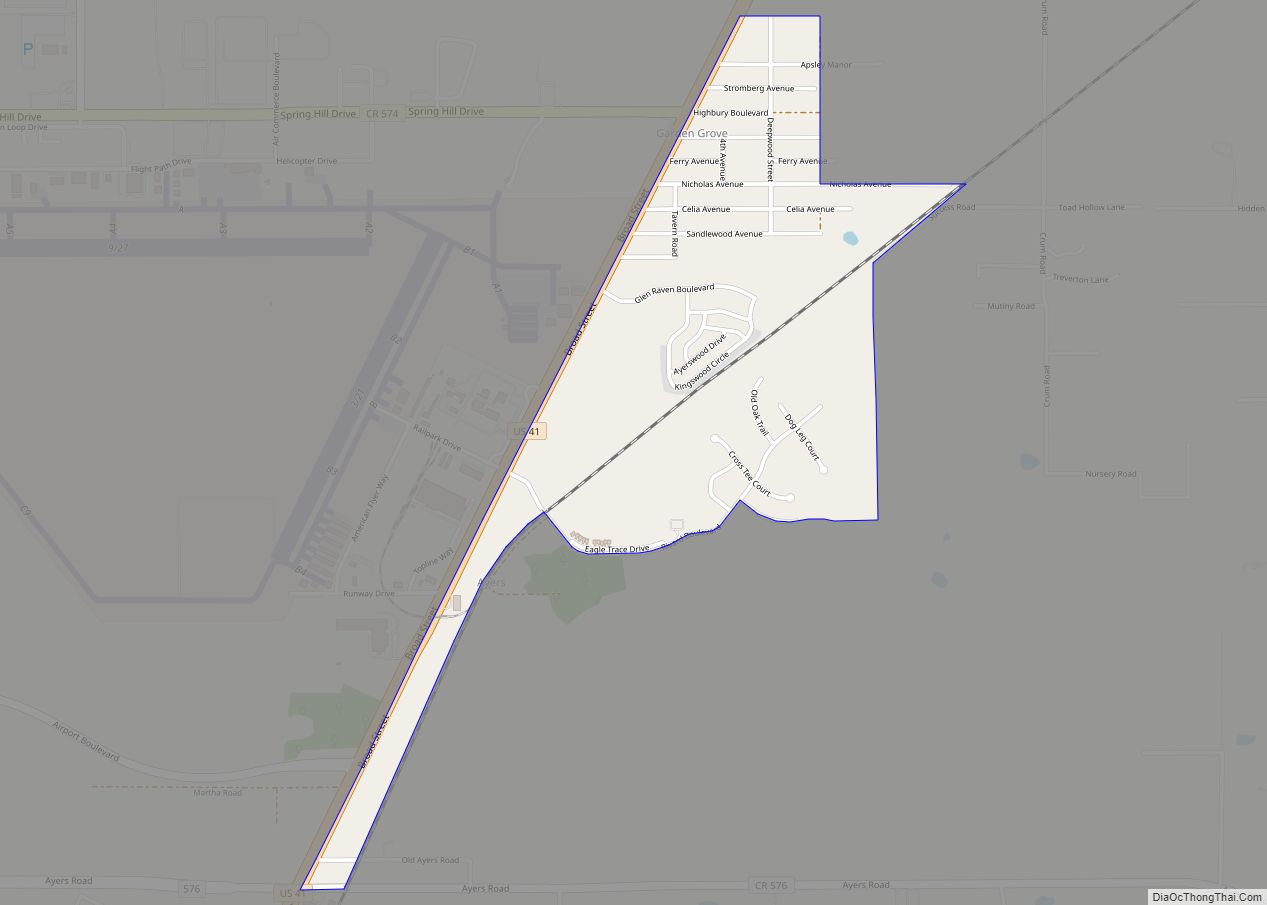
Garden Grove (also known as Garden Grove Estates) is an unincorporated community and census-designated place (CDP) in the U.S. state of Florida, in central Hernando County. The ZIP Code for this community is 34604. As of the 2010 census, Garden Grove had a population of 674.
| Name: | Garden Grove CDP |
|---|---|
| LSAD Code: | 57 |
| LSAD Description: | CDP (suffix) |
| State: | Florida |
| County: | Hernando County |
| Elevation: | 95 ft (29 m) |
| Total Area: | 0.98 sq mi (2.53 km²) |
| Land Area: | 0.97 sq mi (2.51 km²) |
| Water Area: | 0.01 sq mi (0.02 km²) |
| Total Population: | 776 |
| Population Density: | 800.83/sq mi (309.29/km²) |
| FIPS code: | 1225475 |
| GNISfeature ID: | 0282923 |
Online Interactive Map
Click on ![]() to view map in "full screen" mode.
to view map in "full screen" mode.
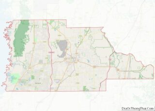
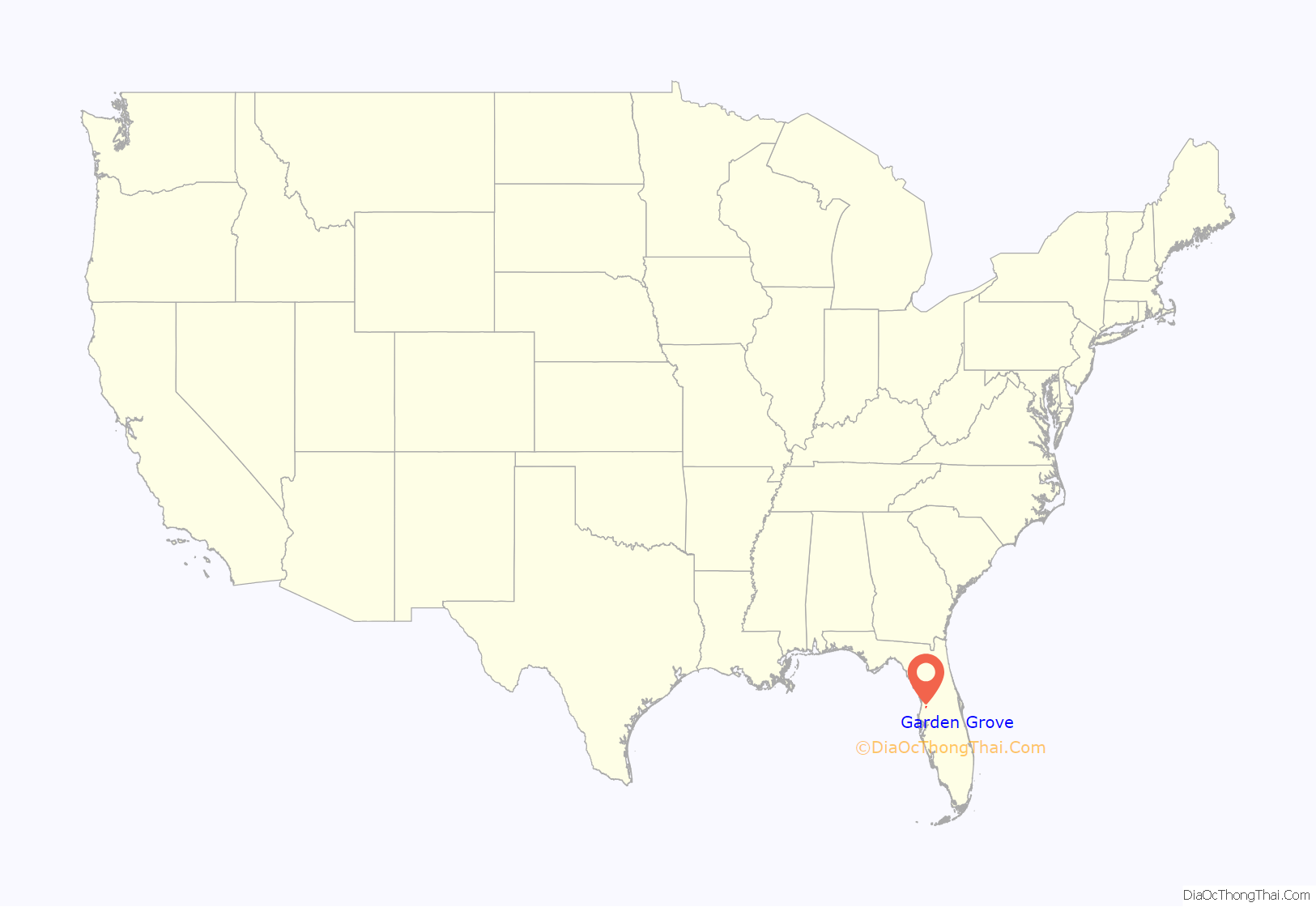
Garden Grove location map. Where is Garden Grove CDP?
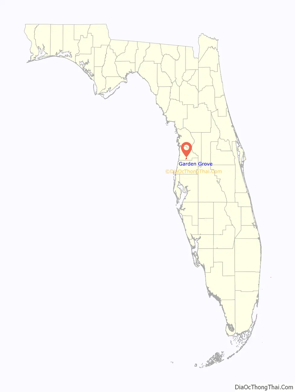
Garden Grove Road Map
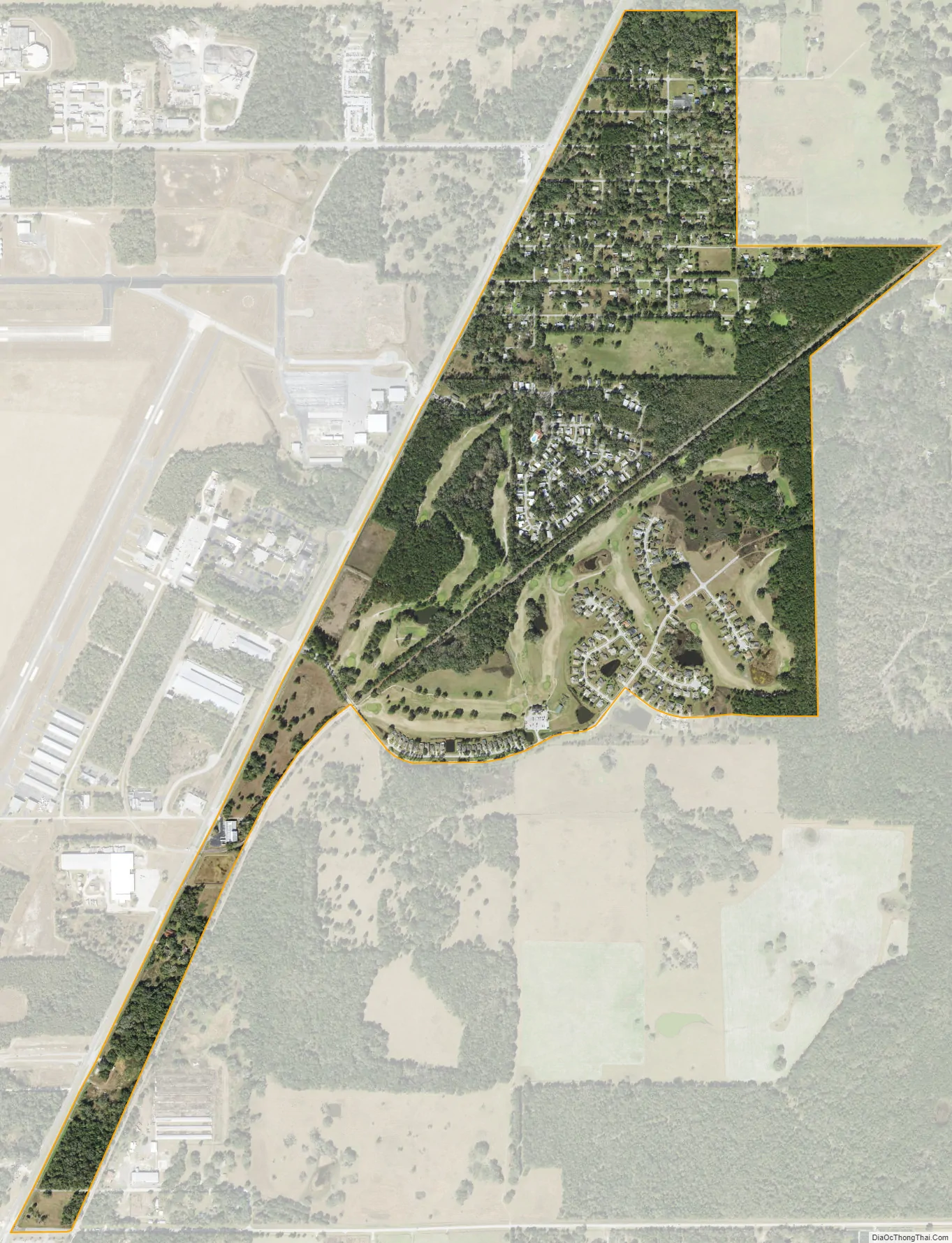
Garden Grove city Satellite Map
Geography
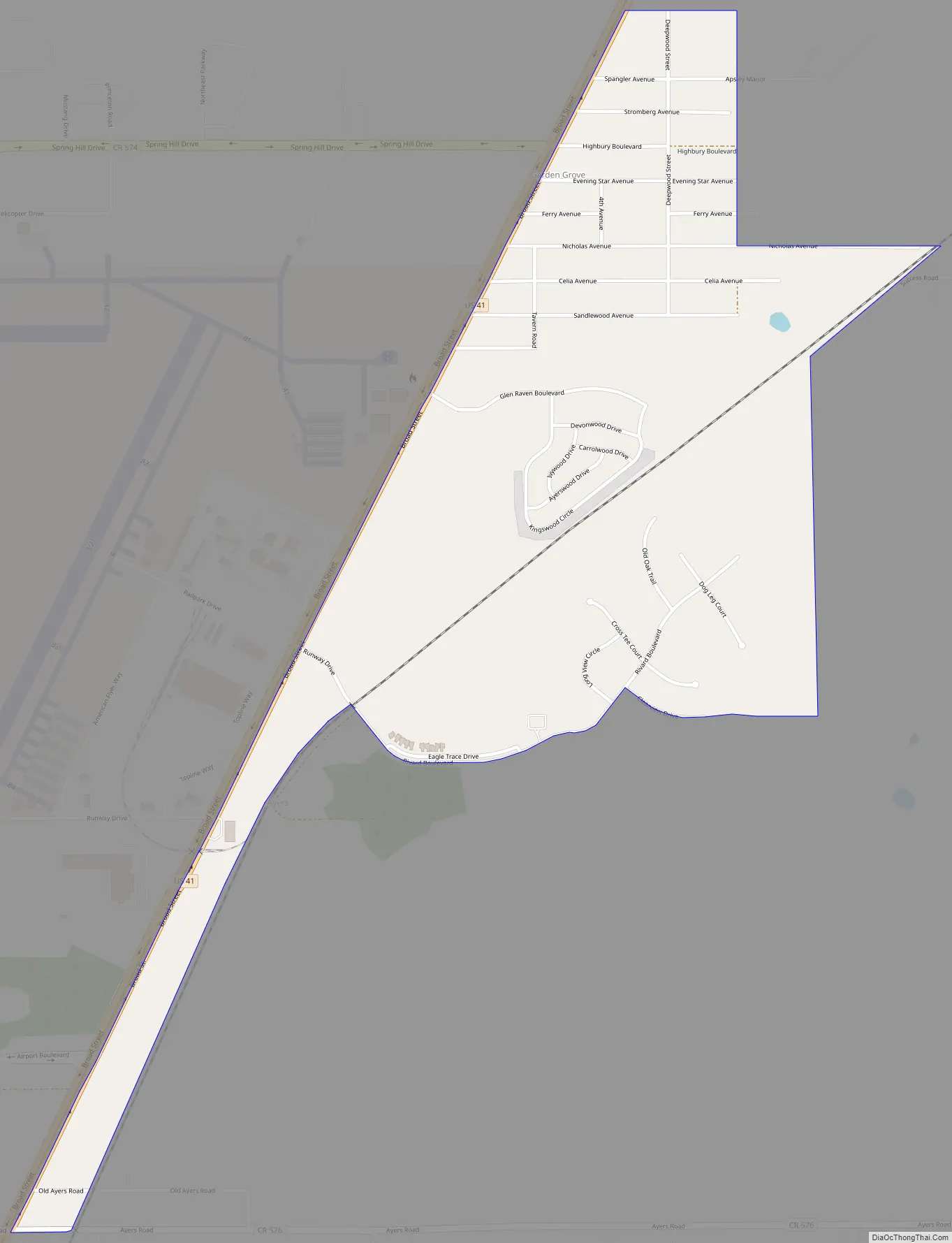
Garden Grove is in southern Hernando County and is bordered by Masaryktown to the south, South Brooksville to the north, and Spring Hill to the west. Garden Grove is located along the eastern edge of Hernando County Airport and is dominated by US 41, the main road through the community.
Though they list their address as being Brooksville, Garden Grove is the headquarters of the Southwest Florida Water Management District which is across from The Trails of Rivard Golf and Country Club.
See also
Map of Florida State and its subdivision:- Alachua
- Baker
- Bay
- Bradford
- Brevard
- Broward
- Calhoun
- Charlotte
- Citrus
- Clay
- Collier
- Columbia
- Desoto
- Dixie
- Duval
- Escambia
- Flagler
- Franklin
- Gadsden
- Gilchrist
- Glades
- Gulf
- Hamilton
- Hardee
- Hendry
- Hernando
- Highlands
- Hillsborough
- Holmes
- Indian River
- Jackson
- Jefferson
- Lafayette
- Lake
- Lee
- Leon
- Levy
- Liberty
- Madison
- Manatee
- Marion
- Martin
- Miami-Dade
- Monroe
- Nassau
- Okaloosa
- Okeechobee
- Orange
- Osceola
- Palm Beach
- Pasco
- Pinellas
- Polk
- Putnam
- Saint Johns
- Saint Lucie
- Santa Rosa
- Sarasota
- Seminole
- Sumter
- Suwannee
- Taylor
- Union
- Volusia
- Wakulla
- Walton
- Washington
- Alabama
- Alaska
- Arizona
- Arkansas
- California
- Colorado
- Connecticut
- Delaware
- District of Columbia
- Florida
- Georgia
- Hawaii
- Idaho
- Illinois
- Indiana
- Iowa
- Kansas
- Kentucky
- Louisiana
- Maine
- Maryland
- Massachusetts
- Michigan
- Minnesota
- Mississippi
- Missouri
- Montana
- Nebraska
- Nevada
- New Hampshire
- New Jersey
- New Mexico
- New York
- North Carolina
- North Dakota
- Ohio
- Oklahoma
- Oregon
- Pennsylvania
- Rhode Island
- South Carolina
- South Dakota
- Tennessee
- Texas
- Utah
- Vermont
- Virginia
- Washington
- West Virginia
- Wisconsin
- Wyoming