Pineland is an unincorporated community and census-designated place (CDP) on Pine Island in Lee County, Florida, United States. The population was 466 at the 2020 census. It is part of the Cape Coral-Fort Myers, Florida Metropolitan Statistical Area.
| Name: | Pineland CDP |
|---|---|
| LSAD Code: | 57 |
| LSAD Description: | CDP (suffix) |
| State: | Florida |
| County: | Lee County |
| Elevation: | 6 ft (2 m) |
| Total Area: | 0.92 sq mi (2.39 km²) |
| Land Area: | 0.90 sq mi (2.32 km²) |
| Water Area: | 0.03 sq mi (0.07 km²) |
| Total Population: | 466 |
| Population Density: | 519.51/sq mi (200.59/km²) |
| ZIP code: | 33945 |
| Area code: | 239 |
| FIPS code: | 1256875 |
| GNISfeature ID: | 0288930 |
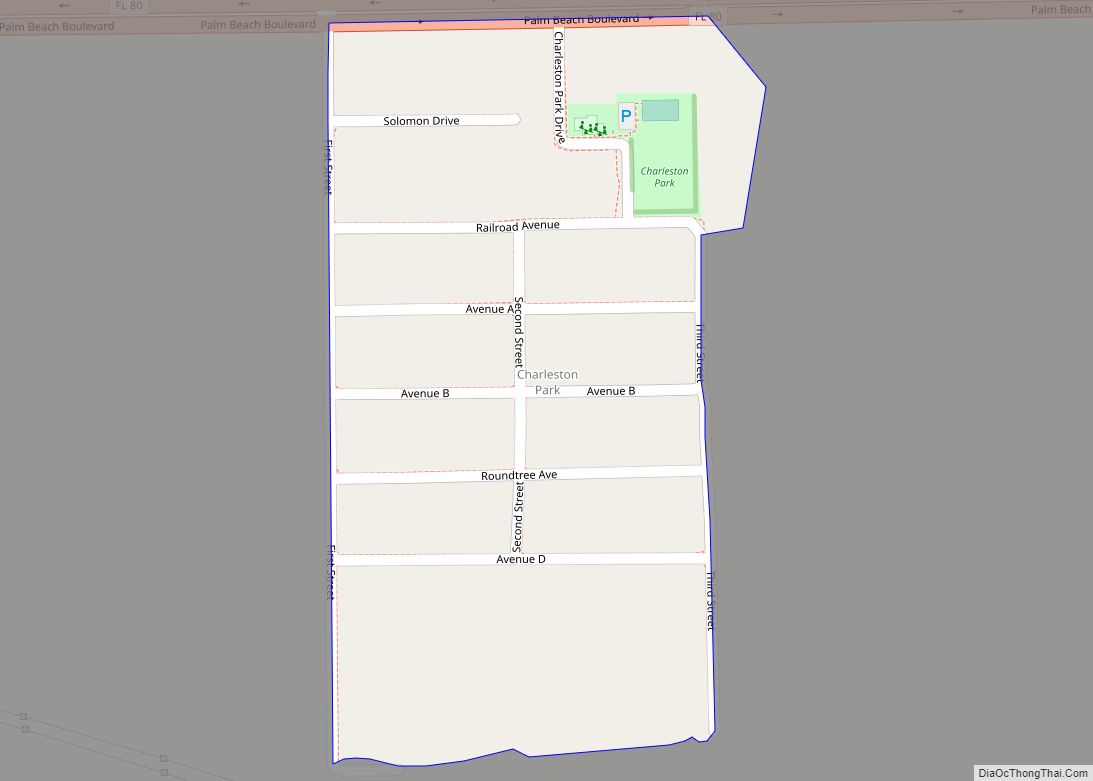
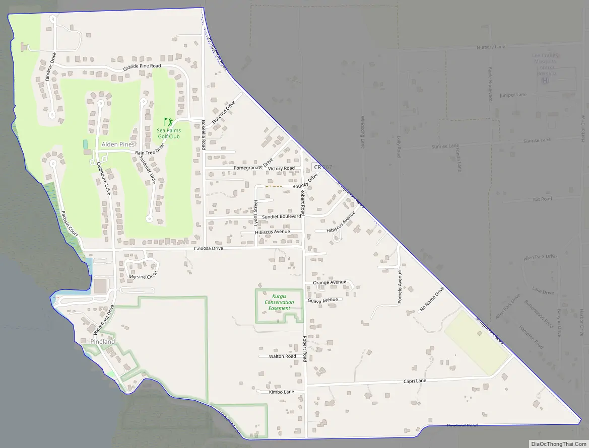
Online Interactive Map
Click on ![]() to view map in "full screen" mode.
to view map in "full screen" mode.
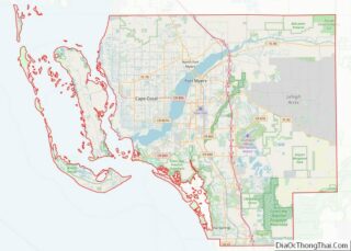
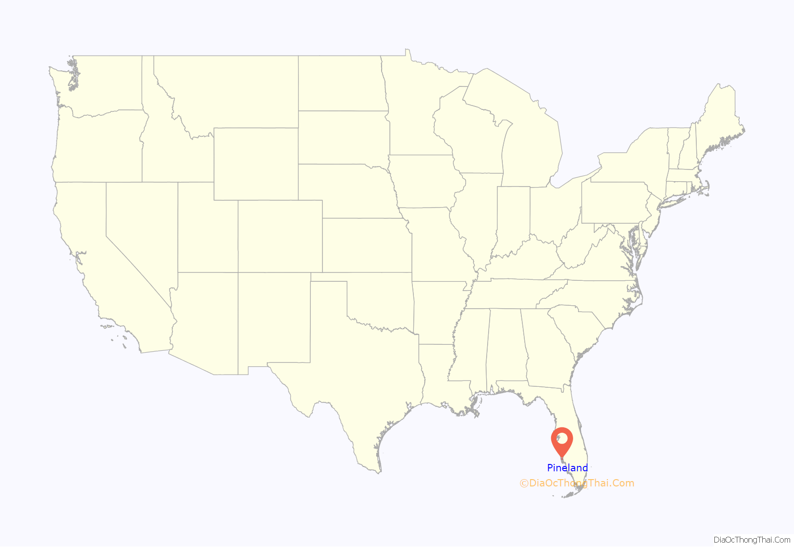
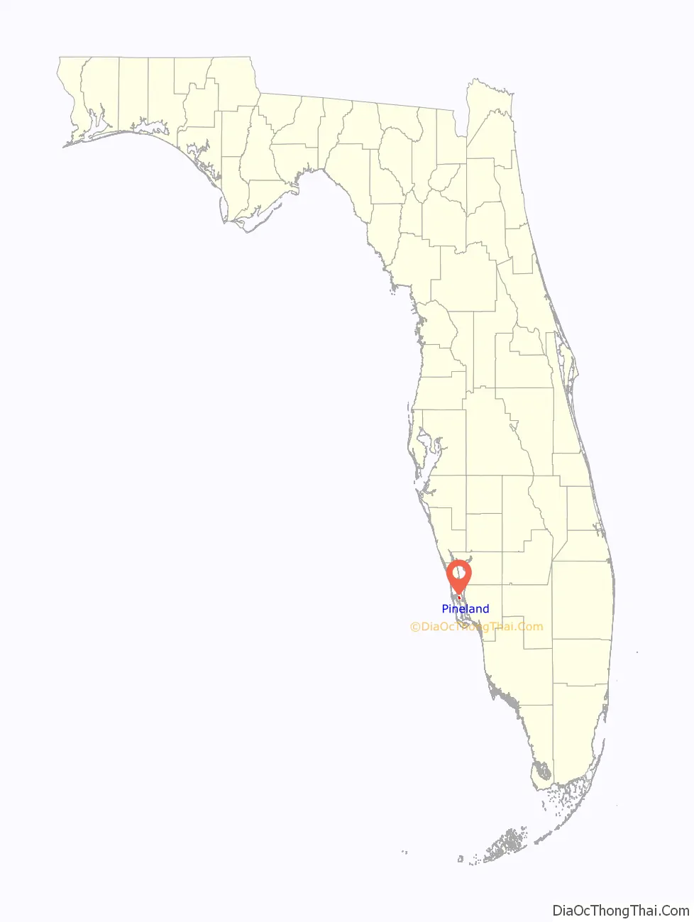
Pineland location map. Where is Pineland CDP?
History
Pineland was the location of one of the largest and oldest native Florida settlements, established at least 2,000 years ago and used by a slowly evolving sequence of cultures. The Calusa people inhabited the area for 1,500 years until the arrival of Europeans. They called the site “Tampa” or “Tanpa”, a name which was accidentally transferred north by European explorers.
Pineland Road Map
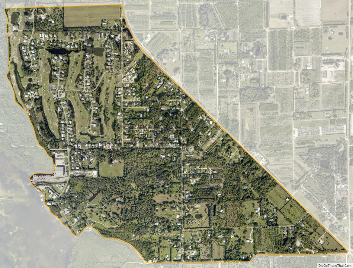
Pineland city Satellite Map
Geography
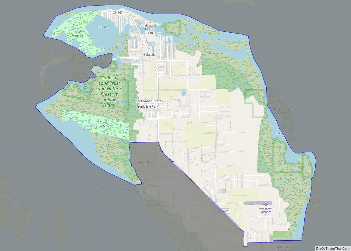
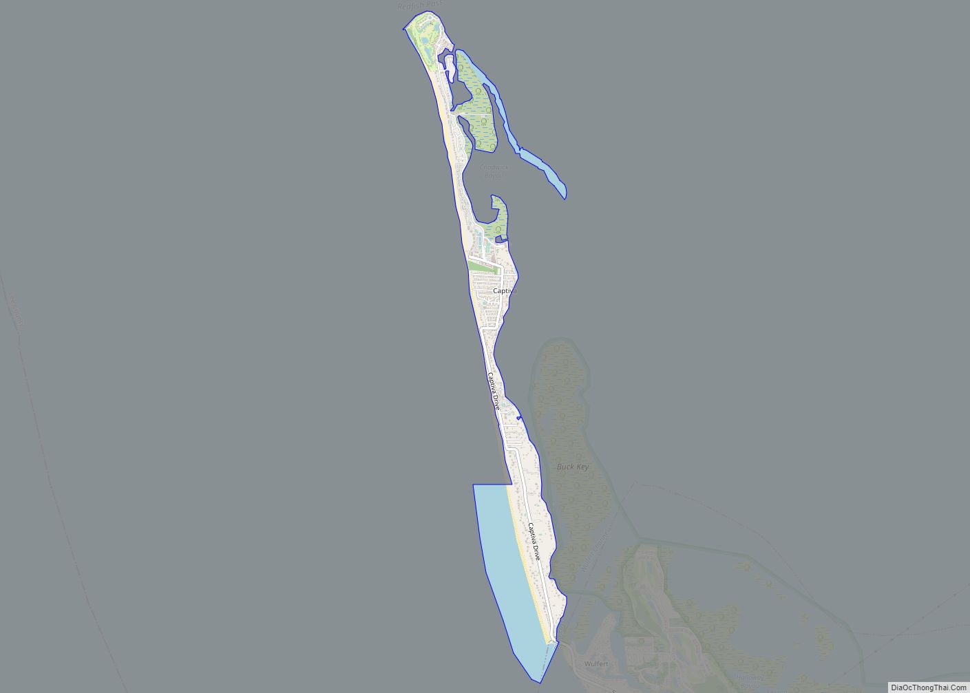
Pineland is located in western Lee County at 26°39′51″N 82°8′46″W / 26.66417°N 82.14611°W / 26.66417; -82.14611 (26.664274, -82.146106), on the west side of Pine Island near its northern end. It is bordered to the north and east by Bokeelia, to the south by Pine Island Center, and to the west by Pine Island Sound, an arm of the Gulf of Mexico. The northeast border of the CDP is Stringfellow Road (County Road 767), which runs north–south the length of the island.
According to the United States Census Bureau, the Pineland CDP has a total area of 0.93 square miles (2.4 km), of which 0.03 square miles (0.07 km), or 2.90%, are water.
See also
Map of Florida State and its subdivision:- Alachua
- Baker
- Bay
- Bradford
- Brevard
- Broward
- Calhoun
- Charlotte
- Citrus
- Clay
- Collier
- Columbia
- Desoto
- Dixie
- Duval
- Escambia
- Flagler
- Franklin
- Gadsden
- Gilchrist
- Glades
- Gulf
- Hamilton
- Hardee
- Hendry
- Hernando
- Highlands
- Hillsborough
- Holmes
- Indian River
- Jackson
- Jefferson
- Lafayette
- Lake
- Lee
- Leon
- Levy
- Liberty
- Madison
- Manatee
- Marion
- Martin
- Miami-Dade
- Monroe
- Nassau
- Okaloosa
- Okeechobee
- Orange
- Osceola
- Palm Beach
- Pasco
- Pinellas
- Polk
- Putnam
- Saint Johns
- Saint Lucie
- Santa Rosa
- Sarasota
- Seminole
- Sumter
- Suwannee
- Taylor
- Union
- Volusia
- Wakulla
- Walton
- Washington
- Alabama
- Alaska
- Arizona
- Arkansas
- California
- Colorado
- Connecticut
- Delaware
- District of Columbia
- Florida
- Georgia
- Hawaii
- Idaho
- Illinois
- Indiana
- Iowa
- Kansas
- Kentucky
- Louisiana
- Maine
- Maryland
- Massachusetts
- Michigan
- Minnesota
- Mississippi
- Missouri
- Montana
- Nebraska
- Nevada
- New Hampshire
- New Jersey
- New Mexico
- New York
- North Carolina
- North Dakota
- Ohio
- Oklahoma
- Oregon
- Pennsylvania
- Rhode Island
- South Carolina
- South Dakota
- Tennessee
- Texas
- Utah
- Vermont
- Virginia
- Washington
- West Virginia
- Wisconsin
- Wyoming