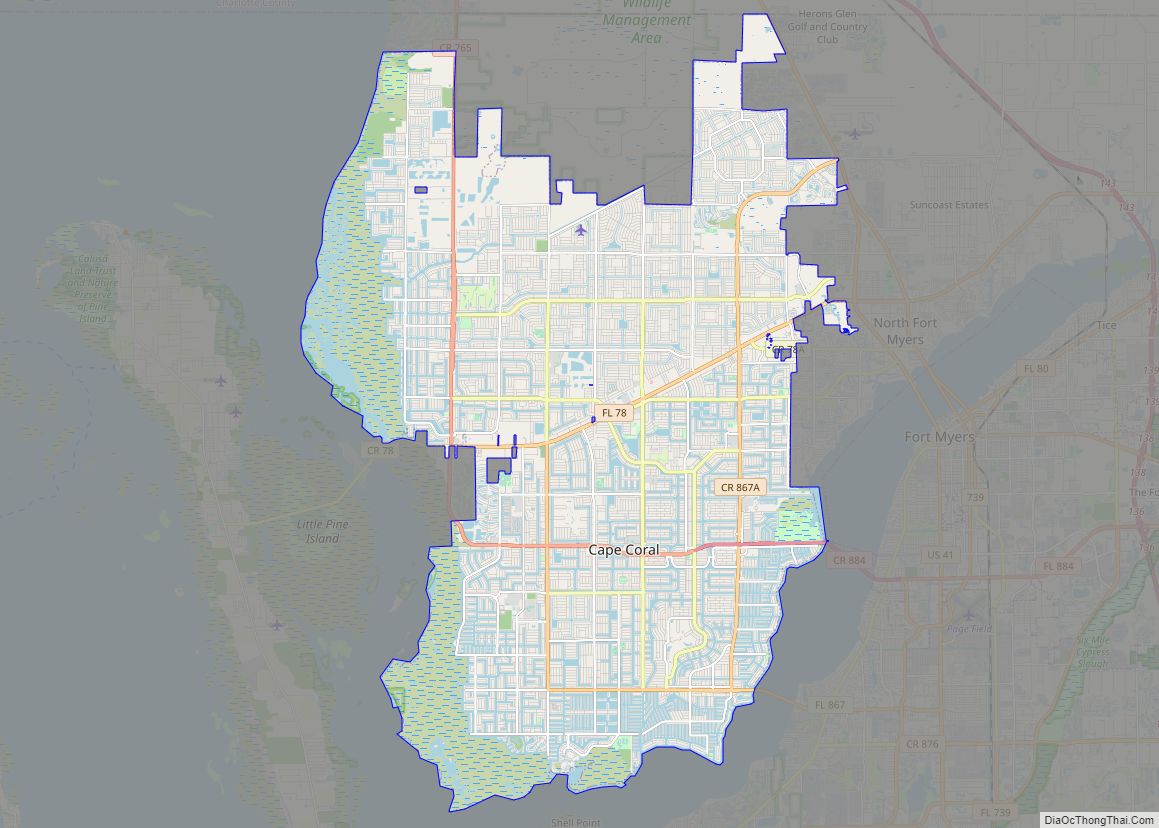
Cape Coral is a city located in Lee County, Florida, United States, on the Gulf of Mexico. Founded in 1957 and developed as a planned community, the city’s population had grown to 194,016 as of the 2020 Census, a rise of 26% from the 2010 Census, making it the 130th most populous city in the United States. With an area of 120 square miles (310 km), Cape Coral is the largest city between Tampa and Miami in both population and area. It is the largest and principal city in the Cape Coral – Fort Myers, Florida Metropolitan Statistical Area. The city has over 400 mi (640 km) of navigable waterways, more than any other city on earth.
| Name: | Cape Coral city |
|---|---|
| LSAD Code: | 25 |
| LSAD Description: | city (suffix) |
| State: | Florida |
| County: | Lee County |
| Founded: | 1957 |
| Incorporated: | 1970 |
| Elevation: | 3 ft (0.9 m) |
| Land Area: | 106.03 sq mi (274.61 km²) |
| Water Area: | 13.38 sq mi (34.65 km²) 9% |
| Population Density: | 1,829.84/sq mi (706.51/km²) |
| Area code: | 239 |
| FIPS code: | 1210275 |
| GNISfeature ID: | 0279997 |
| Website: | www.capecoral.net |
Are you looking for a Cape Coral, Florida map? Look no further. We offer a wide range of maps from a road map to a reference map, as well as things to do in the area. Plus, our interactive map will provide you with more details about the streets and canal system.
Cape Coral, Florida is a great destination for families. It offers beautiful beaches along the Gulf Coast, thrilling water parks, and some of the best golf courses in the United States. So if you’re looking for a fun getaway with your family or friends, Cape Coral, Florida is the perfect spot! Check out our printable maps and other information about this hidden gem.
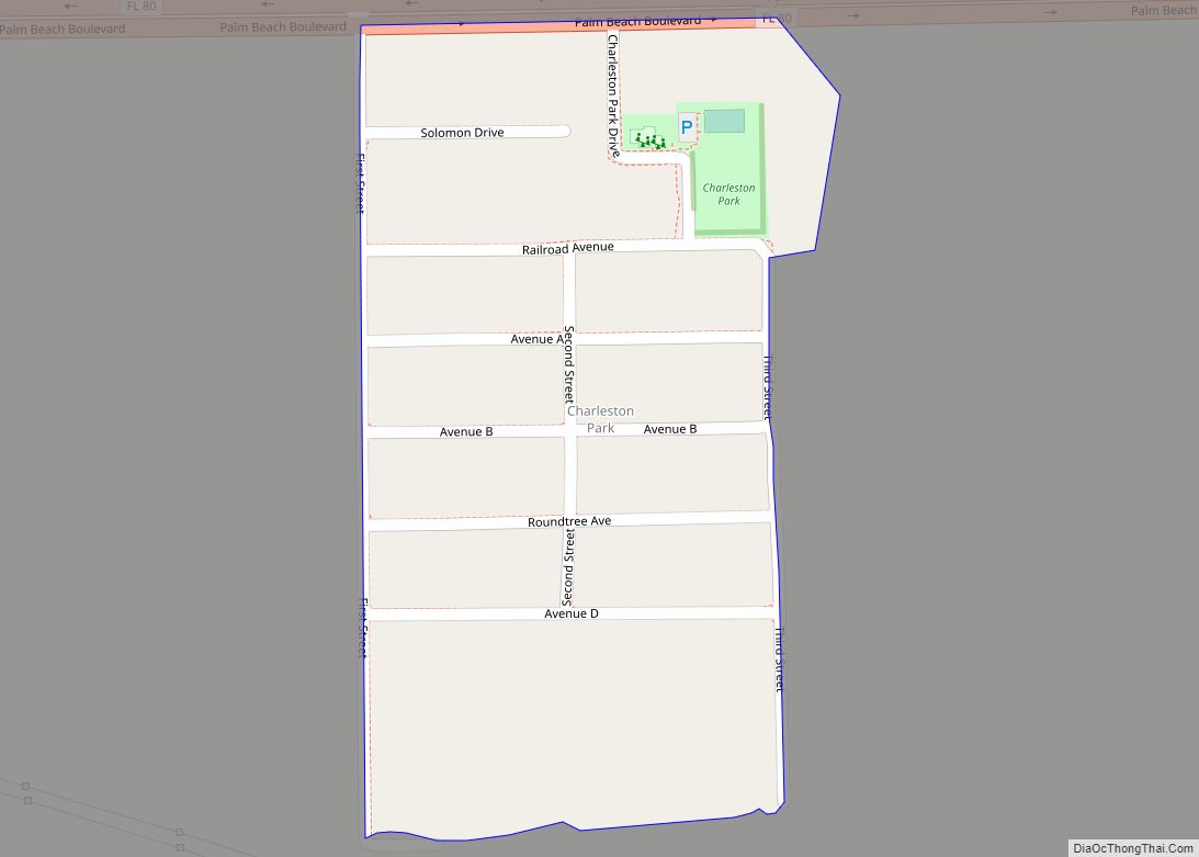
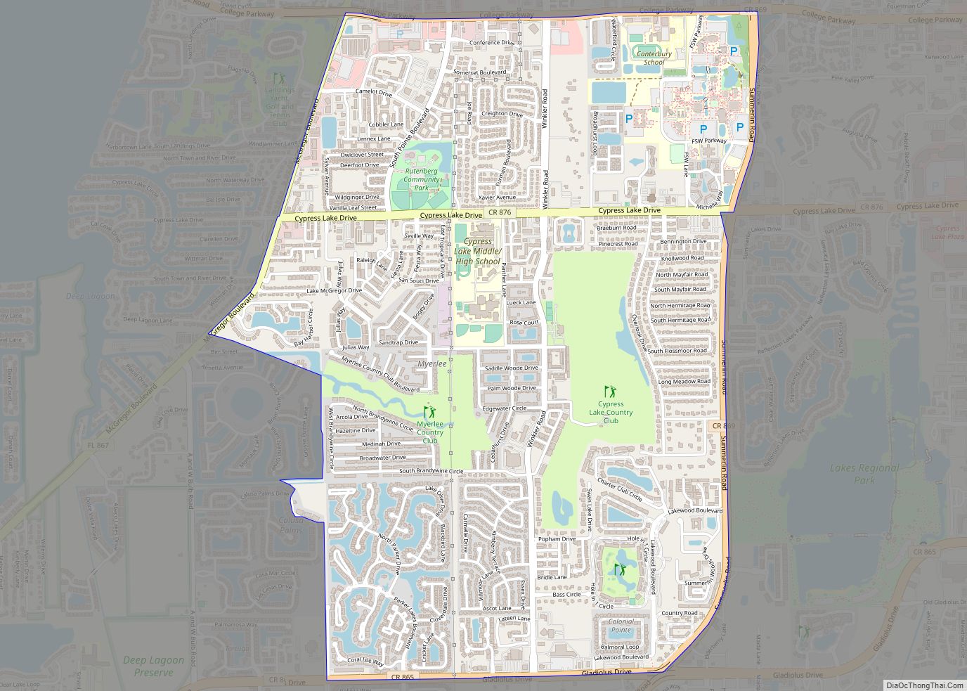
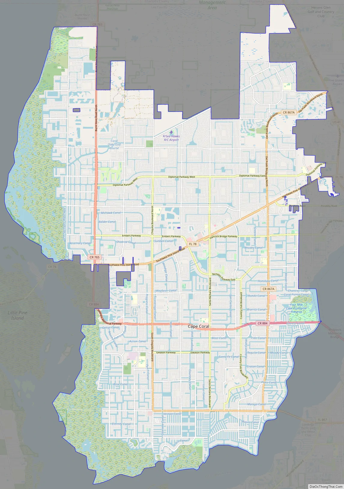
Online Interactive Map
Click on ![]() to view map in "full screen" mode.
to view map in "full screen" mode.
This Cape Coral Florida interactive map will help you find the nearest gas station, restaurant, or airport. The city is located on the southern Gulf Coast of Florida near Fort Myers, Naples, and Sanibel Island. This interactive map shows you a detailed view of the town, highlighting attractions, nearby hotels, restaurants, and more. Learn more and explore this beautiful city.
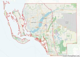
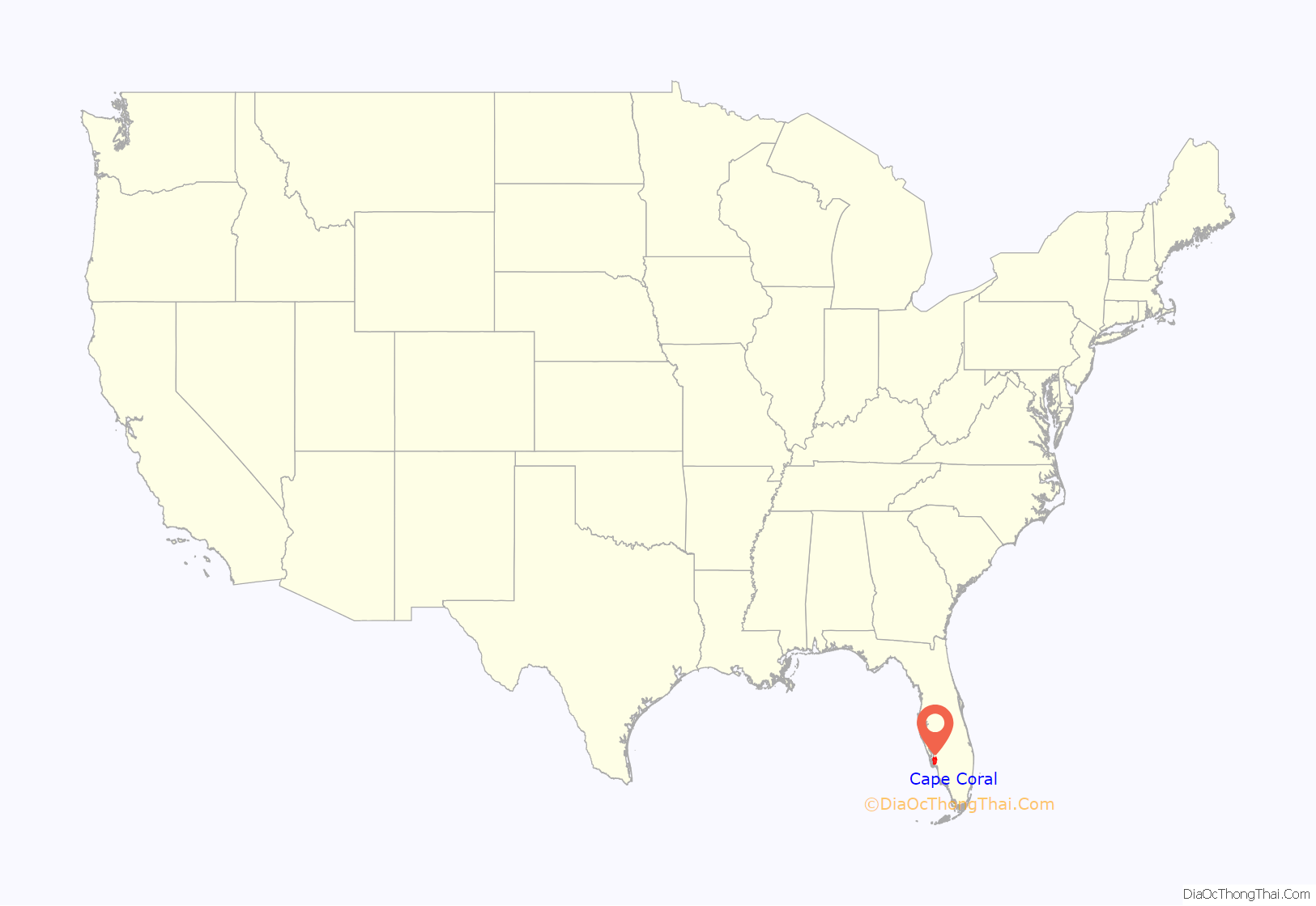
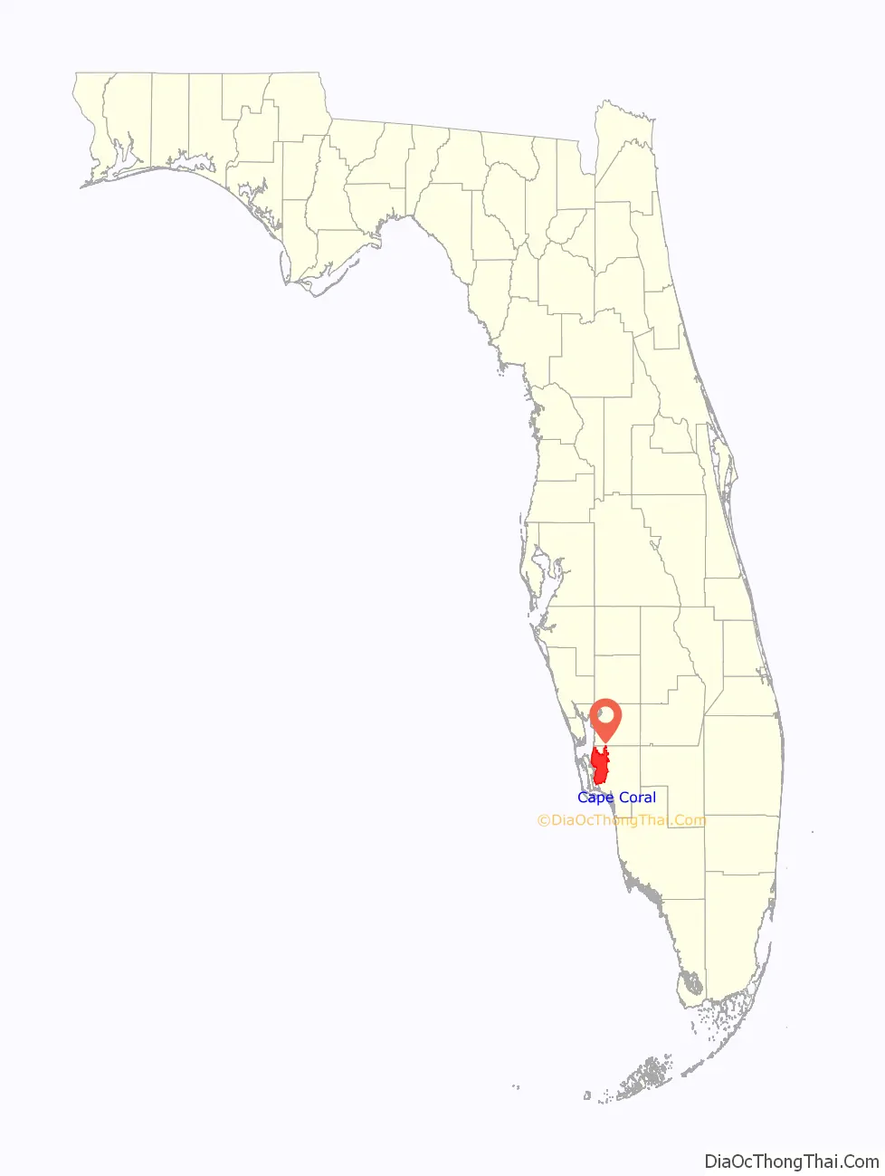
Cape Coral location map. Where is Cape Coral city?
History
Cape Coral’s history began in 1957 when two brothers from Baltimore, Maryland, Leonard and Jack Rosen, flew over the peninsula known as Redfish Point, across the Caloosahatchee River near present-day Fort Myers. The brothers, who were real estate developers, purchased a 103-square-mile (270 km) tract with a small group of partners for $678,000 and in 1958 began development of the city as a planned community.
The Gulf American Land Corporation (GALC) was formed to develop the area. GALC developed a marketing model that was a departure from traditional selling methods. Approval was secured from Lee County to master-plan the entire property into lots. Instead of listing the lots with real estate agents, GALC developed the land sales, dinner-party model, operating from banquet rooms in local hotels. People were invited to attend by offering a free dinner for two. The model, referred to as team-selling, allowed for a well-trained team to close deals in 90 minutes. Buyers would sign a contract and agree to come to the property within six months and cancel if not satisfied. Ezio Valentini, an Italian real estate developer, joined GALC and became director of sales. The program was so successful that offices were opened in 24 states, and an arrangement was made with an airline to charter flights to fly buyers to the property.
Instead of borrowing from banks and lenders, the developers factored the sales contracts to pay for building the infrastructure. Canals were dug, streets paved, houses and businesses built. Cape Coral was promoted like no other Florida development. Celebrities were brought in to tout the benefits of “the Cape”, as it is known locally. The first building in Cape Coral was the Rosens’ sales office. It was built where George’s Auto now stands, at Cape Coral and Coronado Parkways. Cape Coral’s first permanent resident was Kenny Schwartz, the Rosens’ general manager. Cape Coral’s first four homes were completed in May 1958, on Riverside and Flamingo Drives.
Development continued through the early 1960s, mostly on Redfish Point, south of Cape Coral Parkway. By 1963, the population was 2,850; 1,300 buildings had been finished or were under construction; 80 mi (130 km) of road had been built, and 160 mi (260 km) of canals had been dug. The public yacht club, a golf course, medical clinic and shopping center were up and running. A major addition for Cape Coral was the construction of the 3,400 feet (1,000 m) long Cape Coral Bridge across the Caloosahatchee River, which opened in early 1964. Before the bridge, a trip to Fort Myers was more than 20 mi (32 km) via Del Prado Boulevard and over the Edison Bridge to cross the river.
The city incorporated in August 1970, and its population continued to grow rapidly until the real estate slowdown that gripped the region beginning in 2008. On September 28, 2022, Cape Coral suffered major damage when Hurricane Ian made landfall nearby.
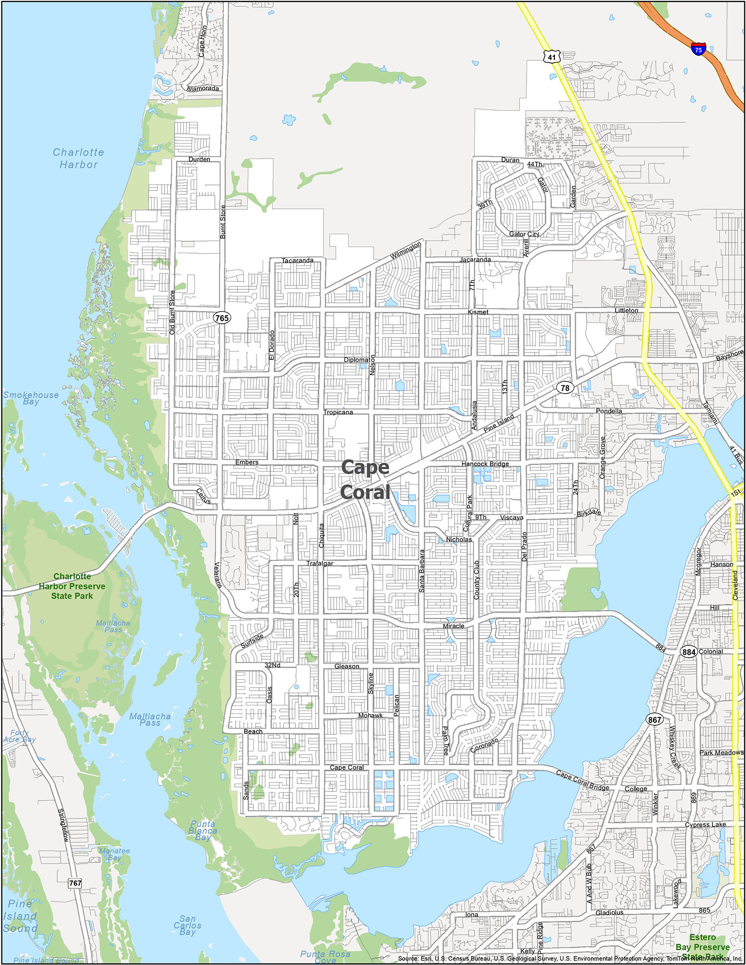
Cape Coral Road Map
Cape Coral, Florida is an amazing city with plenty to see and do. From its charming small-town atmosphere to its big city vibes, there is something for everyone. With this free road map of Cape Coral, you can easily navigate the city’s transportation network, including interstates, highways, and major roads. With 78, 765, Beach Pky, Cape Coral Pky, Ceitus Pky, Coronado Pky, Del Navarra Pky, Diplomat Pky, Duran Pky, Durden Pky, El Dorado Pky, Embers Pky, Gleason Pky, Hancock Bridge Pky, Jacaranda Pky, Kismet Pky, Miracle Pky, Mohawk Pky, Nicholas Pky, Tacaranda Pky, Trafalgar Pky, Tropicana Pky, Veterans Pky, Viscaya Pky, Wildwood Pky, Wilmington Pky, 13th Ave, 20th Ave, 24th Ave, 32nd St, 39th St, 44th Ter, 6th Ct, 7th Pl, 9th St, Academy Blvd, Andalusia Blvd, Averill Blvd, Birkdale Ave, Burnt Store Rd, Chiquita Blvd, Country Club Blvd, Cultural Park Blvd, Del Prado Blvd, El Dorado Blvd, Garden Blvd, Gator City, Hancock Creek South Blvd, Hunter Blvd, Juanita Blvd, Midpoint Bridge, Nelson Rd, Nott Rd, Oasis Blvd, Old Burnt Store Rd, Palm Tree Blvd, Pelican Blvd, Pine Island Rd, Pondella Rd, Ramsey Blvd, Sands Blvd, Santa Barbara Blvd, Skyline Blvd, Surfside Blvd, Vincennes Blvd, you can easily get around and explore all that Cape Coral has to offer.
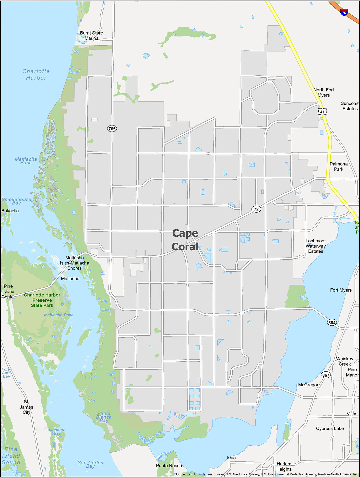
With an estimated population of 185,000 and near-perfect weather, Cape Coral, Florida is an ideal destination for travelers looking to explore the bays, parks, harbors, and neighborhoods of the area. To get the most out of your visit, a reference map is an essential tool. This map will provide you with the important information you need to make the most of your time in Cape Coral.
Cape Coral is located in Lee County, and is bordered by the cities of Fort Myers and Bokeelia. In addition to the cities and towns, the map also highlights the area’s water features including Charlotte Harbor, Matlacha Pass, Smokehouse Bay, and San Carlos Bay. With this reference map, you’ll be able to explore the area with ease and find everything you need to make your visit to Cape Coral a memorable one.
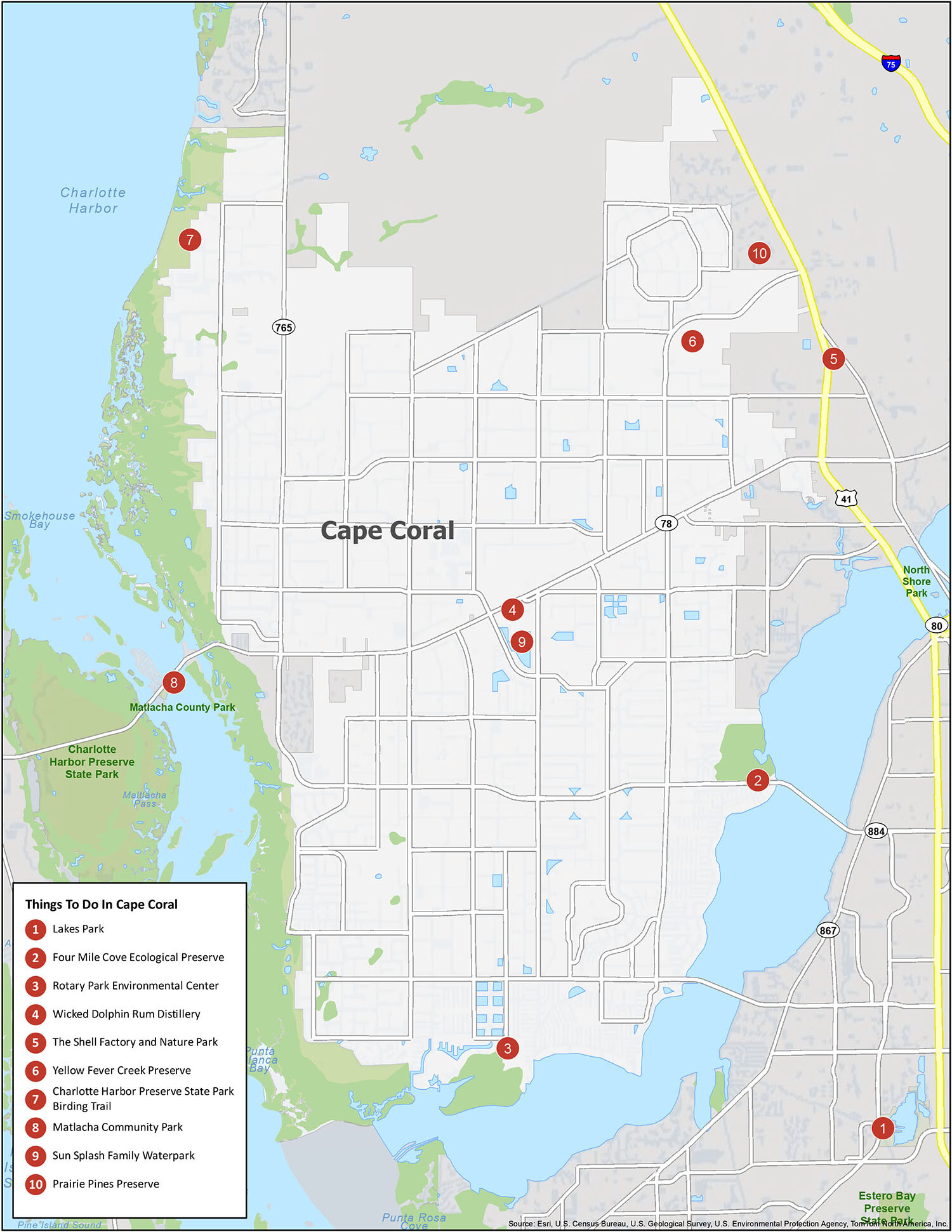
10 things to do in Cape Coral city
Cape Coral Florida is a great place to spend a vacation. With its stunning beaches, parks, and ecological preserves, it’s the perfect destination for anyone looking for a peaceful getaway. Check out this map for quick overview of the area’s features and attractions. From Lakes Park to the Yellow Fever Creek Preserve, and the Wicked Dolphin Rum Distillery to the Sun Splash Family Waterpark, there’s something for everyone to enjoy in Cape Coral Florida.
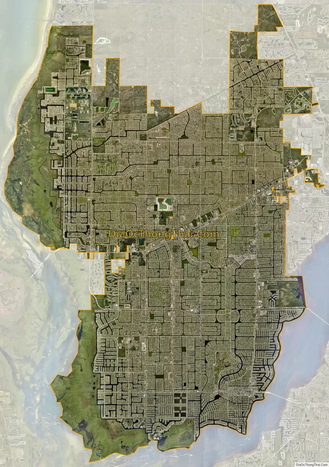
Cape Coral city Satellite Map
Geography
According to the United States Census Bureau, the city has a total area of 120 square miles (310.8 km), of which 110.09 square miles (285.1 km) is land and 9.91 square miles (25.7 km) (9%) is water. Cape Coral is a large peninsula and is bordered in the south and east by the Caloosahatchee River and in the west by Matlacha Pass. Fort Myers lies across the Caloosahatchee River to the east, and Matlacha and Pine Island lie across Matlacha Pass to the west. Matlacha Pass is home to Matlacha Pass National Wildlife Refuge and the Matlacha Pass Aquatic Preserve.
Flora and fauna
The area supports waterfowl, wading birds, migrant songbirds, gopher tortoises, dolphins and reptiles. Rotary Park is home to wading birds, raptors, butterflies, foxes and other wildlife. Nature enthusiasts can track exotic birds and native fish from the boardwalk at Lake Kennedy and watch the West Indian manatees at Sirenia Vista Park. Cape Coral is home to the largest population of burrowing owls in Florida.
Invasive species
Cape Coral is home to three invasive species, the green iguana, the spiny-tailed iguana, and the Nile monitor, which was discovered in 2009. The iguanas are found throughout southern Florida and generally do not pose a threat. The Nile monitor is however a large (3–7 feet), fast traveling, fast swimming carnivore with a wide diet, which can include fish, fowl, and small mammals. The city’s many waterways work against its capture and provide an easy transportation route around the city.
Climate
The city features a borderline tropical savanna climate (Köppen climate classification: Aw), bordering on a tropical monsoon climate (Köppen climate classification: Am). The area averages 355 days of sunshine per year and experiences precipitation on 145 days per year. While the summers are very warm, humid, and rainy, the winters in Cape Coral are dry with moderate temperatures. The city receives about 56 inches of rain each year, the majority of which falls from June to September. During the summer months, afternoon rains are heavy yet brief. The city is affected by the annual hurricane season, which begins officially on June 1 and continues through November.
See also
Map of Florida State and its subdivision:- Alachua
- Baker
- Bay
- Bradford
- Brevard
- Broward
- Calhoun
- Charlotte
- Citrus
- Clay
- Collier
- Columbia
- Desoto
- Dixie
- Duval
- Escambia
- Flagler
- Franklin
- Gadsden
- Gilchrist
- Glades
- Gulf
- Hamilton
- Hardee
- Hendry
- Hernando
- Highlands
- Hillsborough
- Holmes
- Indian River
- Jackson
- Jefferson
- Lafayette
- Lake
- Lee
- Leon
- Levy
- Liberty
- Madison
- Manatee
- Marion
- Martin
- Miami-Dade
- Monroe
- Nassau
- Okaloosa
- Okeechobee
- Orange
- Osceola
- Palm Beach
- Pasco
- Pinellas
- Polk
- Putnam
- Saint Johns
- Saint Lucie
- Santa Rosa
- Sarasota
- Seminole
- Sumter
- Suwannee
- Taylor
- Union
- Volusia
- Wakulla
- Walton
- Washington
- Alabama
- Alaska
- Arizona
- Arkansas
- California
- Colorado
- Connecticut
- Delaware
- District of Columbia
- Florida
- Georgia
- Hawaii
- Idaho
- Illinois
- Indiana
- Iowa
- Kansas
- Kentucky
- Louisiana
- Maine
- Maryland
- Massachusetts
- Michigan
- Minnesota
- Mississippi
- Missouri
- Montana
- Nebraska
- Nevada
- New Hampshire
- New Jersey
- New Mexico
- New York
- North Carolina
- North Dakota
- Ohio
- Oklahoma
- Oregon
- Pennsylvania
- Rhode Island
- South Carolina
- South Dakota
- Tennessee
- Texas
- Utah
- Vermont
- Virginia
- Washington
- West Virginia
- Wisconsin
- Wyoming