Roseland is an unincorporated community and census-designated place (CDP) in Indian River County, Florida, United States. The population was 1,472 at the 2010 census, down from 1,775 at the 2000 census. It is part of the Sebastian–Vero Beach Metropolitan Statistical Area.
| Name: | Roseland CDP |
|---|---|
| LSAD Code: | 57 |
| LSAD Description: | CDP (suffix) |
| State: | Florida |
| County: | Indian River County |
| Incorporated: | 1892 |
| Elevation: | 20 ft (6 m) |
| Total Area: | 3.22 sq mi (8.33 km²) |
| Land Area: | 1.89 sq mi (4.90 km²) |
| Water Area: | 1.32 sq mi (3.43 km²) |
| Total Population: | 1,591 |
| Population Density: | 841.35/sq mi (324.93/km²) |
| ZIP code: | 32957 |
| Area code: | 772 |
| FIPS code: | 1261875 |
| GNISfeature ID: | 0289969 |
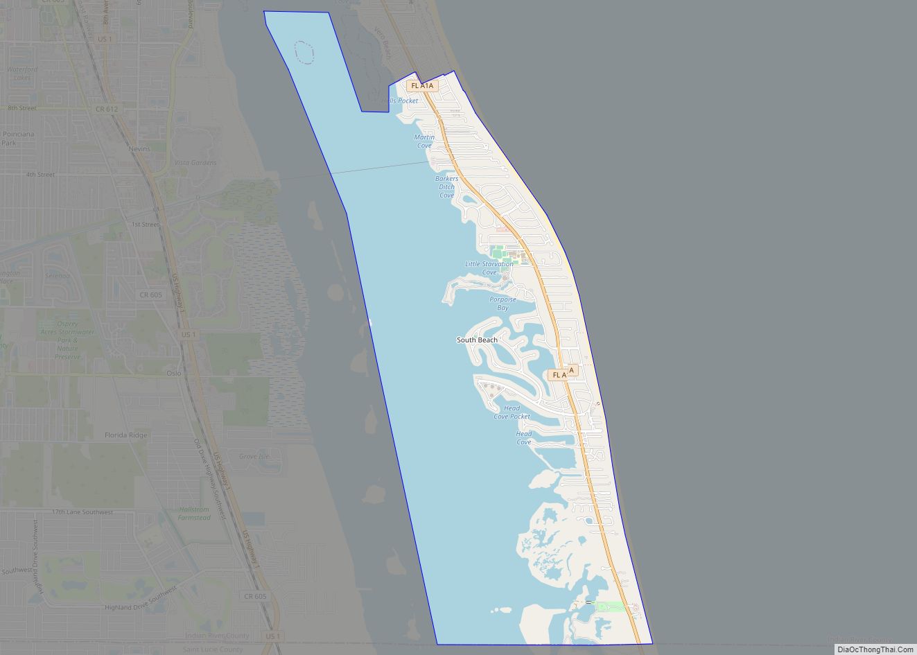
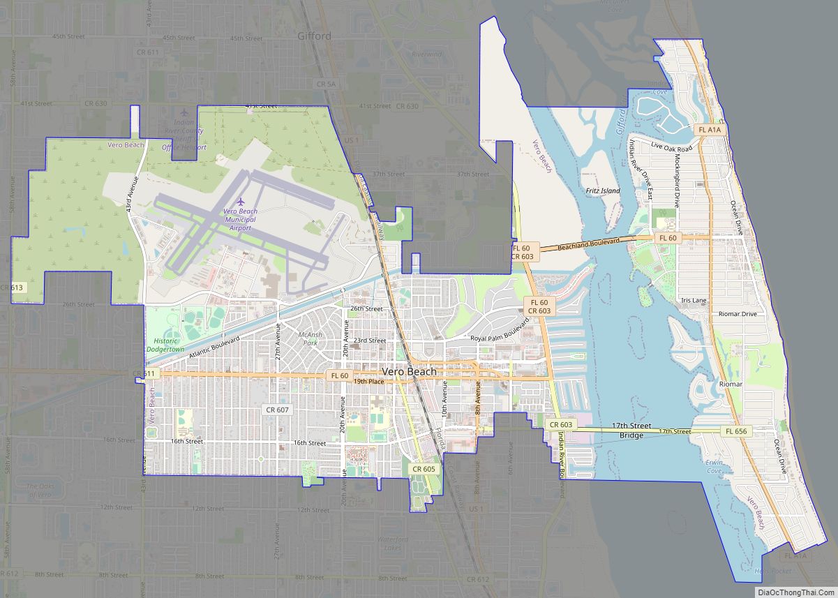
Online Interactive Map
Click on ![]() to view map in "full screen" mode.
to view map in "full screen" mode.
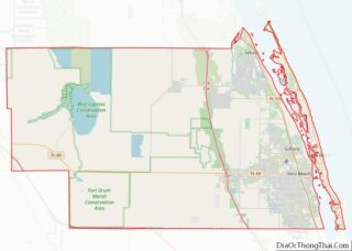
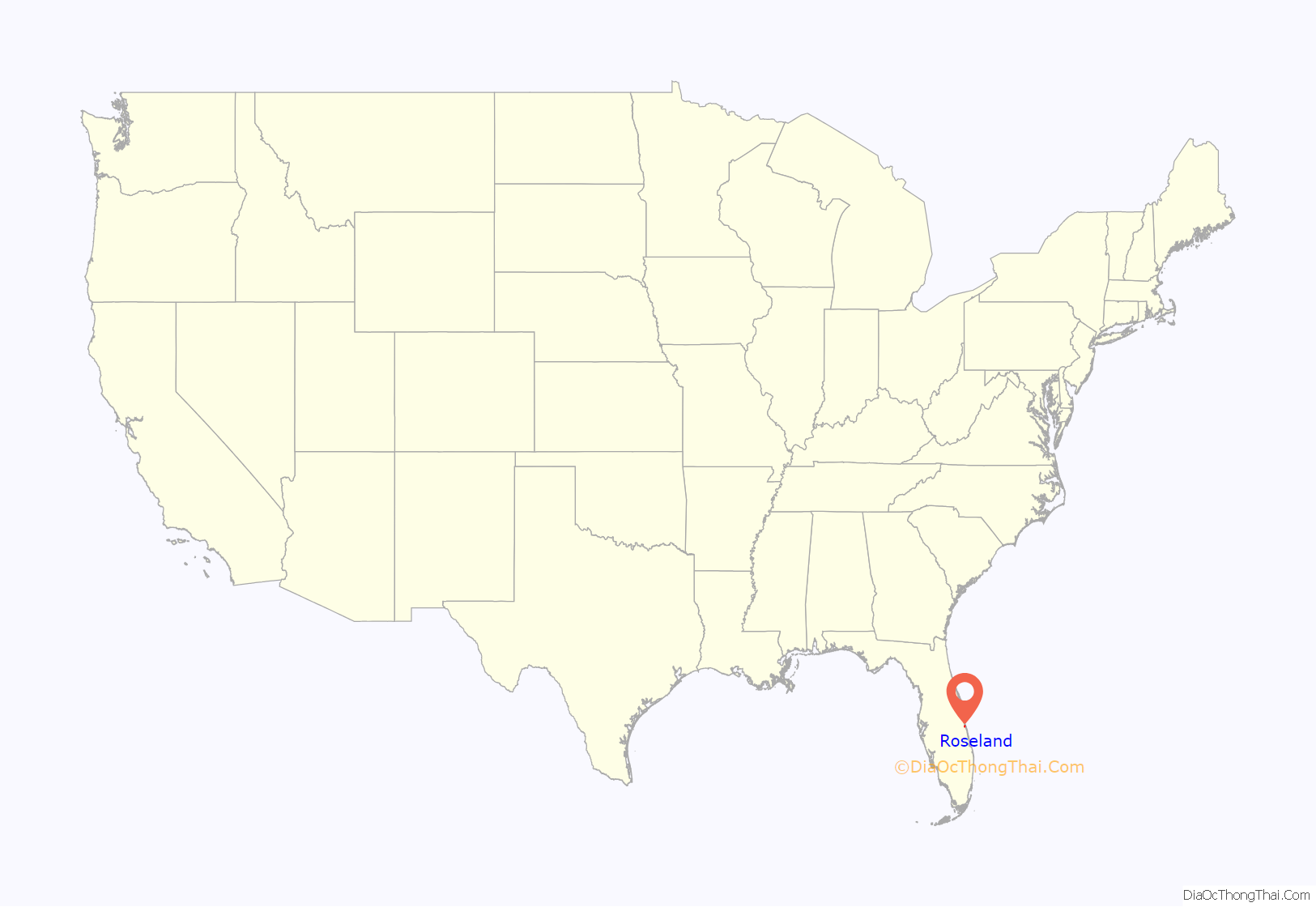
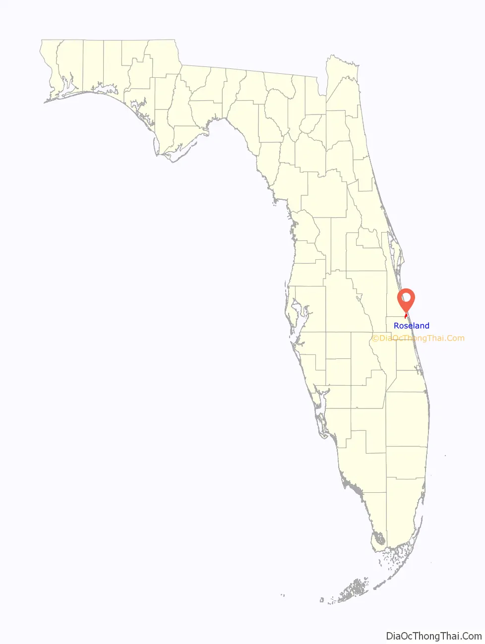
Roseland location map. Where is Roseland CDP?
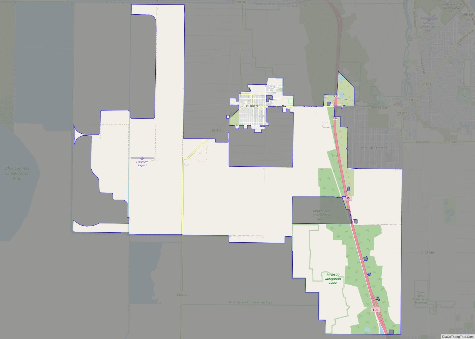
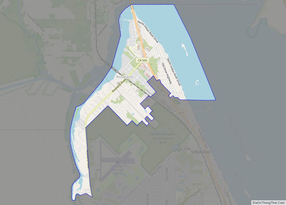
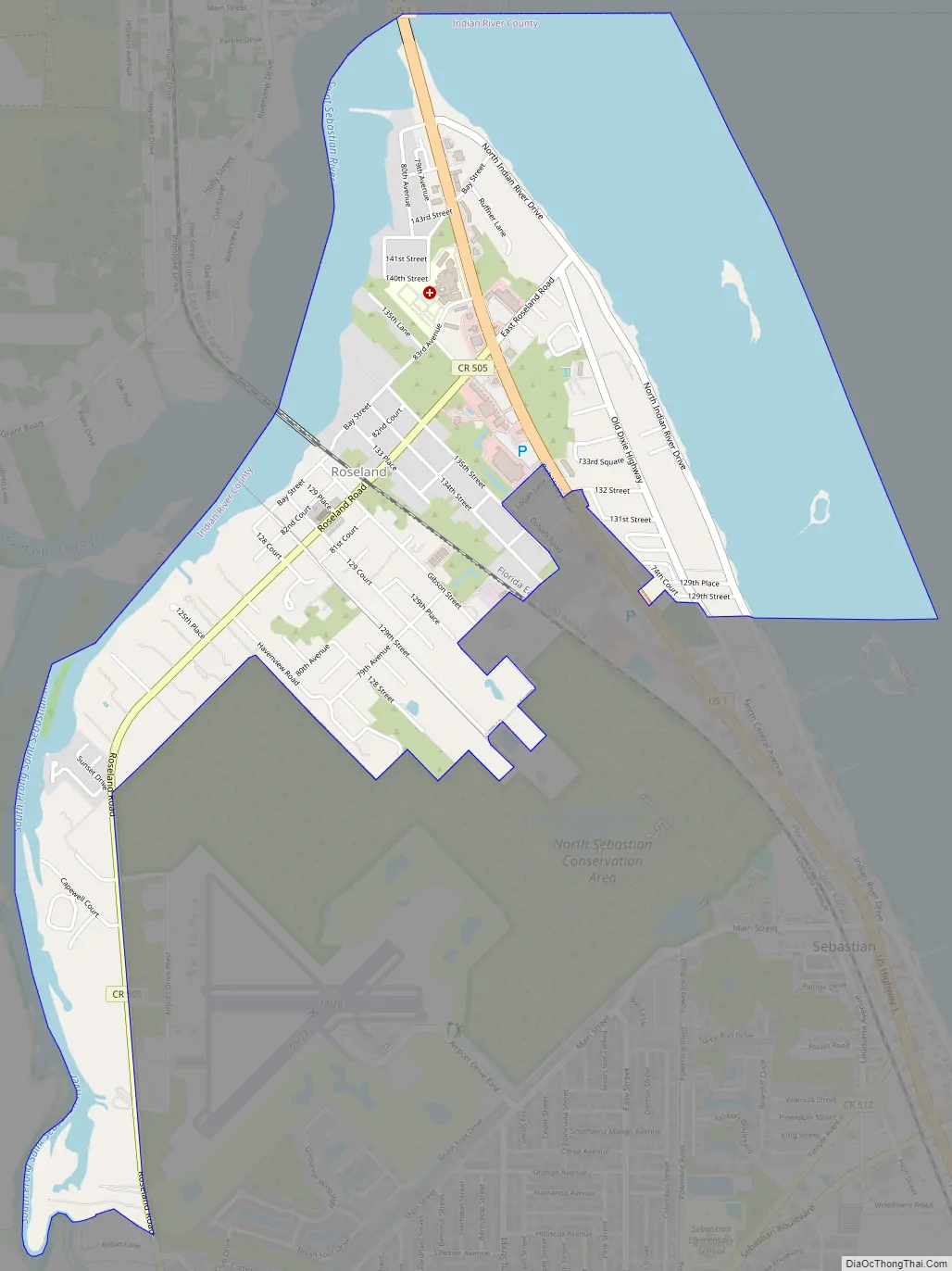
Roseland Road Map
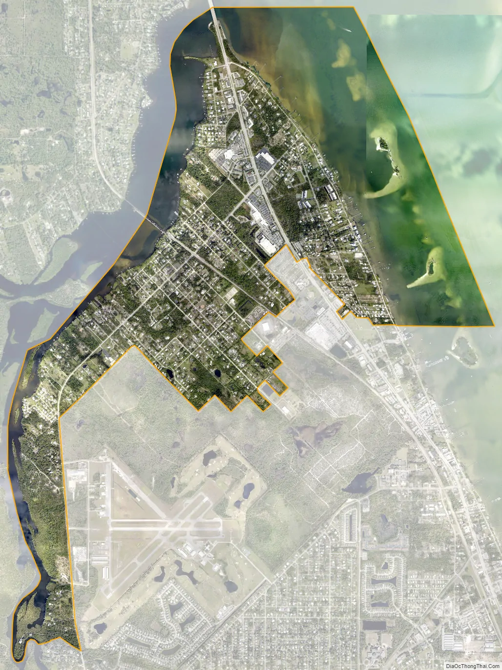
Roseland city Satellite Map
Geography
Roseland is located in northern Indian River County at 27°50′5″N 80°29′21″W / 27.83472°N 80.48917°W / 27.83472; -80.48917 (27.834594, -80.489264). It is bordered to the north by the St. Sebastian River, which forms the Brevard County line. The city of Sebastian is to the south, and unincorporated Micco is to the north, in Brevard County. To the east is the Indian River and Pelican Island National Wildlife Refuge.
U.S. Route 1 passes through the east side of Roseland, leading north 19 miles (31 km) to Melbourne and south 15 miles (24 km) to Vero Beach.
According to the United States Census Bureau, the Roseland CDP has a total area of 3.1 square miles (8.0 km), of which 1.9 square miles (4.9 km) are land and 1.2 square miles (3.1 km), or 38.38%, are water.
See also
Map of Florida State and its subdivision:- Alachua
- Baker
- Bay
- Bradford
- Brevard
- Broward
- Calhoun
- Charlotte
- Citrus
- Clay
- Collier
- Columbia
- Desoto
- Dixie
- Duval
- Escambia
- Flagler
- Franklin
- Gadsden
- Gilchrist
- Glades
- Gulf
- Hamilton
- Hardee
- Hendry
- Hernando
- Highlands
- Hillsborough
- Holmes
- Indian River
- Jackson
- Jefferson
- Lafayette
- Lake
- Lee
- Leon
- Levy
- Liberty
- Madison
- Manatee
- Marion
- Martin
- Miami-Dade
- Monroe
- Nassau
- Okaloosa
- Okeechobee
- Orange
- Osceola
- Palm Beach
- Pasco
- Pinellas
- Polk
- Putnam
- Saint Johns
- Saint Lucie
- Santa Rosa
- Sarasota
- Seminole
- Sumter
- Suwannee
- Taylor
- Union
- Volusia
- Wakulla
- Walton
- Washington
- Alabama
- Alaska
- Arizona
- Arkansas
- California
- Colorado
- Connecticut
- Delaware
- District of Columbia
- Florida
- Georgia
- Hawaii
- Idaho
- Illinois
- Indiana
- Iowa
- Kansas
- Kentucky
- Louisiana
- Maine
- Maryland
- Massachusetts
- Michigan
- Minnesota
- Mississippi
- Missouri
- Montana
- Nebraska
- Nevada
- New Hampshire
- New Jersey
- New Mexico
- New York
- North Carolina
- North Dakota
- Ohio
- Oklahoma
- Oregon
- Pennsylvania
- Rhode Island
- South Carolina
- South Dakota
- Tennessee
- Texas
- Utah
- Vermont
- Virginia
- Washington
- West Virginia
- Wisconsin
- Wyoming