Spring Lake is an unincorporated community and census-designated place (CDP) in Hernando County, Florida, United States. The population was 458 at the 2010 census, up from 327 at the 2000 census.
| Name: | Spring Lake CDP |
|---|---|
| LSAD Code: | 57 |
| LSAD Description: | CDP (suffix) |
| State: | Florida |
| County: | Hernando County |
| Elevation: | 310 ft (90 m) |
| Total Area: | 3.45 sq mi (8.92 km²) |
| Land Area: | 3.33 sq mi (8.62 km²) |
| Water Area: | 0.12 sq mi (0.30 km²) |
| Total Population: | 465 |
| Population Density: | 139.64/sq mi (53.92/km²) |
| FIPS code: | 1268375 |
| GNISfeature ID: | 0291557 |
Online Interactive Map
Click on ![]() to view map in "full screen" mode.
to view map in "full screen" mode.
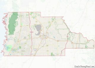
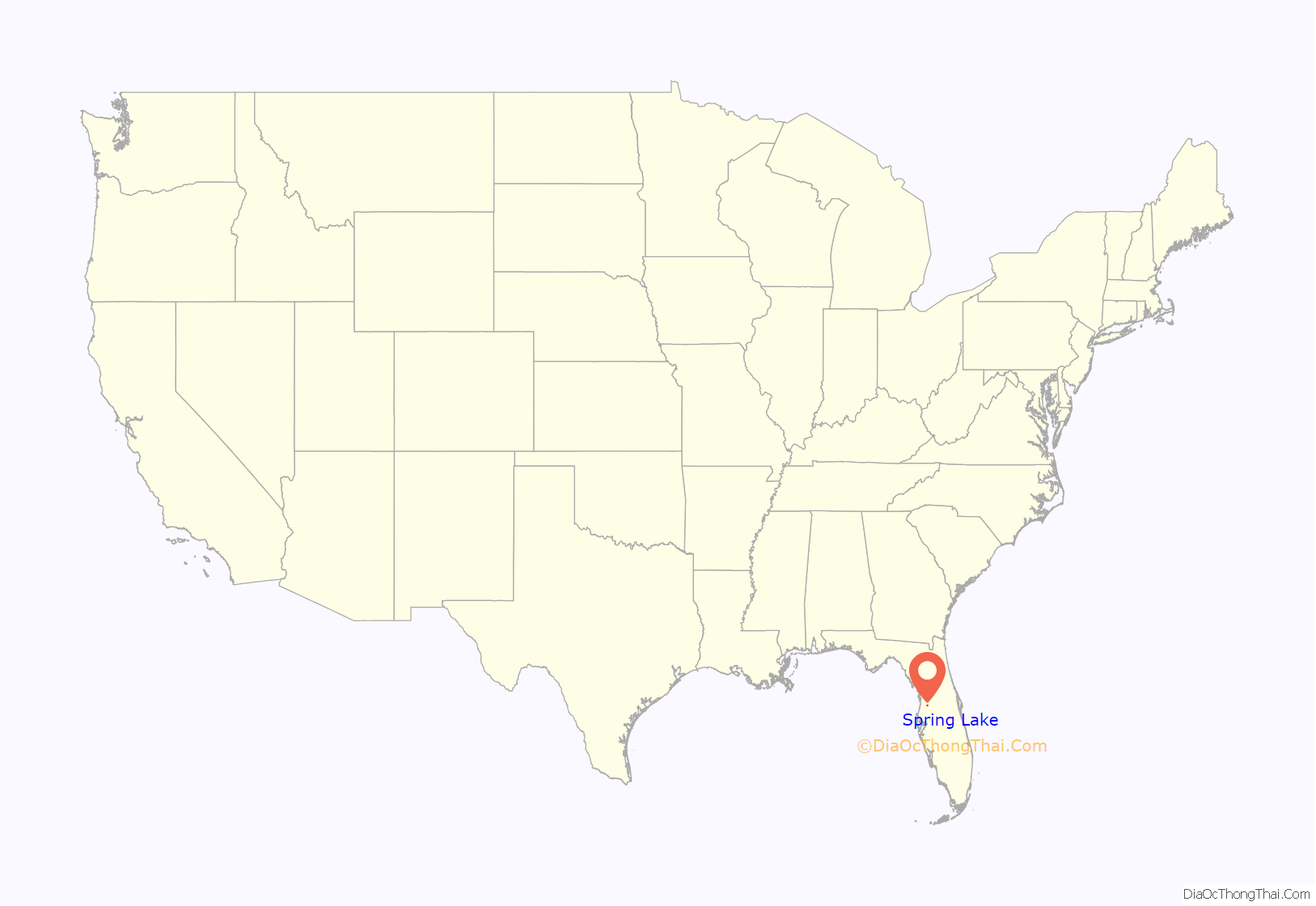
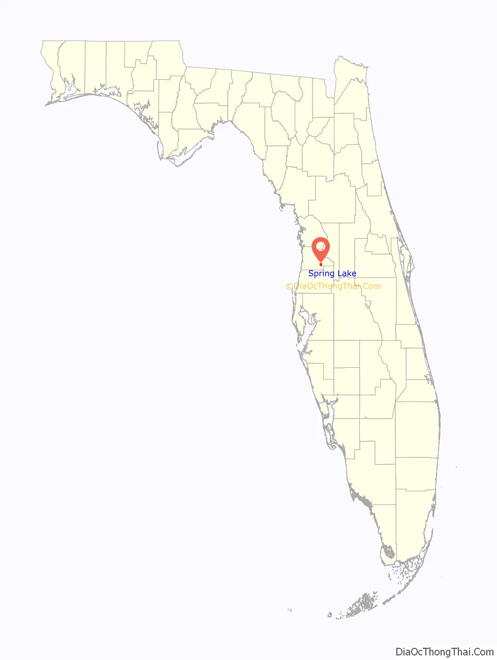
Spring Lake location map. Where is Spring Lake CDP?
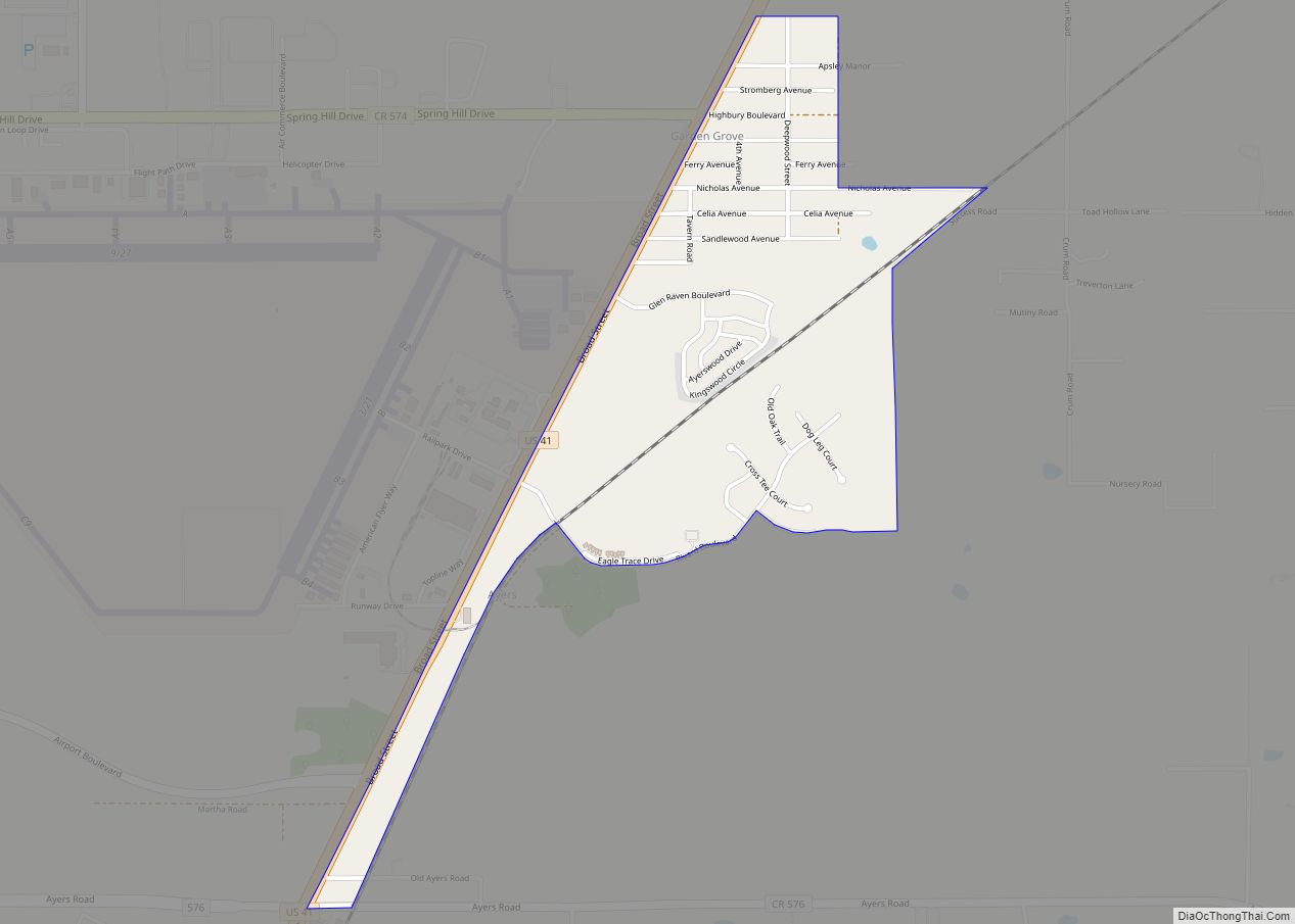
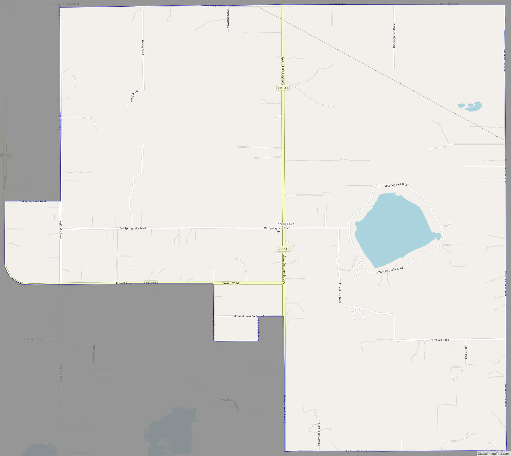
Spring Lake Road Map
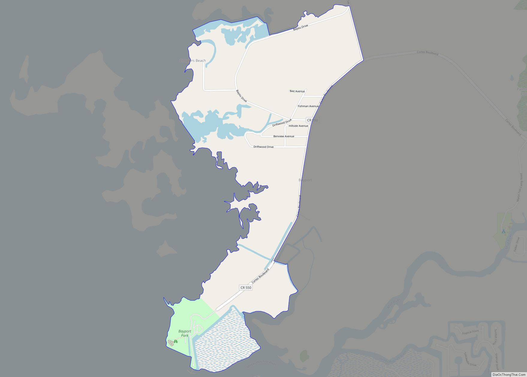
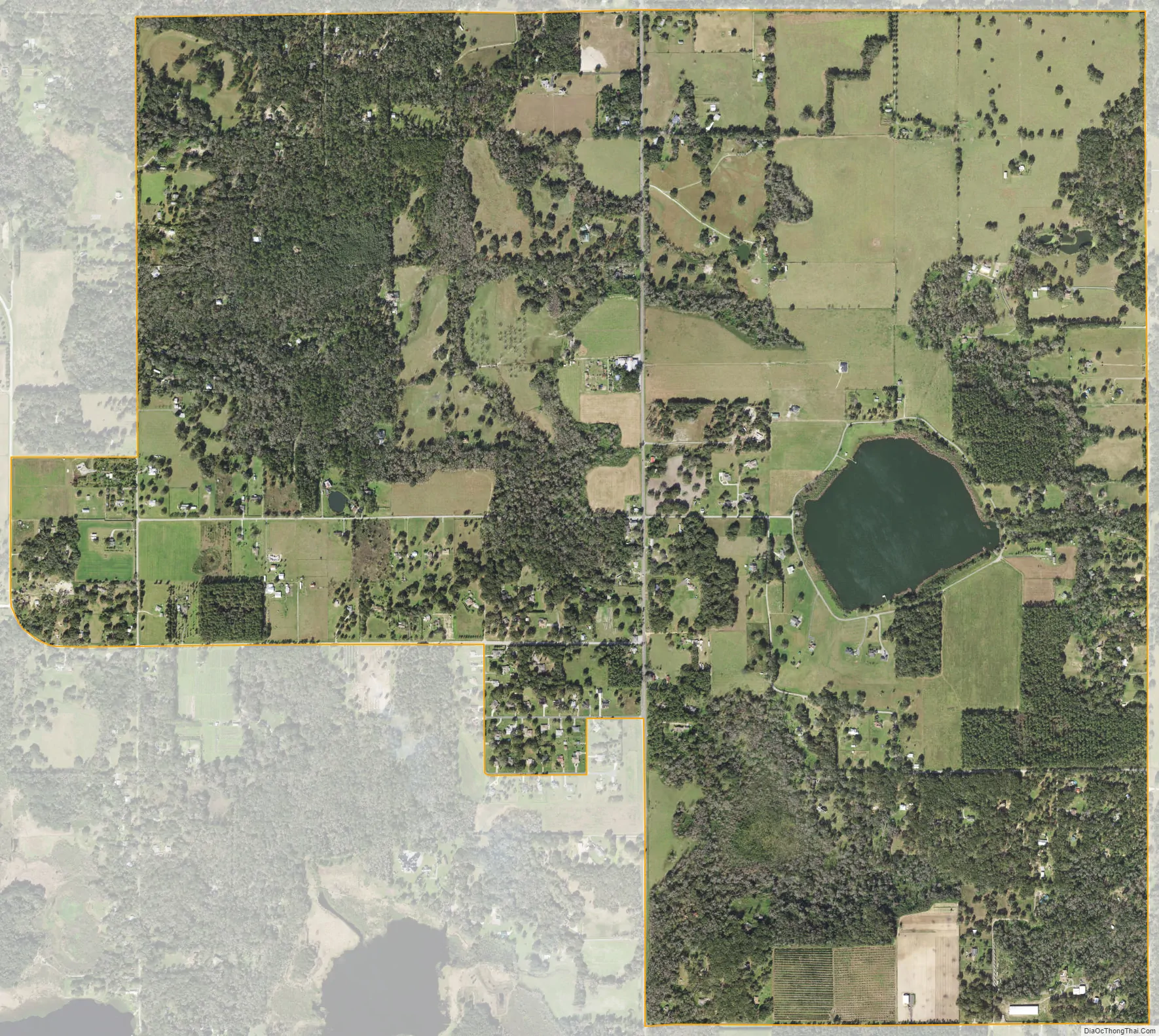
Spring Lake city Satellite Map
Geography
Spring Lake is located in eastern Hernando County at 28°29′19″N 82°18′30″W / 28.48861°N 82.30833°W / 28.48861; -82.30833 (28.488630, -82.308437). It is bordered to the north by Hill ‘n Dale. It is 8 miles (13 km) southeast of Brooksville, the county seat.
Spring Lake contains rolling hills ranging in elevation from 120ft to 280ft.
According to the United States Census Bureau, the CDP has a total area of 3.4 square miles (8.9 km), of which 3.3 square miles (8.6 km) are land and 0.1 square miles (0.3 km), or 3.35%, are water.
See also
Map of Florida State and its subdivision:- Alachua
- Baker
- Bay
- Bradford
- Brevard
- Broward
- Calhoun
- Charlotte
- Citrus
- Clay
- Collier
- Columbia
- Desoto
- Dixie
- Duval
- Escambia
- Flagler
- Franklin
- Gadsden
- Gilchrist
- Glades
- Gulf
- Hamilton
- Hardee
- Hendry
- Hernando
- Highlands
- Hillsborough
- Holmes
- Indian River
- Jackson
- Jefferson
- Lafayette
- Lake
- Lee
- Leon
- Levy
- Liberty
- Madison
- Manatee
- Marion
- Martin
- Miami-Dade
- Monroe
- Nassau
- Okaloosa
- Okeechobee
- Orange
- Osceola
- Palm Beach
- Pasco
- Pinellas
- Polk
- Putnam
- Saint Johns
- Saint Lucie
- Santa Rosa
- Sarasota
- Seminole
- Sumter
- Suwannee
- Taylor
- Union
- Volusia
- Wakulla
- Walton
- Washington
- Alabama
- Alaska
- Arizona
- Arkansas
- California
- Colorado
- Connecticut
- Delaware
- District of Columbia
- Florida
- Georgia
- Hawaii
- Idaho
- Illinois
- Indiana
- Iowa
- Kansas
- Kentucky
- Louisiana
- Maine
- Maryland
- Massachusetts
- Michigan
- Minnesota
- Mississippi
- Missouri
- Montana
- Nebraska
- Nevada
- New Hampshire
- New Jersey
- New Mexico
- New York
- North Carolina
- North Dakota
- Ohio
- Oklahoma
- Oregon
- Pennsylvania
- Rhode Island
- South Carolina
- South Dakota
- Tennessee
- Texas
- Utah
- Vermont
- Virginia
- Washington
- West Virginia
- Wisconsin
- Wyoming