St. Marks is a city in Wakulla County, Florida, United States. It is part of the Tallahassee metropolitan area. The population was 293 at the 2010 census. As of 2018, the population estimated by the U.S. Census Bureau is 319.
| Name: | St. Marks city |
|---|---|
| LSAD Code: | 25 |
| LSAD Description: | city (suffix) |
| State: | Florida |
| County: | Wakulla County |
| Elevation: | 10 ft (3 m) |
| Total Area: | 1.97 sq mi (5.09 km²) |
| Land Area: | 1.96 sq mi (5.07 km²) |
| Water Area: | 0.01 sq mi (0.02 km²) |
| Total Population: | 274 |
| Population Density: | 139.87/sq mi (54.01/km²) |
| FIPS code: | 1262825 |
| GNISfeature ID: | 0290282 |
| Website: | www.cityofstmarks.com |
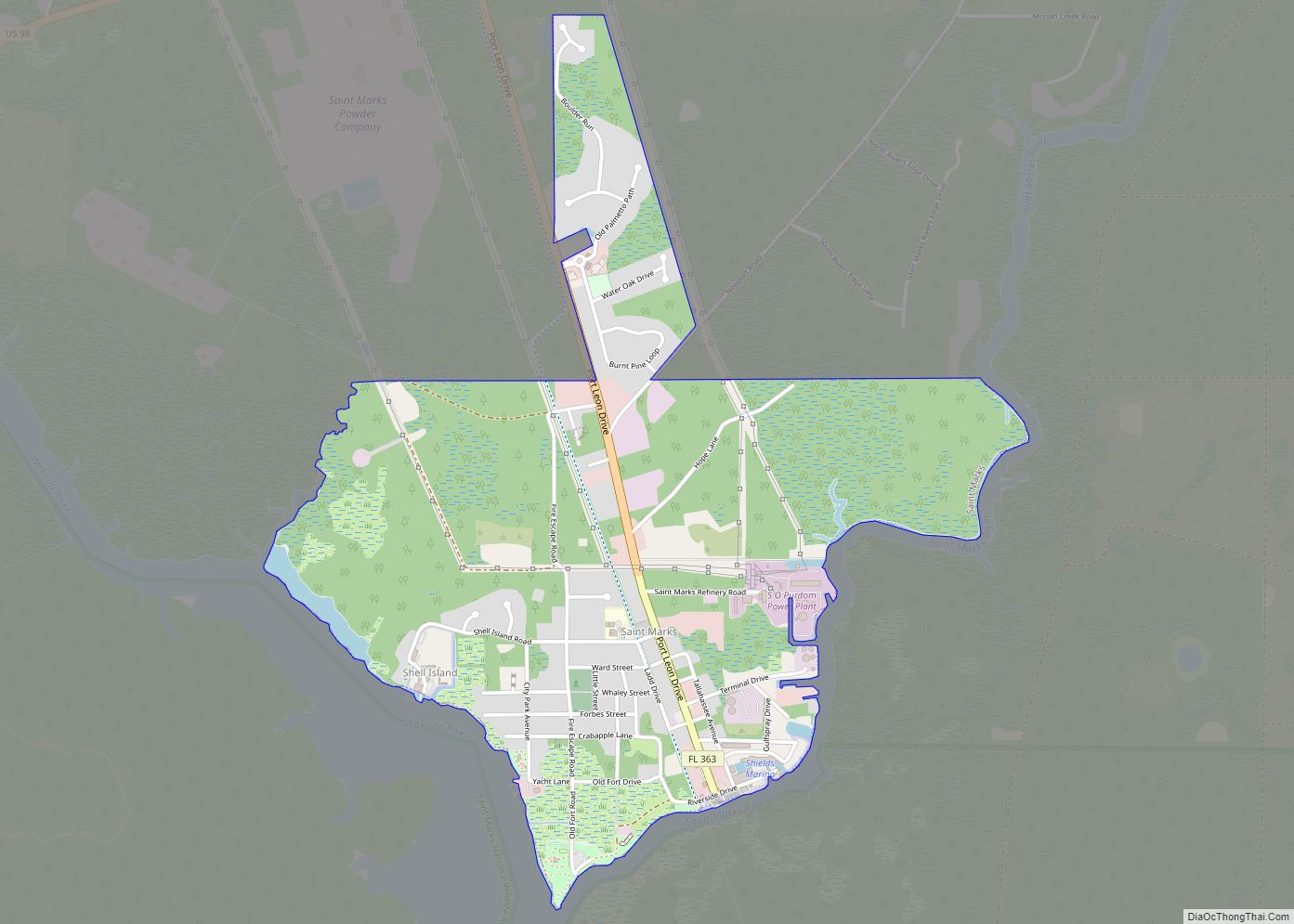
Online Interactive Map
Click on ![]() to view map in "full screen" mode.
to view map in "full screen" mode.
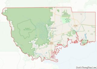
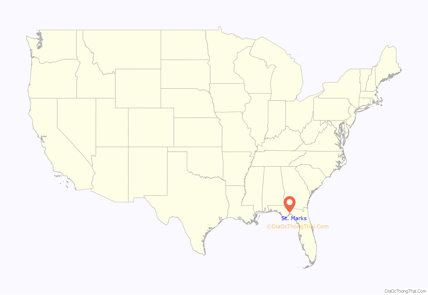
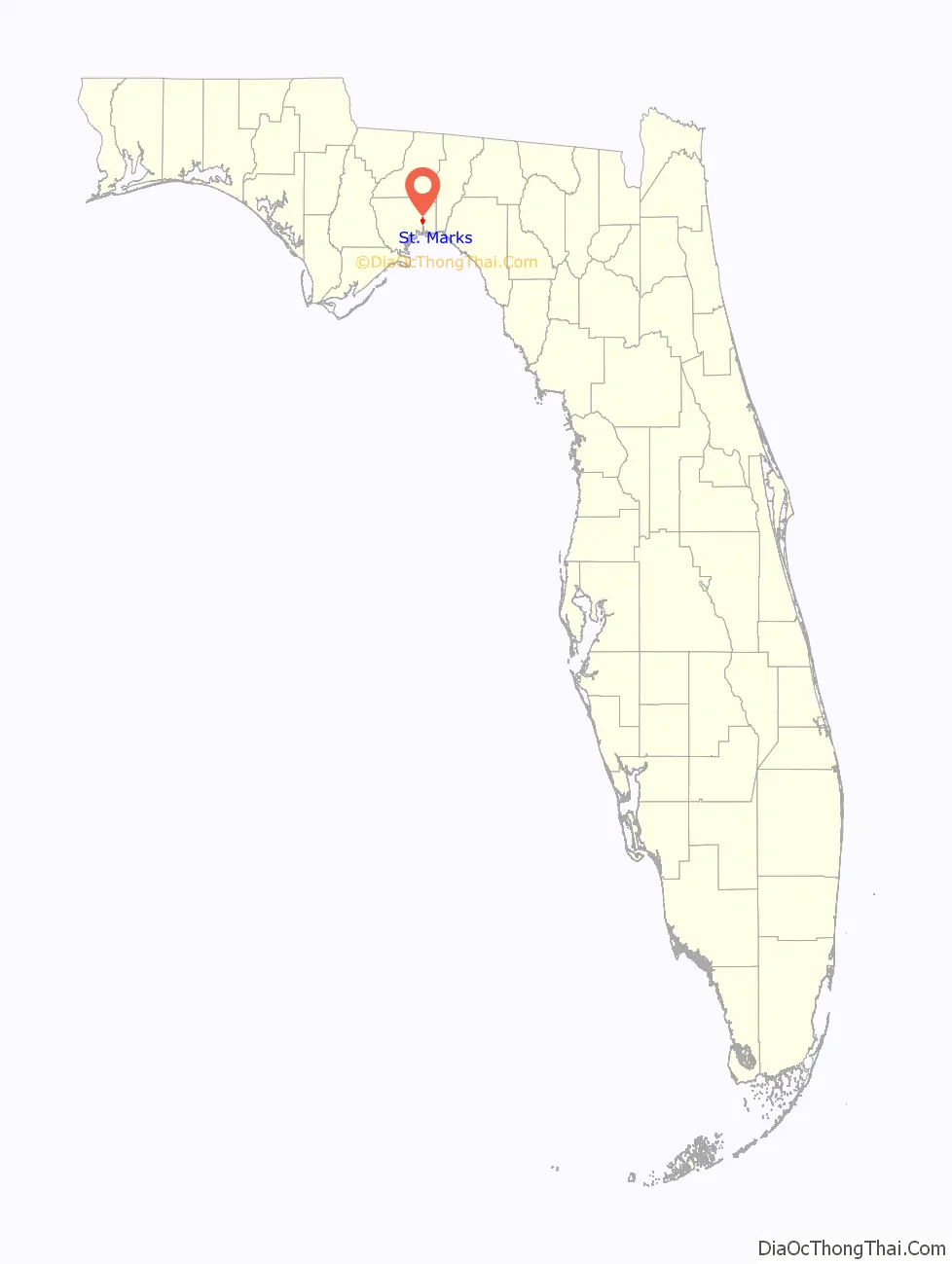
St. Marks location map. Where is St. Marks city?
History
Originally known as San Marcos de Apalache and centered on a Spanish fort, this town was founded by the Spanish in the 17th century in what was then Spanish Florida. There was a trading post of Panton, Leslie & Company in the late 18th century. A long time has passed since St. Marks last had appreciable importance, but this place on Apalachee Bay in Florida’s Big Bend is a very old and historic Gulf port. Fortifications built here by the Spanish in the 17th century, and rebuilt several times, provided the venue for force of arms repeatedly up through the American Civil War.
In the best-known incident, Andrew Jackson, in his incursion into Spanish Florida in 1818, executed British nationals Robert Chrystie Ambrister and Alexander George Arbuthnot at the old fort, as well as the Muscogee (“Creek”) religious leader called Francis the Prophet. This nearly embroiled the United States in international strife. San Marcos de Apalache Historic State Park interprets the site of the old fort.
Today’s St. Marks evidently has its roots in American commercial activity that took hold beneath the walls of the fort upon acquisition of Spanish Florida by the U.S. in 1821—before the settlement moved slightly up the St. Marks River to the present position. Various articles in publications like Florida Historical Quarterly relate how the fort site later held a government “naval” hospital to meet yellow fever emergencies in the merchant marine. And just afterward Confederate batteries were established on the site in the Civil War. Their earthworks remain and are interpreted in the historic state park. But the site also exhibits old Spanish stonework, and not far away (though inaccessible), just down St. Marks River are shallow Spanish quarries where this limestone was evidently obtained in the 1730s.
Limestone quarried here by the Spanish helped to make the St. Marks Light lighthouse, constructed about 1830 by the U.S. government. The lighthouse stands, after a couple of reconstructions, at the mouth of the river six miles from town and accessible by road. The lighthouse is, like San Marcos de Apalache, on the National Register of Historic Places.
A railroad often cited as Florida’s first connected the port of St. Marks with the territorial capital, Tallahassee, some 20 miles inland. The line, the Tallahassee Railroad, was constructed about 1836, and until the Civil War it served in the export of Middle Florida’s cotton through St. Marks.
The capacity of the St. Marks port was limited, and it was surpassed in the 19th century by the larger port of Apalachicola, served by the Thomasville, Tallahassee and Gulf Railroad via Carrabelle, Florida.
The now-abandoned rail line serves as Tallahassee-St. Marks Historic Railroad State Trail, a paved 16 miles (26 km) bicycle and equestrian trail terminating at the St. Marks waterfront.
This section of the coast was damaged by the big storm surge of Hurricane Dennis in 2005. As on other occasions in its history, St. Marks was flooded badly with saltwater.
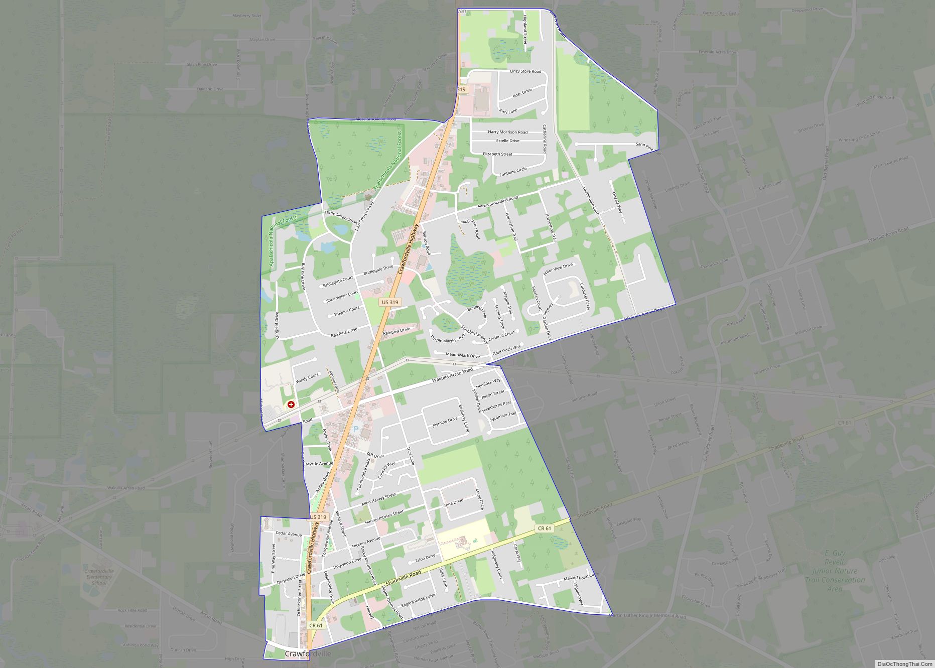
St. Marks Road Map
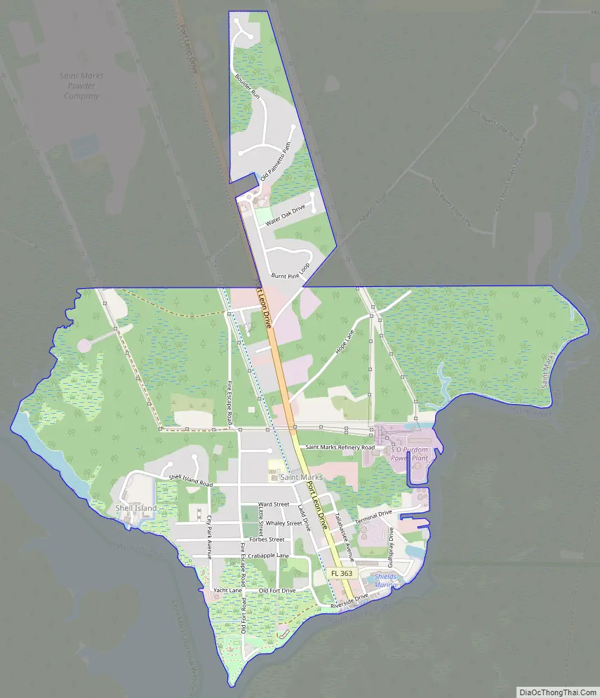
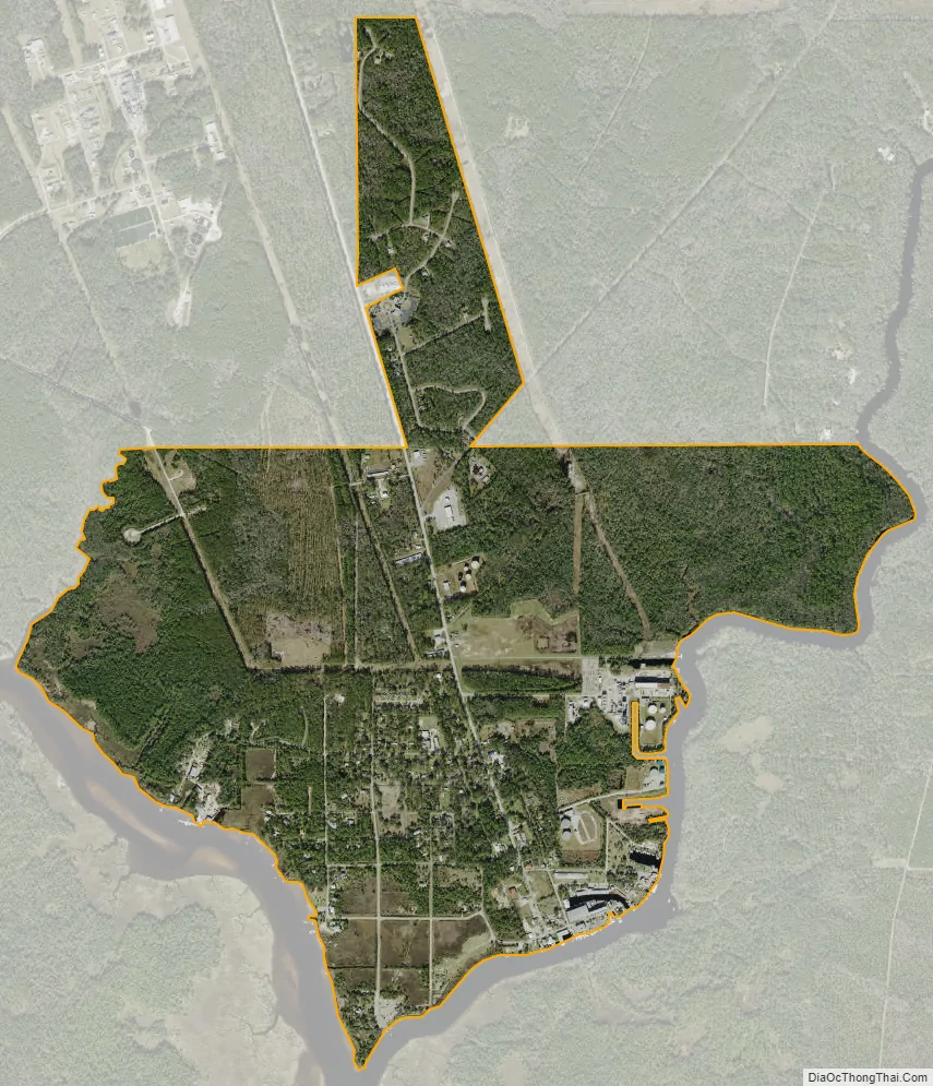
St. Marks city Satellite Map
Geography
St. Marks is located at 30°09′33″N 84°12′26″W / 30.159244°N 84.207152°W / 30.159244; -84.207152.
According to the United States Census Bureau, the city has a total area of 1.9 square miles (4.9 km), of which 1.9 square miles (4.9 km) is land and 0.52% is water.
See also
Map of Florida State and its subdivision:- Alachua
- Baker
- Bay
- Bradford
- Brevard
- Broward
- Calhoun
- Charlotte
- Citrus
- Clay
- Collier
- Columbia
- Desoto
- Dixie
- Duval
- Escambia
- Flagler
- Franklin
- Gadsden
- Gilchrist
- Glades
- Gulf
- Hamilton
- Hardee
- Hendry
- Hernando
- Highlands
- Hillsborough
- Holmes
- Indian River
- Jackson
- Jefferson
- Lafayette
- Lake
- Lee
- Leon
- Levy
- Liberty
- Madison
- Manatee
- Marion
- Martin
- Miami-Dade
- Monroe
- Nassau
- Okaloosa
- Okeechobee
- Orange
- Osceola
- Palm Beach
- Pasco
- Pinellas
- Polk
- Putnam
- Saint Johns
- Saint Lucie
- Santa Rosa
- Sarasota
- Seminole
- Sumter
- Suwannee
- Taylor
- Union
- Volusia
- Wakulla
- Walton
- Washington
- Alabama
- Alaska
- Arizona
- Arkansas
- California
- Colorado
- Connecticut
- Delaware
- District of Columbia
- Florida
- Georgia
- Hawaii
- Idaho
- Illinois
- Indiana
- Iowa
- Kansas
- Kentucky
- Louisiana
- Maine
- Maryland
- Massachusetts
- Michigan
- Minnesota
- Mississippi
- Missouri
- Montana
- Nebraska
- Nevada
- New Hampshire
- New Jersey
- New Mexico
- New York
- North Carolina
- North Dakota
- Ohio
- Oklahoma
- Oregon
- Pennsylvania
- Rhode Island
- South Carolina
- South Dakota
- Tennessee
- Texas
- Utah
- Vermont
- Virginia
- Washington
- West Virginia
- Wisconsin
- Wyoming