Valrico is a census-designated place (CDP) in Hillsborough County, Florida, United States. The population was 35,545 at the 2010 census, up from 6,582 at the 2000 census.
| Name: | Valrico CDP |
|---|---|
| LSAD Code: | 57 |
| LSAD Description: | CDP (suffix) |
| State: | Florida |
| County: | Hillsborough County |
| Elevation: | 56 ft (17 m) |
| Total Area: | 14.22 sq mi (36.84 km²) |
| Land Area: | 13.81 sq mi (35.77 km²) |
| Water Area: | 0.41 sq mi (1.08 km²) |
| Total Population: | 37,895 |
| Population Density: | 2,744.22/sq mi (1,059.55/km²) |
| ZIP code: | 33594-33596 |
| Area code: | 813 |
| FIPS code: | 1273700 |
| GNISfeature ID: | 0292725 |
Online Interactive Map
Click on ![]() to view map in "full screen" mode.
to view map in "full screen" mode.
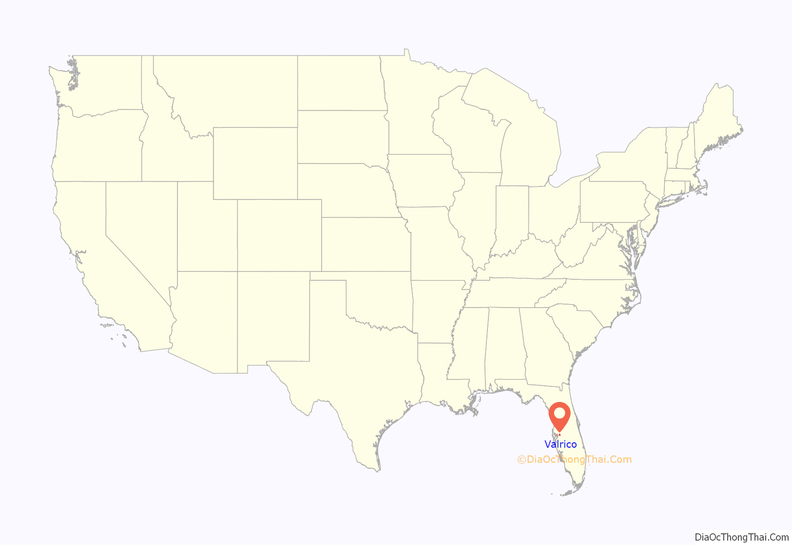
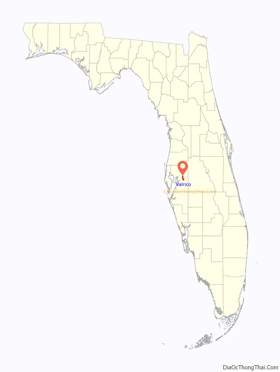
Valrico location map. Where is Valrico CDP?
History
Before the Civil War, the area was known as Long Pond and consisted of several cotton plantations. It was renamed Valrico, meaning “rich valley” in Spanish, in the 1880s when William G. Tousey, a philosophy professor from Tufts College, purchased property in the area. In 1890, an influx of immigrants arrived, following the construction of the Florida Central and Peninsular Railroad through the area.
When the railroad was completed, Tousey began building up the community with retail stores, streets, and a bank. In 1893, Mr. Bryan built a steam mill at Valrico station. In 1895, a major freeze halted these developments, and the population began to dwindle. Nonetheless, the town continued, and a schoolhouse was completed in 1896. The population continued to fall, from 100 people in 1893 to only 50 in 1911.
This setback did not deter local landowners from pushing forward with the town’s development. From 1910 to 1914 Judge Hamner, Governor Van Sant, D. Humbird, W.H., S.C. Phipps and W.F. Miller started an improvement project along Hopewell Road, later designated SR 60. W.F. Miller, serving as president of the Valrico Improvement Association, raised $3,500 to erect the Valrico Civic Center, now known as the James McCabe Theater. The area’s first general store was opened by Lovett Brandon in 1912.
Valrico once again suffered a major blow during the stock market crash of 1929, which saw nearly every business in the town shut down. Not until the mid-1950s did the town begin to see growth again, primarily due to the connection of SR 60 to Tampa’s Adamo Drive, placing Valrico right along a major Florida thoroughfare. Along Mulrennan Road, south of State Road 60, are some of Valrico’s first larger subdivisions, that were built between the late 1960s to early 1980s. Until the early 1980s, Valrico was largely rural. After the completion of Bloomingdale West in 1983, the next phase Bloomingdale East was built on the Valrico side of Bell Shoals. Even in to the present day, there are still many remnants of Valrico’s rural past, as on many of the back roads, there are older homes built on large plots of land. Though most of the area is now largely a suburban bedroom community of subdivisions.
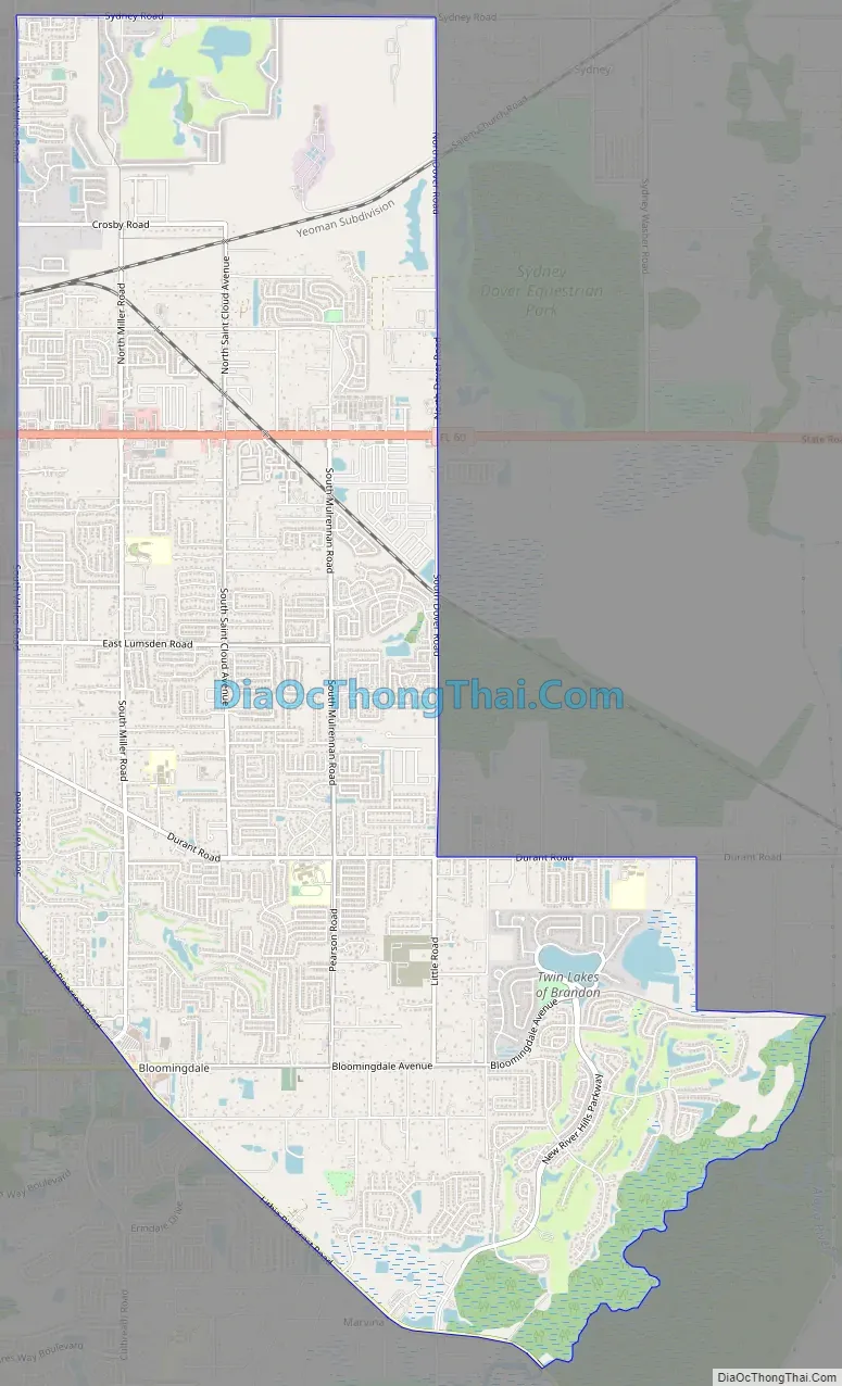
Valrico Road Map
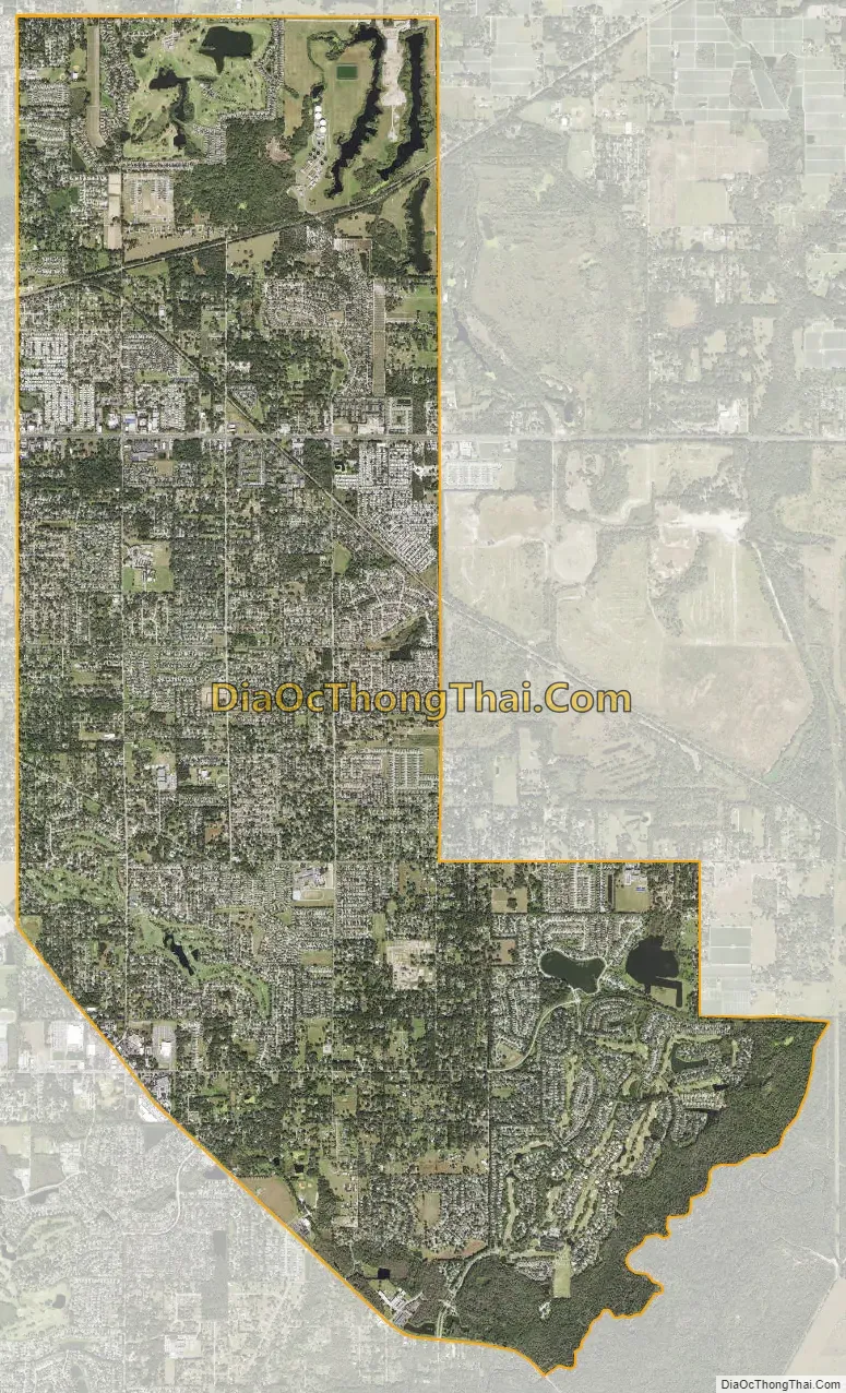
Valrico city Satellite Map
Geography
Valrico is located in east-central Hillsborough County at 27°56′27″N 82°14′33″W / 27.94083°N 82.24250°W / 27.94083; -82.24250 (27.940774, -82.242551). It is bordered to the west by Brandon, to the southwest by Bloomingdale, and to the south by FishHawk. Via State Road 60, it is 14 miles (23 km) east of Tampa and 26 miles (42 km) west of Bartow. It is 10 miles (16 km) southwest of Plant City.
According to the United States Census Bureau, the Valrico CDP has a total area of 14.2 square miles (36.8 km), of which 13.8 square miles (35.8 km) are land and 0.42 square miles (1.1 km), or 2.92%, are water.
See also
Map of Florida State and its subdivision:- Alachua
- Baker
- Bay
- Bradford
- Brevard
- Broward
- Calhoun
- Charlotte
- Citrus
- Clay
- Collier
- Columbia
- Desoto
- Dixie
- Duval
- Escambia
- Flagler
- Franklin
- Gadsden
- Gilchrist
- Glades
- Gulf
- Hamilton
- Hardee
- Hendry
- Hernando
- Highlands
- Hillsborough
- Holmes
- Indian River
- Jackson
- Jefferson
- Lafayette
- Lake
- Lee
- Leon
- Levy
- Liberty
- Madison
- Manatee
- Marion
- Martin
- Miami-Dade
- Monroe
- Nassau
- Okaloosa
- Okeechobee
- Orange
- Osceola
- Palm Beach
- Pasco
- Pinellas
- Polk
- Putnam
- Saint Johns
- Saint Lucie
- Santa Rosa
- Sarasota
- Seminole
- Sumter
- Suwannee
- Taylor
- Union
- Volusia
- Wakulla
- Walton
- Washington
- Alabama
- Alaska
- Arizona
- Arkansas
- California
- Colorado
- Connecticut
- Delaware
- District of Columbia
- Florida
- Georgia
- Hawaii
- Idaho
- Illinois
- Indiana
- Iowa
- Kansas
- Kentucky
- Louisiana
- Maine
- Maryland
- Massachusetts
- Michigan
- Minnesota
- Mississippi
- Missouri
- Montana
- Nebraska
- Nevada
- New Hampshire
- New Jersey
- New Mexico
- New York
- North Carolina
- North Dakota
- Ohio
- Oklahoma
- Oregon
- Pennsylvania
- Rhode Island
- South Carolina
- South Dakota
- Tennessee
- Texas
- Utah
- Vermont
- Virginia
- Washington
- West Virginia
- Wisconsin
- Wyoming


