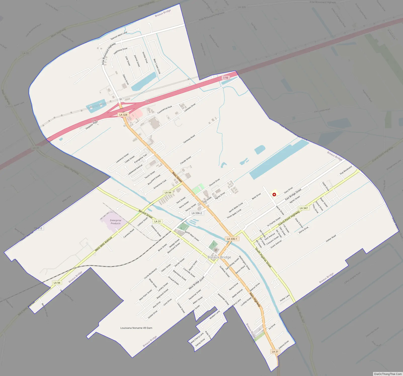
Breaux Bridge (/ˈbroʊˈbrɪdʒ/; French: Pont-Breaux; Cajun French: Pont-(de)-Breaux pronounced [pɔ̃ndbʁo]) is a small city in St. Martin Parish, Louisiana, United States. The population is 8,139 as of the 2010 census, up from 7,281 in 2000. It is part of the Lafayette Metropolitan Statistical Area.
Originally dubbed “La Capitale Mondiale de l’Écrevisse,” Breaux Bridge was officially designated the Crawfish Capital of the World by former Speaker of the Louisiana House of Representatives Bob Angelle. Breaux Bridge hosts an annual Crawfish Festival, and is regionally noted for listing nicknames in its telephone directory.
| Name: | Breaux Bridge city |
|---|---|
| LSAD Code: | 25 |
| LSAD Description: | city (suffix) |
| State: | Louisiana |
| County: | St. Martin Parish |
| Elevation: | 23 ft (7 m) |
| Total Area: | 7.90 sq mi (20.45 km²) |
| Land Area: | 7.72 sq mi (19.98 km²) |
| Water Area: | 0.18 sq mi (0.46 km²) |
| Total Population: | 7,513 |
| Population Density: | 973.69/sq mi (375.96/km²) |
| Area code: | 337 |
| FIPS code: | 2209340 |
| Website: | http://www.breauxbridgelive.com |
Online Interactive Map
Click on ![]() to view map in "full screen" mode.
to view map in "full screen" mode.
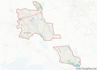
Breaux Bridge location map. Where is Breaux Bridge city?


History
On August 25, 1829, Scholastique Picou Breaux founded Breaux Bridge, Louisiana at the age of 33.
Scholastique was born Scholastique Melanie Picou on July 25, 1796. At a young age, she married Agricole Breaux; together, they had five children. In 1817, the couple replaced the Bayou Têche suspension footbridge built by Agricole’s father with a vehicular bridge that allowed wagon passage and made way for the area’s increasing commerce. At the age of 32, Scholastique became a widow.
A determined Acadian woman, Scholastique drew up Plan de la Ville du Pont des Breaux (“Plan for the City of Breaux Bridge”), which included a detailed map of the area and a diagram of streets. She developed the area by selling land lots to other Acadian settlers. In 1847, a church parish was created; and 12 years later, the area was officially incorporated. After founding the town, Scholastique remarried and birthed an additional two children.
Breaux’s Bridge
Agricole’s father was the Acadian pioneer Firmin Breaux. Breaux first arrived in the area during early 1765. By 1774, his branding iron was registered, and by 1786 he was one of the largest property owners in the Bayou Têche country. In 1799, Breaux built a footbridge across the Bayou Têche to help ease the passage across for his family and neighbors. This first bridge was a suspension footbridge, likely made of rope and small planks. It was stabilized by being tied to small pilings located at each end of the bridge as well as to a pair of huge live oak trees on both sides of the bayou. When traveling directions were given, residents would often instruct people to “go to Breaux’s bridge . . .” This was later adopted as the city’s name.
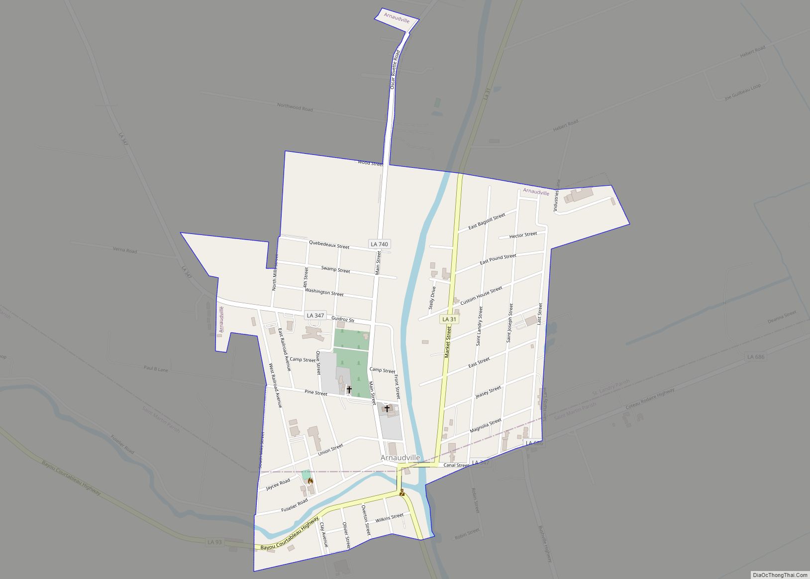
Breaux Bridge Road Map
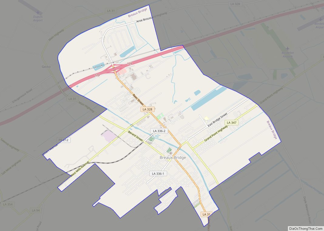
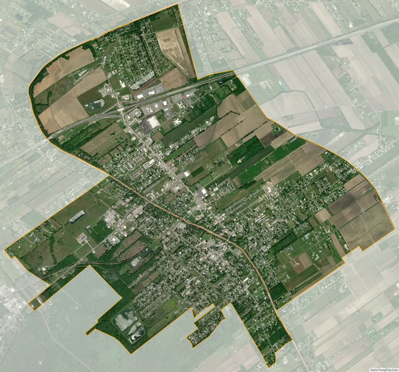
Breaux Bridge city Satellite Map
Geography
According to the United States Census Bureau, the city has a total area of 6.7 square miles (17 km), of which 6.6 square miles (17 km) is land and 0.1 square miles (0.26 km) is water.
See also
Map of Louisiana State and its subdivision:- Acadia
- Allen
- Ascension
- Assumption
- Avoyelles
- Beauregard
- Bienville
- Bossier
- Caddo
- Calcasieu
- Caldwell
- Cameron
- Catahoula
- Claiborne
- Concordia
- De Soto
- East Baton Rouge
- East Carroll
- East Feliciana
- Evangeline
- Franklin
- Grant
- Iberia
- Iberville
- Jackson
- Jefferson
- Jefferson Davis
- La Salle
- Lafayette
- Lafourche
- Lincoln
- Livingston
- Madison
- Morehouse
- Natchitoches
- Orleans
- Ouachita
- Plaquemines
- Pointe Coupee
- Rapides
- Red River
- Richland
- Sabine
- Saint Bernard
- Saint Charles
- Saint Helena
- Saint James
- Saint John the Baptist
- Saint Landry
- Saint Martin
- Saint Mary
- Saint Tammany
- Tangipahoa
- Tensas
- Terrebonne
- Union
- Vermilion
- Vernon
- Washington
- Webster
- West Baton Rouge
- West Carroll
- West Feliciana
- Winn
- Alabama
- Alaska
- Arizona
- Arkansas
- California
- Colorado
- Connecticut
- Delaware
- District of Columbia
- Florida
- Georgia
- Hawaii
- Idaho
- Illinois
- Indiana
- Iowa
- Kansas
- Kentucky
- Louisiana
- Maine
- Maryland
- Massachusetts
- Michigan
- Minnesota
- Mississippi
- Missouri
- Montana
- Nebraska
- Nevada
- New Hampshire
- New Jersey
- New Mexico
- New York
- North Carolina
- North Dakota
- Ohio
- Oklahoma
- Oregon
- Pennsylvania
- Rhode Island
- South Carolina
- South Dakota
- Tennessee
- Texas
- Utah
- Vermont
- Virginia
- Washington
- West Virginia
- Wisconsin
- Wyoming