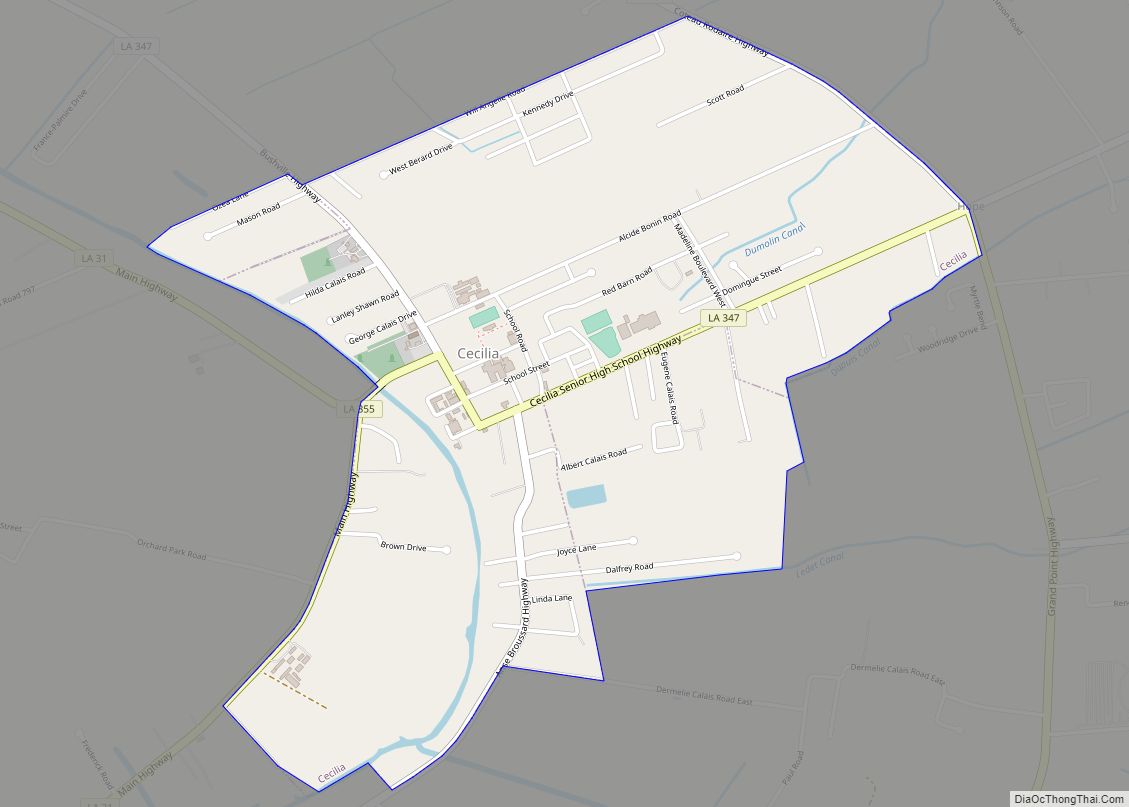
Cecilia is a census-designated place (CDP) in St. Martin Parish, in the U.S. state of Louisiana. The community lies within the region of Acadiana, and the Lafayette metropolitan statistical area. It had a population of 1,505 at the 2000 U.S. census, estimated to have grown to 1,917 in 2019 at the American Community Survey’s 5-year estimates.
| Name: | Cecilia CDP |
|---|---|
| LSAD Code: | 57 |
| LSAD Description: | CDP (suffix) |
| State: | Louisiana |
| County: | St. Martin Parish |
| Elevation: | 26 ft (8 m) |
| Total Area: | 2.14 sq mi (5.54 km²) |
| Land Area: | 2.12 sq mi (5.49 km²) |
| Water Area: | 0.02 sq mi (0.06 km²) |
| Total Population: | 1,807 |
| Population Density: | 853.16/sq mi (329.37/km²) |
| ZIP code: | 70521 |
| Area code: | 337 |
| FIPS code: | 2213575 |
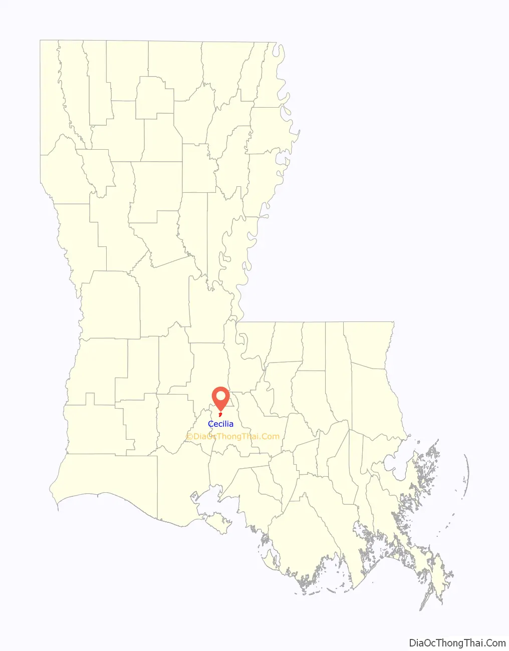
Online Interactive Map
Click on ![]() to view map in "full screen" mode.
to view map in "full screen" mode.
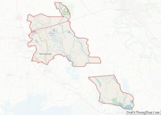
Cecilia location map. Where is Cecilia CDP?

History
Cecilia sits on land that was historically inhabited by the Atakapa Tribe. The Atakapa lived in what is now Southwest Louisiana and Texas, and had a trading post at St. Martinville, before French settlers took over the land.
Cecilia was originally known by the Spanish as La Punta. It was translated by the French into La Grande Pointe, a name that was used by many people until contemporary times when it was then called Cecilia, named after the first postal clerk.
Pierre Guidry, the first settler of Cecilia, acquired three tracts of land from Mrs. Joseph Alexander Declouet in 1791. Joseph Angelle settled nearby soon after.
Both men apparently settled on lands that had been given to Declouet by a Spanish land grant dated May 16, 1772, that included some 2,600 acres (11 km) of land.
During the American Civil War, the settlement was also known as La Place. This name was dropped when postal authorities began to confuse it with the LaPlace in St. John the Baptist Parish.
Cecilia is the birthplace of several Louisiana political figures: state Representative and House Speaker Robert Joseph “Bob” Angelle (1896–1979), former Secretary of State of Louisiana and Lieutenant Governor Paul J. Hardy (born 1942), and former state Representatives J. Burton Angelle and Jesse J. Guidry, who became secretary of the Louisiana Department of Wildlife and Fisheries; Angelle from 1972 to 1980 and 1984 to 1988 and Guidry from 1981 to 1984. Former National Football League player Ramsey Dardar was also born in Cecilia.
Cecilia is the burial site of Louis Hebert, a Confederate general. On April 19, 1964, dedication ceremonies were held in a grove of live oaks on the banks of Bayou Teche about three miles (5 km) from Cecilia on Highway 328 to mark Hebert’s grave. The marker reads as follows: “Approximately 100 yards (91 m) to the west is the probable resting place of General Louis Hebert, C. S. A. Born in Iberville Parish in 1820, Hebert graduated from West Point in 1845 third in his class. After an army service of two years, he resigned to manage his family’s sugar interests. Before the war he was a member of the State Senate and Chief Engineer of Louisiana. He fought at Wilson’s Creek, Elkhorn, Corinth, Vicksburg, and Port Fisher. He was an editor and teacher in Iberville and St. Martin parishes and lived until 1901.” General Hebert taught at Huron Plantation near Cecilia and tutored children of Vincent Barras in St. Martinville.
Cecilia became one of the last remaining strongholds of the Cajun French language in Louisiana and 42.60% of the total population used the language for daily communication, including 20.25% of the children according to a study in 2013.
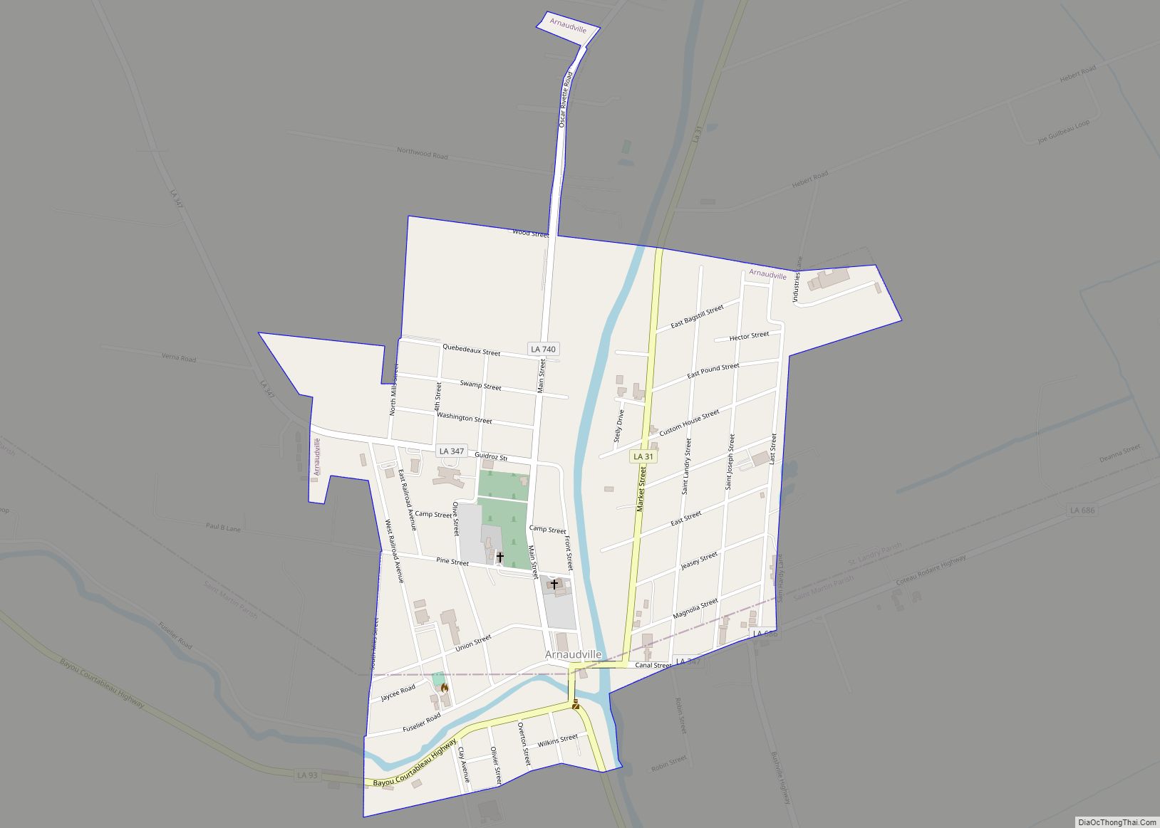
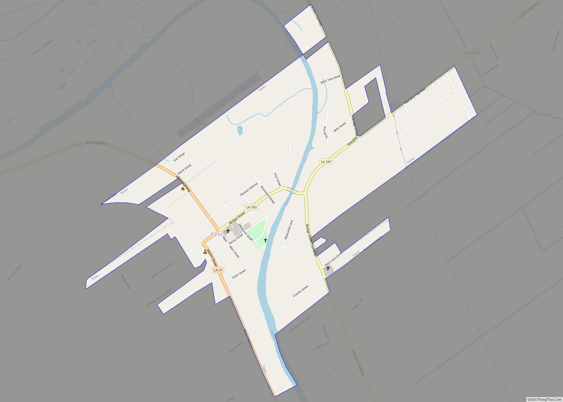
Cecilia Road Map
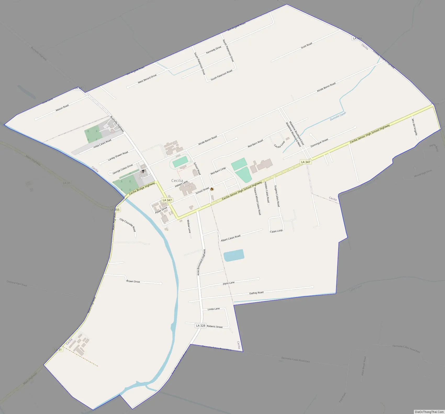
Cecilia city Satellite Map

Geography
Cecilia is located at 30°20′11″N 91°50′52″W / 30.33639°N 91.84778°W / 30.33639; -91.84778 (30.336379, -91.847867), in south central Louisiana; it lies within Acadiana, and the Lafayette metropolitan area. According to the United States Census Bureau, the CDP has a total area of 2.1 square miles (5.4 km), all land.
See also
Map of Louisiana State and its subdivision:- Acadia
- Allen
- Ascension
- Assumption
- Avoyelles
- Beauregard
- Bienville
- Bossier
- Caddo
- Calcasieu
- Caldwell
- Cameron
- Catahoula
- Claiborne
- Concordia
- De Soto
- East Baton Rouge
- East Carroll
- East Feliciana
- Evangeline
- Franklin
- Grant
- Iberia
- Iberville
- Jackson
- Jefferson
- Jefferson Davis
- La Salle
- Lafayette
- Lafourche
- Lincoln
- Livingston
- Madison
- Morehouse
- Natchitoches
- Orleans
- Ouachita
- Plaquemines
- Pointe Coupee
- Rapides
- Red River
- Richland
- Sabine
- Saint Bernard
- Saint Charles
- Saint Helena
- Saint James
- Saint John the Baptist
- Saint Landry
- Saint Martin
- Saint Mary
- Saint Tammany
- Tangipahoa
- Tensas
- Terrebonne
- Union
- Vermilion
- Vernon
- Washington
- Webster
- West Baton Rouge
- West Carroll
- West Feliciana
- Winn
- Alabama
- Alaska
- Arizona
- Arkansas
- California
- Colorado
- Connecticut
- Delaware
- District of Columbia
- Florida
- Georgia
- Hawaii
- Idaho
- Illinois
- Indiana
- Iowa
- Kansas
- Kentucky
- Louisiana
- Maine
- Maryland
- Massachusetts
- Michigan
- Minnesota
- Mississippi
- Missouri
- Montana
- Nebraska
- Nevada
- New Hampshire
- New Jersey
- New Mexico
- New York
- North Carolina
- North Dakota
- Ohio
- Oklahoma
- Oregon
- Pennsylvania
- Rhode Island
- South Carolina
- South Dakota
- Tennessee
- Texas
- Utah
- Vermont
- Virginia
- Washington
- West Virginia
- Wisconsin
- Wyoming