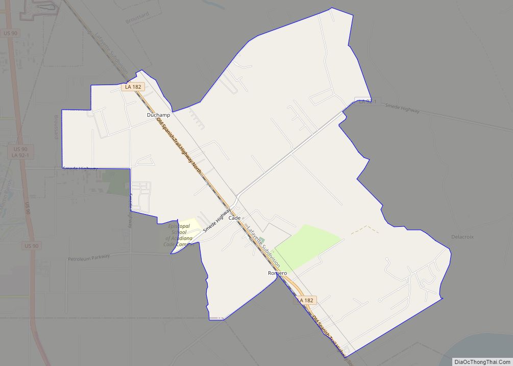
Cade is a census-designated place (CDP) in St. Martin Parish, Louisiana, United States. At the 2014 census estimates, Cade had a population of 1,188; in 2019, the American Community Survey estimated its population was 1,655. With the 2020 U.S. Census the population was 1874. The community is served by a single ZIP code: 70519.
The community was founded and named after Captain Cade, who was the long time sheriff of New Iberia. It is now home to the Episcopal School of Acadiana, Bruce Foods, Spanish Trail Golf Course, and The Pines Ranch (Louisiana’s first organic ranch). In contrast with many rural communities, Cade does not have a police station, or health center. The crime and unemployment rate are low in Cade compared to the U.S. average.
| Name: | Cade CDP |
|---|---|
| LSAD Code: | 57 |
| LSAD Description: | CDP (suffix) |
| State: | Louisiana |
| County: | St. Martin Parish |
| Total Area: | 6.72 sq mi (17.40 km²) |
| Land Area: | 6.72 sq mi (17.40 km²) |
| Water Area: | 0.00 sq mi (0.00 km²) |
| Total Population: | 1,874 |
| Population Density: | 278.99/sq mi (107.72/km²) |
| Area code: | 337 |
| FIPS code: | 2211580 |
Online Interactive Map
Click on ![]() to view map in "full screen" mode.
to view map in "full screen" mode.
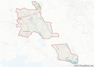
Cade location map. Where is Cade CDP?


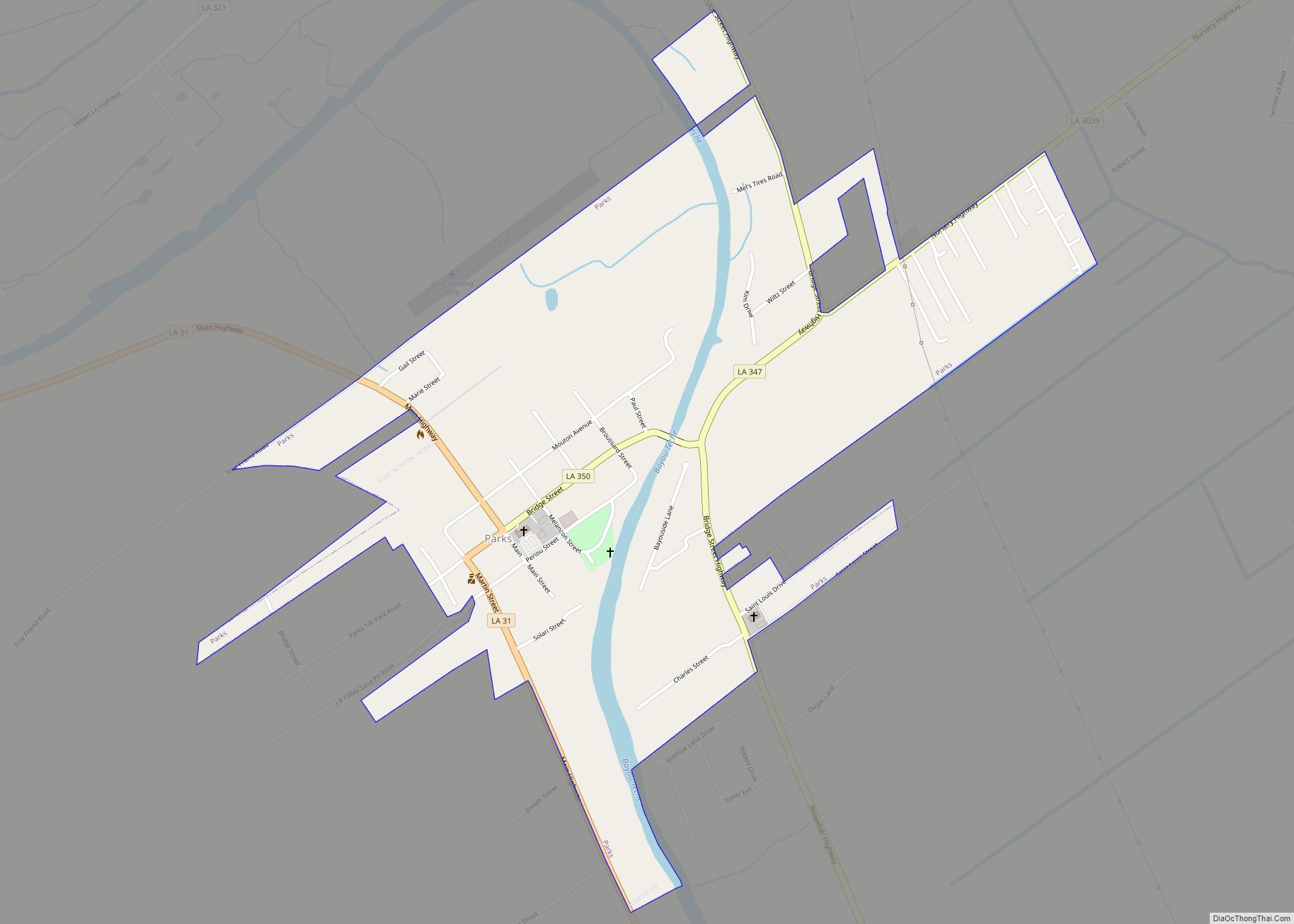
Cade Road Map

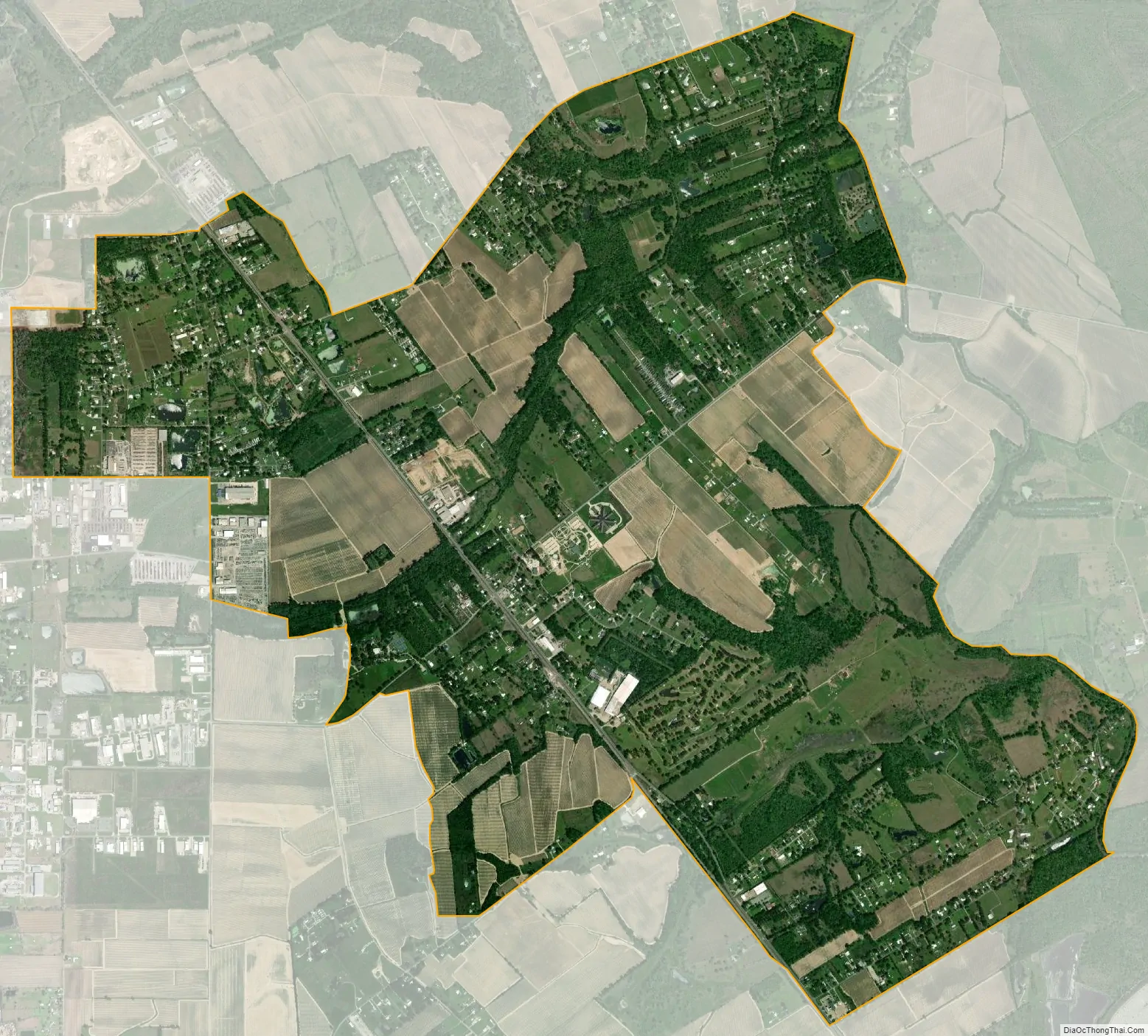
Cade city Satellite Map
Geography
The community of Cade, located in southwestern St. Martin Parish, is situated at Louisiana highways 182 and 92-1. To the northwest on LA-182 are the Lafayette Parish cities of Broussard, 6 miles (9.7 km), and Lafayette, 13 miles (21 km), the parish seat, and 8 miles (13 km) to the southeast is New Iberia, the seat of Iberia Parish. Louisiana Highway 92-1 heads west 7 miles (11 km) to the city of Youngsville and 6 miles (9.7 km) northeast to St. Martinville, the St. Martin Parish seat in which LA-92-1 heads east 4 miles to intersect with Louisiana Highway 31 and heads 2 miles north to the St. Martinville.
See also
Map of Louisiana State and its subdivision:- Acadia
- Allen
- Ascension
- Assumption
- Avoyelles
- Beauregard
- Bienville
- Bossier
- Caddo
- Calcasieu
- Caldwell
- Cameron
- Catahoula
- Claiborne
- Concordia
- De Soto
- East Baton Rouge
- East Carroll
- East Feliciana
- Evangeline
- Franklin
- Grant
- Iberia
- Iberville
- Jackson
- Jefferson
- Jefferson Davis
- La Salle
- Lafayette
- Lafourche
- Lincoln
- Livingston
- Madison
- Morehouse
- Natchitoches
- Orleans
- Ouachita
- Plaquemines
- Pointe Coupee
- Rapides
- Red River
- Richland
- Sabine
- Saint Bernard
- Saint Charles
- Saint Helena
- Saint James
- Saint John the Baptist
- Saint Landry
- Saint Martin
- Saint Mary
- Saint Tammany
- Tangipahoa
- Tensas
- Terrebonne
- Union
- Vermilion
- Vernon
- Washington
- Webster
- West Baton Rouge
- West Carroll
- West Feliciana
- Winn
- Alabama
- Alaska
- Arizona
- Arkansas
- California
- Colorado
- Connecticut
- Delaware
- District of Columbia
- Florida
- Georgia
- Hawaii
- Idaho
- Illinois
- Indiana
- Iowa
- Kansas
- Kentucky
- Louisiana
- Maine
- Maryland
- Massachusetts
- Michigan
- Minnesota
- Mississippi
- Missouri
- Montana
- Nebraska
- Nevada
- New Hampshire
- New Jersey
- New Mexico
- New York
- North Carolina
- North Dakota
- Ohio
- Oklahoma
- Oregon
- Pennsylvania
- Rhode Island
- South Carolina
- South Dakota
- Tennessee
- Texas
- Utah
- Vermont
- Virginia
- Washington
- West Virginia
- Wisconsin
- Wyoming