Maurice is a town in Vermilion Parish, Louisiana, United States. The population was 964 at the 2010 census and 2,118 for the 2020 Census. It is part of the Abbeville micropolitan statistical area.
| Name: | Maurice village |
|---|---|
| LSAD Code: | 47 |
| LSAD Description: | village (suffix) |
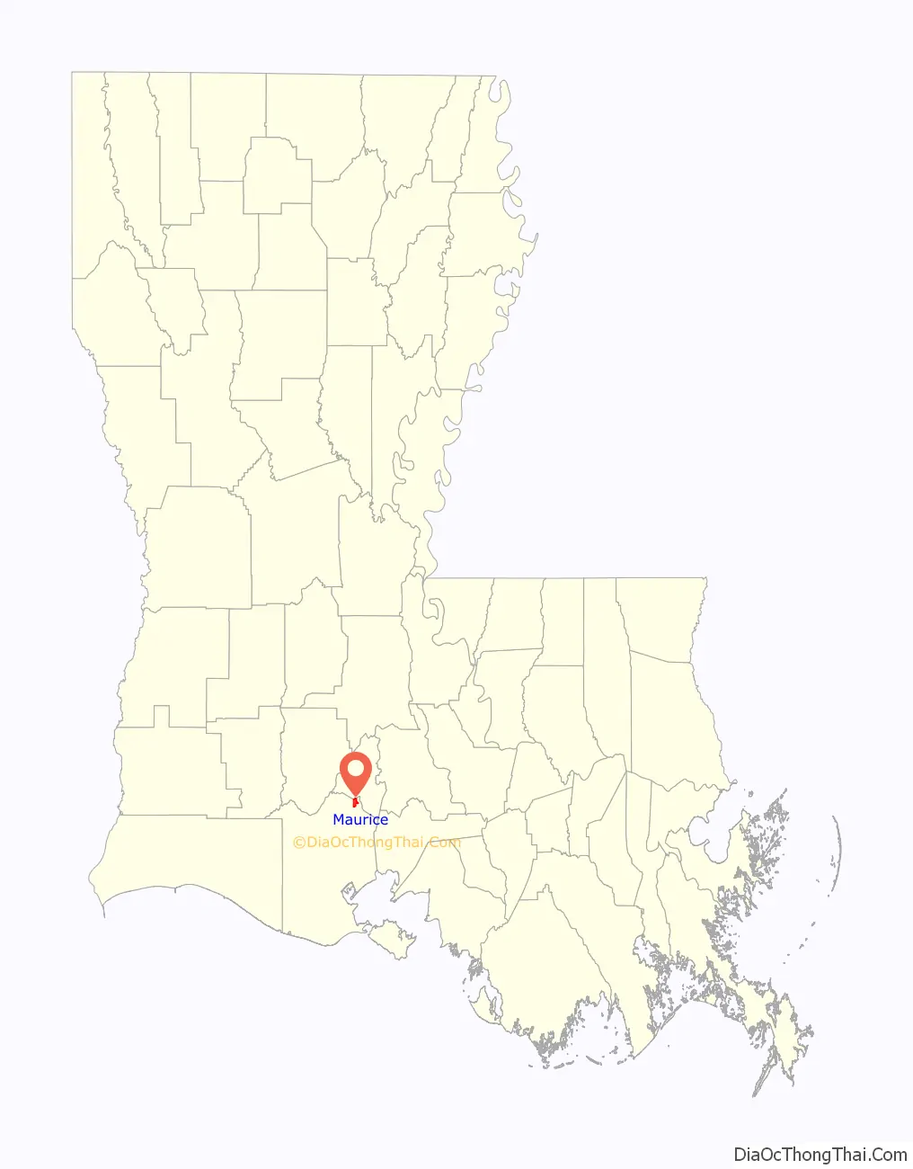
| State: | Louisiana |
| County: | Vermilion Parish |
| Total Area: | 2.78 sq mi (7.21 km²) |
| Land Area: | 2.78 sq mi (7.21 km²) |
| Water Area: | 0.00 sq mi (0.00 km²) |
| Total Population: | 2,118 |
| Population Density: | 760.78/sq mi (293.69/km²) |
| Area code: | 337 |
| FIPS code: | 2249240 |
Online Interactive Map
Click on ![]() to view map in "full screen" mode.
to view map in "full screen" mode.
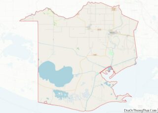
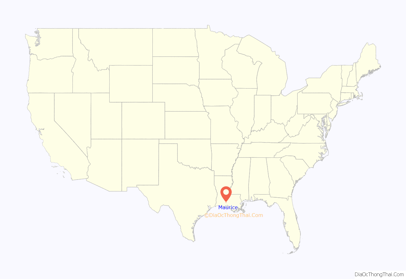
Maurice location map. Where is Maurice village?
History
The village, originally called “Mauriceville”, derives its name from its founder Maurice Villien. Villien, a native of Savoy, France, came to America in 1855 and sold goods in New Orleans, New Iberia and Milton. His wife had land holdings there and they established a home and grocery store. On May 29, 1889, the 10-acre (40,000 m) site, on which the church and rectory in Maurice were to be built, was donated by Villien. The town was incorporated on December 27, 1911 and Joseph Villien, Maurice’s son, became mayor until 1928. Today, Joseph Street leads to the old home.
The community’s first church was La Chapelle a Maurice and Sunday services were held in a small schoolhouse on the Villien property until the St. Alphonsus Church was built in January 1893. The Broussard Cove School was the first school built on land donated by Joseph Clark in 1885 and moved to Maurice in July 1899 to land donated by Maurice Villien. It was located on Maurice Avenue and the Indian Bayou Road until 1914 when it burned down.
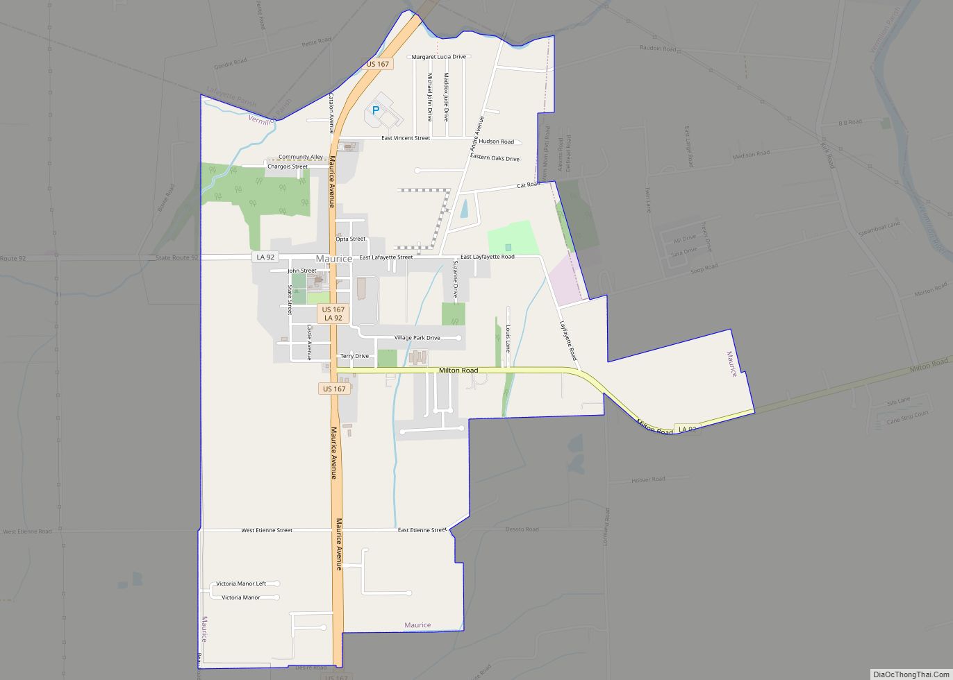
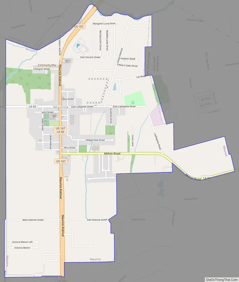
Maurice Road Map
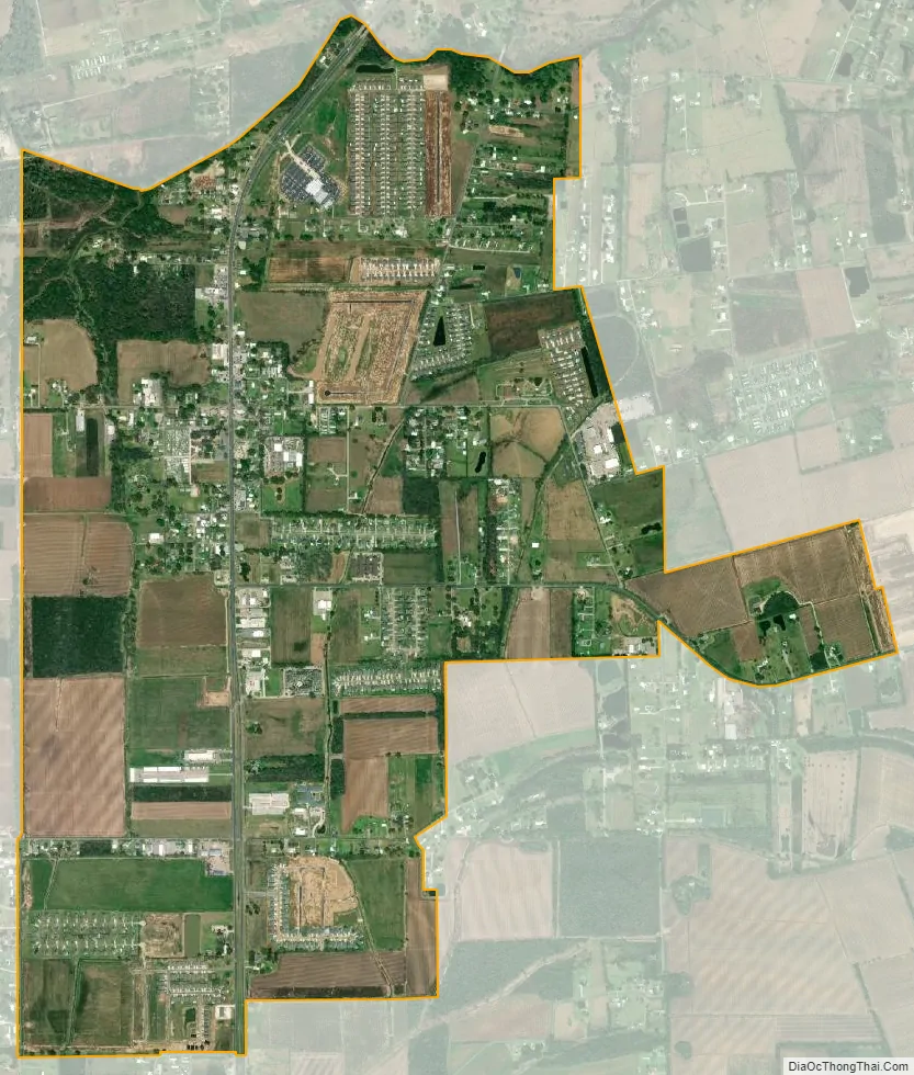
Maurice city Satellite Map
Geography
Maurice is located at 30°6′26″N 92°7′26″W / 30.10722°N 92.12389°W / 30.10722; -92.12389 (30.107171, -92.123977), along the Gulf Coast in southern Acadiana. According to the United States Census Bureau, the village has a total area of 2.0 square miles (5.3 km), all land.
The northeastern border of the village is the Vermilion/Lafayette parish line. U.S. Route 167 passes through the village heading 11 miles (18 km) northeast to Lafayette, the parish seat of Lafayette Parish and 10 miles (16 km) south to Abbeville, the parish seat of Vermilion Parish. The communities of Youngsville 9 miles (14 km) and Milton 4 miles (6.4 km) are both located east of the village via Louisiana Highway 92 which intersects with U.S. 167.
See also
Map of Louisiana State and its subdivision:- Acadia
- Allen
- Ascension
- Assumption
- Avoyelles
- Beauregard
- Bienville
- Bossier
- Caddo
- Calcasieu
- Caldwell
- Cameron
- Catahoula
- Claiborne
- Concordia
- De Soto
- East Baton Rouge
- East Carroll
- East Feliciana
- Evangeline
- Franklin
- Grant
- Iberia
- Iberville
- Jackson
- Jefferson
- Jefferson Davis
- La Salle
- Lafayette
- Lafourche
- Lincoln
- Livingston
- Madison
- Morehouse
- Natchitoches
- Orleans
- Ouachita
- Plaquemines
- Pointe Coupee
- Rapides
- Red River
- Richland
- Sabine
- Saint Bernard
- Saint Charles
- Saint Helena
- Saint James
- Saint John the Baptist
- Saint Landry
- Saint Martin
- Saint Mary
- Saint Tammany
- Tangipahoa
- Tensas
- Terrebonne
- Union
- Vermilion
- Vernon
- Washington
- Webster
- West Baton Rouge
- West Carroll
- West Feliciana
- Winn
- Alabama
- Alaska
- Arizona
- Arkansas
- California
- Colorado
- Connecticut
- Delaware
- District of Columbia
- Florida
- Georgia
- Hawaii
- Idaho
- Illinois
- Indiana
- Iowa
- Kansas
- Kentucky
- Louisiana
- Maine
- Maryland
- Massachusetts
- Michigan
- Minnesota
- Mississippi
- Missouri
- Montana
- Nebraska
- Nevada
- New Hampshire
- New Jersey
- New Mexico
- New York
- North Carolina
- North Dakota
- Ohio
- Oklahoma
- Oregon
- Pennsylvania
- Rhode Island
- South Carolina
- South Dakota
- Tennessee
- Texas
- Utah
- Vermont
- Virginia
- Washington
- West Virginia
- Wisconsin
- Wyoming