Rugby is a city in, and the county seat of, Pierce County, North Dakota, United States. The population was 2,509 at the 2020 census, making it the 19th largest city in North Dakota. Rugby was founded in 1886.
Rugby is often billed as the geographic center of North America.
| Name: | Rugby city |
|---|---|
| LSAD Code: | 25 |
| LSAD Description: | city (suffix) |
| State: | North Dakota |
| County: | Pierce County |
| Elevation: | 1,549 ft (472 m) |
| Total Area: | 2.30 sq mi (5.96 km²) |
| Land Area: | 2.29 sq mi (5.92 km²) |
| Water Area: | 0.02 sq mi (0.04 km²) |
| Total Population: | 2,509 |
| Population Density: | 1,098.03/sq mi (423.93/km²) |
| ZIP code: | 58368 |
| Area code: | 701 |
| FIPS code: | 3868860 |
| GNISfeature ID: | 1031031 |
| Website: | cityofrugbynd.com |
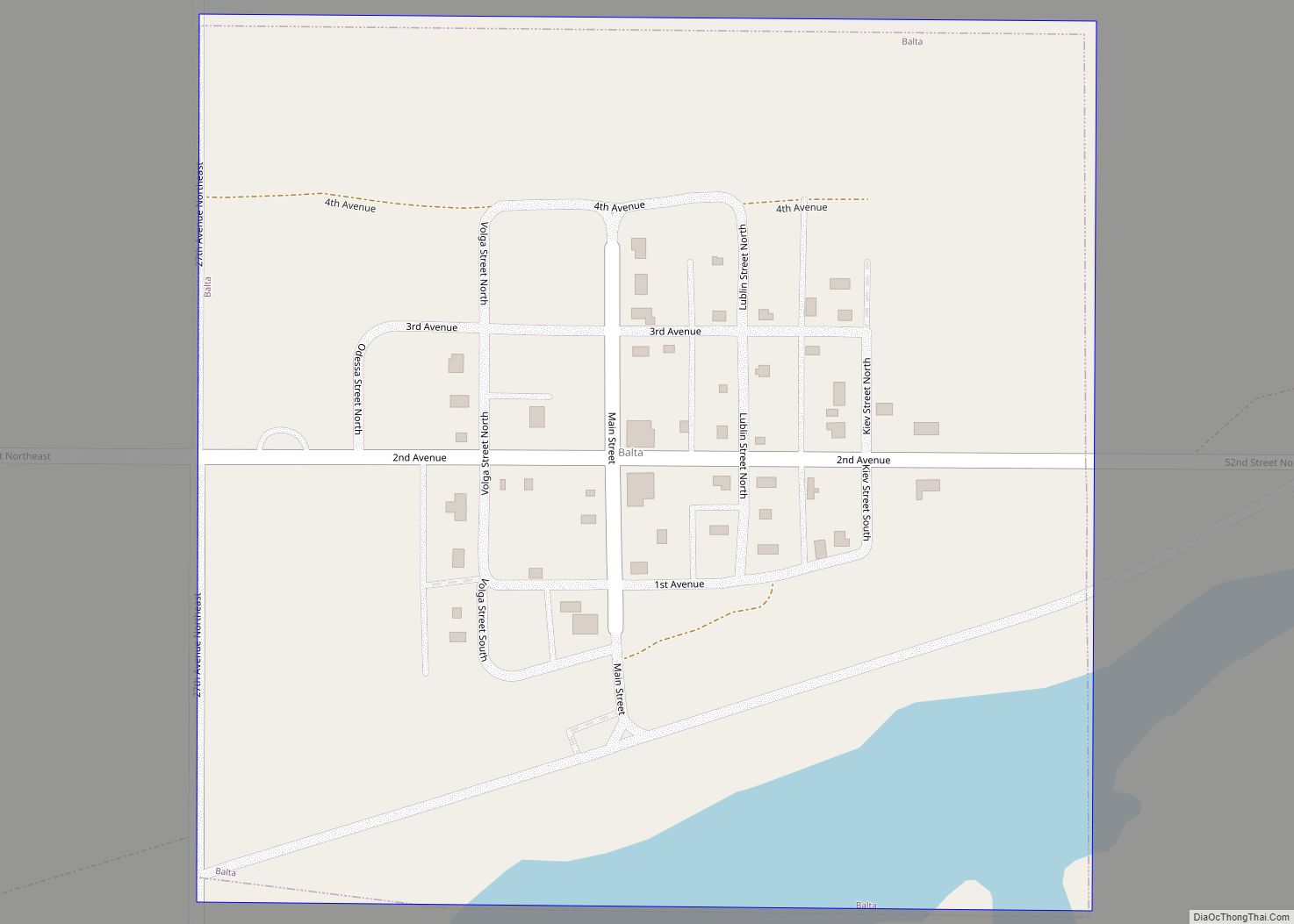
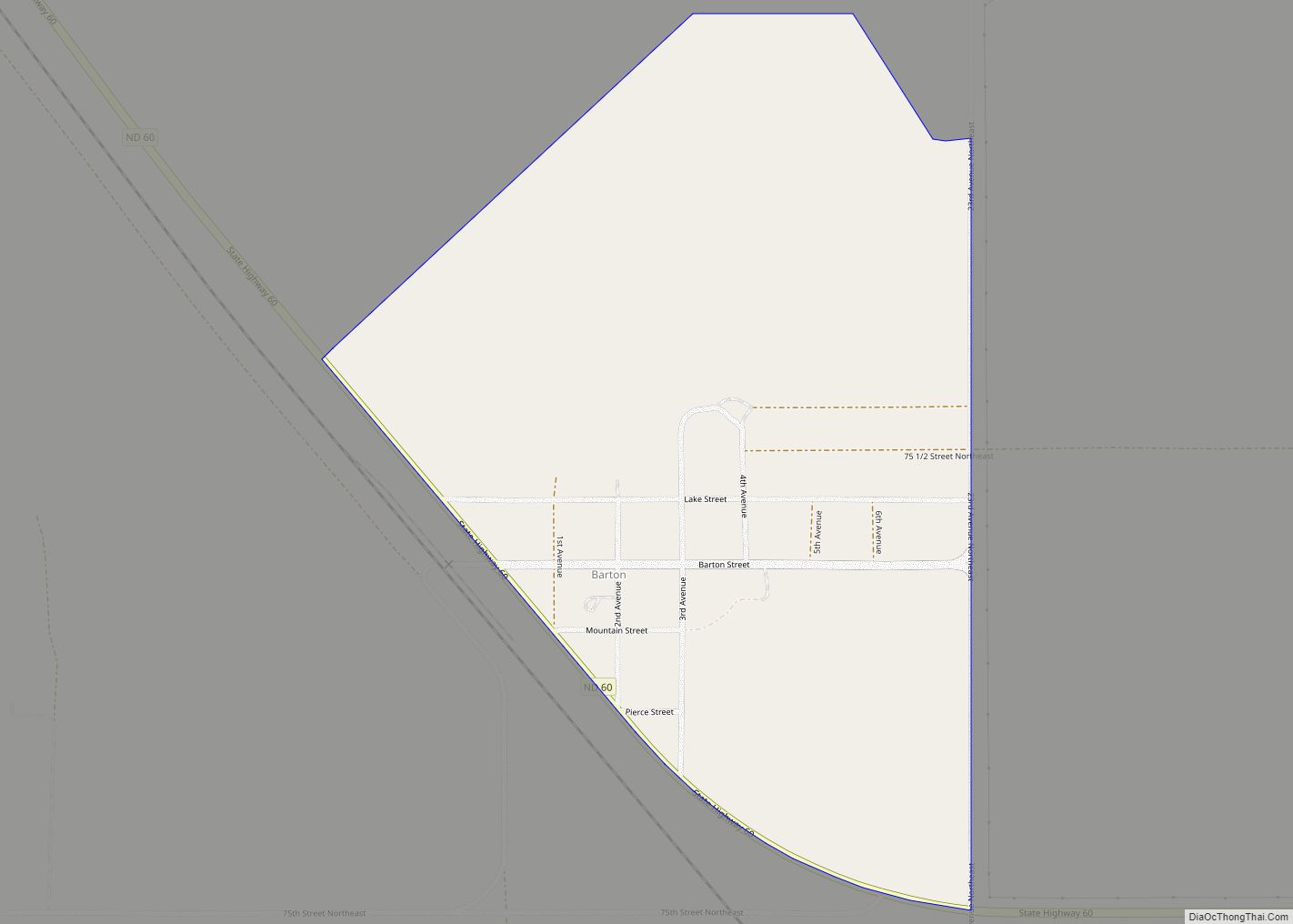
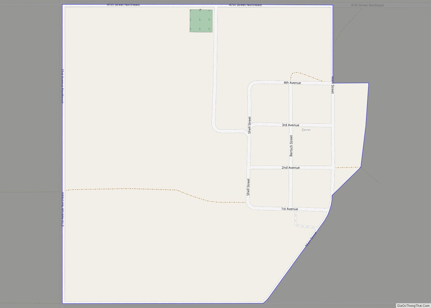
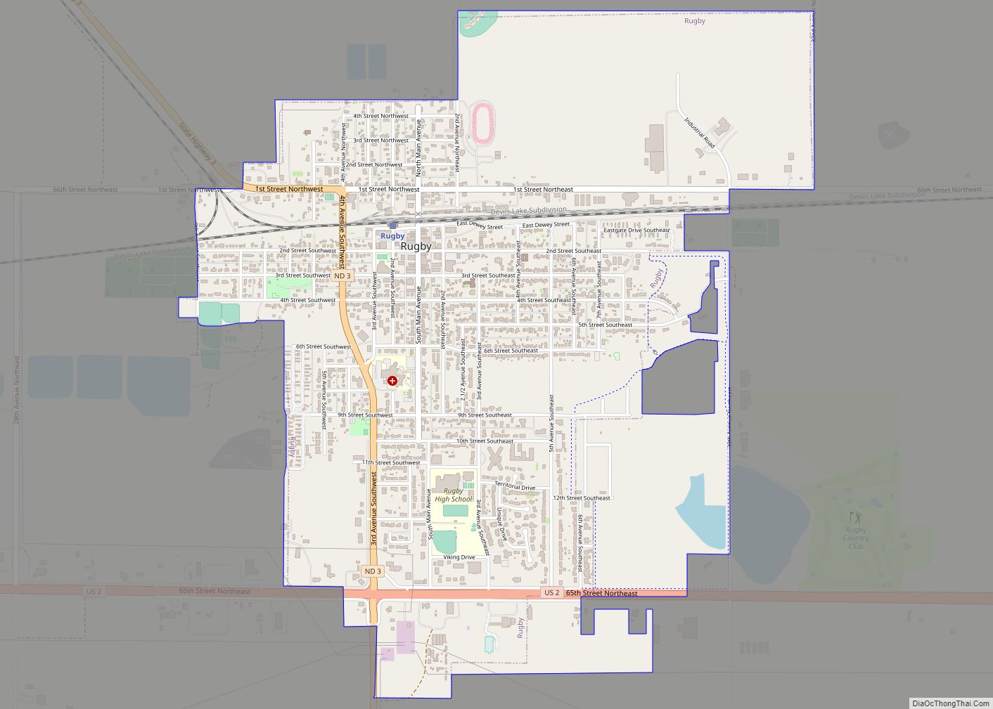
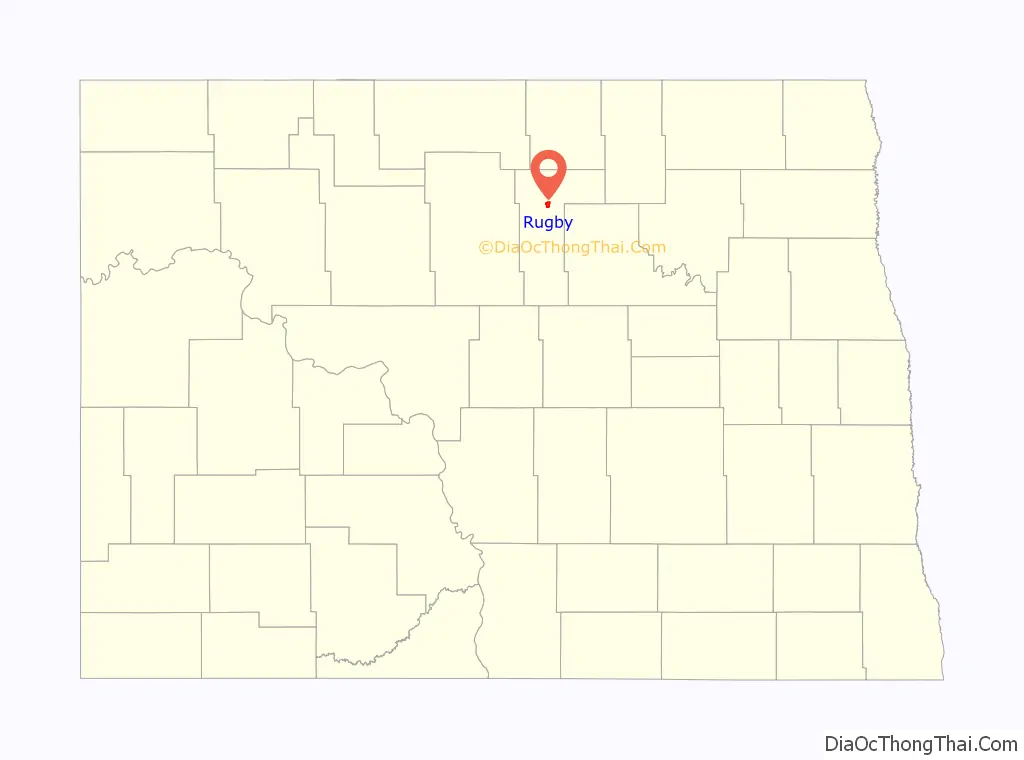
Online Interactive Map
Click on ![]() to view map in "full screen" mode.
to view map in "full screen" mode.
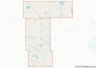
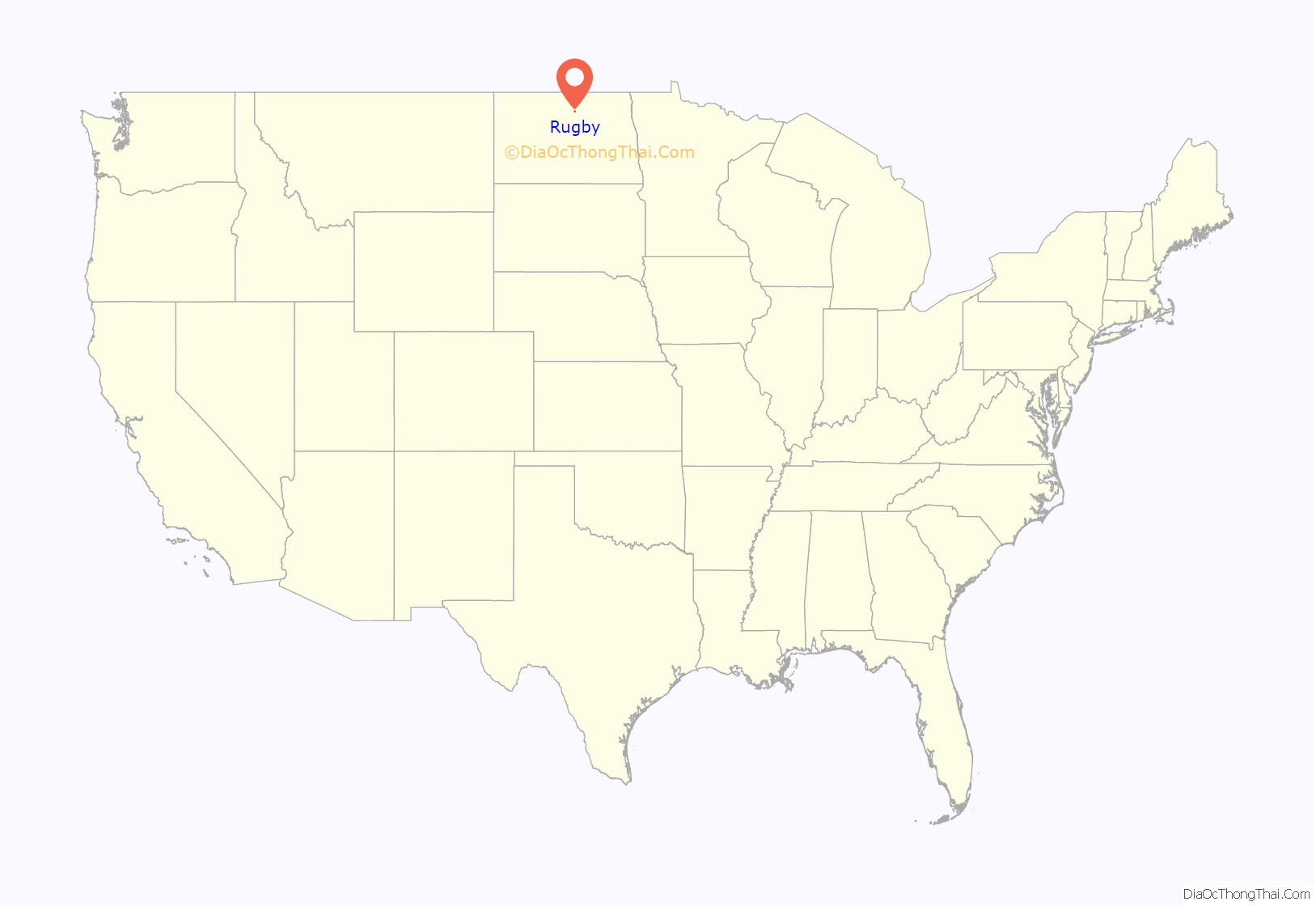
Rugby location map. Where is Rugby city?
History
Rugby was founded in 1886 at a junction on the Great Northern Railway, where a branch line to Bottineau met the main line. The railroad promoters initially platted the town as Rugby Junction, getting the name Rugby from the town of Rugby in Warwickshire, England. It was one of several sites along the Great Northern’s transcontinental route between Devils Lake and Minot that were named after places in England (the others were Berwick, Leeds, Knox, Norwich, Penn, Surrey, Churches Ferry, Tunbridge, and York). When the community became a city, the Junction was dropped from the name.
North Dakota’s first permanent settlers arrived in 1812 from the Earl of Selkirk’s colony in neighboring Rupert’s Land. As farmers, they were more advanced than many of their contemporaries in the rest of the United States, having adopted sophisticated farming methods and machinery. Many of these implements, including an early McCormick Deering threshing machine, have found their way to the restored Pioneer Village in Rugby.
In 1931, the town of Rugby erected a 15-foot-tall (4.6 m) rock obelisk marking the “Geographical Center of North America”. This was moved to a slightly different location in 1971 with the expansion of US Highway 2. According to a listing by the U.S. Geological Survey, Rugby is actually approximately 15 miles (24 km) from the geographic center of North America (6 miles (9.7 km) west of Balta), and even this designation carries no official status.
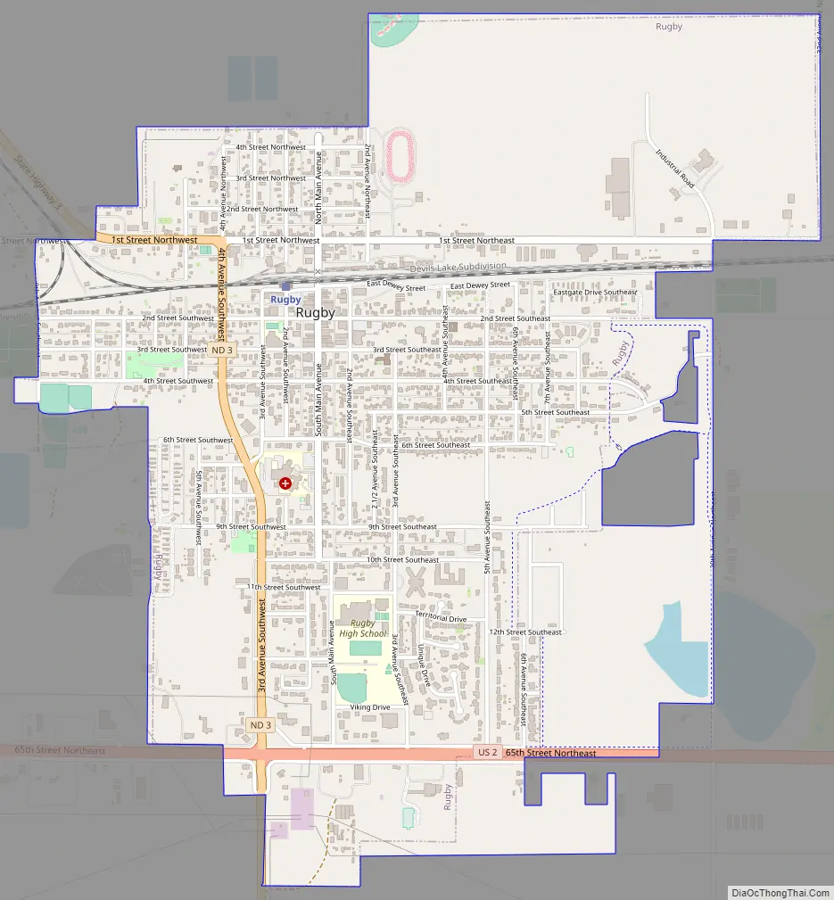
Rugby Road Map
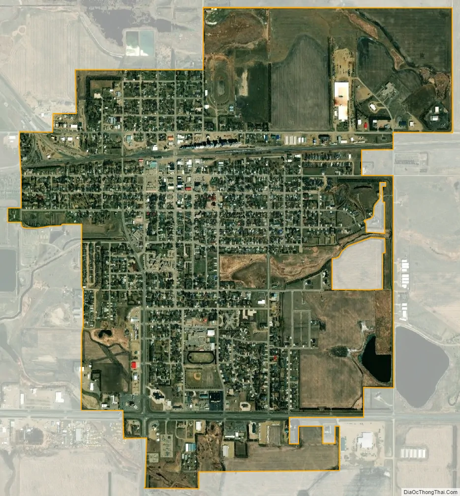
Rugby city Satellite Map
Geography
Rugby is located in eastern Pierce County at the intersection of U.S. Route 2 and North Dakota Highway 3. The Great Northern Railroad line passes through the community. Minot lies 66 miles to the west along Route 2.
According to the United States Census Bureau, the city has a total area of 1.94 square miles (5.02 km), all land. Rugby claims to be the geographic center of North America and a monument stands in the city to signify this. The monument features flags of the United States, Canada, and Mexico. However, modern calculations that take on account the distortions caused by cartographic projections show that center is 145 miles southwest of Rugby, in a town called Center, North Dakota.
See also
Map of North Dakota State and its subdivision:- Adams
- Barnes
- Benson
- Billings
- Bottineau
- Bowman
- Burke
- Burleigh
- Cass
- Cavalier
- Dickey
- Divide
- Dunn
- Eddy
- Emmons
- Foster
- Golden Valley
- Grand Forks
- Grant
- Griggs
- Hettinger
- Kidder
- Lamoure
- Logan
- McHenry
- McIntosh
- McKenzie
- McLean
- Mercer
- Morton
- Mountrail
- Nelson
- Oliver
- Pembina
- Pierce
- Ramsey
- Ransom
- Renville
- Richland
- Rolette
- Sargent
- Sheridan
- Sioux
- Slope
- Stark
- Steele
- Stutsman
- Towner
- Traill
- Walsh
- Ward
- Wells
- Williams
- Alabama
- Alaska
- Arizona
- Arkansas
- California
- Colorado
- Connecticut
- Delaware
- District of Columbia
- Florida
- Georgia
- Hawaii
- Idaho
- Illinois
- Indiana
- Iowa
- Kansas
- Kentucky
- Louisiana
- Maine
- Maryland
- Massachusetts
- Michigan
- Minnesota
- Mississippi
- Missouri
- Montana
- Nebraska
- Nevada
- New Hampshire
- New Jersey
- New Mexico
- New York
- North Carolina
- North Dakota
- Ohio
- Oklahoma
- Oregon
- Pennsylvania
- Rhode Island
- South Carolina
- South Dakota
- Tennessee
- Texas
- Utah
- Vermont
- Virginia
- Washington
- West Virginia
- Wisconsin
- Wyoming