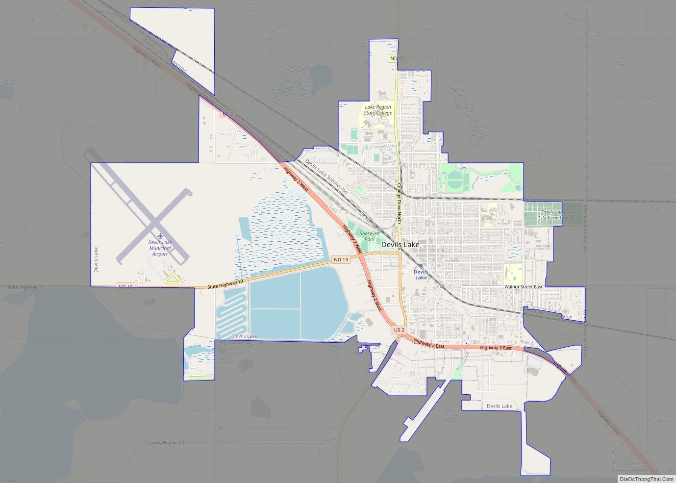
Devils Lake is a city in Ramsey County, North Dakota, United States. It is the county seat of Ramsey County. The population was 7,192 at the 2020 census. It is named after the nearby body of water called Devils Lake. The first house in Devils Lake was built in 1882. It was surveyed in 1883 and named Creelsburg and later Creel City, after the surveyor, Heber M. Creel. In 1884 it was renamed Devils Lake.
The local paper is the Devils Lake Journal. Devils Lake Municipal Airport serves the city. Devils Lake is home to Lake Region State College and the North Dakota School for the Deaf.
| Name: | Devils Lake city |
|---|---|
| LSAD Code: | 25 |
| LSAD Description: | city (suffix) |
| State: | North Dakota |
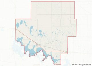
| County: | Ramsey County |
| Founded: | 1882 |
| Elevation: | 1,447 ft (441 m) |
| Total Area: | 6.96 sq mi (18.04 km²) |
| Land Area: | 6.96 sq mi (18.02 km²) |
| Water Area: | 0.01 sq mi (0.01 km²) |
| Total Population: | 7,192 |
| Population Density: | 1,033.48/sq mi (399.04/km²) |
| ZIP code: | 58301 |
| Area code: | 701 |
| FIPS code: | 3819420 |
| GNISfeature ID: | 1028672 |
| Website: | devilslakend.com |
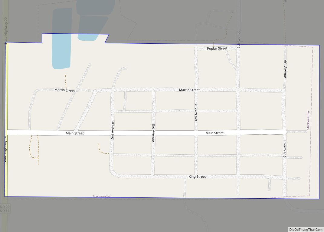
Online Interactive Map
Click on ![]() to view map in "full screen" mode.
to view map in "full screen" mode.
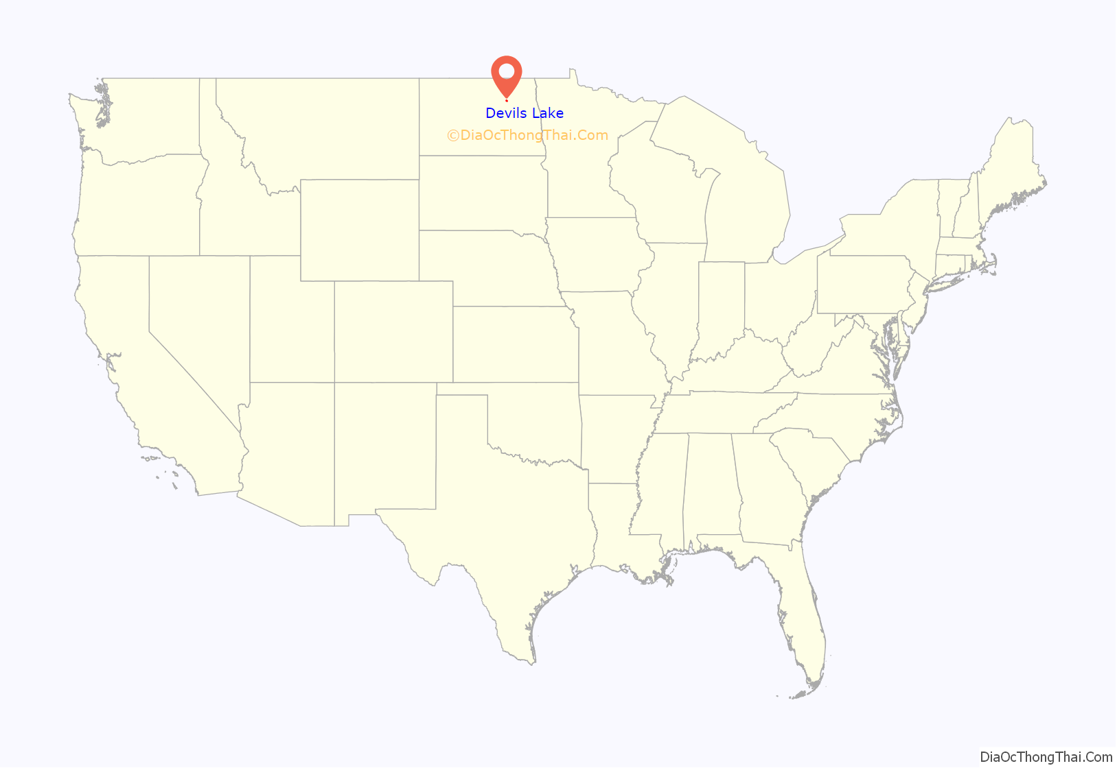
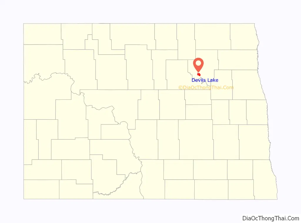
Devils Lake location map. Where is Devils Lake city?
History
The present site of Devils Lake was, historically, a territory of the Dakota people. However, the Sisseton, Wahpeton, and Cut-Head bands of the Dakotas were relocated to the Spirit Lake Reservation as a result of the 1867 treaty between the United States and the Dakota that established a reservation for those who had not been forcibly relocated to Crow Creek Reservation in what is now South Dakota. The name “Devils Lake” is a calque of the Dakota phrase mni wak’áŋ (literally translating to spirit water), which is also reflected in the names of the Spirit Lake Tribe and the nearby town of Minnewaukan.
The Dakota called the lake mni wak’áŋ, which separately translates as mni (water) and wak’áŋ (literally meaning “pure source” but often translated as “spirit” or “sacred”). The European-American settlers misconstrued this name to mean “Bad Spirit Lake” or “Devils Lake.” The “bad” referred to the high salinity of the lake, making it unfit to drink, and “spirit” referenced the mirages often seen across the water. The Christian concept of the devil was not present in the Dakota philosophy and religious practices.
The Hidatsa name for the lake is mirixubaash ( meaning “sacred water”).
The first post office was founded November 15, 1882, and was originally named Creelsburg. It was founded by Lieutenant Heber M. Creel, a West Point graduate and topographical engineer stationed at nearby Fort Totten. After resigning from the U.S. Army, he surveyed the land and established the townsite.
The surrounding Creel Township is named for Mr. Creel. The name was later changed to Creel City and expanded by the Great Northern Railway. When the village was incorporated in 1884, the name was changed to City of Devils Lake and then shortened to Devils Lake.
During a period of increased rainfall, beginning in the 1990s and unprecedented in the history of North Dakota, caused the nearby lake, which has no natural outlet, to rise. The surface area has quadrupled, and the higher water has resulted in the moving or destruction of over 400 houses.
Devils Lake Road Map
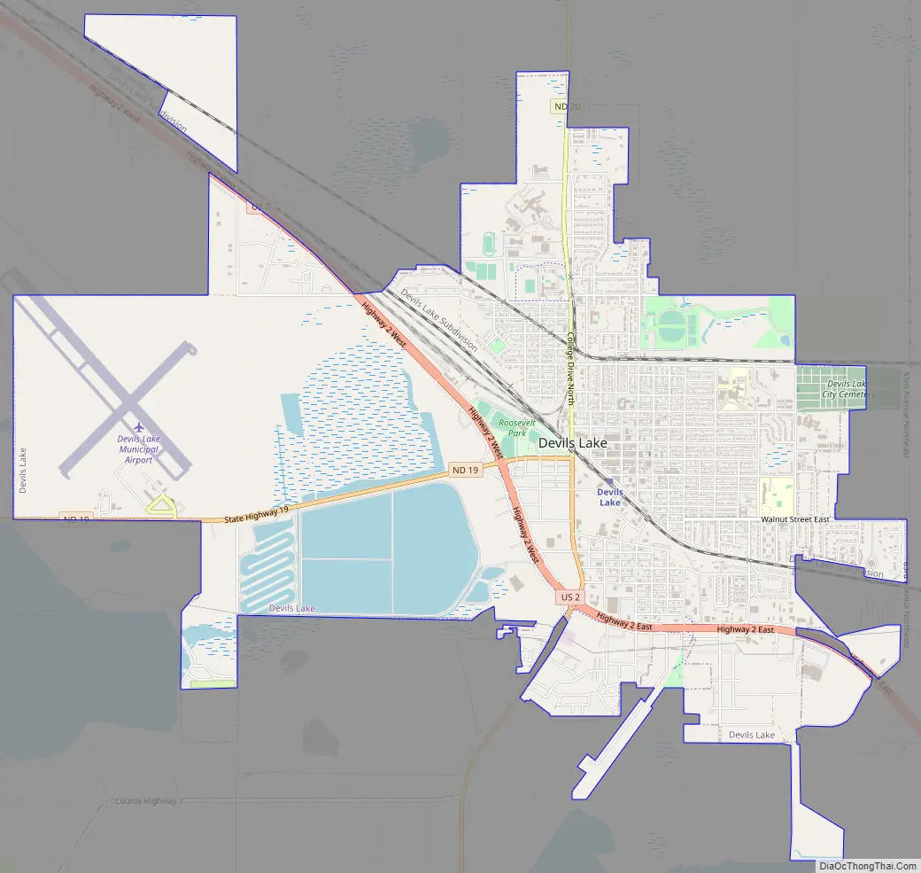
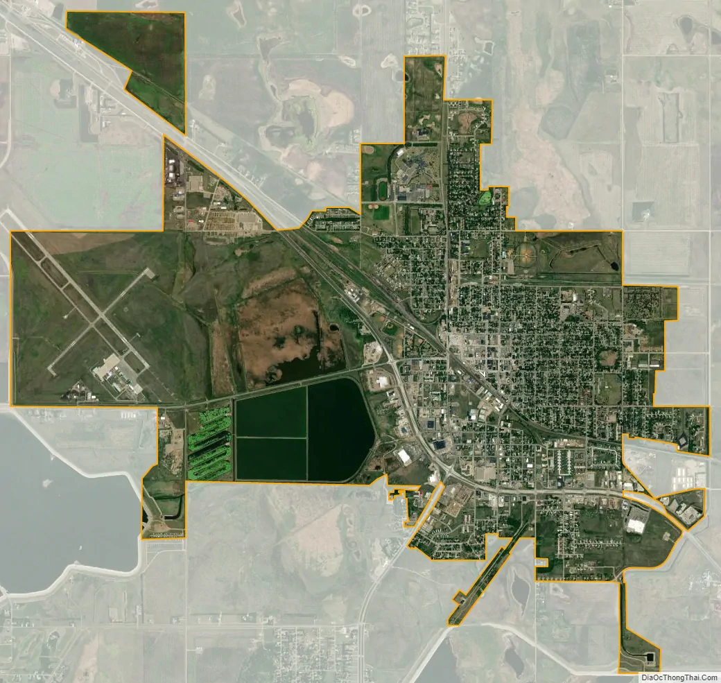
Devils Lake city Satellite Map
Geography
According to the United States Census Bureau, the city has a total area of 6.51 square miles (16.86 km), of which 6.50 square miles (16.83 km) is land and 0.01 square miles (0.03 km) is water.
Like all of North Dakota, Devils Lake has a humid continental climate (Köppen Dfb) with very cold winters with frequent light snowfall, and warm to very warm, wetter summers with most rain from convective thunderstorms. During the 1936 North American cold wave, the town was one of the coldest places south of the Canada–US border, averaging −21 °F or −29.4 °C for the five weeks ending February 21, 1936 (though at a different site from that now in use). On average 53.4 nights fall to or below 0 °F or −17.8 °C, 104.1 days fail to top freezing, and 184.5 nights fall below 32 °F or 0 °C. In the winter, only 17.5 days on average top freezing, and in severe winters months can pass without even a minor thaw. Extreme heat is rare in summer, with only one day in three years topping 100 °F or 37.8 °C, and only 9.3 topping 90 °F or 32.2 °C.
See also
Map of North Dakota State and its subdivision:- Adams
- Barnes
- Benson
- Billings
- Bottineau
- Bowman
- Burke
- Burleigh
- Cass
- Cavalier
- Dickey
- Divide
- Dunn
- Eddy
- Emmons
- Foster
- Golden Valley
- Grand Forks
- Grant
- Griggs
- Hettinger
- Kidder
- Lamoure
- Logan
- McHenry
- McIntosh
- McKenzie
- McLean
- Mercer
- Morton
- Mountrail
- Nelson
- Oliver
- Pembina
- Pierce
- Ramsey
- Ransom
- Renville
- Richland
- Rolette
- Sargent
- Sheridan
- Sioux
- Slope
- Stark
- Steele
- Stutsman
- Towner
- Traill
- Walsh
- Ward
- Wells
- Williams
- Alabama
- Alaska
- Arizona
- Arkansas
- California
- Colorado
- Connecticut
- Delaware
- District of Columbia
- Florida
- Georgia
- Hawaii
- Idaho
- Illinois
- Indiana
- Iowa
- Kansas
- Kentucky
- Louisiana
- Maine
- Maryland
- Massachusetts
- Michigan
- Minnesota
- Mississippi
- Missouri
- Montana
- Nebraska
- Nevada
- New Hampshire
- New Jersey
- New Mexico
- New York
- North Carolina
- North Dakota
- Ohio
- Oklahoma
- Oregon
- Pennsylvania
- Rhode Island
- South Carolina
- South Dakota
- Tennessee
- Texas
- Utah
- Vermont
- Virginia
- Washington
- West Virginia
- Wisconsin
- Wyoming