Center is a city in Oliver County, North Dakota, United States. It is the county seat of, and the only incorporated place in, Oliver County. The population was 588 at the 2020 census.
| Name: | Center city |
|---|---|
| LSAD Code: | 25 |
| LSAD Description: | city (suffix) |
| State: | North Dakota |
| County: | Oliver County |
| Founded: | 1902 |
| Elevation: | 1,975 ft (602 m) |
| Total Area: | 0.48 sq mi (1.24 km²) |
| Land Area: | 0.48 sq mi (1.24 km²) |
| Water Area: | 0.00 sq mi (0.00 km²) |
| Total Population: | 588 |
| Population Density: | 1,230.13/sq mi (474.59/km²) |
| ZIP code: | 58530 |
| Area code: | 701 |
| FIPS code: | 3813180 |
| GNISfeature ID: | 1028320 |
| Website: | centernd.net |
Online Interactive Map
Click on ![]() to view map in "full screen" mode.
to view map in "full screen" mode.
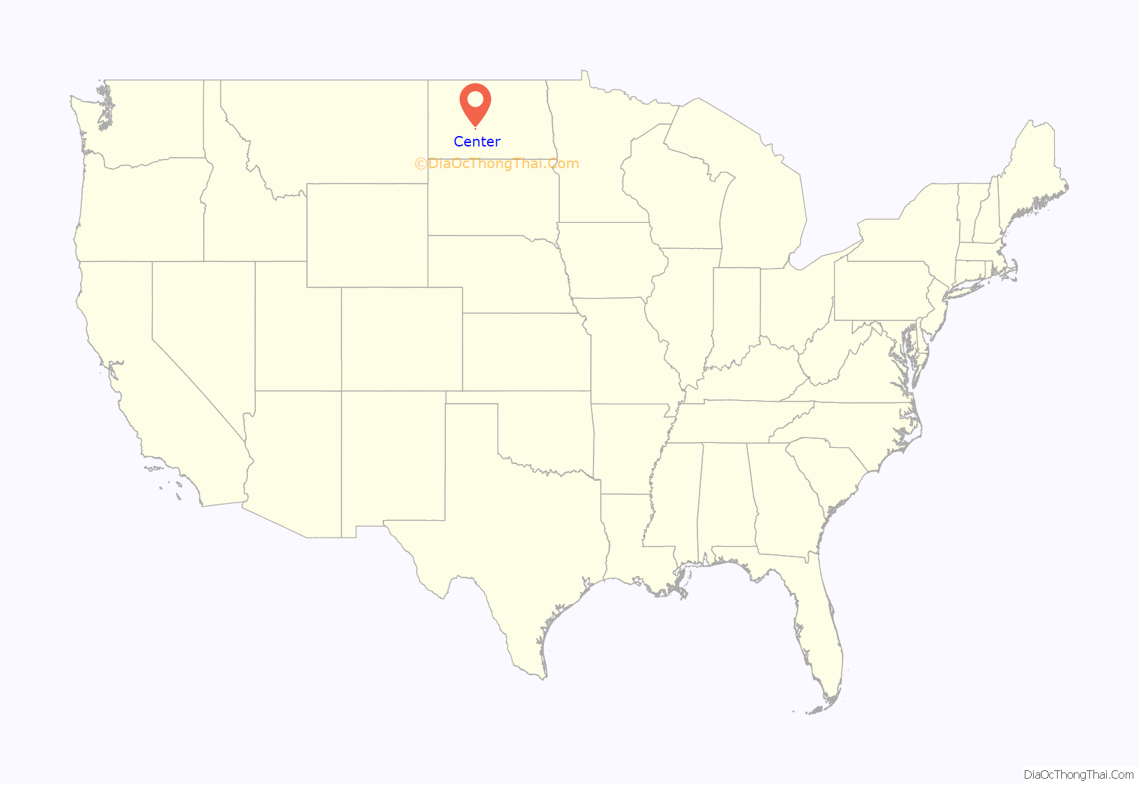
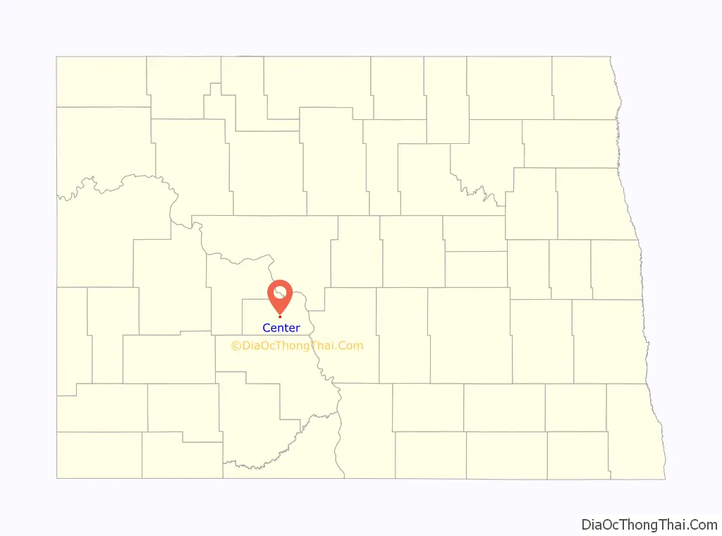
Center location map. Where is Center city?
History
Center was founded in 1902. The city was named from its location near the geographical center of Oliver County. Coincidentally, it has also been calculated to be the geographical center of North America.
The town is somewhat notable for the blizzard-related death of Hazel Miner, who would go on to be the subject of a song and memorials.
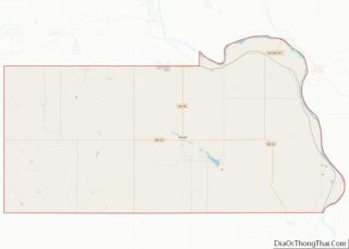
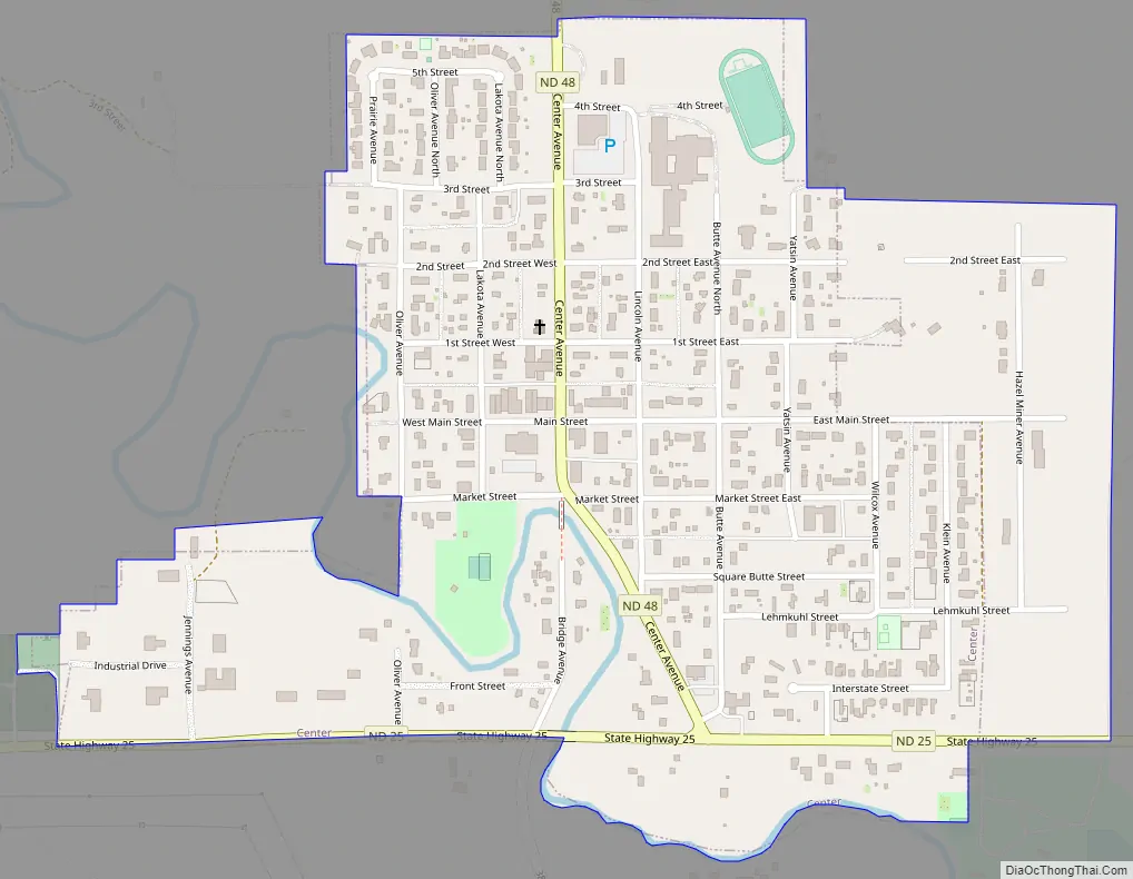
Center Road Map
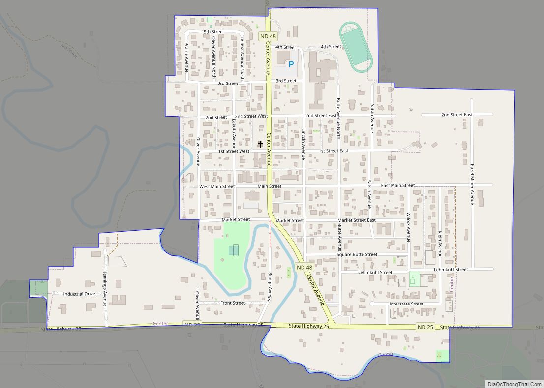
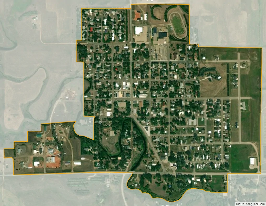
Center city Satellite Map
Geography
According to the United States Census Bureau, the city has a total area of 0.46 square miles (1.19 km), all land.
Southwest of Center, there is a large open air coal mine. Southeast of Center, at Nelson Lake there is a large power plant. West of Nelson Lake is situated the Square Butte high-voltage direct current transmission line’s static inverter.
Center of North America
Peter Rogerson, a professor of geography at the University at Buffalo in New York, used new scientific methods and the azimuthal equidistant projection to calculate the “geographic center” of the North American continent. By some extraordinary coincidence, he found that Center, North Dakota, is the continent’s geographical center.
See also
Map of North Dakota State and its subdivision:- Adams
- Barnes
- Benson
- Billings
- Bottineau
- Bowman
- Burke
- Burleigh
- Cass
- Cavalier
- Dickey
- Divide
- Dunn
- Eddy
- Emmons
- Foster
- Golden Valley
- Grand Forks
- Grant
- Griggs
- Hettinger
- Kidder
- Lamoure
- Logan
- McHenry
- McIntosh
- McKenzie
- McLean
- Mercer
- Morton
- Mountrail
- Nelson
- Oliver
- Pembina
- Pierce
- Ramsey
- Ransom
- Renville
- Richland
- Rolette
- Sargent
- Sheridan
- Sioux
- Slope
- Stark
- Steele
- Stutsman
- Towner
- Traill
- Walsh
- Ward
- Wells
- Williams
- Alabama
- Alaska
- Arizona
- Arkansas
- California
- Colorado
- Connecticut
- Delaware
- District of Columbia
- Florida
- Georgia
- Hawaii
- Idaho
- Illinois
- Indiana
- Iowa
- Kansas
- Kentucky
- Louisiana
- Maine
- Maryland
- Massachusetts
- Michigan
- Minnesota
- Mississippi
- Missouri
- Montana
- Nebraska
- Nevada
- New Hampshire
- New Jersey
- New Mexico
- New York
- North Carolina
- North Dakota
- Ohio
- Oklahoma
- Oregon
- Pennsylvania
- Rhode Island
- South Carolina
- South Dakota
- Tennessee
- Texas
- Utah
- Vermont
- Virginia
- Washington
- West Virginia
- Wisconsin
- Wyoming