Arthur is a village in, and the county seat of Arthur County, Nebraska, United States. The population was 117 at the 2010 census.
| Name: | Arthur village |
|---|---|
| LSAD Code: | 47 |
| LSAD Description: | village (suffix) |
| State: | Nebraska |
| County: | Arthur County |
| Elevation: | 3,655 ft (1,114 m) |
| Total Area: | 0.31 sq mi (0.80 km²) |
| Land Area: | 0.31 sq mi (0.80 km²) |
| Water Area: | 0.00 sq mi (0.00 km²) |
| Total Population: | 128 |
| Population Density: | 412.90/sq mi (159.30/km²) |
| ZIP code: | 69121 |
| Area code: | 308 |
| FIPS code: | 3102200 |
| GNISfeature ID: | 0827062 |
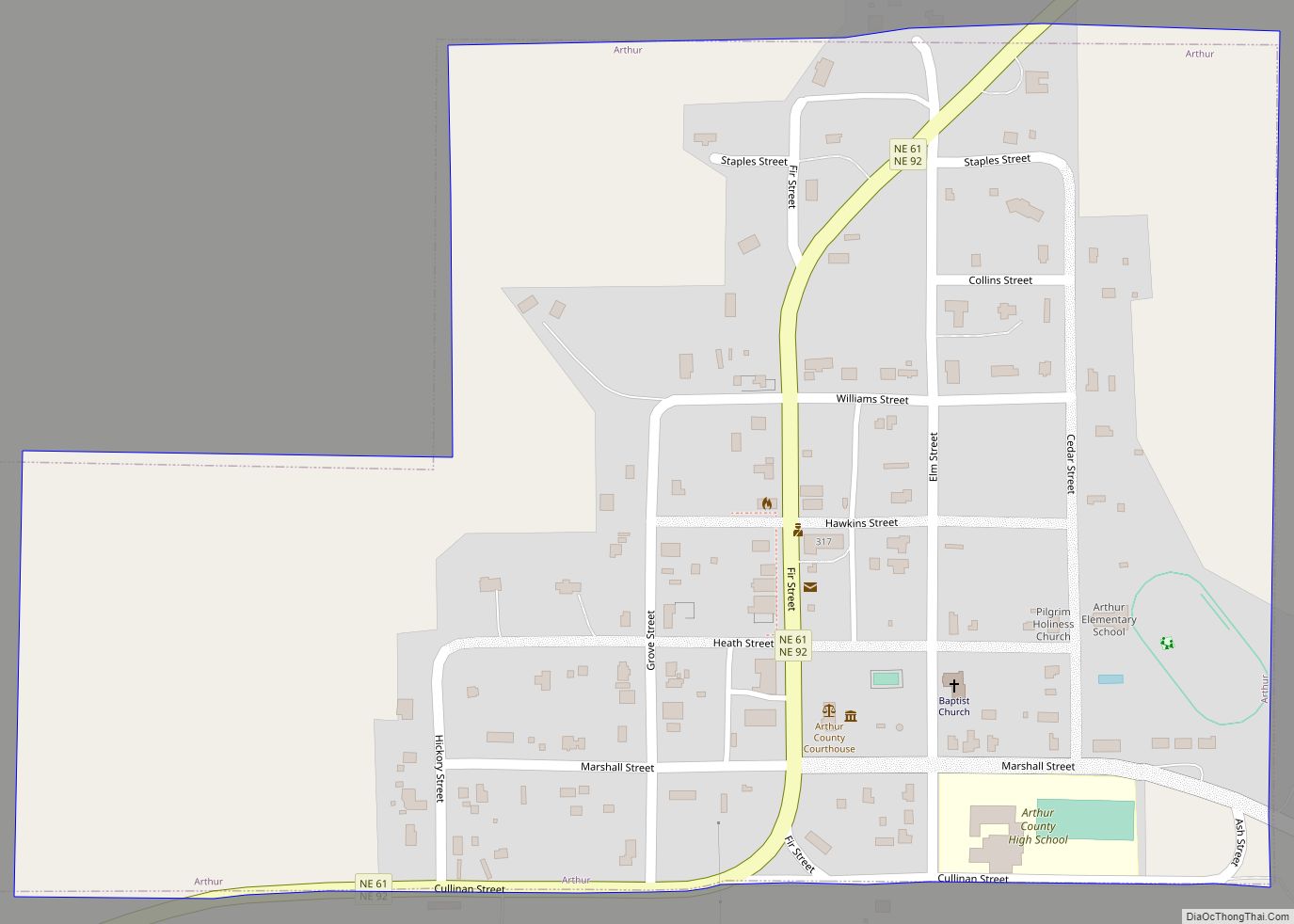
Online Interactive Map
Click on ![]() to view map in "full screen" mode.
to view map in "full screen" mode.
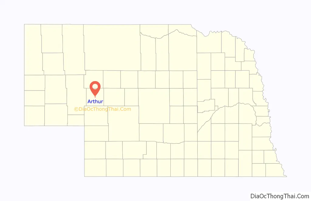
Arthur location map. Where is Arthur village?

History
Arthur was founded in 1913 to be the seat of Arthur County, then just organizing. The town and county were both named for President Chester A. Arthur. Arthur was incorporated as a village in 1944. The first county office was a covered wagon, with a one-room courthouse being built in 1915. A year before that, in the Spring, a general store was constructed, and afterward a newspaper, the first church and the post office were established. A one-room highschool was also built in 1914, expanding to two rooms in 1920. In 1916 the Arthur State Bank was founded. Into the 1920s, Arthur continued to be built. The town got electricity in 1926, though most of the county would not have it until the early 1950s.
Then in 1932, the Great Depression struck Arthur, closing its bank, which was not replaced until 1939 with the Arthur County Co-op Credit Association. Following WWII, in 1950 construction of a new, large and modern highschool was completed. A new courthouse was built in 1960-1961. In 1980, the census population was 125.
Historic sites
Two sites in Arthur are listed in the National Register of Historic Places. The Pilgrim Holiness Church was built in 1928 out of straw bales, in response to the region’s dearth of trees or construction sod. The First Arthur County Courthouse and Jail complex was built in 1914-15; the courthouse is billed as the smallest ever built in the United States. Both sites are now maintained by the Arthur County Historical Society.
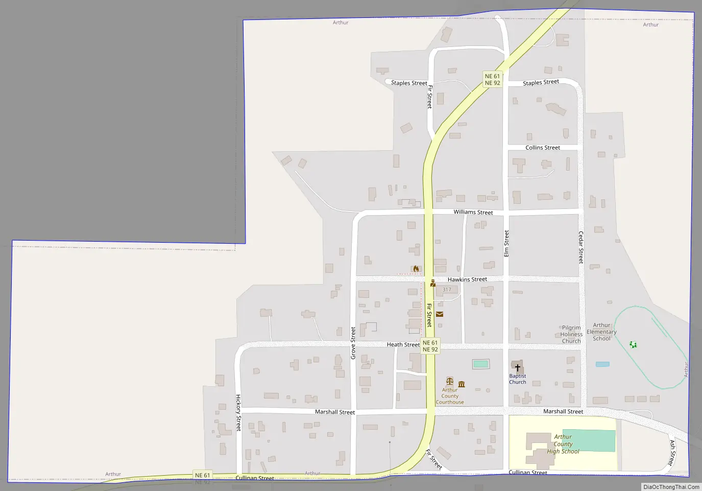
Arthur Road Map
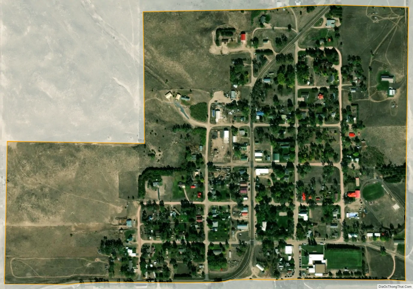
Arthur city Satellite Map
Geography
Arthur is located at 41°34′20″N 101°41′27″W / 41.572244°N 101.690738°W / 41.572244; -101.690738 (41.572244, −101.690738), in the Nebraska Sandhills.
According to the United States Census Bureau, the village has a total area of 0.31 square miles (0.80 km), all land.
Climate
Arthur has a borderline humid continental climate (Köppen Dfa/Dwa) just wet enough to avoid being classed as a cool semi-arid climate (BSk). Like most of the High Plains, winters vary from frigid due to incursions of Arctic air, to an average of six afternoons between December and February of 60 °F or 15.6 °C or higher during the afternoon due to chinook winds off the Rocky Mountains. In contrast, 18.2 mornings below 0 °F or −17.8 °C can be expected each winter, alongside 176.5 mornings below freezing and 38.6 afternoons that do not top freezing. Snowfall is moderate in winter due to dryness: the median between 1971 and 2000 being 24.0 inches or 0.61 metres and no day having median snow cover over 3 inches or 0.076 metres.
Spring warms up steadily but erratically: although the first afternoon over 70 °F or 21.1 °C can be expected on March 13, the last morning below freezing is not expected until May 14, and the first fall morning below freezing can be expected on September 26, giving a frost-free season of only 134 days. Most precipitation falls as rain from late spring and summer thunderstorms: the wettest month on record is June 2014 with 8.89 inches (225.8 mm) and the wettest calendar year 2009 with 28.56 inches (725.4 mm), whilst the driest year on record has been 1931 with 9.02 inches (229.1 mm). The wettest day on record has been September 4, 1937 with 3.58 inches or 90.9 millimetres. During dry spells with the upper subtropical ridge is pushed northwards, heatwaves and droughts can occur: 113 °F or 45 °C was recorded during the infamous 1936 heat wave, when Arthur averaged 98.6 °F (37.0 °C) as monthly maximum; in contrast, the wet month of July 1958 had an average maximum of only 79.8 °F or 26.6 °C.
See also
Map of Nebraska State and its subdivision:- Adams
- Antelope
- Arthur
- Banner
- Blaine
- Boone
- Box Butte
- Boyd
- Brown
- Buffalo
- Burt
- Butler
- Cass
- Cedar
- Chase
- Cherry
- Cheyenne
- Clay
- Colfax
- Cuming
- Custer
- Dakota
- Dawes
- Dawson
- Deuel
- Dixon
- Dodge
- Douglas
- Dundy
- Fillmore
- Franklin
- Frontier
- Furnas
- Gage
- Garden
- Garfield
- Gosper
- Grant
- Greeley
- Hall
- Hamilton
- Harlan
- Hayes
- Hitchcock
- Holt
- Hooker
- Howard
- Jefferson
- Johnson
- Kearney
- Keith
- Keya Paha
- Kimball
- Knox
- Lancaster
- Lincoln
- Logan
- Loup
- Madison
- McPherson
- Merrick
- Morrill
- Nance
- Nemaha
- Nuckolls
- Otoe
- Pawnee
- Perkins
- Phelps
- Pierce
- Platte
- Polk
- Red Willow
- Richardson
- Rock
- Saline
- Sarpy
- Saunders
- Scotts Bluff
- Seward
- Sheridan
- Sherman
- Sioux
- Stanton
- Thayer
- Thomas
- Thurston
- Valley
- Washington
- Wayne
- Webster
- Wheeler
- York
- Alabama
- Alaska
- Arizona
- Arkansas
- California
- Colorado
- Connecticut
- Delaware
- District of Columbia
- Florida
- Georgia
- Hawaii
- Idaho
- Illinois
- Indiana
- Iowa
- Kansas
- Kentucky
- Louisiana
- Maine
- Maryland
- Massachusetts
- Michigan
- Minnesota
- Mississippi
- Missouri
- Montana
- Nebraska
- Nevada
- New Hampshire
- New Jersey
- New Mexico
- New York
- North Carolina
- North Dakota
- Ohio
- Oklahoma
- Oregon
- Pennsylvania
- Rhode Island
- South Carolina
- South Dakota
- Tennessee
- Texas
- Utah
- Vermont
- Virginia
- Washington
- West Virginia
- Wisconsin
- Wyoming