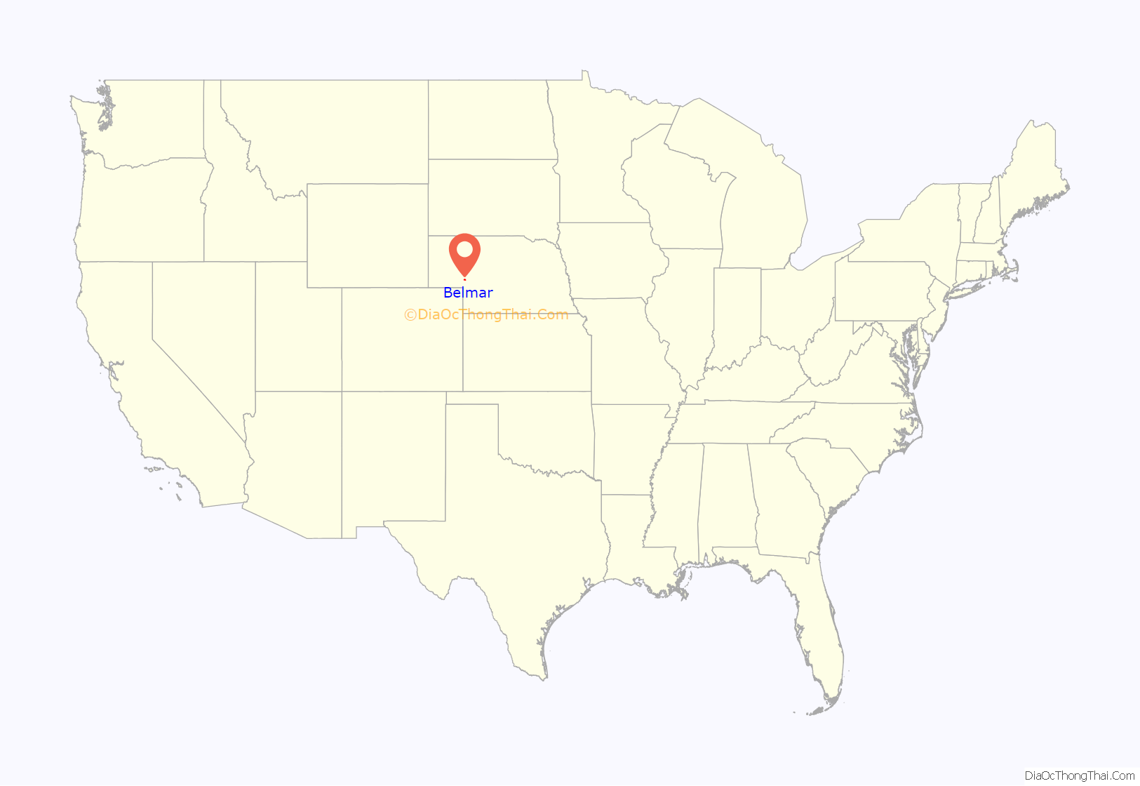
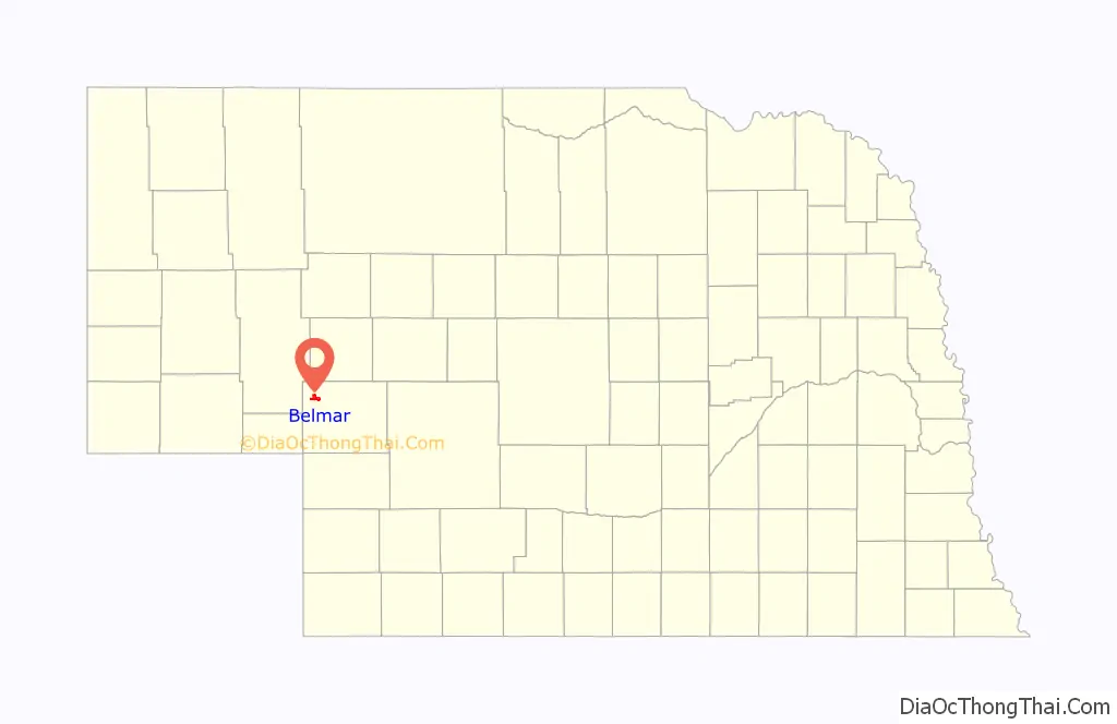
Belmar is an unincorporated community and census-designated place in Keith County, Nebraska, United States. As of the 2010 census it had a population of 216.
| Name: | Belmar CDP |
|---|---|
| LSAD Code: | 57 |
| LSAD Description: | CDP (suffix) |
| State: | Nebraska |
| County: | Keith County |
| Elevation: | 3,353 ft (1,022 m) |
| Total Area: | 4.58 sq mi (11.87 km²) |
| Land Area: | 4.58 sq mi (11.87 km²) |
| Water Area: | 0.00 sq mi (0.00 km²) |
| Total Population: | 199 |
| Population Density: | 43.43/sq mi (16.77/km²) |
| ZIP code: | 69147 |
| FIPS code: | 3104055 |
| GNISfeature ID: | 835246 |
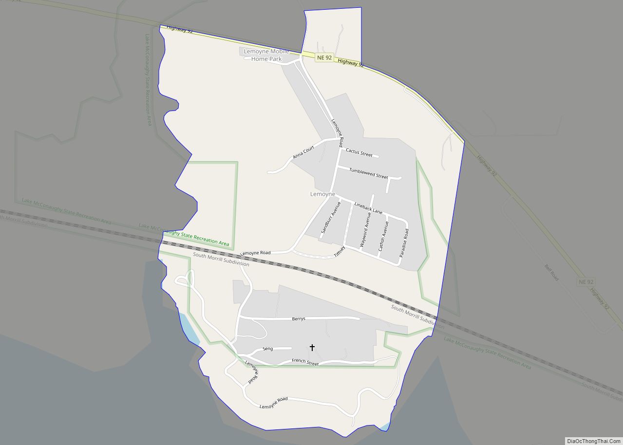
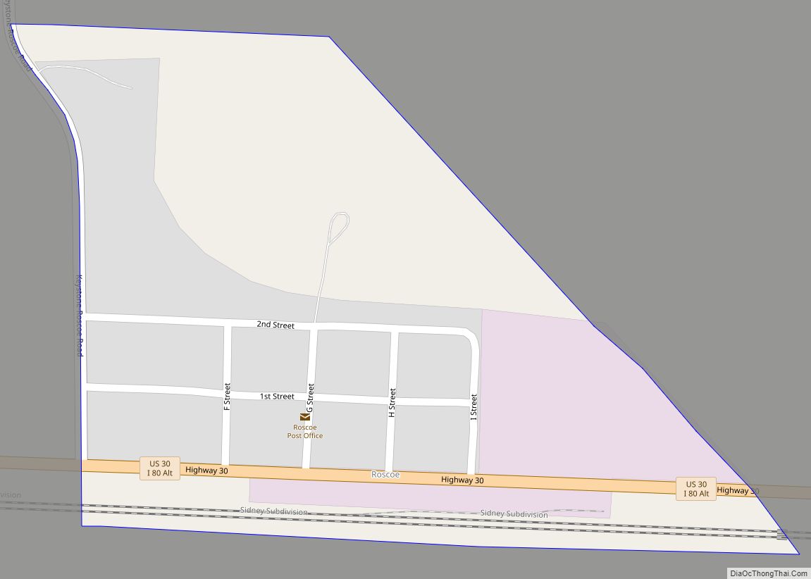
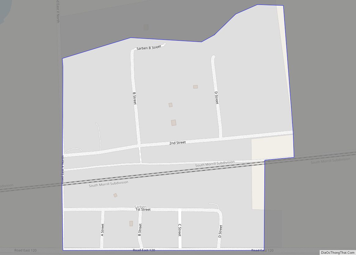
Online Interactive Map
Click on ![]() to view map in "full screen" mode.
to view map in "full screen" mode.
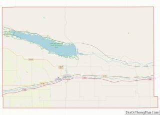
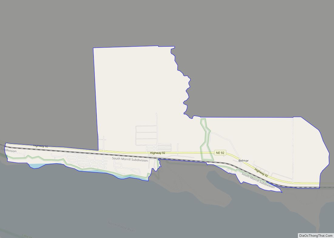
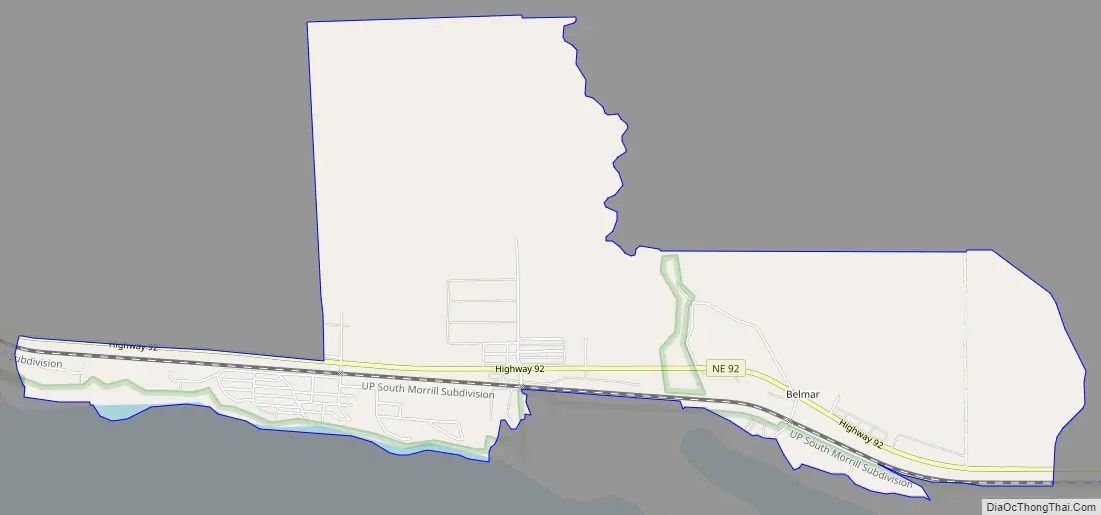
Belmar location map. Where is Belmar CDP?
History
Belmar got its start following construction of the Union Pacific Railroad through the territory. It was likely named for a railroad official.
A post office was established at Belmar in 1910, and remained in operation until it was discontinued in 1941.
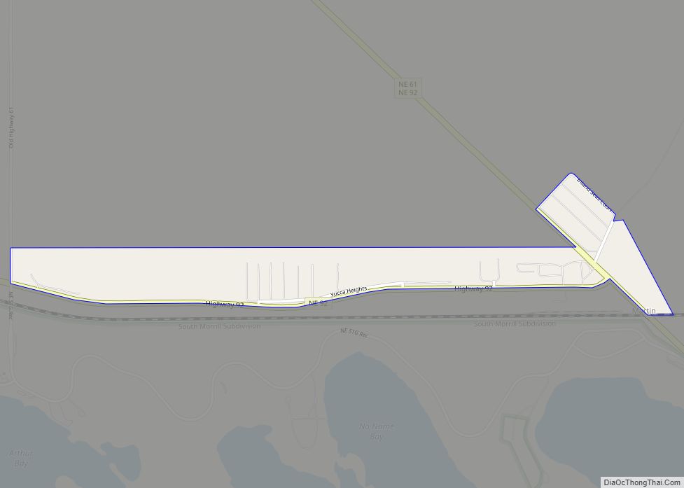
Belmar Road Map
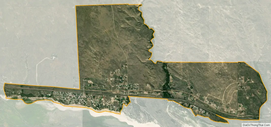
Belmar city Satellite Map
Geography
Belmar is in northwestern Keith County, on the north side of Lake McConaughy, a reservoir on the North Platte River. Nebraska Highway 92 runs through the community, leading west 12 miles (19 km) to Lewellen and east 6 miles (10 km) to Lemoyne. Ogallala, the Keith county seat, is 24 miles (39 km) to the southeast via Highways 92 and 61.
According to the U.S. Census Bureau, the Belmar CDP has an area of 4.6 square miles (11.9 km), all land.
See also
Map of Nebraska State and its subdivision:- Adams
- Antelope
- Arthur
- Banner
- Blaine
- Boone
- Box Butte
- Boyd
- Brown
- Buffalo
- Burt
- Butler
- Cass
- Cedar
- Chase
- Cherry
- Cheyenne
- Clay
- Colfax
- Cuming
- Custer
- Dakota
- Dawes
- Dawson
- Deuel
- Dixon
- Dodge
- Douglas
- Dundy
- Fillmore
- Franklin
- Frontier
- Furnas
- Gage
- Garden
- Garfield
- Gosper
- Grant
- Greeley
- Hall
- Hamilton
- Harlan
- Hayes
- Hitchcock
- Holt
- Hooker
- Howard
- Jefferson
- Johnson
- Kearney
- Keith
- Keya Paha
- Kimball
- Knox
- Lancaster
- Lincoln
- Logan
- Loup
- Madison
- McPherson
- Merrick
- Morrill
- Nance
- Nemaha
- Nuckolls
- Otoe
- Pawnee
- Perkins
- Phelps
- Pierce
- Platte
- Polk
- Red Willow
- Richardson
- Rock
- Saline
- Sarpy
- Saunders
- Scotts Bluff
- Seward
- Sheridan
- Sherman
- Sioux
- Stanton
- Thayer
- Thomas
- Thurston
- Valley
- Washington
- Wayne
- Webster
- Wheeler
- York
- Alabama
- Alaska
- Arizona
- Arkansas
- California
- Colorado
- Connecticut
- Delaware
- District of Columbia
- Florida
- Georgia
- Hawaii
- Idaho
- Illinois
- Indiana
- Iowa
- Kansas
- Kentucky
- Louisiana
- Maine
- Maryland
- Massachusetts
- Michigan
- Minnesota
- Mississippi
- Missouri
- Montana
- Nebraska
- Nevada
- New Hampshire
- New Jersey
- New Mexico
- New York
- North Carolina
- North Dakota
- Ohio
- Oklahoma
- Oregon
- Pennsylvania
- Rhode Island
- South Carolina
- South Dakota
- Tennessee
- Texas
- Utah
- Vermont
- Virginia
- Washington
- West Virginia
- Wisconsin
- Wyoming