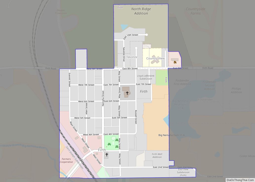
Firth is a village in Lancaster County, Nebraska, United States. It is part of the Lincoln, Nebraska Metropolitan Statistical Area. The population was 649 at the 2020 census.
| Name: | Firth village |
|---|---|
| LSAD Code: | 47 |
| LSAD Description: | village (suffix) |
| State: | Nebraska |
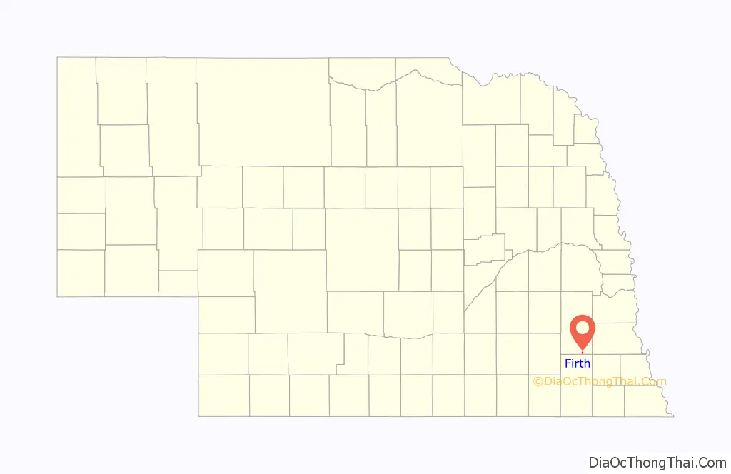
| County: | Lancaster County |
| Elevation: | 1,355 ft (413 m) |
| Total Area: | 0.35 sq mi (0.92 km²) |
| Land Area: | 0.35 sq mi (0.92 km²) |
| Water Area: | 0.00 sq mi (0.00 km²) |
| Total Population: | 649 |
| Population Density: | 1,838.53/sq mi (708.98/km²) |
| ZIP code: | 68358 |
| Area code: | 402 |
| FIPS code: | 3116935 |
| GNISfeature ID: | 2398879 |
| Website: | http://www.firth.nebraska.gov |
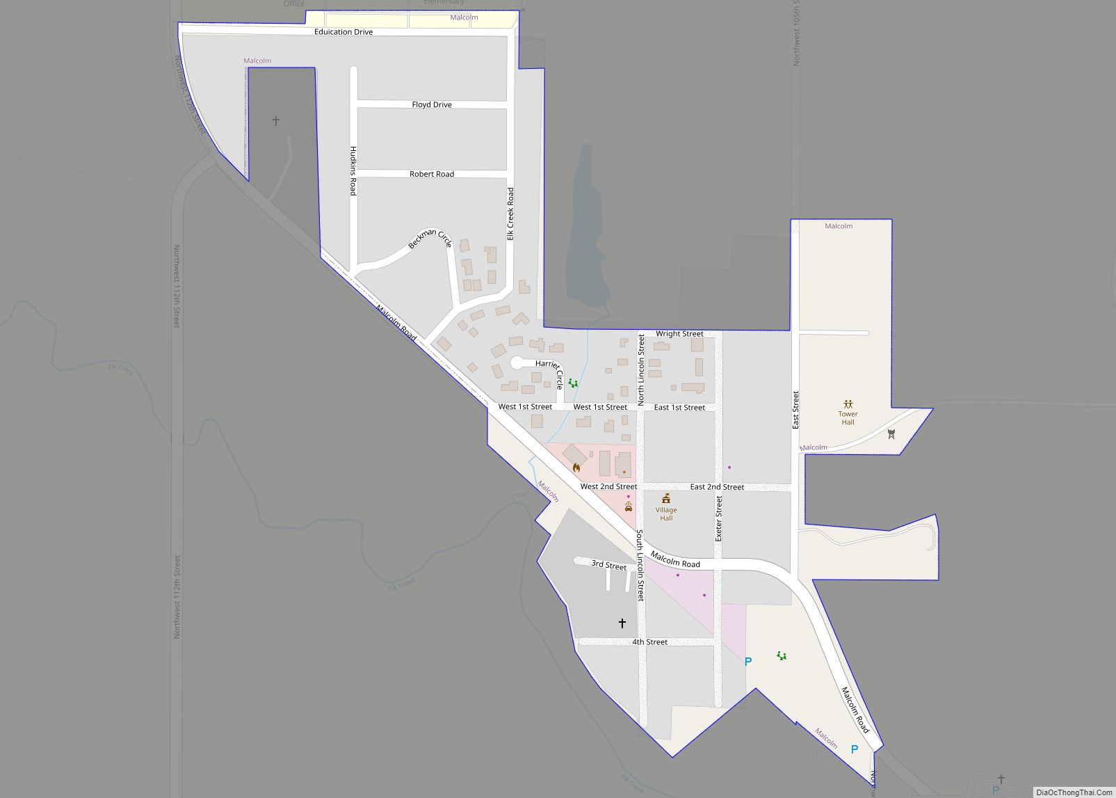
Online Interactive Map
Click on ![]() to view map in "full screen" mode.
to view map in "full screen" mode.
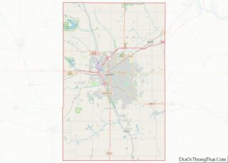
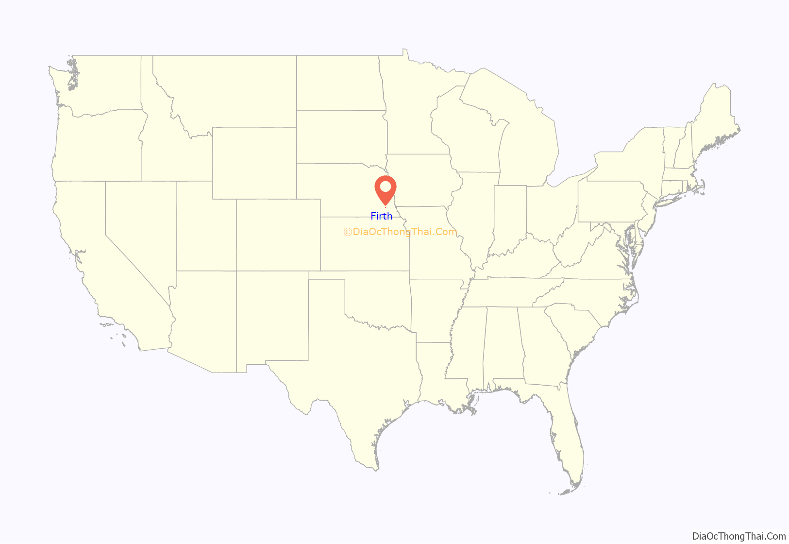
Firth location map. Where is Firth village?
History
A courthouse square was planned in the area that would become Firth sometime before 1860. However, due to Firth’s remote location, residents would have had to travel to Nebraska City for supplies, meaning that the area remained largely uninhabited by non-Natives for many years. Firth was settled in the early 1870s, as the Atchison & Nebraska Railroad was extended toward Lincoln. The post office was established in 1872, named for Superintendent Frank Firth of the Atchison & Nebraska Railroad, and was incorporated in 1879.
Once the railroad was completed, Firth became an important hub of business on the Atchison & Nebraska line, shipping 700 carloads of grain and livestock daily. In 1916, a brick school was built to replace the two-story schoolhouse which had previously served the village. In 1964, Firth became one of several schools to consolidate and form the Norris School District. The brick school building was torn down in 1971 after years of vacancy. Fundraising in the area allowed for the Lakeview Rest Home to be built in the 1970s on land donated by Henry and Bertha TeKolste.
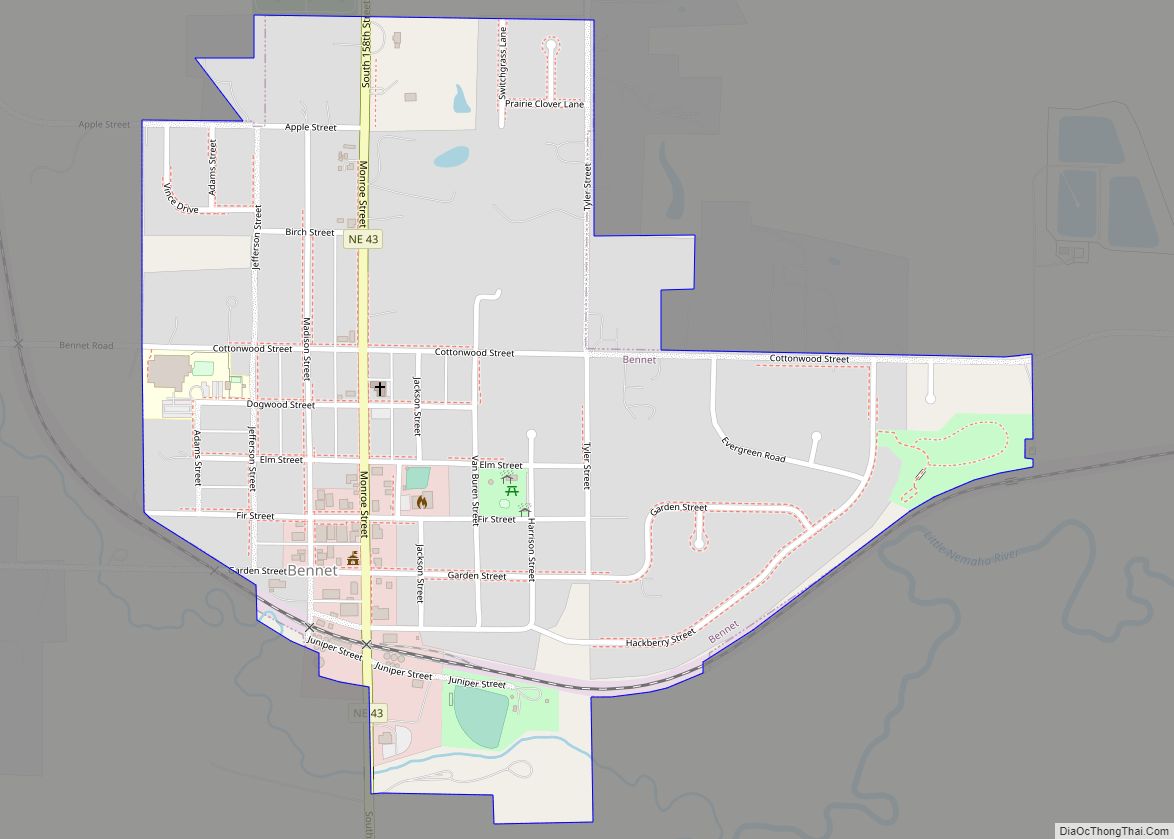
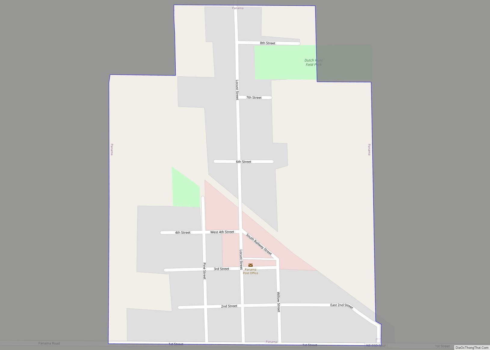
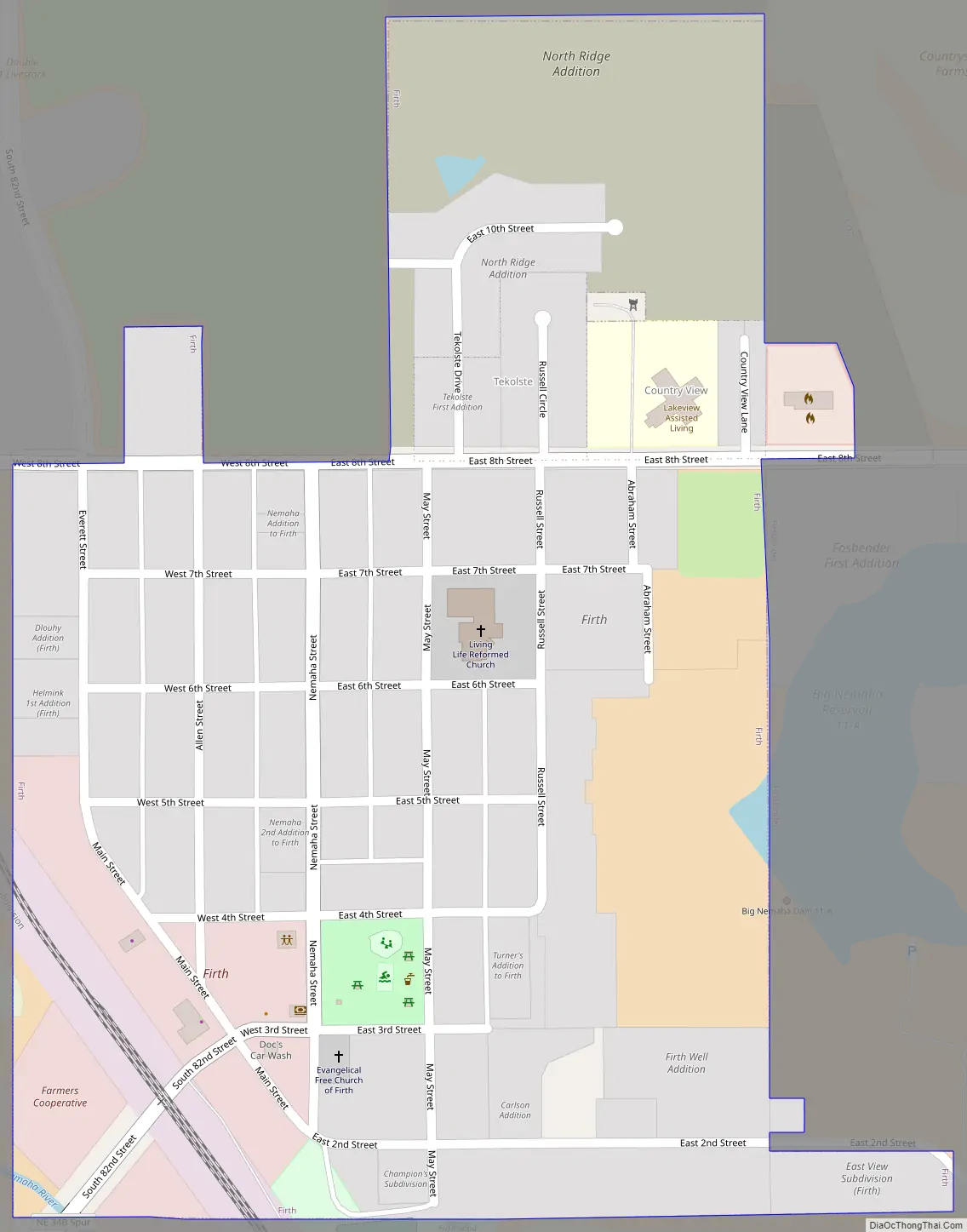
Firth Road Map
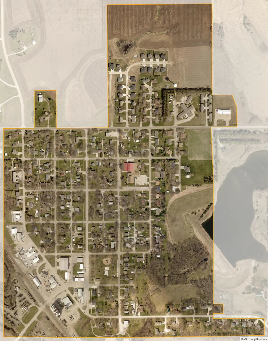
Firth city Satellite Map
Geography
According to the United States Census Bureau, the village has a total area of 0.28 square miles (0.73 km), all land. Firth is bordered to the east by Big Nemaha Reservoir.
See also
Map of Nebraska State and its subdivision:- Adams
- Antelope
- Arthur
- Banner
- Blaine
- Boone
- Box Butte
- Boyd
- Brown
- Buffalo
- Burt
- Butler
- Cass
- Cedar
- Chase
- Cherry
- Cheyenne
- Clay
- Colfax
- Cuming
- Custer
- Dakota
- Dawes
- Dawson
- Deuel
- Dixon
- Dodge
- Douglas
- Dundy
- Fillmore
- Franklin
- Frontier
- Furnas
- Gage
- Garden
- Garfield
- Gosper
- Grant
- Greeley
- Hall
- Hamilton
- Harlan
- Hayes
- Hitchcock
- Holt
- Hooker
- Howard
- Jefferson
- Johnson
- Kearney
- Keith
- Keya Paha
- Kimball
- Knox
- Lancaster
- Lincoln
- Logan
- Loup
- Madison
- McPherson
- Merrick
- Morrill
- Nance
- Nemaha
- Nuckolls
- Otoe
- Pawnee
- Perkins
- Phelps
- Pierce
- Platte
- Polk
- Red Willow
- Richardson
- Rock
- Saline
- Sarpy
- Saunders
- Scotts Bluff
- Seward
- Sheridan
- Sherman
- Sioux
- Stanton
- Thayer
- Thomas
- Thurston
- Valley
- Washington
- Wayne
- Webster
- Wheeler
- York
- Alabama
- Alaska
- Arizona
- Arkansas
- California
- Colorado
- Connecticut
- Delaware
- District of Columbia
- Florida
- Georgia
- Hawaii
- Idaho
- Illinois
- Indiana
- Iowa
- Kansas
- Kentucky
- Louisiana
- Maine
- Maryland
- Massachusetts
- Michigan
- Minnesota
- Mississippi
- Missouri
- Montana
- Nebraska
- Nevada
- New Hampshire
- New Jersey
- New Mexico
- New York
- North Carolina
- North Dakota
- Ohio
- Oklahoma
- Oregon
- Pennsylvania
- Rhode Island
- South Carolina
- South Dakota
- Tennessee
- Texas
- Utah
- Vermont
- Virginia
- Washington
- West Virginia
- Wisconsin
- Wyoming