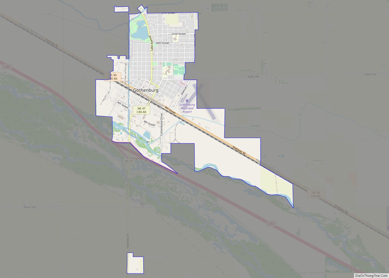
Gothenburg is a city in Dawson County, Nebraska, United States. It is part of the Lexington, Nebraska Micropolitan Statistical Area. The population was 3,574 at the 2010 census.
| Name: | Gothenburg city |
|---|---|
| LSAD Code: | 25 |
| LSAD Description: | city (suffix) |
| State: | Nebraska |
| County: | Dawson County |
| Elevation: | 2,569 ft (783 m) |
| Total Area: | 3.68 sq mi (9.52 km²) |
| Land Area: | 3.63 sq mi (9.41 km²) |
| Water Area: | 0.04 sq mi (0.12 km²) |
| Total Population: | 3,478 |
| Population Density: | 957.60/sq mi (369.75/km²) |
| ZIP code: | 69138 |
| Area code: | 308 |
| FIPS code: | 3119385 |
| GNISfeature ID: | 0829595 |
| Website: | http://www.ci.gothenburg.ne.us/ |
Online Interactive Map
Click on ![]() to view map in "full screen" mode.
to view map in "full screen" mode.
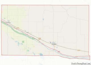
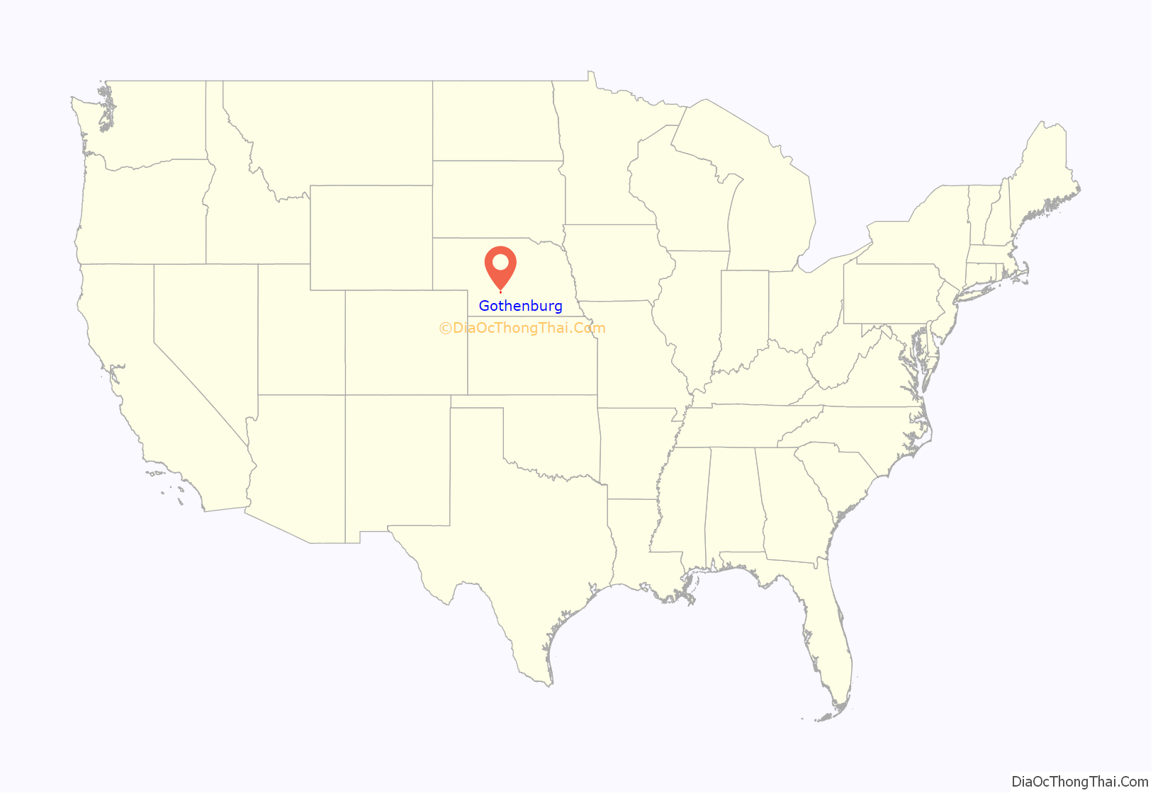
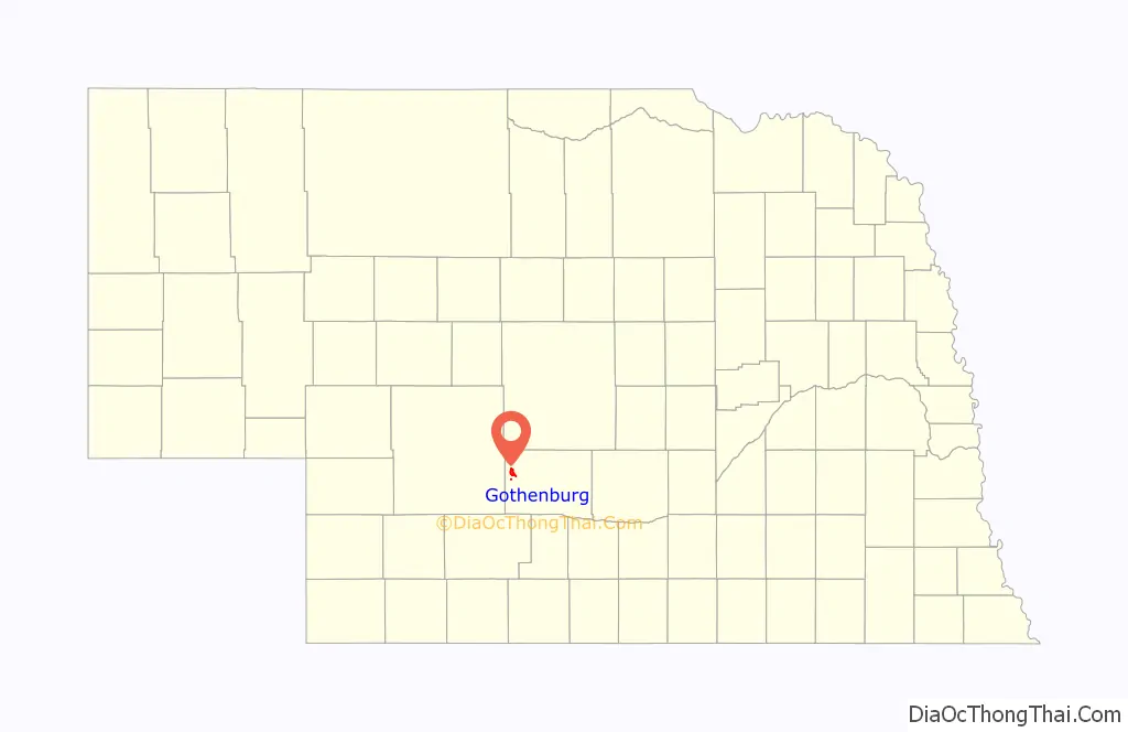
Gothenburg location map. Where is Gothenburg city?
History
Gothenburg, Nebraska is named after Gothenburg, Sweden, and is noted for its large number of residents of Swedish descent. Gothenburg, Nebraska, and Gothenburg (Swedish: Göteborg), Sweden, are believed to be the only two cities named Gothenburg in the world.
Gothenburg was founded in 1882 by Olof Bergstrom. After coming to America from Sweden in 1881, Bergstrom worked for a time on the Union Pacific Railroad, then homesteaded in Dawson County near Gothenburg. He eventually became a land agent for the UP. Bergstrom selected the site that was to become Gothenburg and located a farmstead about a mile north. The Union Pacific Railroad laid out the original town of eight blocks parallel to the railroad tracks. Bergstrom made several return trips to Sweden to lead groups of settlers to Dawson County.
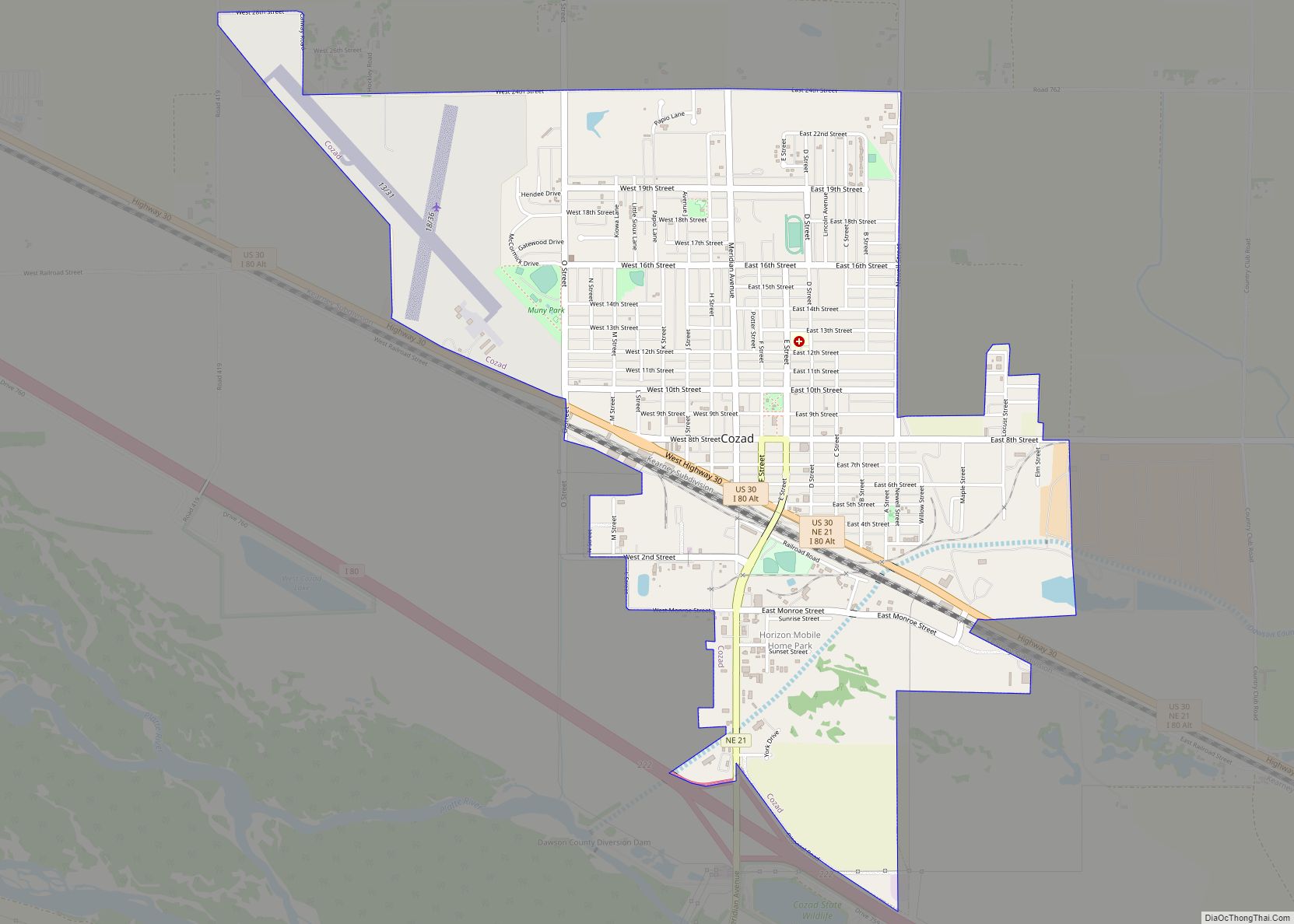
Gothenburg Road Map
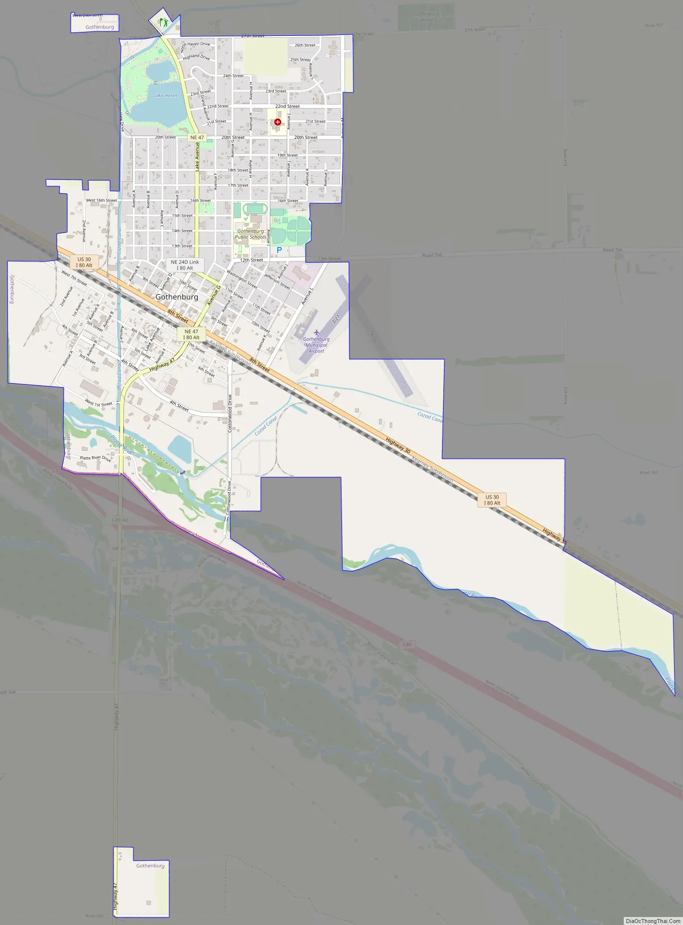
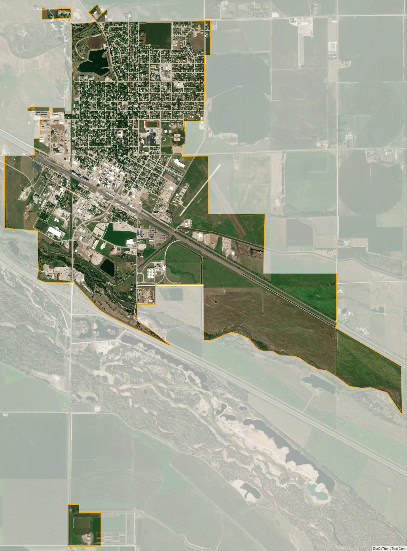
Gothenburg city Satellite Map
Geography
Gothenburg is located at 40°55′54″N 100°9′34″W / 40.93167°N 100.15944°W / 40.93167; -100.15944 (40.931560, -100.159381).
According to the United States Census Bureau, the city has a total area of 3.64 square miles (9.43 km), of which 3.59 square miles (9.30 km) is land and 0.05 square miles (0.13 km) is water.
Climate
See also
Map of Nebraska State and its subdivision:- Adams
- Antelope
- Arthur
- Banner
- Blaine
- Boone
- Box Butte
- Boyd
- Brown
- Buffalo
- Burt
- Butler
- Cass
- Cedar
- Chase
- Cherry
- Cheyenne
- Clay
- Colfax
- Cuming
- Custer
- Dakota
- Dawes
- Dawson
- Deuel
- Dixon
- Dodge
- Douglas
- Dundy
- Fillmore
- Franklin
- Frontier
- Furnas
- Gage
- Garden
- Garfield
- Gosper
- Grant
- Greeley
- Hall
- Hamilton
- Harlan
- Hayes
- Hitchcock
- Holt
- Hooker
- Howard
- Jefferson
- Johnson
- Kearney
- Keith
- Keya Paha
- Kimball
- Knox
- Lancaster
- Lincoln
- Logan
- Loup
- Madison
- McPherson
- Merrick
- Morrill
- Nance
- Nemaha
- Nuckolls
- Otoe
- Pawnee
- Perkins
- Phelps
- Pierce
- Platte
- Polk
- Red Willow
- Richardson
- Rock
- Saline
- Sarpy
- Saunders
- Scotts Bluff
- Seward
- Sheridan
- Sherman
- Sioux
- Stanton
- Thayer
- Thomas
- Thurston
- Valley
- Washington
- Wayne
- Webster
- Wheeler
- York
- Alabama
- Alaska
- Arizona
- Arkansas
- California
- Colorado
- Connecticut
- Delaware
- District of Columbia
- Florida
- Georgia
- Hawaii
- Idaho
- Illinois
- Indiana
- Iowa
- Kansas
- Kentucky
- Louisiana
- Maine
- Maryland
- Massachusetts
- Michigan
- Minnesota
- Mississippi
- Missouri
- Montana
- Nebraska
- Nevada
- New Hampshire
- New Jersey
- New Mexico
- New York
- North Carolina
- North Dakota
- Ohio
- Oklahoma
- Oregon
- Pennsylvania
- Rhode Island
- South Carolina
- South Dakota
- Tennessee
- Texas
- Utah
- Vermont
- Virginia
- Washington
- West Virginia
- Wisconsin
- Wyoming