Gretna is a city in Sarpy County, Nebraska, United States. The population was 5,083 at the 2020 census.
| Name: | Gretna city |
|---|---|
| LSAD Code: | 25 |
| LSAD Description: | city (suffix) |
| State: | Nebraska |
| County: | Sarpy County |
| Elevation: | 1,112 ft (339 m) |
| Total Area: | 6.93 sq mi (17.96 km²) |
| Land Area: | 6.84 sq mi (17.71 km²) |
| Water Area: | 0.10 sq mi (0.25 km²) |
| Total Population: | 5,083 |
| Population Density: | 743.56/sq mi (287.07/km²) |
| ZIP code: | 68028 |
| Area code: | 402 |
| FIPS code: | 3120260 |
| GNISfeature ID: | 2394248 |
| Website: | http://www.gretnane.org/ |
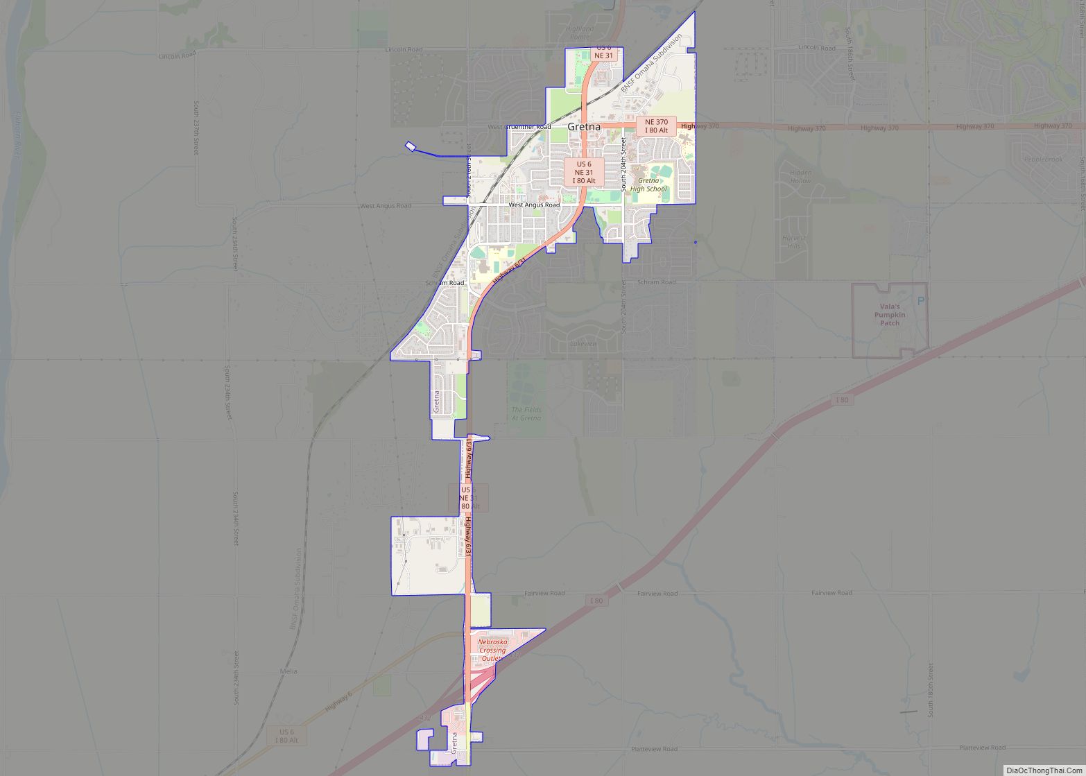
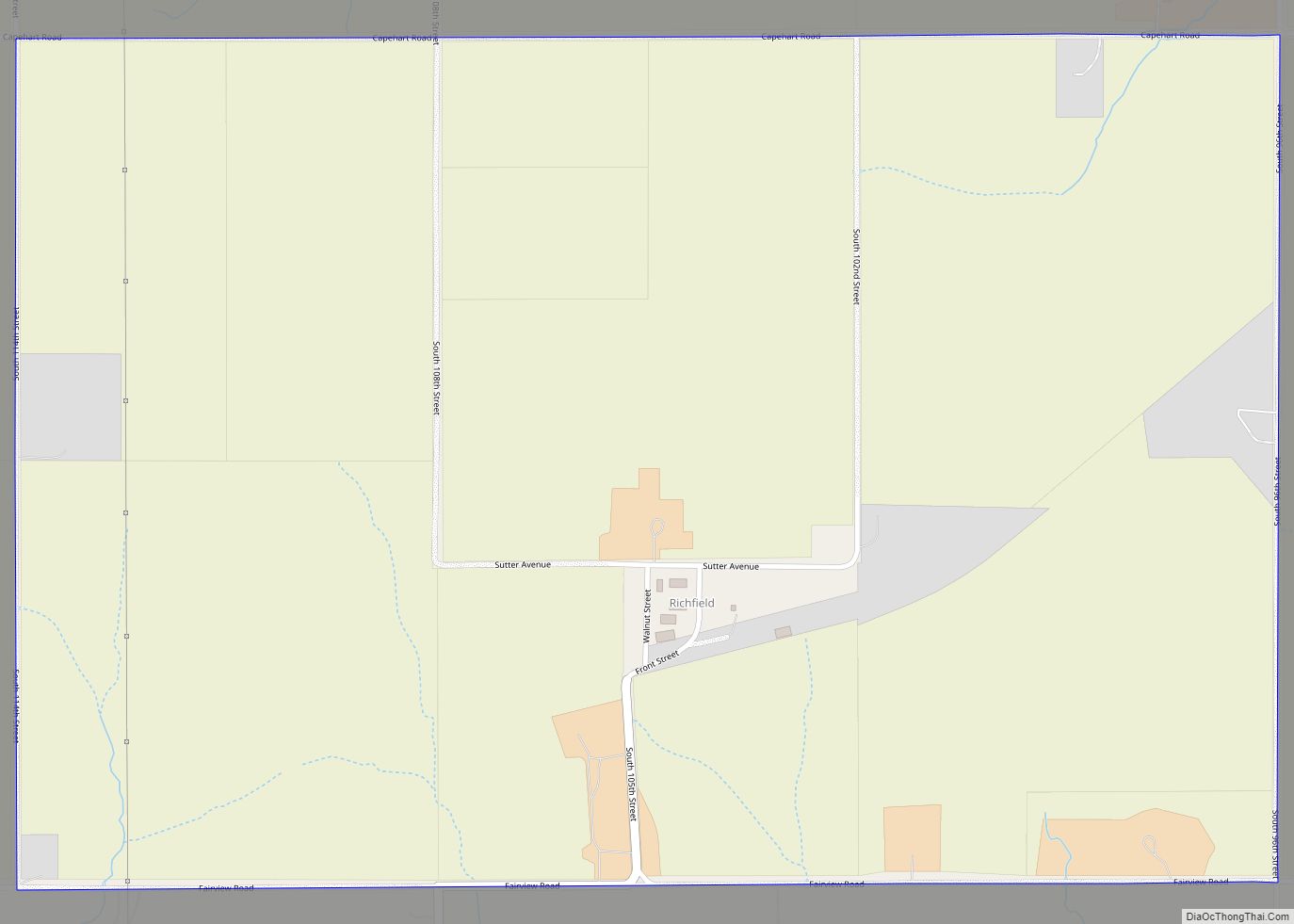
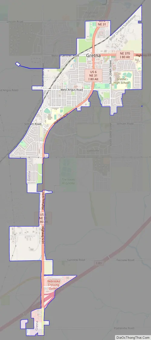
Online Interactive Map
Click on ![]() to view map in "full screen" mode.
to view map in "full screen" mode.
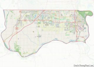
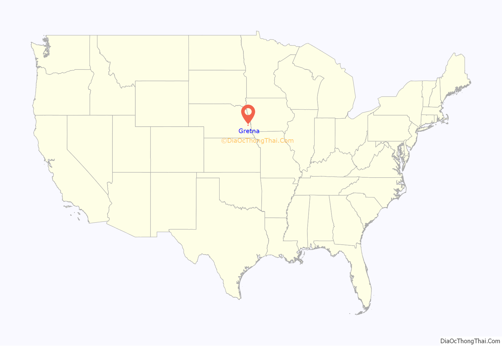
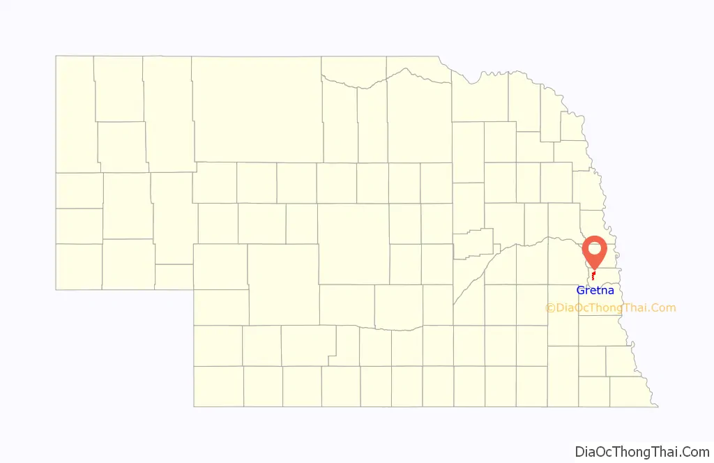
Gretna location map. Where is Gretna city?
History
Gretna started shortly after the Burlington Railroad built a short line between Omaha and Ashland in the summer of 1886. Advent of the village of Gretna on this new laid rail line was the cue for the exit of the nearby trading post of Forest City, which had existed since 1856. In its day, Forest City, located 2.5 miles southwest of where Gretna now stands, was a flourishing and busy place, but it was doomed by the rail road which passed it by. The only marker that exists today to show the site of old Forest City is the cemetery (Holy Sepulcher) which is located a little to the east of what was the center of activity in the settlement. Names that were prominent in the beginnings of Forest City were the families of William Langdon, John Thomas and John Conner.
The Lincoln Land Company, recognizing the potential of the site, surveyed and platted the town site of Gretna in 1887. The village was incorporated by July 10, 1889. The name suggests Scotland’s Gretna Green, the ancestral county of some of the earliest settlers.
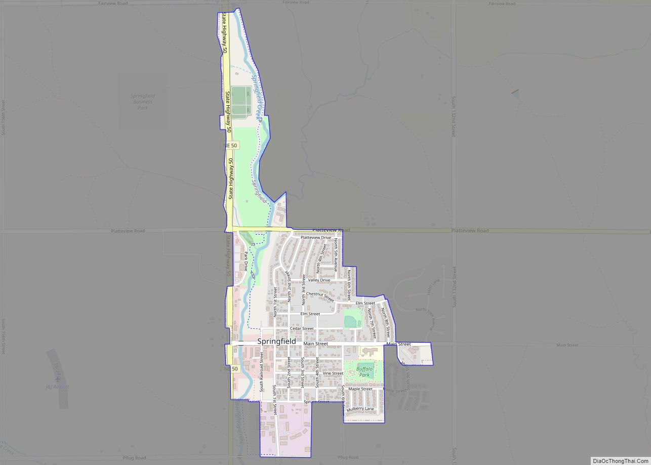
Gretna Road Map
Gretna city Satellite Map
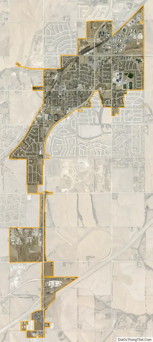
Geography
According to the United States Census Bureau, the city has a total area of 2.10 square miles (5.44 km), all land.
See also
Map of Nebraska State and its subdivision:- Adams
- Antelope
- Arthur
- Banner
- Blaine
- Boone
- Box Butte
- Boyd
- Brown
- Buffalo
- Burt
- Butler
- Cass
- Cedar
- Chase
- Cherry
- Cheyenne
- Clay
- Colfax
- Cuming
- Custer
- Dakota
- Dawes
- Dawson
- Deuel
- Dixon
- Dodge
- Douglas
- Dundy
- Fillmore
- Franklin
- Frontier
- Furnas
- Gage
- Garden
- Garfield
- Gosper
- Grant
- Greeley
- Hall
- Hamilton
- Harlan
- Hayes
- Hitchcock
- Holt
- Hooker
- Howard
- Jefferson
- Johnson
- Kearney
- Keith
- Keya Paha
- Kimball
- Knox
- Lancaster
- Lincoln
- Logan
- Loup
- Madison
- McPherson
- Merrick
- Morrill
- Nance
- Nemaha
- Nuckolls
- Otoe
- Pawnee
- Perkins
- Phelps
- Pierce
- Platte
- Polk
- Red Willow
- Richardson
- Rock
- Saline
- Sarpy
- Saunders
- Scotts Bluff
- Seward
- Sheridan
- Sherman
- Sioux
- Stanton
- Thayer
- Thomas
- Thurston
- Valley
- Washington
- Wayne
- Webster
- Wheeler
- York
- Alabama
- Alaska
- Arizona
- Arkansas
- California
- Colorado
- Connecticut
- Delaware
- District of Columbia
- Florida
- Georgia
- Hawaii
- Idaho
- Illinois
- Indiana
- Iowa
- Kansas
- Kentucky
- Louisiana
- Maine
- Maryland
- Massachusetts
- Michigan
- Minnesota
- Mississippi
- Missouri
- Montana
- Nebraska
- Nevada
- New Hampshire
- New Jersey
- New Mexico
- New York
- North Carolina
- North Dakota
- Ohio
- Oklahoma
- Oregon
- Pennsylvania
- Rhode Island
- South Carolina
- South Dakota
- Tennessee
- Texas
- Utah
- Vermont
- Virginia
- Washington
- West Virginia
- Wisconsin
- Wyoming