Bellevue (French for “beautiful view”; previously named Belleview) is a suburban city in Sarpy County, Nebraska, United States. It is part of the Omaha–Council Bluffs metropolitan area, and had a population of 64,176 as of the 2020 Census, making it the third-largest city in Nebraska, behind Omaha and Lincoln, and the second largest city in the U.S. named “Bellevue,” behind Bellevue, Washington.
Originally settled by European Americans in the 1830s, Bellevue was incorporated in 1855 and is the oldest continuous town in Nebraska. It has been credited by the Nebraska State Legislature as being the state’s second-oldest settlement; previously it served as the seat of government in Nebraska.
| Name: | Bellevue city |
|---|---|
| LSAD Code: | 25 |
| LSAD Description: | city (suffix) |
| State: | Nebraska |
| County: | Sarpy County |
| Elevation: | 1,001 ft (305 m) |
| Total Area: | 21.71 sq mi (56.24 km²) |
| Land Area: | 21.49 sq mi (55.65 km²) |
| Water Area: | 0.23 sq mi (0.59 km²) |
| Total Population: | 64,176 |
| Population Density: | 2,986.74/sq mi (1,153.17/km²) |
| Area code: | 402/531 |
| FIPS code: | 3103950 |
| GNISfeature ID: | 2394120 |
| Website: | http://www.bellevue.net/ |
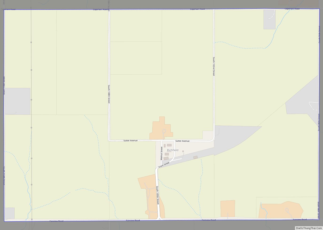
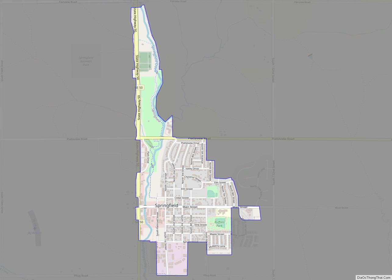
Online Interactive Map
Click on ![]() to view map in "full screen" mode.
to view map in "full screen" mode.
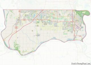
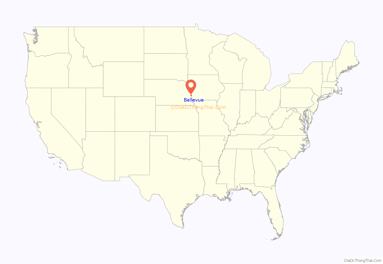
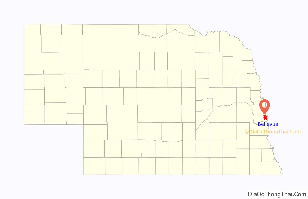
Bellevue location map. Where is Bellevue city?
History
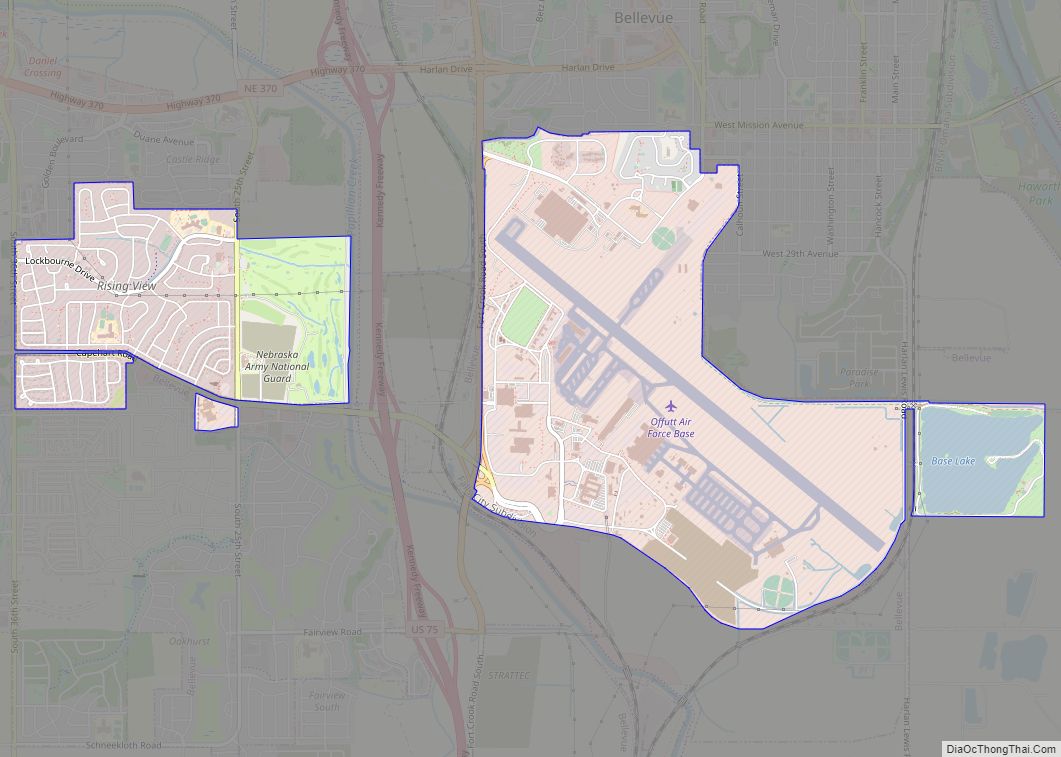
Bellevue was originally founded as a trading post for the Missouri Fur Company by Joshua Pilcher, but there were financial problems, and, eventually, Lucien Fontanelle became the owner of the post, and the first permanent resident of Bellevue. Moses Merrill founded a mission, which was the first Christian mission in Nebraska, in Bellevue. Since it was the oldest city in the Nebraska Territory, the residents were optimistic that Bellevue would become the capital of it, and the new territorial governor, Francis Burt, had already moved there, but shortly after, he died. The next governor selected Omaha as the capital instead. In 1921, the Offutt Air Force Base, housing the United States Strategic Command, was built south of Bellevue. The planes that dropped the Hiroshima and Nagasaki atomic bombs were built there.
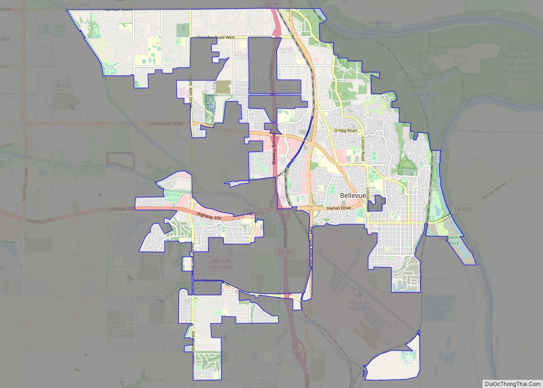
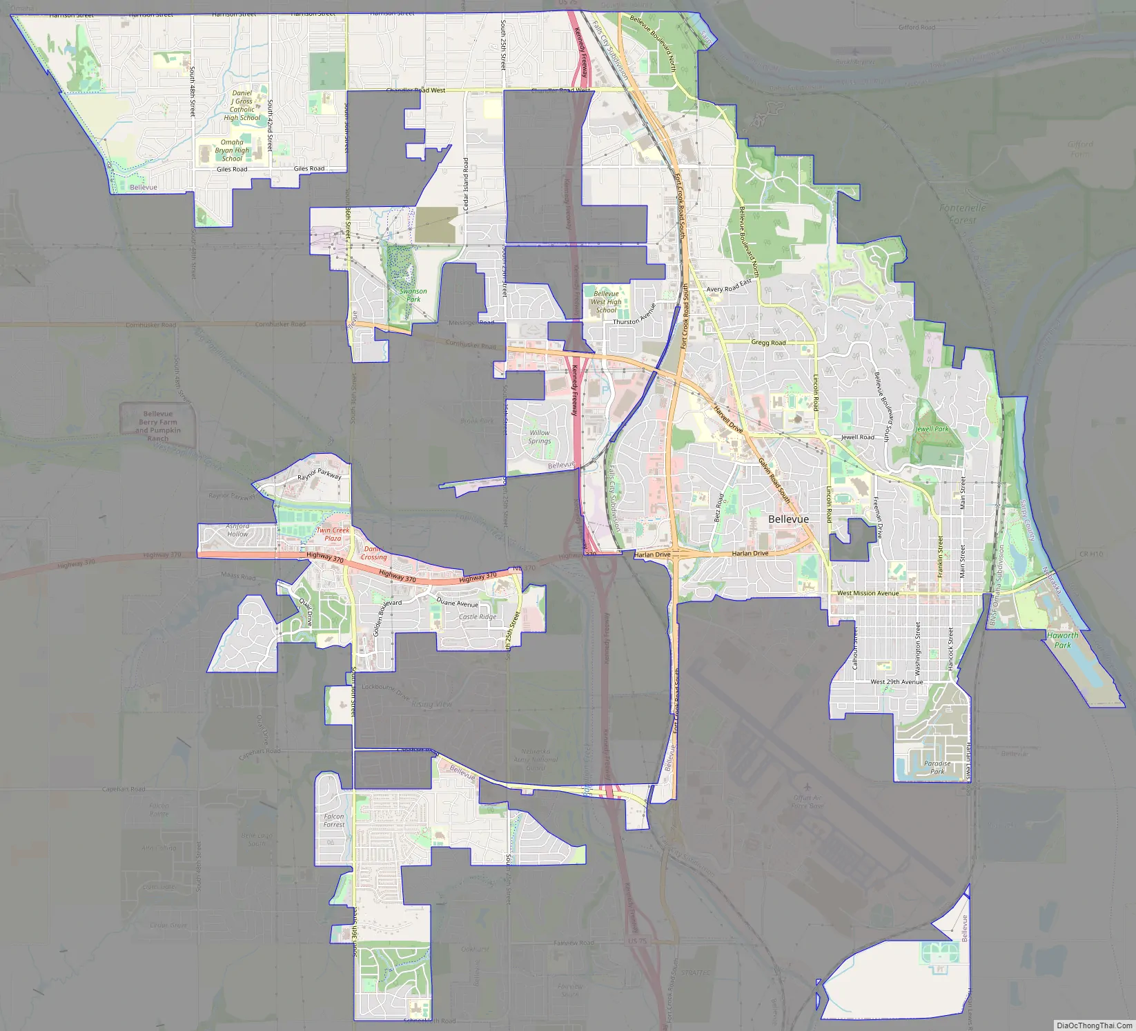
Bellevue Road Map
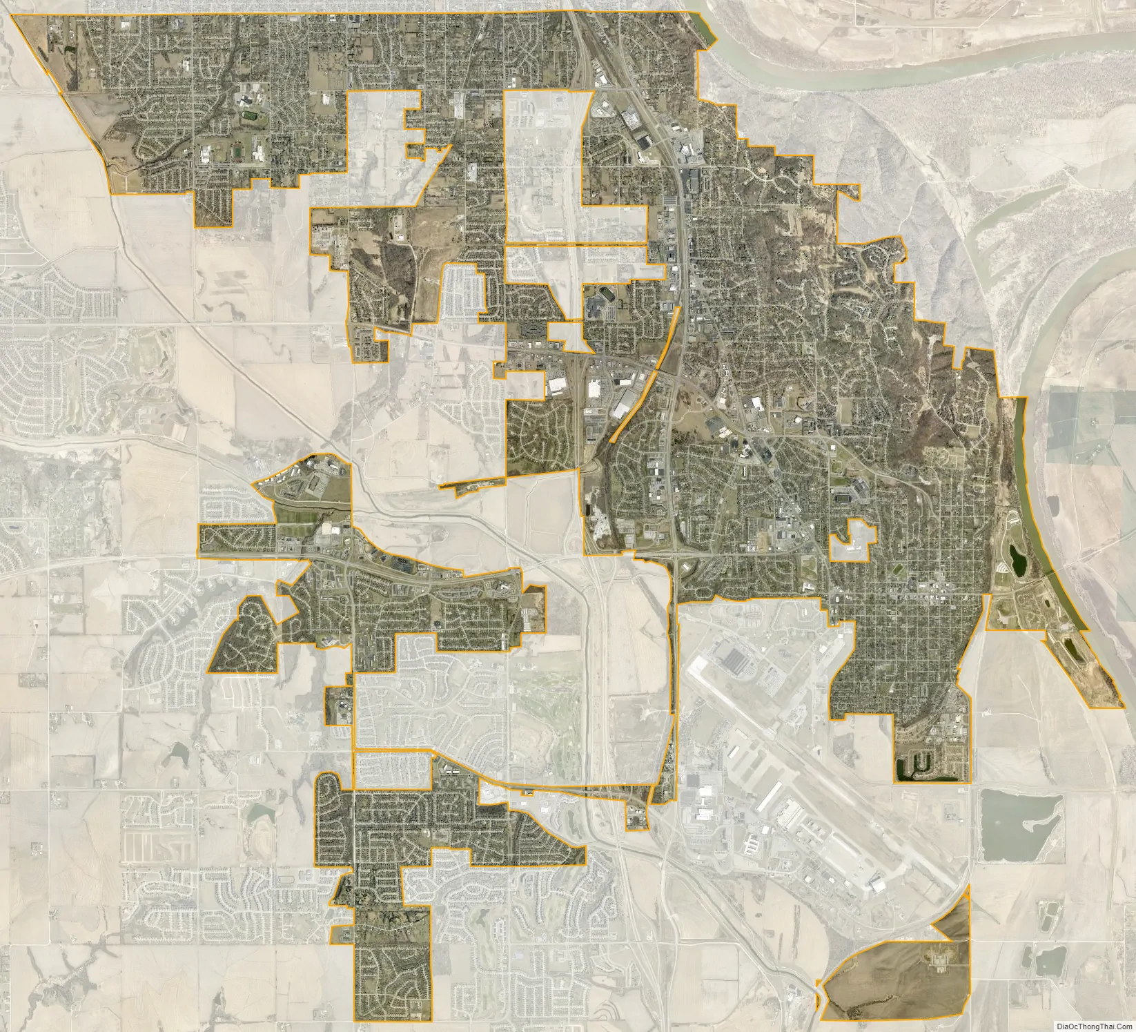
Bellevue city Satellite Map
Geography
Bellevue is located at an elevation of 1159 ft (353 m). According to the United States Census Bureau, the city has a total area of 16.02 square miles (41.49 km), of which 15.85 square miles (41.05 km) is land and 0.17 square miles (0.44 km) is water. It is bounded on the east by the Missouri River.
See also
Map of Nebraska State and its subdivision:- Adams
- Antelope
- Arthur
- Banner
- Blaine
- Boone
- Box Butte
- Boyd
- Brown
- Buffalo
- Burt
- Butler
- Cass
- Cedar
- Chase
- Cherry
- Cheyenne
- Clay
- Colfax
- Cuming
- Custer
- Dakota
- Dawes
- Dawson
- Deuel
- Dixon
- Dodge
- Douglas
- Dundy
- Fillmore
- Franklin
- Frontier
- Furnas
- Gage
- Garden
- Garfield
- Gosper
- Grant
- Greeley
- Hall
- Hamilton
- Harlan
- Hayes
- Hitchcock
- Holt
- Hooker
- Howard
- Jefferson
- Johnson
- Kearney
- Keith
- Keya Paha
- Kimball
- Knox
- Lancaster
- Lincoln
- Logan
- Loup
- Madison
- McPherson
- Merrick
- Morrill
- Nance
- Nemaha
- Nuckolls
- Otoe
- Pawnee
- Perkins
- Phelps
- Pierce
- Platte
- Polk
- Red Willow
- Richardson
- Rock
- Saline
- Sarpy
- Saunders
- Scotts Bluff
- Seward
- Sheridan
- Sherman
- Sioux
- Stanton
- Thayer
- Thomas
- Thurston
- Valley
- Washington
- Wayne
- Webster
- Wheeler
- York
- Alabama
- Alaska
- Arizona
- Arkansas
- California
- Colorado
- Connecticut
- Delaware
- District of Columbia
- Florida
- Georgia
- Hawaii
- Idaho
- Illinois
- Indiana
- Iowa
- Kansas
- Kentucky
- Louisiana
- Maine
- Maryland
- Massachusetts
- Michigan
- Minnesota
- Mississippi
- Missouri
- Montana
- Nebraska
- Nevada
- New Hampshire
- New Jersey
- New Mexico
- New York
- North Carolina
- North Dakota
- Ohio
- Oklahoma
- Oregon
- Pennsylvania
- Rhode Island
- South Carolina
- South Dakota
- Tennessee
- Texas
- Utah
- Vermont
- Virginia
- Washington
- West Virginia
- Wisconsin
- Wyoming