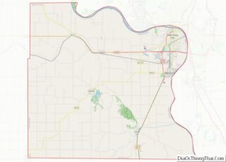
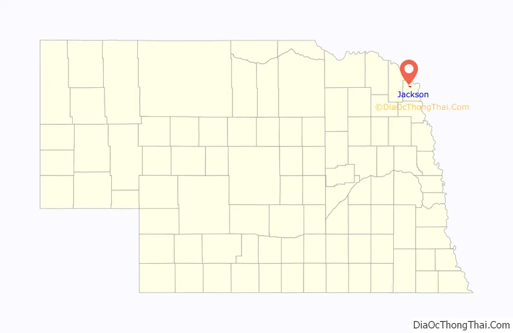
Jackson is a village in Dakota County, Nebraska, United States. It is part of the Sioux City, IA–NE–SD Metropolitan Statistical Area. The population was 223 at the 2010 census.
| Name: | Jackson village |
|---|---|
| LSAD Code: | 47 |
| LSAD Description: | village (suffix) |
| State: | Nebraska |
| County: | Dakota County |
| Elevation: | 1,115 ft (340 m) |
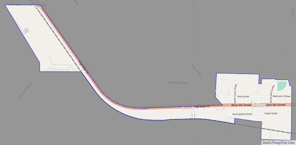
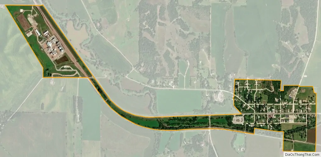
| Total Area: | 0.45 sq mi (1.17 km²) |
| Land Area: | 0.45 sq mi (1.17 km²) |
| Water Area: | 0.00 sq mi (0.00 km²) |
| Total Population: | 207 |
| Population Density: | 460.00/sq mi (177.45/km²) |
| ZIP code: | 68743 |
| Area code: | 402 |
| FIPS code: | 3124355 |
| GNISfeature ID: | 0830326 |
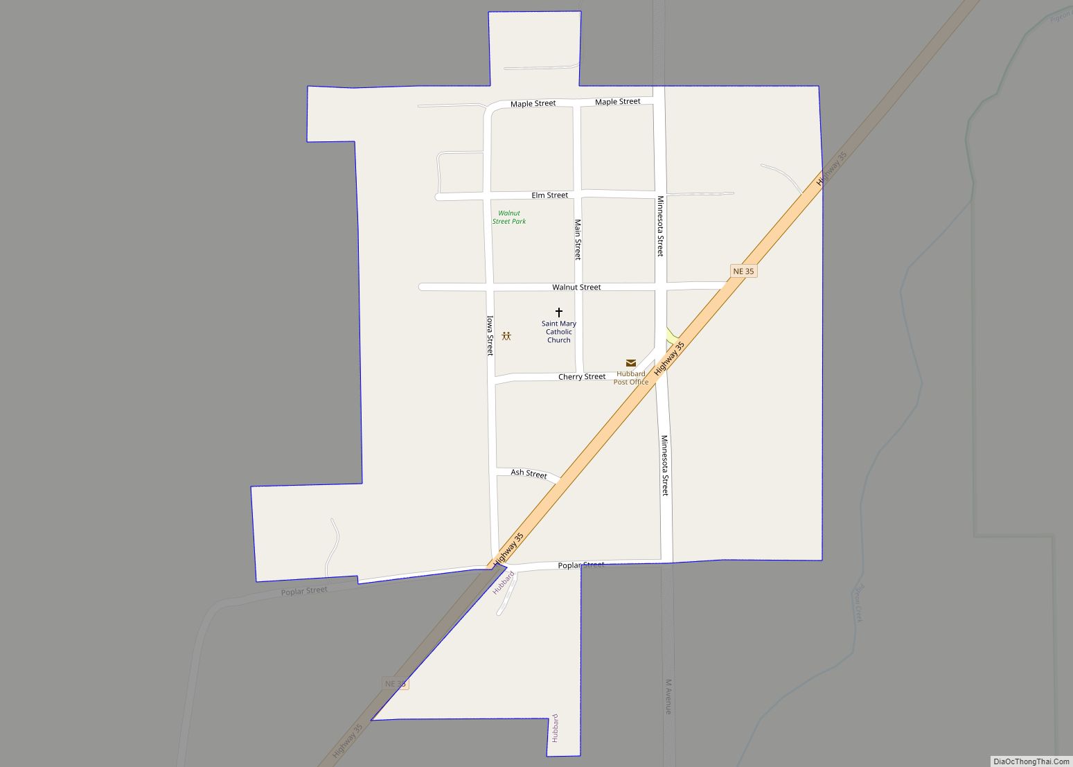
Online Interactive Map
Click on ![]() to view map in "full screen" mode.
to view map in "full screen" mode.
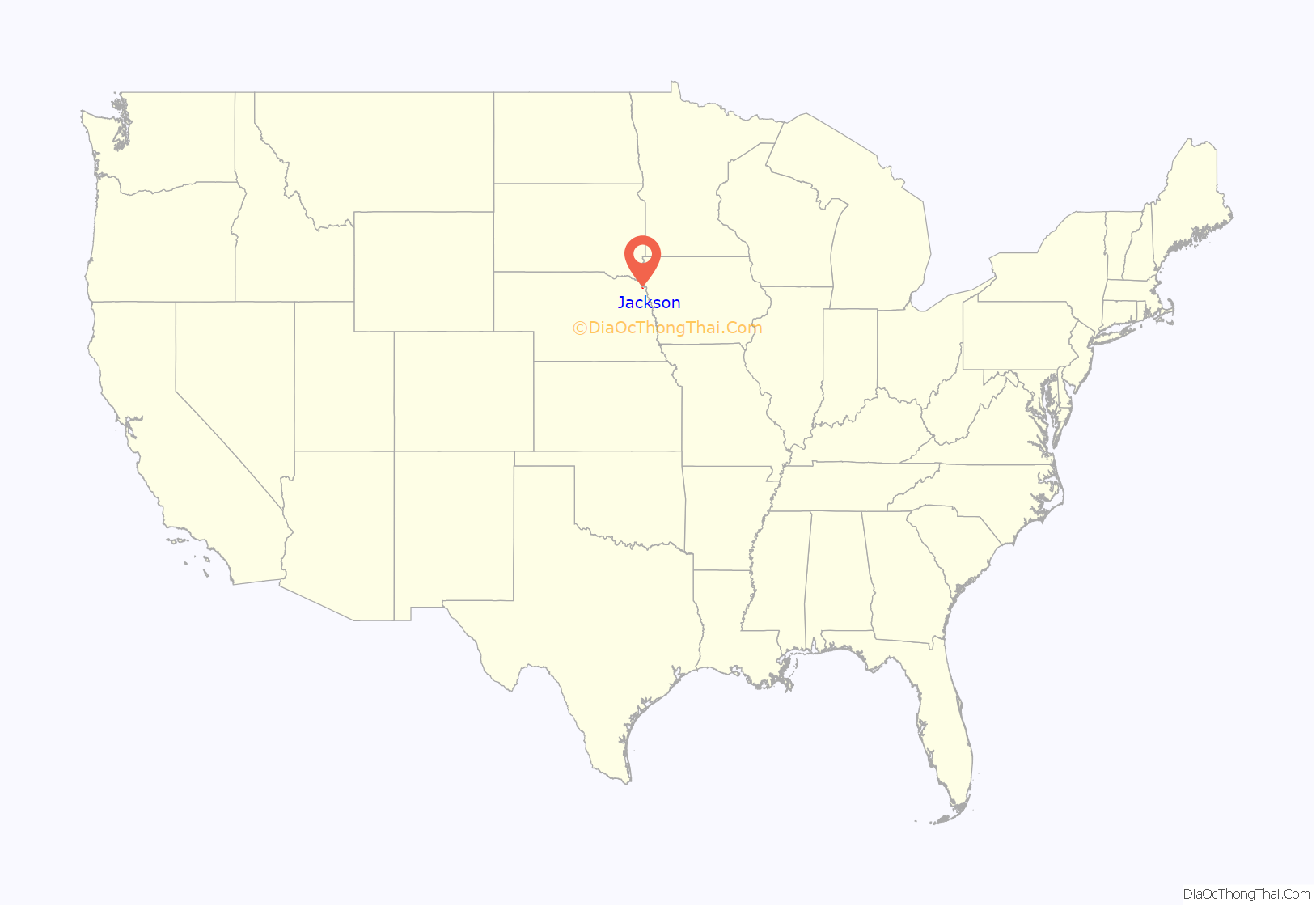
Jackson location map. Where is Jackson village?
History
Prior to the establishment of Jackson, the townsite of Old St. John’s was settled approximately 1.5 miles north of the current site of Jackson on June 2, 1856, by a Catholic colony of sixty Irish immigrants led by Father Trecy. The colony was one of the first towns settled in Dakota County, and the first Catholic parish in Nebraska. When the rising Missouri River began to threaten the town around 1860, all of the residents of Old St. John’s moved south to what is now known as Jackson.
Jackson was originally called Franklin, and under the latter name was laid out in about 1860. When it was discovered there was another post office in the state with the name Franklin, the community was renamed in honor of Andrew Jackson in order to avoid repetition.
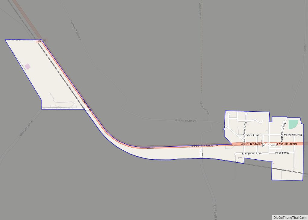
Jackson Road Map
Jackson city Satellite Map
Geography
Jackson is located at 42°26′56″N 96°33′58″W / 42.44889°N 96.56611°W / 42.44889; -96.56611 (42.448789, -96.566207).
According to the United States Census Bureau, the village has a total area of 0.45 square miles (1.17 km), all land.
See also
Map of Nebraska State and its subdivision:- Adams
- Antelope
- Arthur
- Banner
- Blaine
- Boone
- Box Butte
- Boyd
- Brown
- Buffalo
- Burt
- Butler
- Cass
- Cedar
- Chase
- Cherry
- Cheyenne
- Clay
- Colfax
- Cuming
- Custer
- Dakota
- Dawes
- Dawson
- Deuel
- Dixon
- Dodge
- Douglas
- Dundy
- Fillmore
- Franklin
- Frontier
- Furnas
- Gage
- Garden
- Garfield
- Gosper
- Grant
- Greeley
- Hall
- Hamilton
- Harlan
- Hayes
- Hitchcock
- Holt
- Hooker
- Howard
- Jefferson
- Johnson
- Kearney
- Keith
- Keya Paha
- Kimball
- Knox
- Lancaster
- Lincoln
- Logan
- Loup
- Madison
- McPherson
- Merrick
- Morrill
- Nance
- Nemaha
- Nuckolls
- Otoe
- Pawnee
- Perkins
- Phelps
- Pierce
- Platte
- Polk
- Red Willow
- Richardson
- Rock
- Saline
- Sarpy
- Saunders
- Scotts Bluff
- Seward
- Sheridan
- Sherman
- Sioux
- Stanton
- Thayer
- Thomas
- Thurston
- Valley
- Washington
- Wayne
- Webster
- Wheeler
- York
- Alabama
- Alaska
- Arizona
- Arkansas
- California
- Colorado
- Connecticut
- Delaware
- District of Columbia
- Florida
- Georgia
- Hawaii
- Idaho
- Illinois
- Indiana
- Iowa
- Kansas
- Kentucky
- Louisiana
- Maine
- Maryland
- Massachusetts
- Michigan
- Minnesota
- Mississippi
- Missouri
- Montana
- Nebraska
- Nevada
- New Hampshire
- New Jersey
- New Mexico
- New York
- North Carolina
- North Dakota
- Ohio
- Oklahoma
- Oregon
- Pennsylvania
- Rhode Island
- South Carolina
- South Dakota
- Tennessee
- Texas
- Utah
- Vermont
- Virginia
- Washington
- West Virginia
- Wisconsin
- Wyoming