South Sioux City is a city in Dakota County, Nebraska, United States. It is located immediately across the Missouri River from Sioux City, Iowa, and is part of the Sioux City, IA-NE-SD Metropolitan Statistical Area. As of the 2010 census, the city population was 13,353, making it the 14th largest city in Nebraska.
| Name: | South Sioux City city |
|---|---|
| LSAD Code: | 25 |
| LSAD Description: | city (suffix) |
| State: | Nebraska |
| County: | Dakota County |
| Incorporated: | 1887 |
| Elevation: | 1,102 ft (336 m) |
| Total Area: | 6.63 sq mi (17.16 km²) |
| Land Area: | 6.30 sq mi (16.32 km²) |
| Water Area: | 0.33 sq mi (0.85 km²) |
| Total Population: | 14,043 |
| Population Density: | 2,229.40/sq mi (860.74/km²) |
| ZIP code: | 68776 |
| Area code: | 402 |
| FIPS code: | 3146030 |
| GNISfeature ID: | 0833621 |
| Website: | http://www.southsiouxcity.org/ |
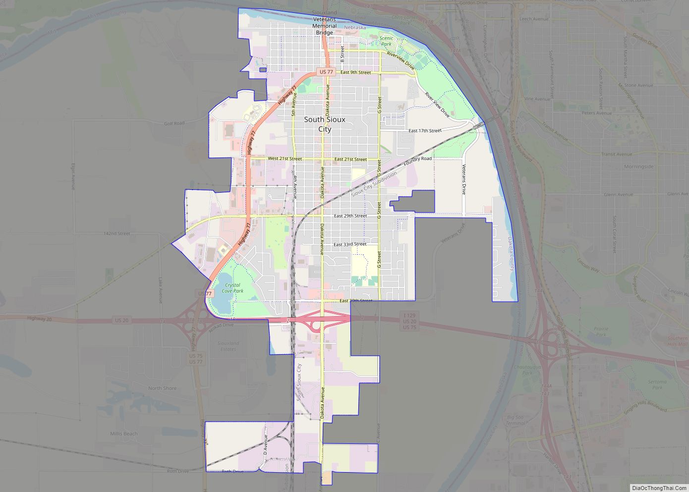
Online Interactive Map
Click on ![]() to view map in "full screen" mode.
to view map in "full screen" mode.
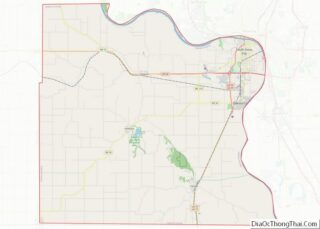
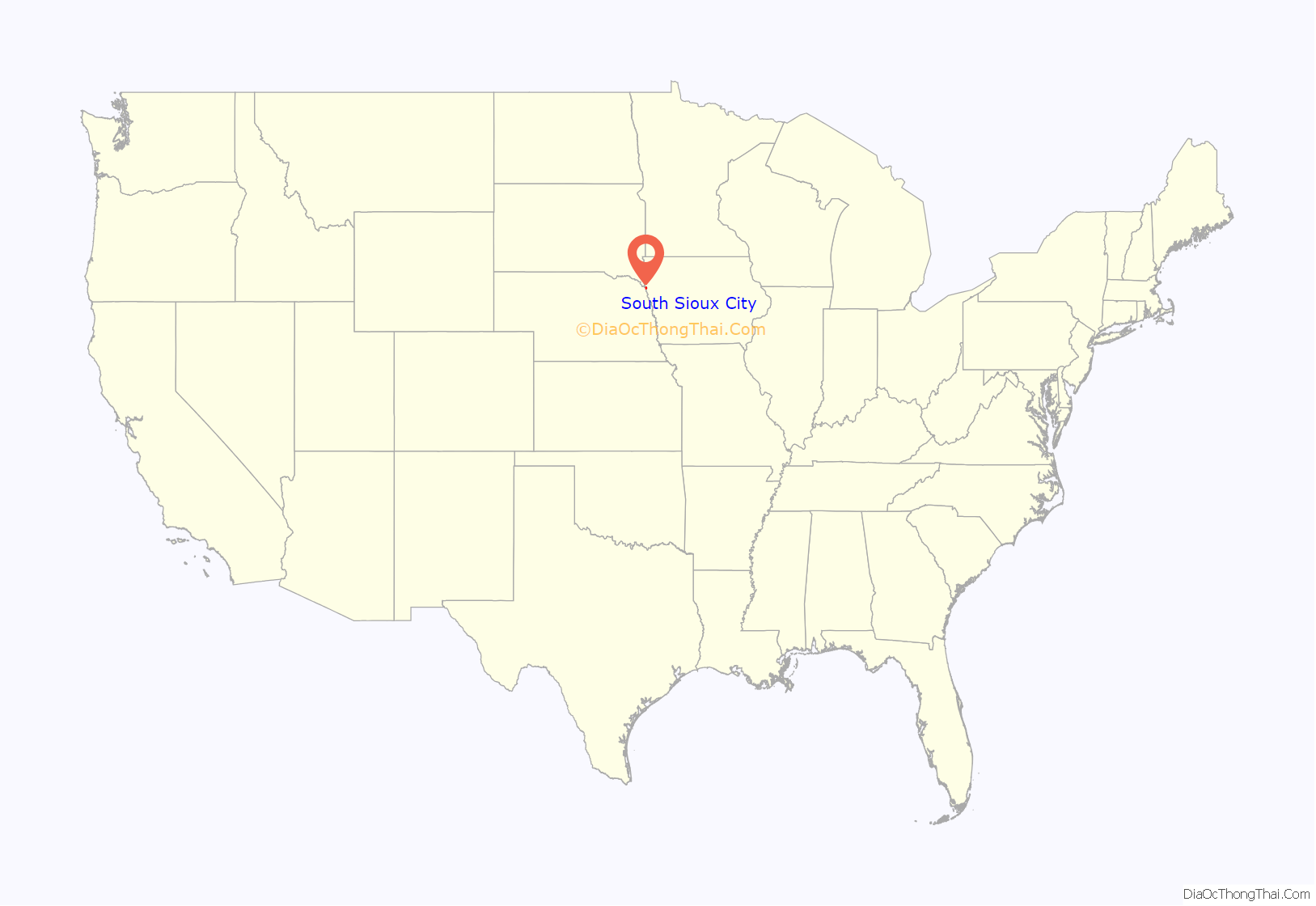
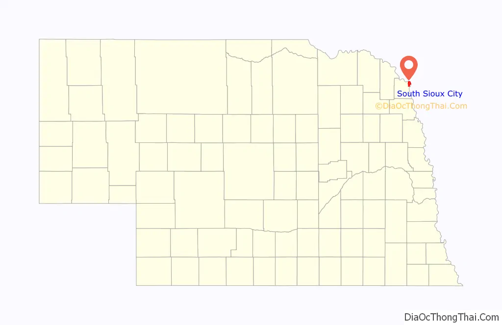
South Sioux City location map. Where is South Sioux City city?
History
Meriwether Lewis and William Clark passed through the South Sioux City area in 1804.
European settlement on the Nebraska side of the river began as early as 1854. Several town sites were platted and incorporated in the 1850s. Pacific City, incorporated in 1858, was a short-lived settlement. Covington and South Covington, both incorporated in 1857, merged in 1870. Another town, Stanton, was founded in 1856.
South Sioux City was incorporated in 1887. A special election in 1893 approved the merger of Covington and Stanton into the city of South Sioux City.
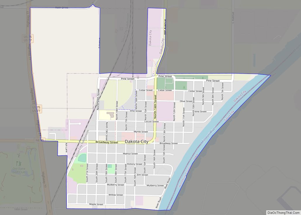
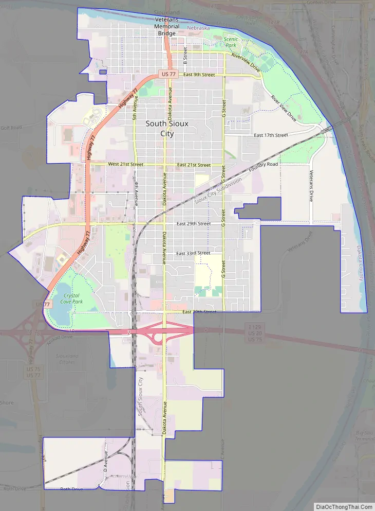
South Sioux City Road Map
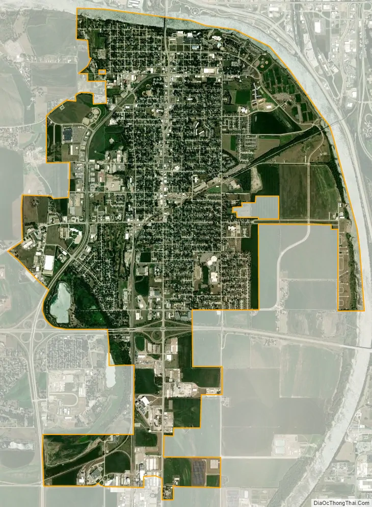
South Sioux City city Satellite Map
Geography
South Sioux City is located at 42°28′16″N 96°24′53″W / 42.47111°N 96.41472°W / 42.47111; -96.41472 (42.471095, -96.414732).
According to the United States Census Bureau, the city has a total area of 5.96 square miles (15.44 km), of which 5.71 square miles (14.79 km) is land and 0.25 square miles (0.65 km) is water.
In contrast to its hilly larger neighbor, South Sioux City is relatively flat. The difference in elevation across most of the city is less than 20 feet, generally ranging between 1,085 and 1,105 feet above sea level.
See also
Map of Nebraska State and its subdivision:- Adams
- Antelope
- Arthur
- Banner
- Blaine
- Boone
- Box Butte
- Boyd
- Brown
- Buffalo
- Burt
- Butler
- Cass
- Cedar
- Chase
- Cherry
- Cheyenne
- Clay
- Colfax
- Cuming
- Custer
- Dakota
- Dawes
- Dawson
- Deuel
- Dixon
- Dodge
- Douglas
- Dundy
- Fillmore
- Franklin
- Frontier
- Furnas
- Gage
- Garden
- Garfield
- Gosper
- Grant
- Greeley
- Hall
- Hamilton
- Harlan
- Hayes
- Hitchcock
- Holt
- Hooker
- Howard
- Jefferson
- Johnson
- Kearney
- Keith
- Keya Paha
- Kimball
- Knox
- Lancaster
- Lincoln
- Logan
- Loup
- Madison
- McPherson
- Merrick
- Morrill
- Nance
- Nemaha
- Nuckolls
- Otoe
- Pawnee
- Perkins
- Phelps
- Pierce
- Platte
- Polk
- Red Willow
- Richardson
- Rock
- Saline
- Sarpy
- Saunders
- Scotts Bluff
- Seward
- Sheridan
- Sherman
- Sioux
- Stanton
- Thayer
- Thomas
- Thurston
- Valley
- Washington
- Wayne
- Webster
- Wheeler
- York
- Alabama
- Alaska
- Arizona
- Arkansas
- California
- Colorado
- Connecticut
- Delaware
- District of Columbia
- Florida
- Georgia
- Hawaii
- Idaho
- Illinois
- Indiana
- Iowa
- Kansas
- Kentucky
- Louisiana
- Maine
- Maryland
- Massachusetts
- Michigan
- Minnesota
- Mississippi
- Missouri
- Montana
- Nebraska
- Nevada
- New Hampshire
- New Jersey
- New Mexico
- New York
- North Carolina
- North Dakota
- Ohio
- Oklahoma
- Oregon
- Pennsylvania
- Rhode Island
- South Carolina
- South Dakota
- Tennessee
- Texas
- Utah
- Vermont
- Virginia
- Washington
- West Virginia
- Wisconsin
- Wyoming