Kilgore is a village in Cherry County, Nebraska, United States. The population was 77 at the 2010 census.
| Name: | Kilgore village |
|---|---|
| LSAD Code: | 47 |
| LSAD Description: | village (suffix) |
| State: | Nebraska |
| County: | Cherry County |
| Elevation: | 2,917 ft (889 m) |
| Total Area: | 0.45 sq mi (1.16 km²) |
| Land Area: | 0.45 sq mi (1.16 km²) |
| Water Area: | 0.00 sq mi (0.00 km²) |
| Total Population: | 63 |
| Population Density: | 140.63/sq mi (54.32/km²) |
| ZIP code: | 69216 |
| Area code: | 402 |
| FIPS code: | 3125405 |
| GNISfeature ID: | 0830495 |
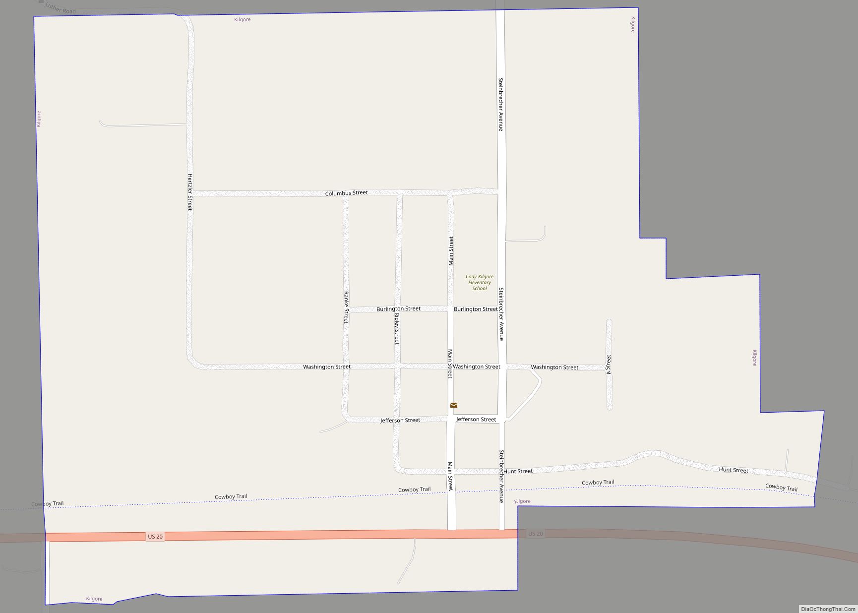
Online Interactive Map
Click on ![]() to view map in "full screen" mode.
to view map in "full screen" mode.
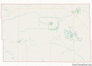
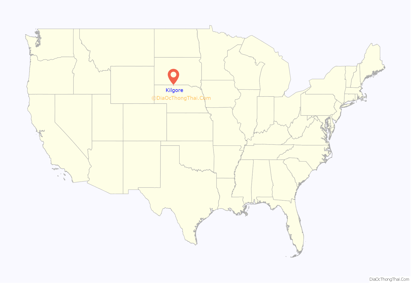
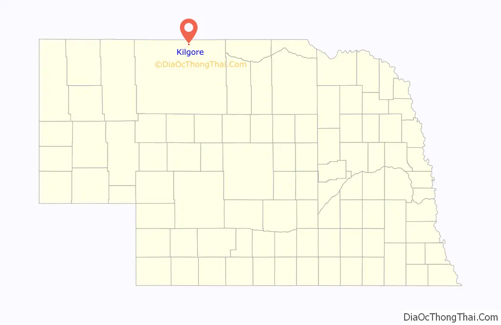
Kilgore location map. Where is Kilgore village?
History
Kilgore was founded, under the name of Boulware, in 1883 when the Fremont, Elkhorn and Missouri Valley Railroad was extended to that point. In 1885, the village was renamed Georgia. Georgia was incorporated in 1893; the name of the settlement was changed in 1904 to Kilgore when the post office objected to the name Georgia, which could be confused with the state of Georgia. The name Kilgore was chosen in honor of a family of pioneer settlers.
The village experienced a heyday from the 1900s to the late 1920s. During that era, Kilgore “boasted a post office, a medical doctor, a pharmacist, four general merchandise stores, two hotels, a livery stable, a lumber yard, hardware store, a harness and blacksmith shop, two new car dealerships, a hair dresser, pool hall, barber shop, bulk oil plant, three filling stations, a well driller, a livestock trucker, a full-time railroad depot, and a grain and feed elevator. There were two passenger trains each way each day, a town dray wagon, a small dairy, a meat market, two saloons, and several bootleggers who sold liquor to the Indians. The community also built a brick K-12 schoolhouse in 1929 when the population was over 250.” But with the decline in railroads, the village’s importance declined. Today, Kilgore has fewer than 100 residents.
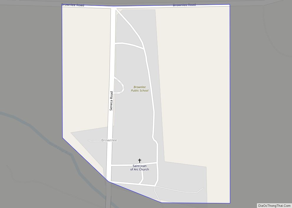
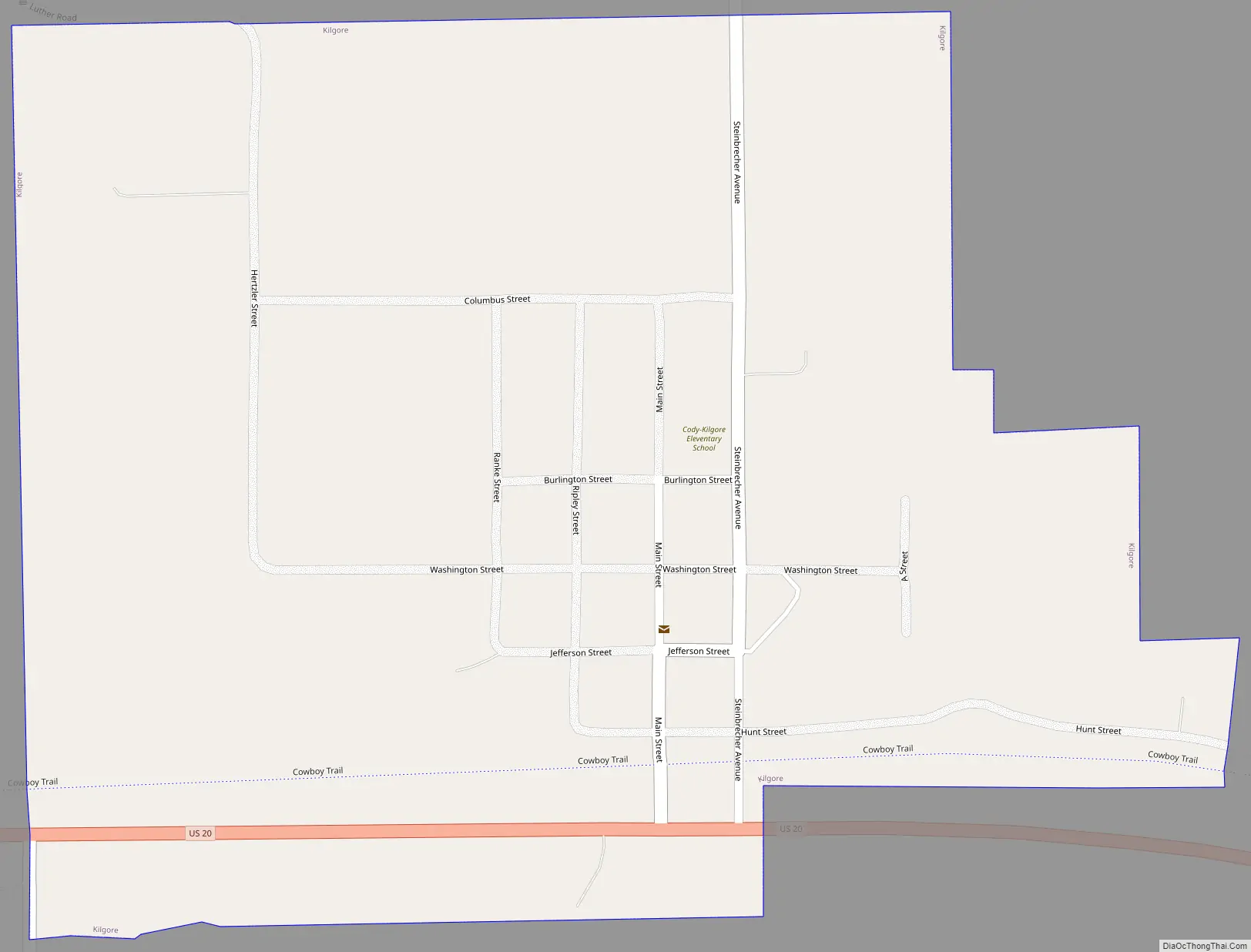
Kilgore Road Map
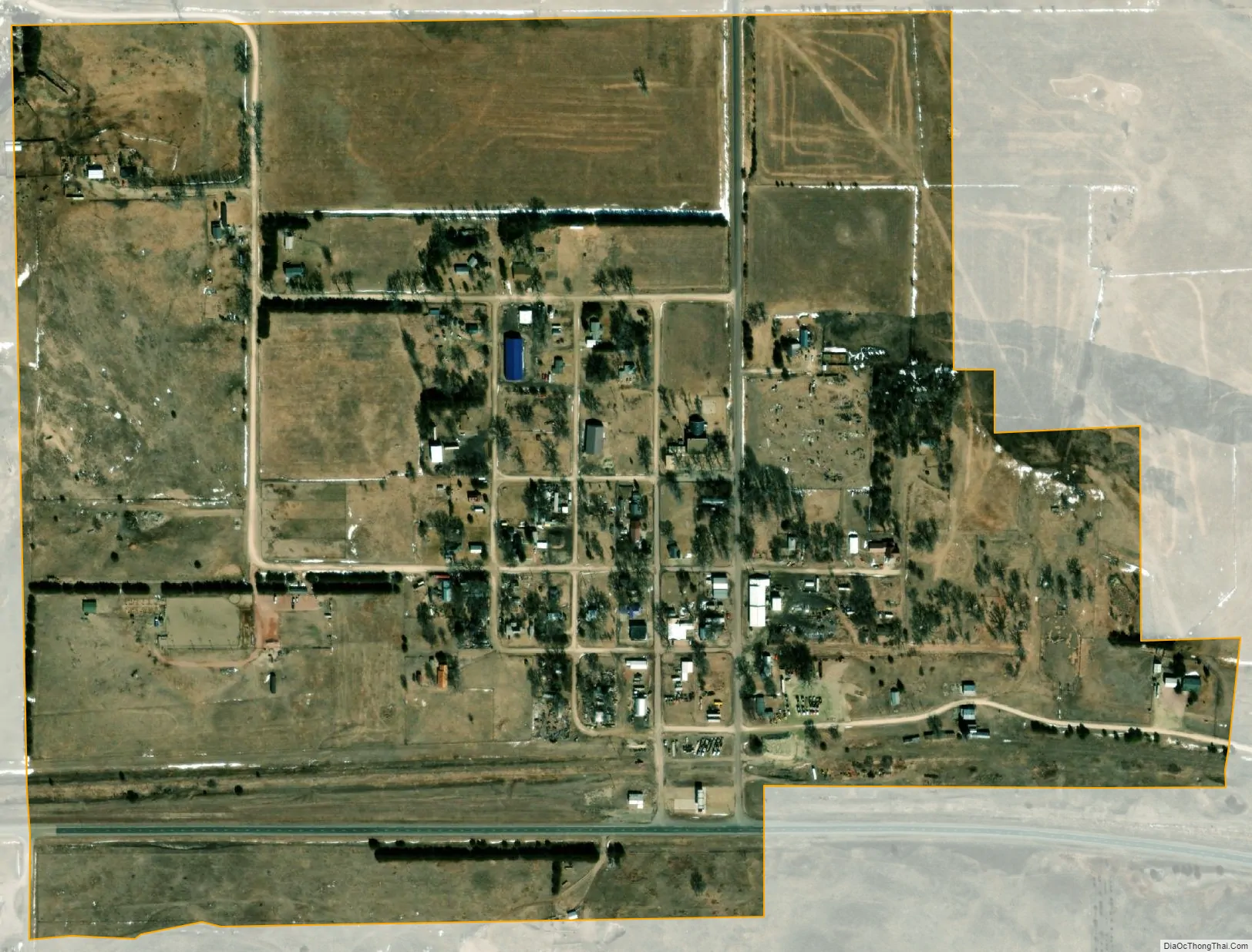
Kilgore city Satellite Map
Geography
According to the United States Census Bureau, Kilgore has a total area of 0.45 square miles (1.17 km), all land.
See also
Map of Nebraska State and its subdivision:- Adams
- Antelope
- Arthur
- Banner
- Blaine
- Boone
- Box Butte
- Boyd
- Brown
- Buffalo
- Burt
- Butler
- Cass
- Cedar
- Chase
- Cherry
- Cheyenne
- Clay
- Colfax
- Cuming
- Custer
- Dakota
- Dawes
- Dawson
- Deuel
- Dixon
- Dodge
- Douglas
- Dundy
- Fillmore
- Franklin
- Frontier
- Furnas
- Gage
- Garden
- Garfield
- Gosper
- Grant
- Greeley
- Hall
- Hamilton
- Harlan
- Hayes
- Hitchcock
- Holt
- Hooker
- Howard
- Jefferson
- Johnson
- Kearney
- Keith
- Keya Paha
- Kimball
- Knox
- Lancaster
- Lincoln
- Logan
- Loup
- Madison
- McPherson
- Merrick
- Morrill
- Nance
- Nemaha
- Nuckolls
- Otoe
- Pawnee
- Perkins
- Phelps
- Pierce
- Platte
- Polk
- Red Willow
- Richardson
- Rock
- Saline
- Sarpy
- Saunders
- Scotts Bluff
- Seward
- Sheridan
- Sherman
- Sioux
- Stanton
- Thayer
- Thomas
- Thurston
- Valley
- Washington
- Wayne
- Webster
- Wheeler
- York
- Alabama
- Alaska
- Arizona
- Arkansas
- California
- Colorado
- Connecticut
- Delaware
- District of Columbia
- Florida
- Georgia
- Hawaii
- Idaho
- Illinois
- Indiana
- Iowa
- Kansas
- Kentucky
- Louisiana
- Maine
- Maryland
- Massachusetts
- Michigan
- Minnesota
- Mississippi
- Missouri
- Montana
- Nebraska
- Nevada
- New Hampshire
- New Jersey
- New Mexico
- New York
- North Carolina
- North Dakota
- Ohio
- Oklahoma
- Oregon
- Pennsylvania
- Rhode Island
- South Carolina
- South Dakota
- Tennessee
- Texas
- Utah
- Vermont
- Virginia
- Washington
- West Virginia
- Wisconsin
- Wyoming