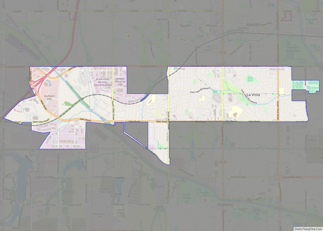
La Vista is a city in Sarpy County, Nebraska, United States. The population was 16,746 at the 2020 census. The city was incorporated on February 23, 1960.
La Vista is a suburb of Omaha. It is bordered by the cities of Omaha and Ralston on the north, Papillion on the south, Bellevue on the east, and Interstate 80 to the west. La Vista is Sarpy County’s third largest city, after Bellevue and Papillion, the county seat.
| Name: | La Vista city |
|---|---|
| LSAD Code: | 25 |
| LSAD Description: | city (suffix) |
| State: | Nebraska |
| County: | Sarpy County |
| Elevation: | 1,096 ft (334 m) |
| Total Area: | 3.28 sq mi (8.50 km²) |
| Land Area: | 3.28 sq mi (8.49 km²) |
| Water Area: | 0.00 sq mi (0.01 km²) |
| Total Population: | 16,746 |
| Population Density: | 5,105.49/sq mi (1,972.44/km²) |
| ZIP code: | 68128 |
| Area code: | 402 |
| FIPS code: | 3126385 |
| GNISfeature ID: | 2395575 |
| Website: | http://cityoflavista.org/ |
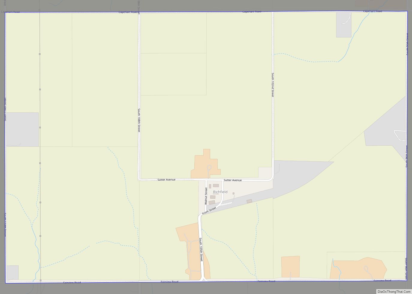
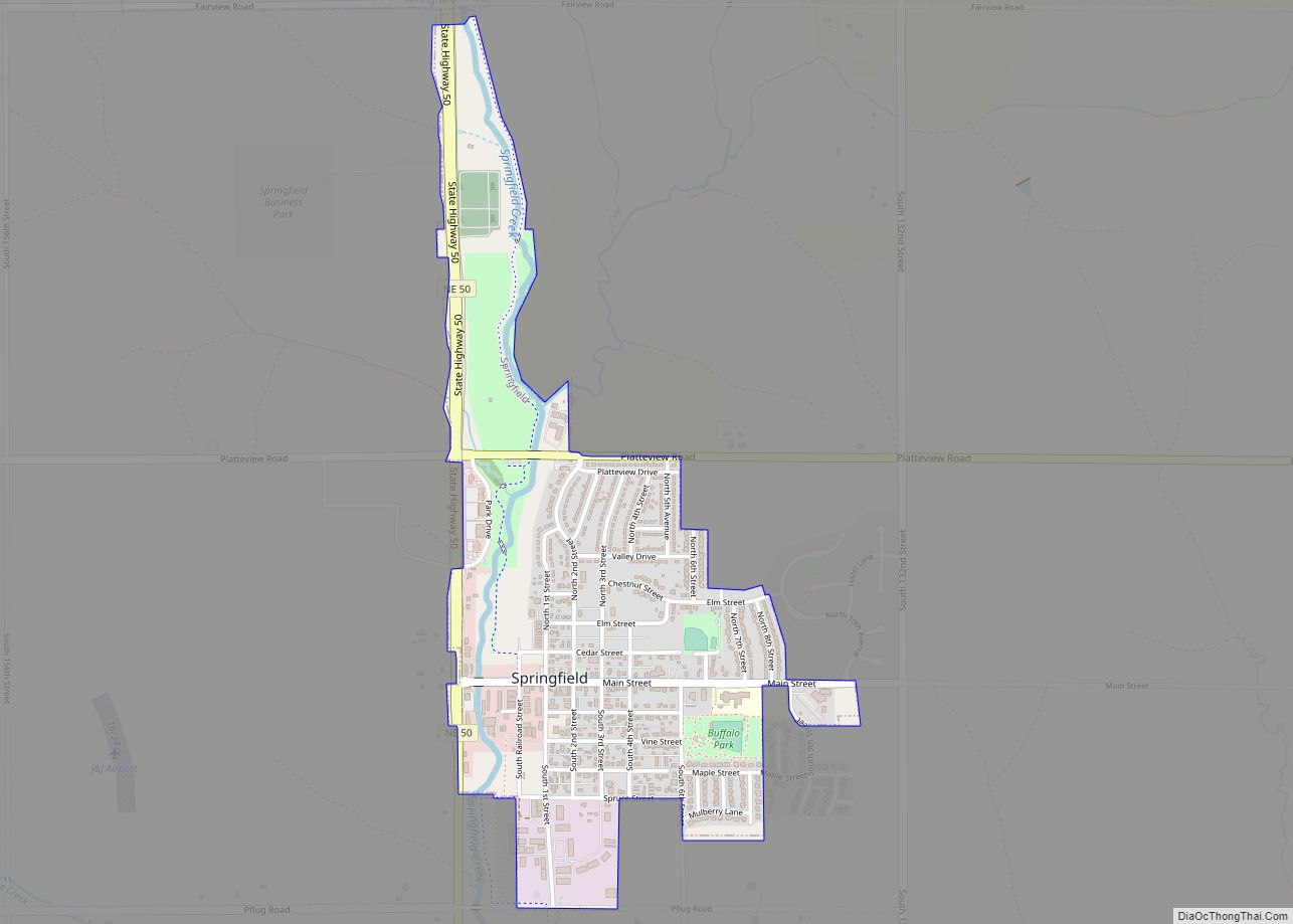
Online Interactive Map
Click on ![]() to view map in "full screen" mode.
to view map in "full screen" mode.
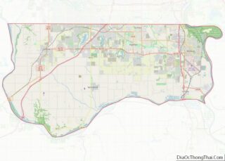
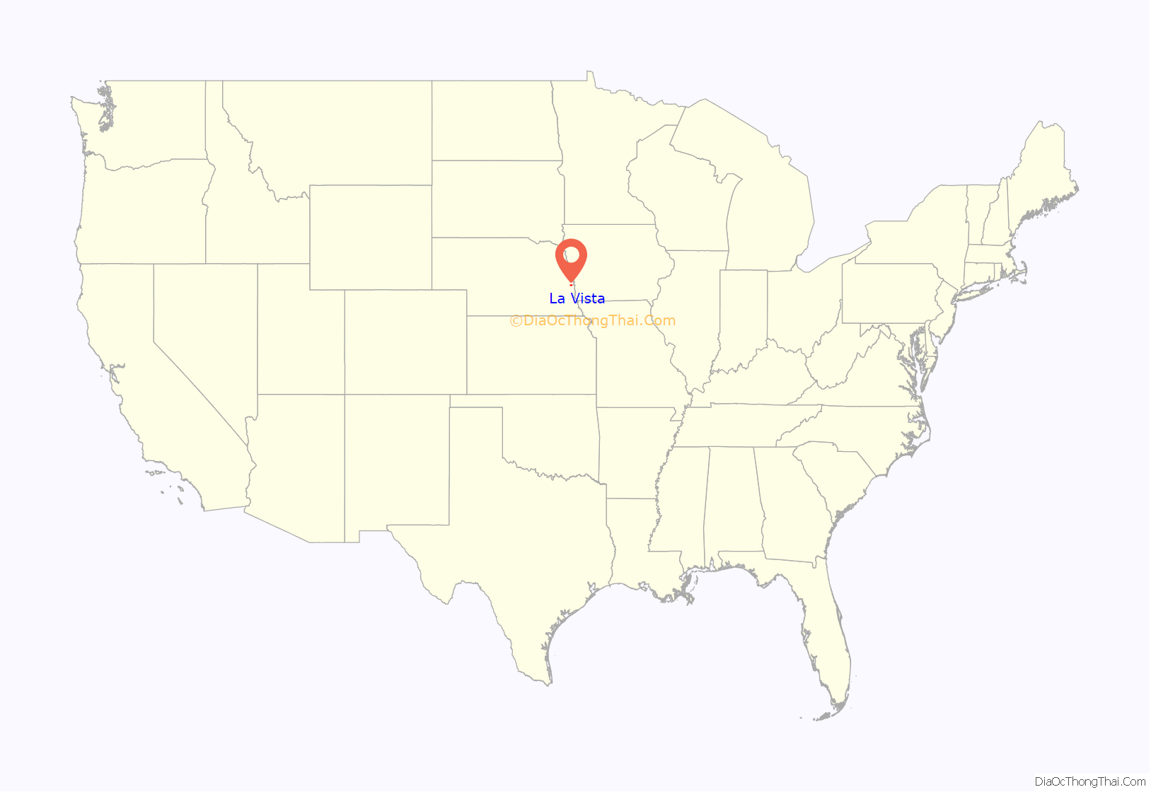
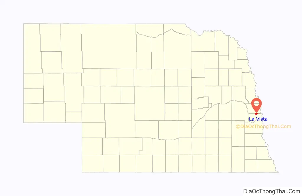
La Vista location map. Where is La Vista city?
History
La Vista was established in 1959 by a developer who planned to build 335 homes on La Vista’s land. Priced at a modest $9,999 each, it soon became known as “House of Nines.” At the time, the assessed valuation was just over $1,000,000. The first families began moving into their homes in January 1960. La Vista (meaning “the view”) was selected as its name by these “early settlers” because of the beautiful scenic view of the Big Papio Creek basin southeast of the development.
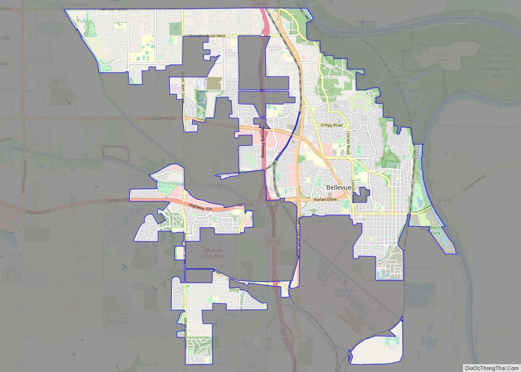
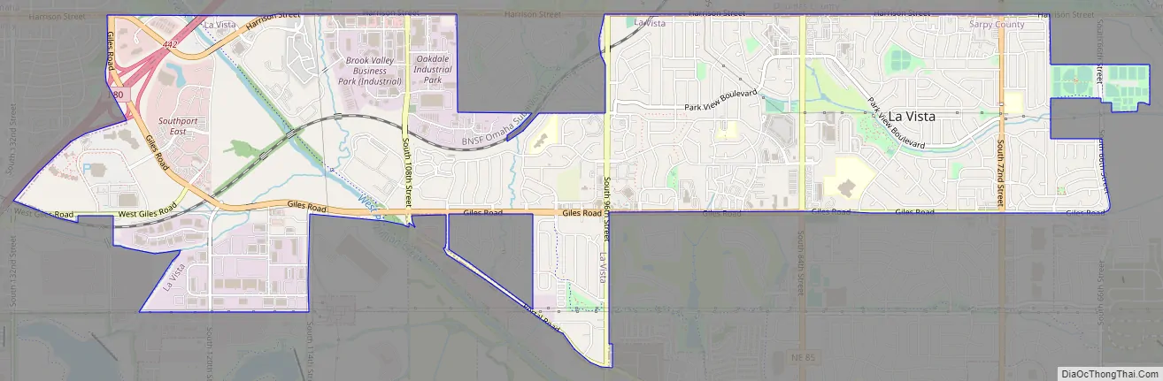
La Vista Road Map
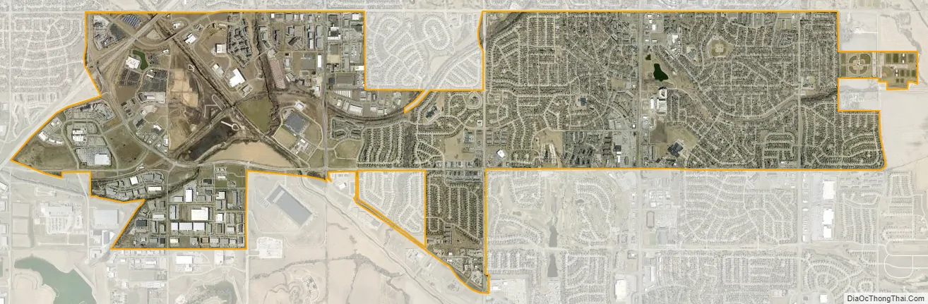
La Vista city Satellite Map
Geography
According to the United States Census Bureau, the city has a total area of 3.28 square miles (8.50 km), all land.
See also
Map of Nebraska State and its subdivision:- Adams
- Antelope
- Arthur
- Banner
- Blaine
- Boone
- Box Butte
- Boyd
- Brown
- Buffalo
- Burt
- Butler
- Cass
- Cedar
- Chase
- Cherry
- Cheyenne
- Clay
- Colfax
- Cuming
- Custer
- Dakota
- Dawes
- Dawson
- Deuel
- Dixon
- Dodge
- Douglas
- Dundy
- Fillmore
- Franklin
- Frontier
- Furnas
- Gage
- Garden
- Garfield
- Gosper
- Grant
- Greeley
- Hall
- Hamilton
- Harlan
- Hayes
- Hitchcock
- Holt
- Hooker
- Howard
- Jefferson
- Johnson
- Kearney
- Keith
- Keya Paha
- Kimball
- Knox
- Lancaster
- Lincoln
- Logan
- Loup
- Madison
- McPherson
- Merrick
- Morrill
- Nance
- Nemaha
- Nuckolls
- Otoe
- Pawnee
- Perkins
- Phelps
- Pierce
- Platte
- Polk
- Red Willow
- Richardson
- Rock
- Saline
- Sarpy
- Saunders
- Scotts Bluff
- Seward
- Sheridan
- Sherman
- Sioux
- Stanton
- Thayer
- Thomas
- Thurston
- Valley
- Washington
- Wayne
- Webster
- Wheeler
- York
- Alabama
- Alaska
- Arizona
- Arkansas
- California
- Colorado
- Connecticut
- Delaware
- District of Columbia
- Florida
- Georgia
- Hawaii
- Idaho
- Illinois
- Indiana
- Iowa
- Kansas
- Kentucky
- Louisiana
- Maine
- Maryland
- Massachusetts
- Michigan
- Minnesota
- Mississippi
- Missouri
- Montana
- Nebraska
- Nevada
- New Hampshire
- New Jersey
- New Mexico
- New York
- North Carolina
- North Dakota
- Ohio
- Oklahoma
- Oregon
- Pennsylvania
- Rhode Island
- South Carolina
- South Dakota
- Tennessee
- Texas
- Utah
- Vermont
- Virginia
- Washington
- West Virginia
- Wisconsin
- Wyoming