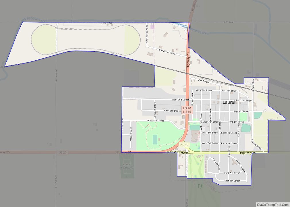
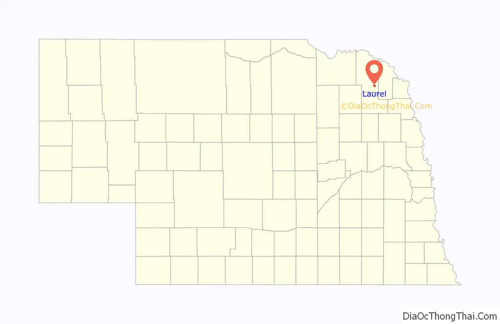
Laurel is a city in Cedar County, Nebraska located at the merger of Highway 20 and Highway 15 in the northeast corner of the state. Laurel sits roughly 40 miles east of Norfolk, Nebraska, west of Sioux City, Iowa, and south of Yankton, South Dakota. Wayne State College in Wayne, Nebraska is 15 miles south of Laurel. Its population was 975 at the 2020 census.
| Name: | Laurel city |
|---|---|
| LSAD Code: | 25 |
| LSAD Description: | city (suffix) |
| State: | Nebraska |
| County: | Cedar County |
| Elevation: | 1,476 ft (450 m) |
| Total Area: | 1.35 sq mi (3.50 km²) |
| Land Area: | 1.35 sq mi (3.50 km²) |
| Water Area: | 0.00 sq mi (0.00 km²) |
| Total Population: | 975 |
| Population Density: | 718.40/sq mi (277.37/km²) |
| ZIP code: | 68745 |
| Area code: | 402 |
| FIPS code: | 3126350 |
| GNISfeature ID: | 0830637 |
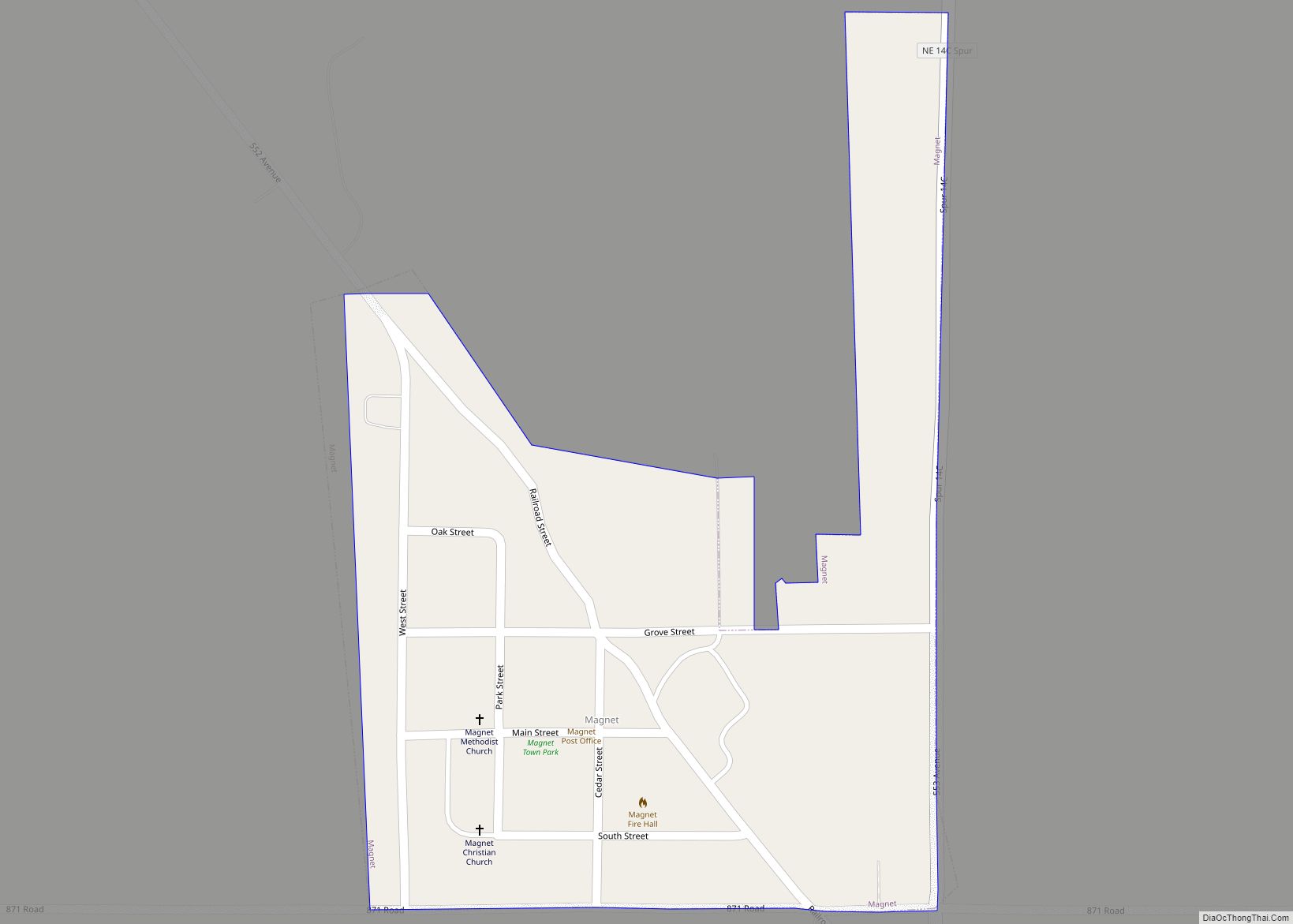
Online Interactive Map
Click on ![]() to view map in "full screen" mode.
to view map in "full screen" mode.
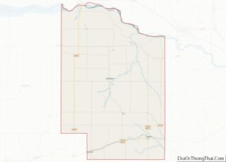
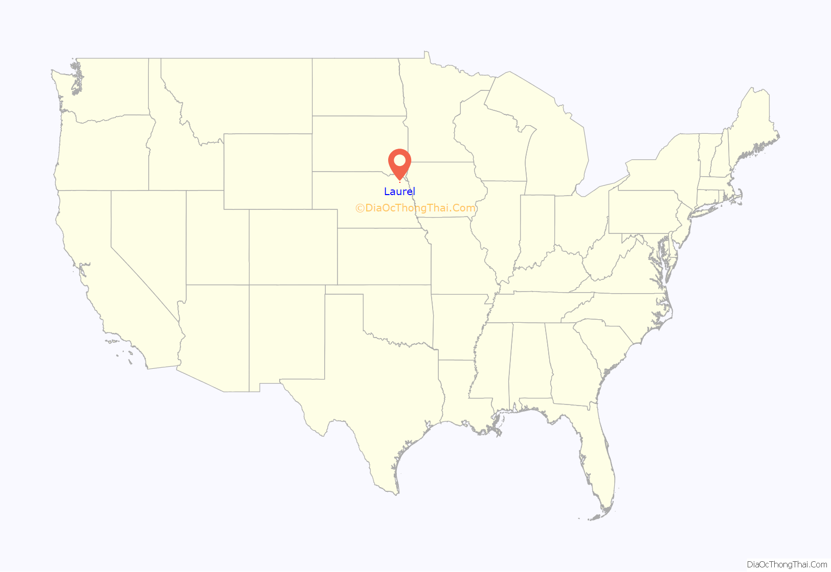
Laurel location map. Where is Laurel city?
History
Laurel was founded in 1893 and was originally named Claremont Junction. The present name is after Laura Martin, the daughter of one of the cities founders.
In 2021 the city completed its last phase of a $2.6 million dollar Downtown Revitalization Project which included removing the median from and pouring new concrete on East 2nd (Main) Street, widening the downtown sidewalks, and constructing a new city hall which houses the city offices, senior center, and can be used for parties and events.
Also in 2021 the city opened its new fire hall in thanks to fundraising and donations. The new fire hall holds up to seven fire engines, two ambulances, and has storage, classroom, a common area spaces. The volunteer fire department and EMS are housed out of the hall.
The city is currently in the initial phase of constructing a new school which will be attached to part of the existing school. Once the new area is complete, the existing structure will receive renovations and updates. This is part of a $25 million dollar bond that passed in 2021 by a single vote, 596-595.
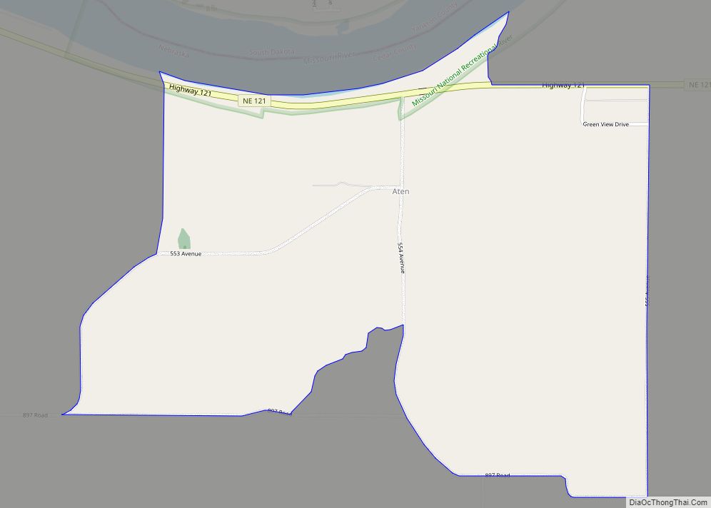
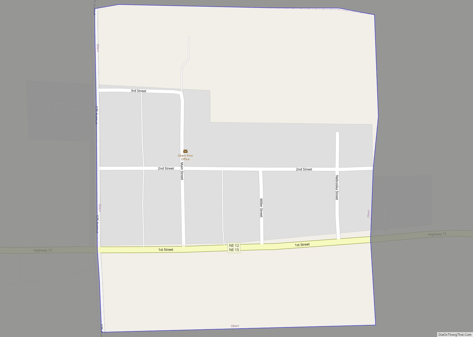
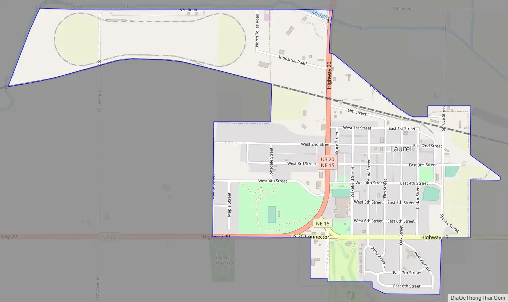
Laurel Road Map
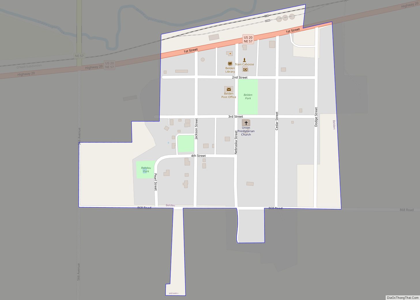
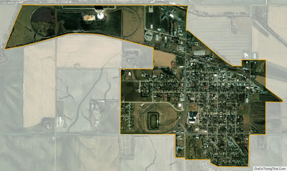
Laurel city Satellite Map
See also
Map of Nebraska State and its subdivision:- Adams
- Antelope
- Arthur
- Banner
- Blaine
- Boone
- Box Butte
- Boyd
- Brown
- Buffalo
- Burt
- Butler
- Cass
- Cedar
- Chase
- Cherry
- Cheyenne
- Clay
- Colfax
- Cuming
- Custer
- Dakota
- Dawes
- Dawson
- Deuel
- Dixon
- Dodge
- Douglas
- Dundy
- Fillmore
- Franklin
- Frontier
- Furnas
- Gage
- Garden
- Garfield
- Gosper
- Grant
- Greeley
- Hall
- Hamilton
- Harlan
- Hayes
- Hitchcock
- Holt
- Hooker
- Howard
- Jefferson
- Johnson
- Kearney
- Keith
- Keya Paha
- Kimball
- Knox
- Lancaster
- Lincoln
- Logan
- Loup
- Madison
- McPherson
- Merrick
- Morrill
- Nance
- Nemaha
- Nuckolls
- Otoe
- Pawnee
- Perkins
- Phelps
- Pierce
- Platte
- Polk
- Red Willow
- Richardson
- Rock
- Saline
- Sarpy
- Saunders
- Scotts Bluff
- Seward
- Sheridan
- Sherman
- Sioux
- Stanton
- Thayer
- Thomas
- Thurston
- Valley
- Washington
- Wayne
- Webster
- Wheeler
- York
- Alabama
- Alaska
- Arizona
- Arkansas
- California
- Colorado
- Connecticut
- Delaware
- District of Columbia
- Florida
- Georgia
- Hawaii
- Idaho
- Illinois
- Indiana
- Iowa
- Kansas
- Kentucky
- Louisiana
- Maine
- Maryland
- Massachusetts
- Michigan
- Minnesota
- Mississippi
- Missouri
- Montana
- Nebraska
- Nevada
- New Hampshire
- New Jersey
- New Mexico
- New York
- North Carolina
- North Dakota
- Ohio
- Oklahoma
- Oregon
- Pennsylvania
- Rhode Island
- South Carolina
- South Dakota
- Tennessee
- Texas
- Utah
- Vermont
- Virginia
- Washington
- West Virginia
- Wisconsin
- Wyoming