Leigh is a village in Colfax County, Nebraska, United States. The population was 405 at the 2010 census.
| Name: | Leigh village |
|---|---|
| LSAD Code: | 47 |
| LSAD Description: | village (suffix) |
| State: | Nebraska |
| County: | Colfax County |
| Elevation: | 1,604 ft (489 m) |
| Total Area: | 0.61 sq mi (1.58 km²) |
| Land Area: | 0.60 sq mi (1.55 km²) |
| Water Area: | 0.01 sq mi (0.03 km²) |
| Total Population: | 435 |
| Population Density: | 726.21/sq mi (280.57/km²) |
| ZIP code: | 68643 |
| Area code: | 402 |
| FIPS code: | 3126560 |
| GNISfeature ID: | 0830670 |
| Website: | https://www.cityofleigh.com/ |
Online Interactive Map
Click on ![]() to view map in "full screen" mode.
to view map in "full screen" mode.
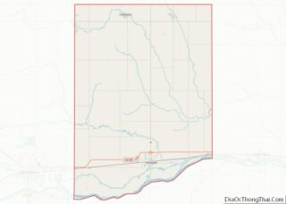
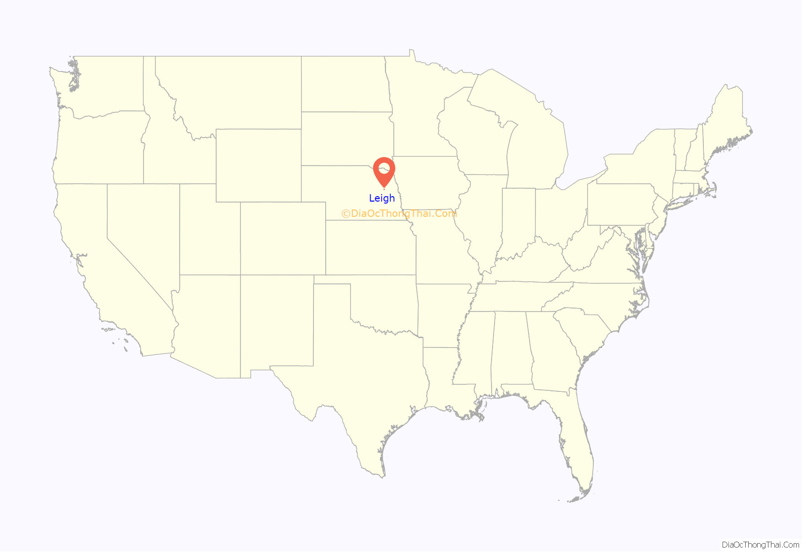
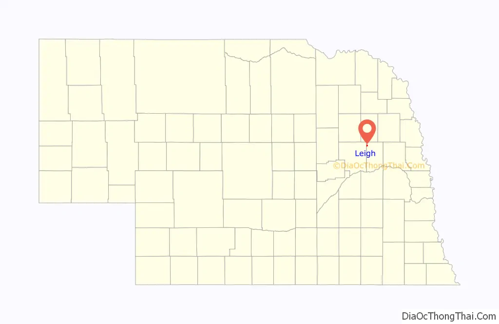
Leigh location map. Where is Leigh village?
History
Leigh was founded in the 1870s. Leigh was the maiden name of the first postmaster’s wife. A post office was established at Leigh in 1875. Carl H. Jark (1905-1984), United States Army Lieutenant General, was born in Leigh.
Audrey Stevens Niyogi (1932–2010), an American biochemist best known as a co-discoverer of RNA polymerase was born near Leigh.
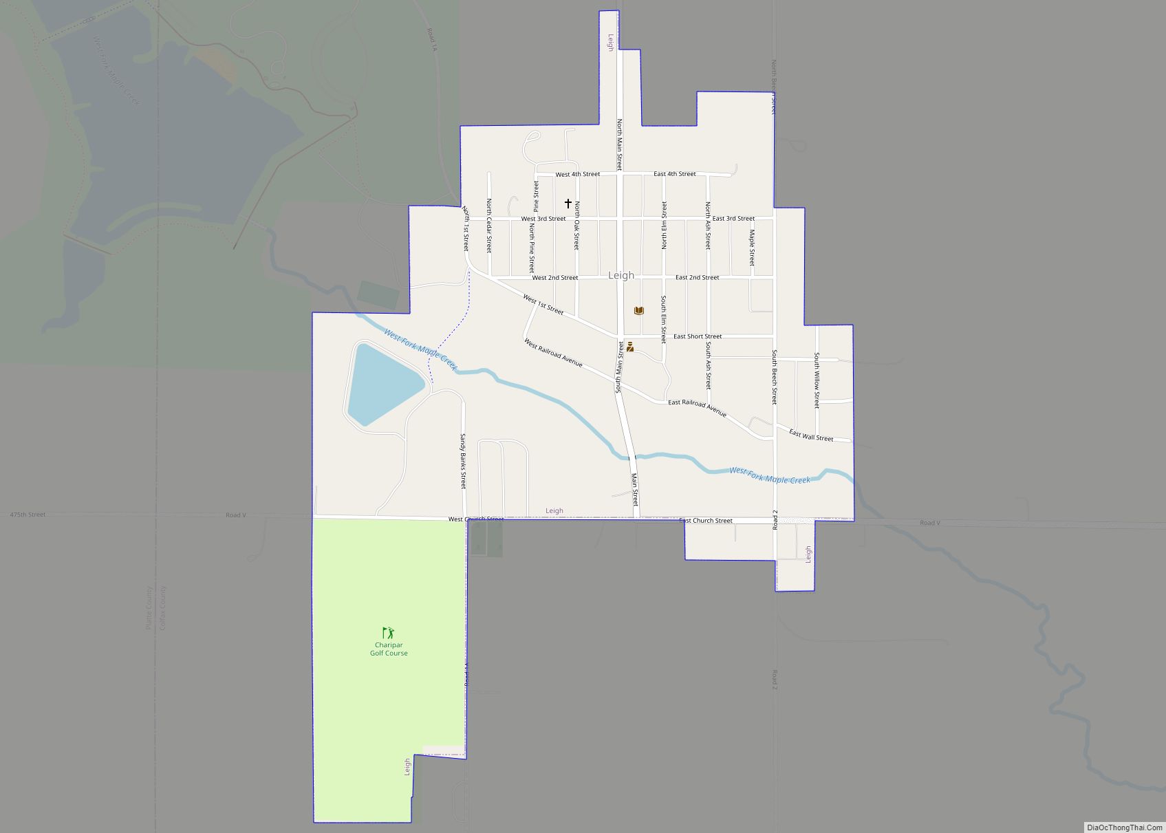
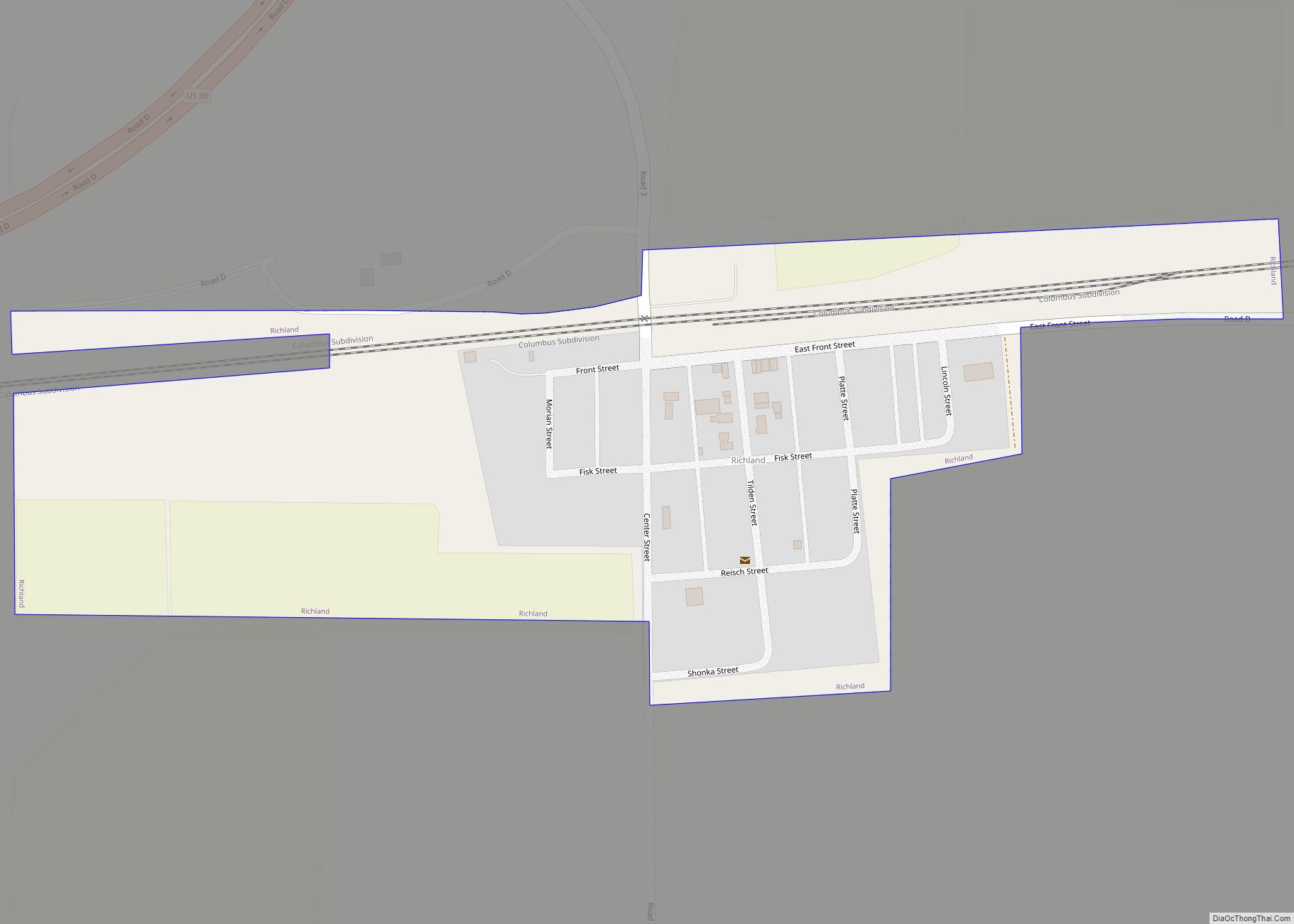
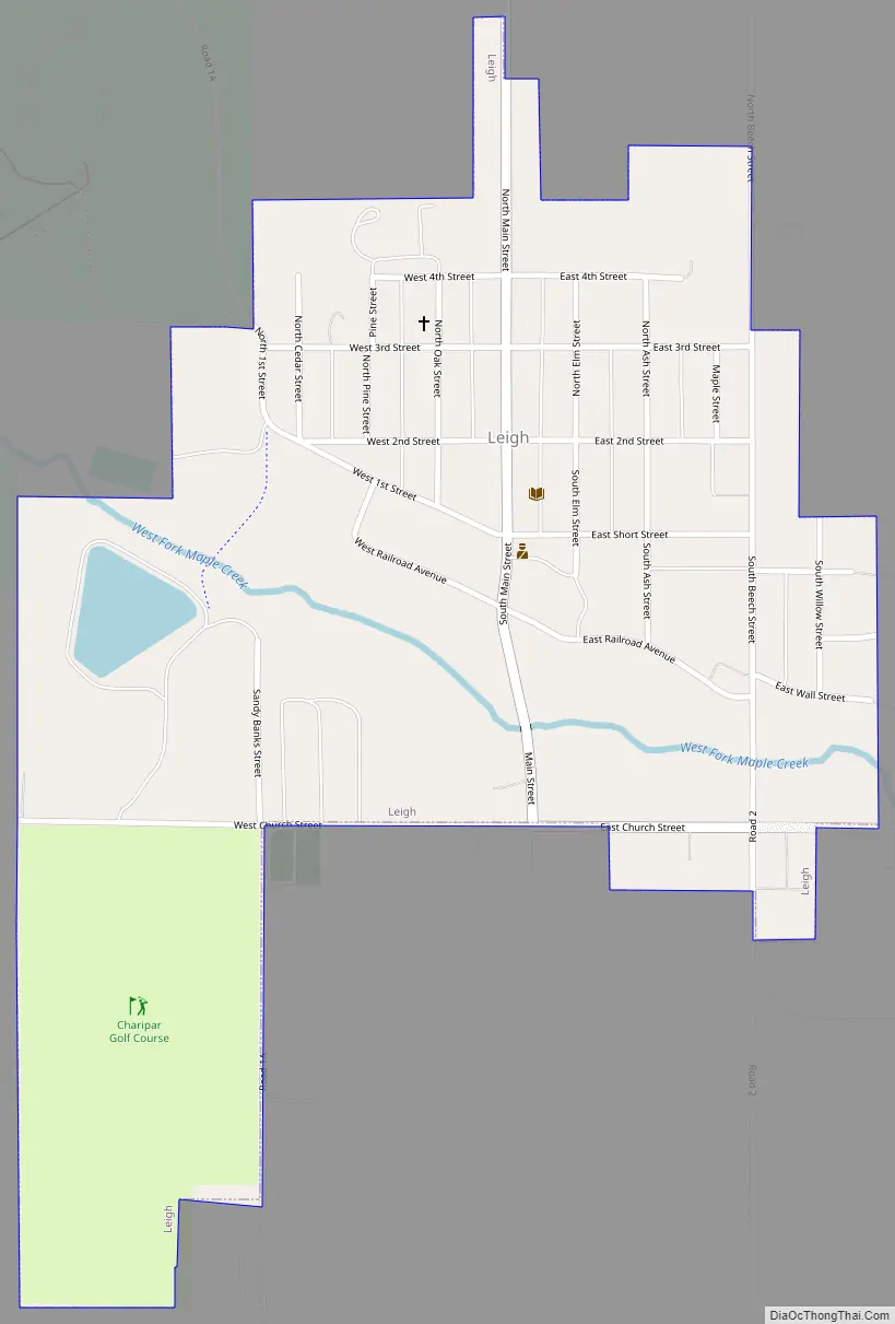
Leigh Road Map
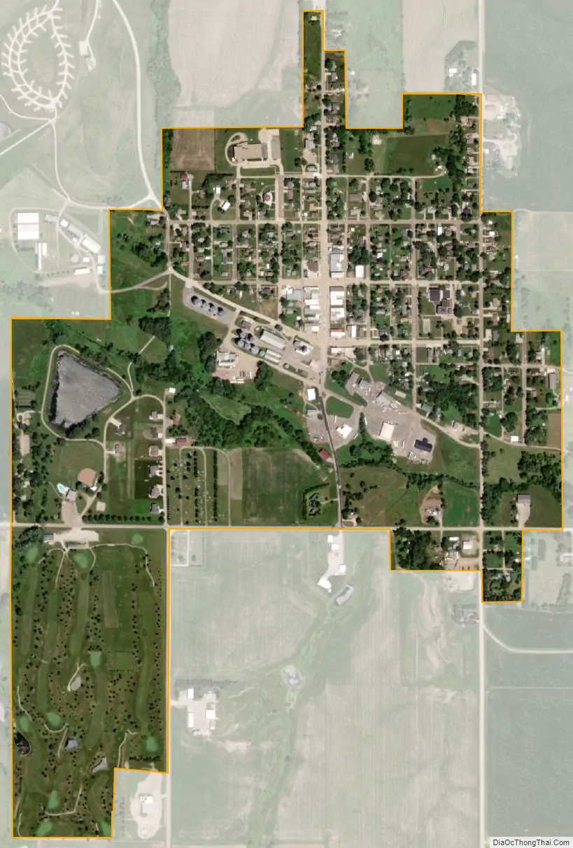
Leigh city Satellite Map
Geography
Leigh is located at 41°42′16″N 97°14′15″W / 41.70444°N 97.23750°W / 41.70444; -97.23750 (41.704544, -97.237586).
According to the United States Census Bureau, the village has a total area of 0.61 square miles (1.58 km), of which 0.60 square miles (1.55 km) is land and 0.01 square miles (0.03 km) is water.
See also
Map of Nebraska State and its subdivision:- Adams
- Antelope
- Arthur
- Banner
- Blaine
- Boone
- Box Butte
- Boyd
- Brown
- Buffalo
- Burt
- Butler
- Cass
- Cedar
- Chase
- Cherry
- Cheyenne
- Clay
- Colfax
- Cuming
- Custer
- Dakota
- Dawes
- Dawson
- Deuel
- Dixon
- Dodge
- Douglas
- Dundy
- Fillmore
- Franklin
- Frontier
- Furnas
- Gage
- Garden
- Garfield
- Gosper
- Grant
- Greeley
- Hall
- Hamilton
- Harlan
- Hayes
- Hitchcock
- Holt
- Hooker
- Howard
- Jefferson
- Johnson
- Kearney
- Keith
- Keya Paha
- Kimball
- Knox
- Lancaster
- Lincoln
- Logan
- Loup
- Madison
- McPherson
- Merrick
- Morrill
- Nance
- Nemaha
- Nuckolls
- Otoe
- Pawnee
- Perkins
- Phelps
- Pierce
- Platte
- Polk
- Red Willow
- Richardson
- Rock
- Saline
- Sarpy
- Saunders
- Scotts Bluff
- Seward
- Sheridan
- Sherman
- Sioux
- Stanton
- Thayer
- Thomas
- Thurston
- Valley
- Washington
- Wayne
- Webster
- Wheeler
- York
- Alabama
- Alaska
- Arizona
- Arkansas
- California
- Colorado
- Connecticut
- Delaware
- District of Columbia
- Florida
- Georgia
- Hawaii
- Idaho
- Illinois
- Indiana
- Iowa
- Kansas
- Kentucky
- Louisiana
- Maine
- Maryland
- Massachusetts
- Michigan
- Minnesota
- Mississippi
- Missouri
- Montana
- Nebraska
- Nevada
- New Hampshire
- New Jersey
- New Mexico
- New York
- North Carolina
- North Dakota
- Ohio
- Oklahoma
- Oregon
- Pennsylvania
- Rhode Island
- South Carolina
- South Dakota
- Tennessee
- Texas
- Utah
- Vermont
- Virginia
- Washington
- West Virginia
- Wisconsin
- Wyoming