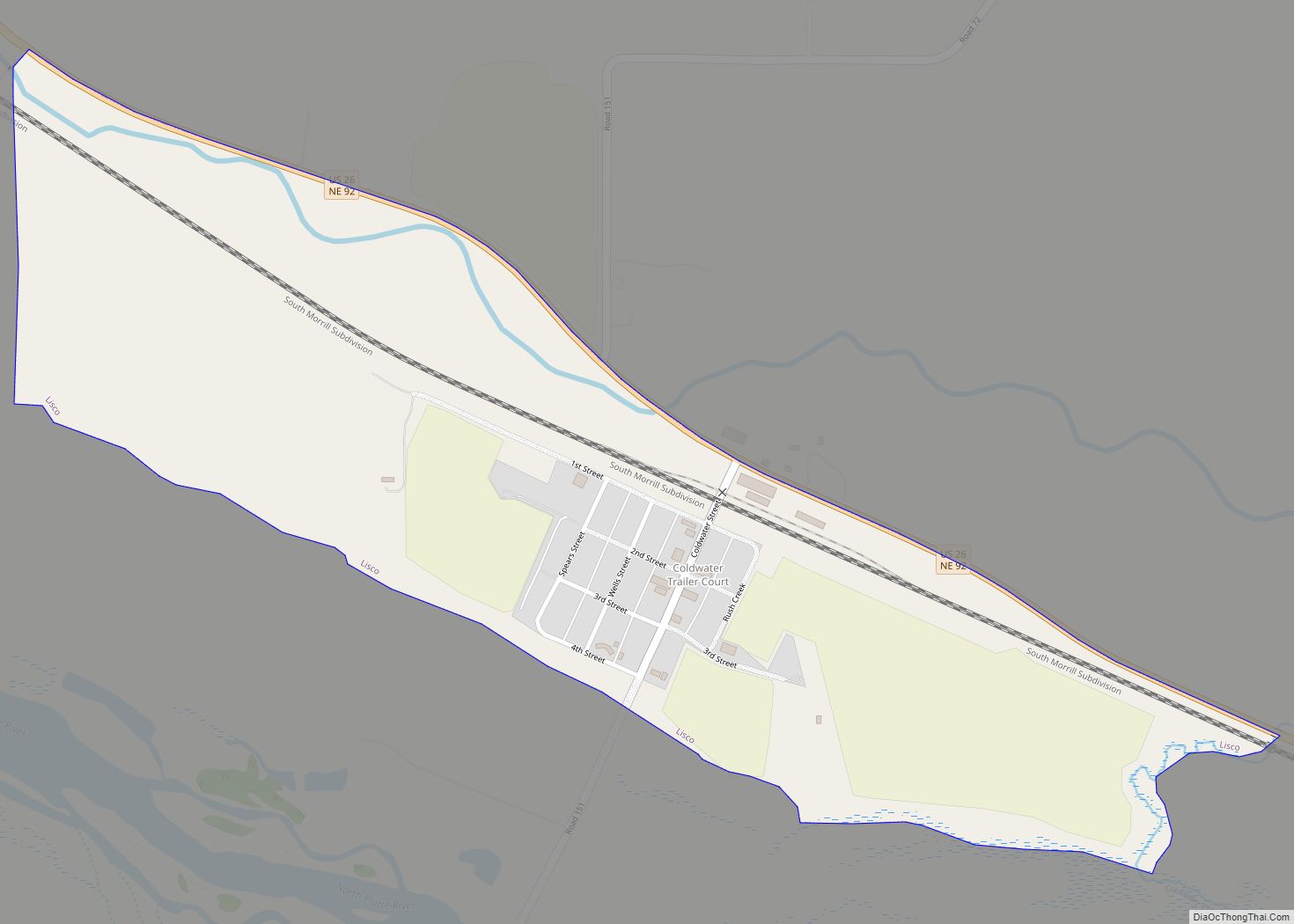
Lisco is an unincorporated community and census-designated place (CDP) in Garden County, Nebraska, United States. The population was 64 at the 2010 census.
| Name: | Lisco CDP |
|---|---|
| LSAD Code: | 57 |
| LSAD Description: | CDP (suffix) |
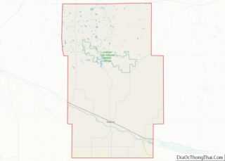
| State: | Nebraska |
| County: | Garden County |
| Elevation: | 3,485 ft (1,062 m) |
| Total Area: | 0.59 sq mi (1.54 km²) |
| Land Area: | 0.59 sq mi (1.54 km²) |
| Water Area: | 0.00 sq mi (0.00 km²) |
| Total Population: | 68 |
| Population Density: | 114.29/sq mi (44.09/km²) |
| ZIP code: | 69148 |
| FIPS code: | 3128315 |
| GNISfeature ID: | 830753 |
Online Interactive Map
Click on ![]() to view map in "full screen" mode.
to view map in "full screen" mode.
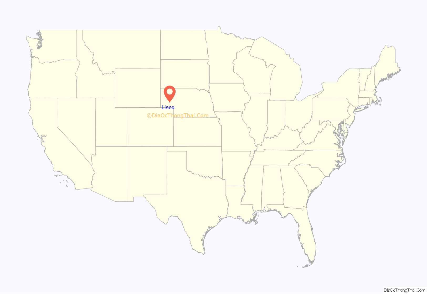
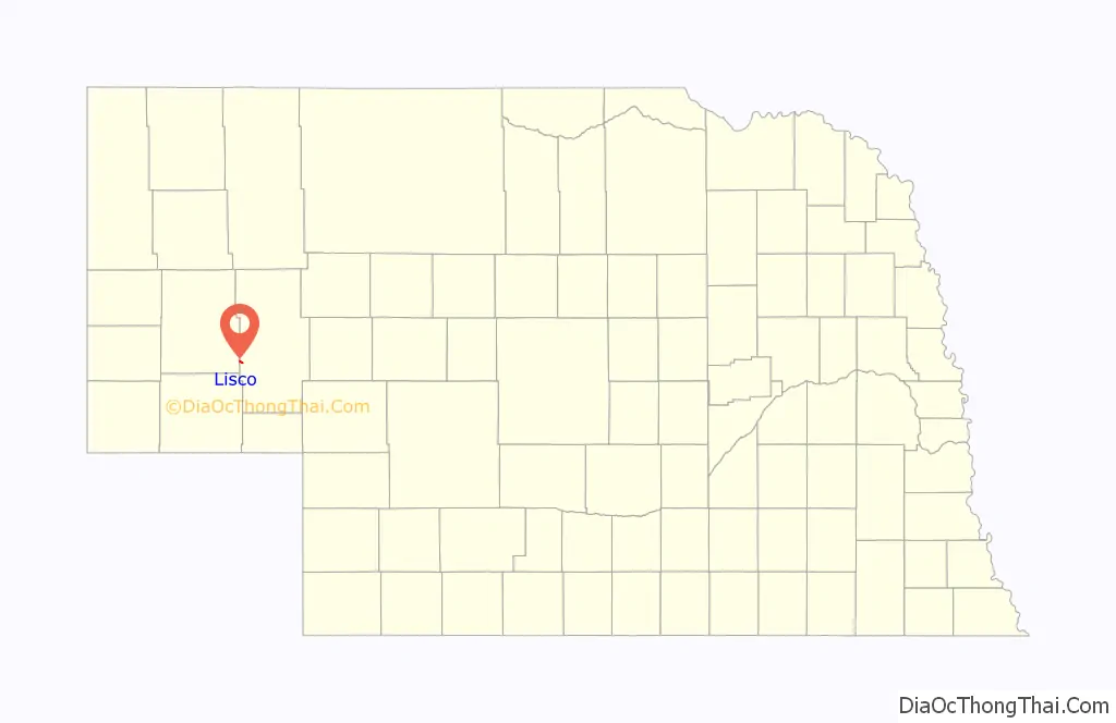
Lisco location map. Where is Lisco CDP?
History
Lisco was laid out in 1909 when the Union Pacific Railroad was extended to that point. The community was named after Reuben Lisco, a cattleman who owned about 40,000 acres (16,000 ha) of land in the area, including the land on which the town currently stands. Mr. Lisco later became the president of the Lisco State Bank.
In the 2000 United States Census, the community of Lisco was mistakenly called “Cisco” by the Census Bureau. The surrounding census county division (CCD) was still called Lisco. By 2005, the Census Bureau had realized its error, stating that “Lisco census designated place (CDP) is erroneously shown…with the name ‘Cisco.'”
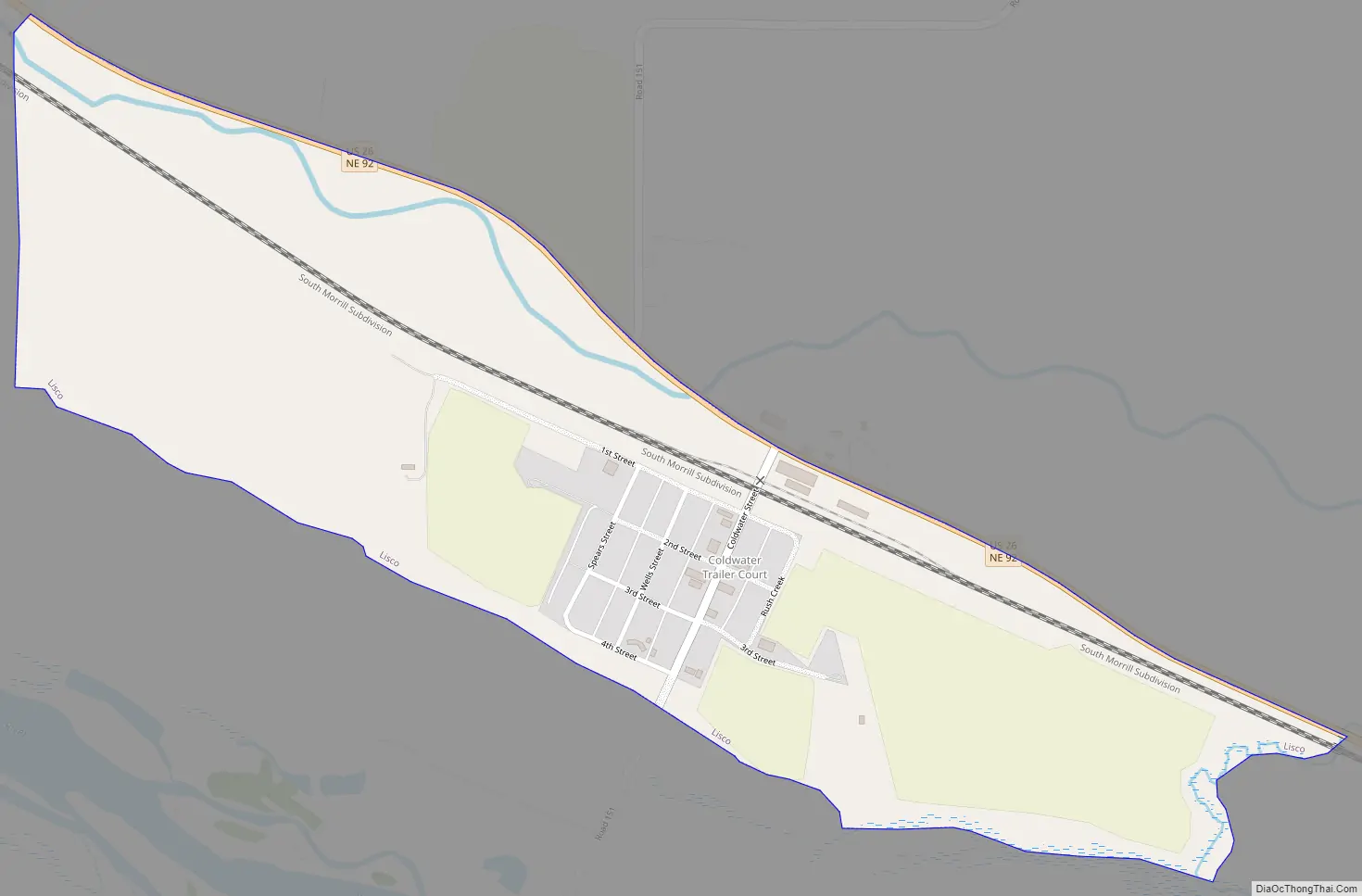
Lisco Road Map
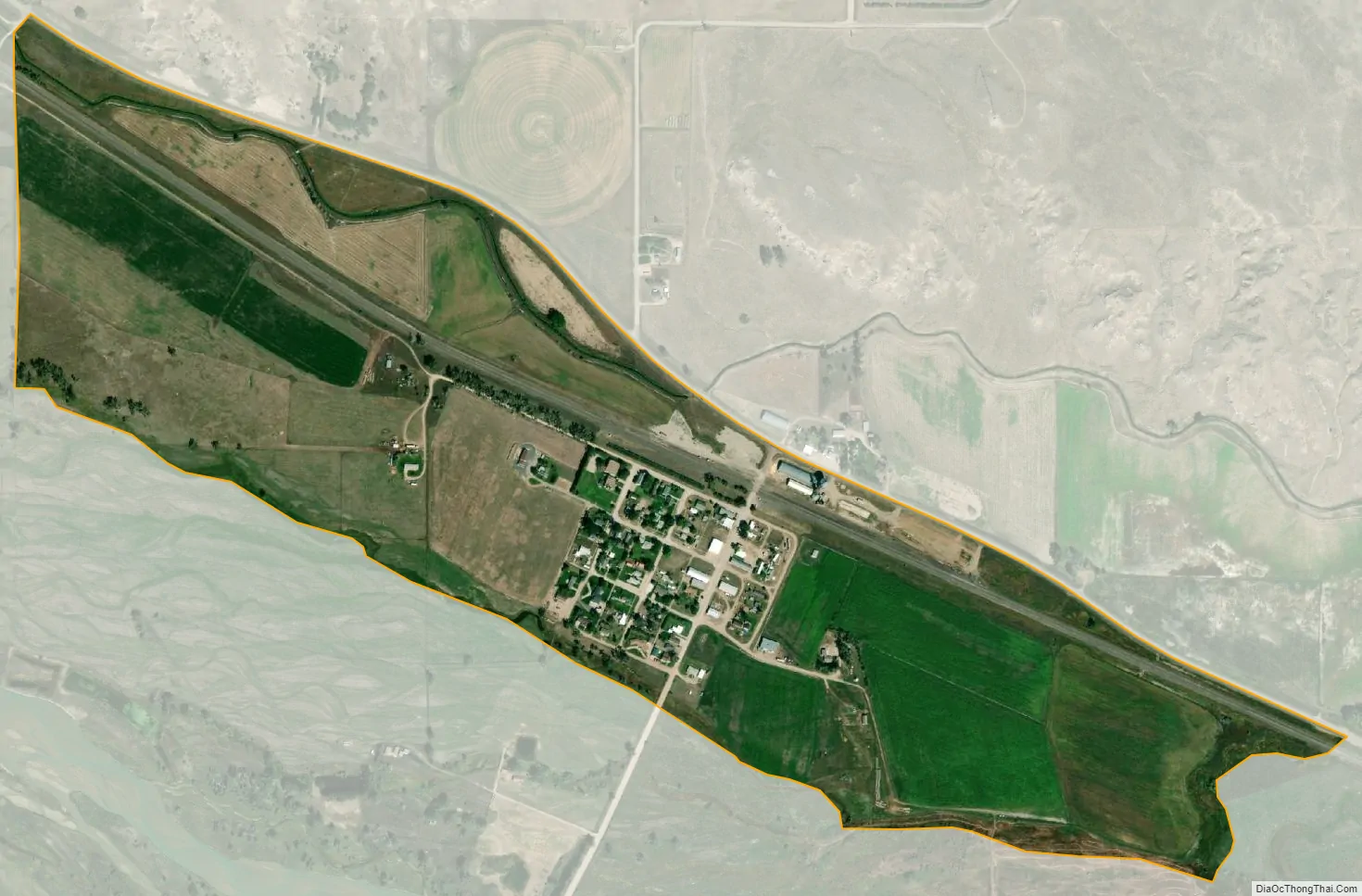
Lisco city Satellite Map
Geography
Lisco is located in western Garden County at 41°29′50″N 102°37′13″W / 41.49722°N 102.62028°W / 41.49722; -102.62028 (41.4972022, -102.6201979), on the north side of the valley of the North Platte River. The western border of Lisco follows the Morrill County line. U.S. Route 26 passes through the community, leading northwest 29 miles (47 km) to Bridgeport and southeast 58 miles (93 km) to Ogallala.
According to the United States Census Bureau, the Lisco CDP has a total area of 0.60 square miles (1.55 km), all land.
See also
Map of Nebraska State and its subdivision:- Adams
- Antelope
- Arthur
- Banner
- Blaine
- Boone
- Box Butte
- Boyd
- Brown
- Buffalo
- Burt
- Butler
- Cass
- Cedar
- Chase
- Cherry
- Cheyenne
- Clay
- Colfax
- Cuming
- Custer
- Dakota
- Dawes
- Dawson
- Deuel
- Dixon
- Dodge
- Douglas
- Dundy
- Fillmore
- Franklin
- Frontier
- Furnas
- Gage
- Garden
- Garfield
- Gosper
- Grant
- Greeley
- Hall
- Hamilton
- Harlan
- Hayes
- Hitchcock
- Holt
- Hooker
- Howard
- Jefferson
- Johnson
- Kearney
- Keith
- Keya Paha
- Kimball
- Knox
- Lancaster
- Lincoln
- Logan
- Loup
- Madison
- McPherson
- Merrick
- Morrill
- Nance
- Nemaha
- Nuckolls
- Otoe
- Pawnee
- Perkins
- Phelps
- Pierce
- Platte
- Polk
- Red Willow
- Richardson
- Rock
- Saline
- Sarpy
- Saunders
- Scotts Bluff
- Seward
- Sheridan
- Sherman
- Sioux
- Stanton
- Thayer
- Thomas
- Thurston
- Valley
- Washington
- Wayne
- Webster
- Wheeler
- York
- Alabama
- Alaska
- Arizona
- Arkansas
- California
- Colorado
- Connecticut
- Delaware
- District of Columbia
- Florida
- Georgia
- Hawaii
- Idaho
- Illinois
- Indiana
- Iowa
- Kansas
- Kentucky
- Louisiana
- Maine
- Maryland
- Massachusetts
- Michigan
- Minnesota
- Mississippi
- Missouri
- Montana
- Nebraska
- Nevada
- New Hampshire
- New Jersey
- New Mexico
- New York
- North Carolina
- North Dakota
- Ohio
- Oklahoma
- Oregon
- Pennsylvania
- Rhode Island
- South Carolina
- South Dakota
- Tennessee
- Texas
- Utah
- Vermont
- Virginia
- Washington
- West Virginia
- Wisconsin
- Wyoming