Louisville is a city in northern Cass County, Nebraska, United States. The population was 1,319 at the 2020 census.
| Name: | Louisville city |
|---|---|
| LSAD Code: | 25 |
| LSAD Description: | city (suffix) |
| State: | Nebraska |
| County: | Cass County |
| Elevation: | 1,040 ft (320 m) |
| Total Area: | 0.65 sq mi (1.68 km²) |
| Land Area: | 0.65 sq mi (1.68 km²) |
| Water Area: | 0.00 sq mi (0.00 km²) |
| Total Population: | 1,319 |
| Population Density: | 2,032.36/sq mi (784.30/km²) |
| ZIP code: | 68037 |
| Area code: | 402 |
| FIPS code: | 3129260 |
| GNISfeature ID: | 2395772 |
| Website: | https://www.louisvillenebraska.com |
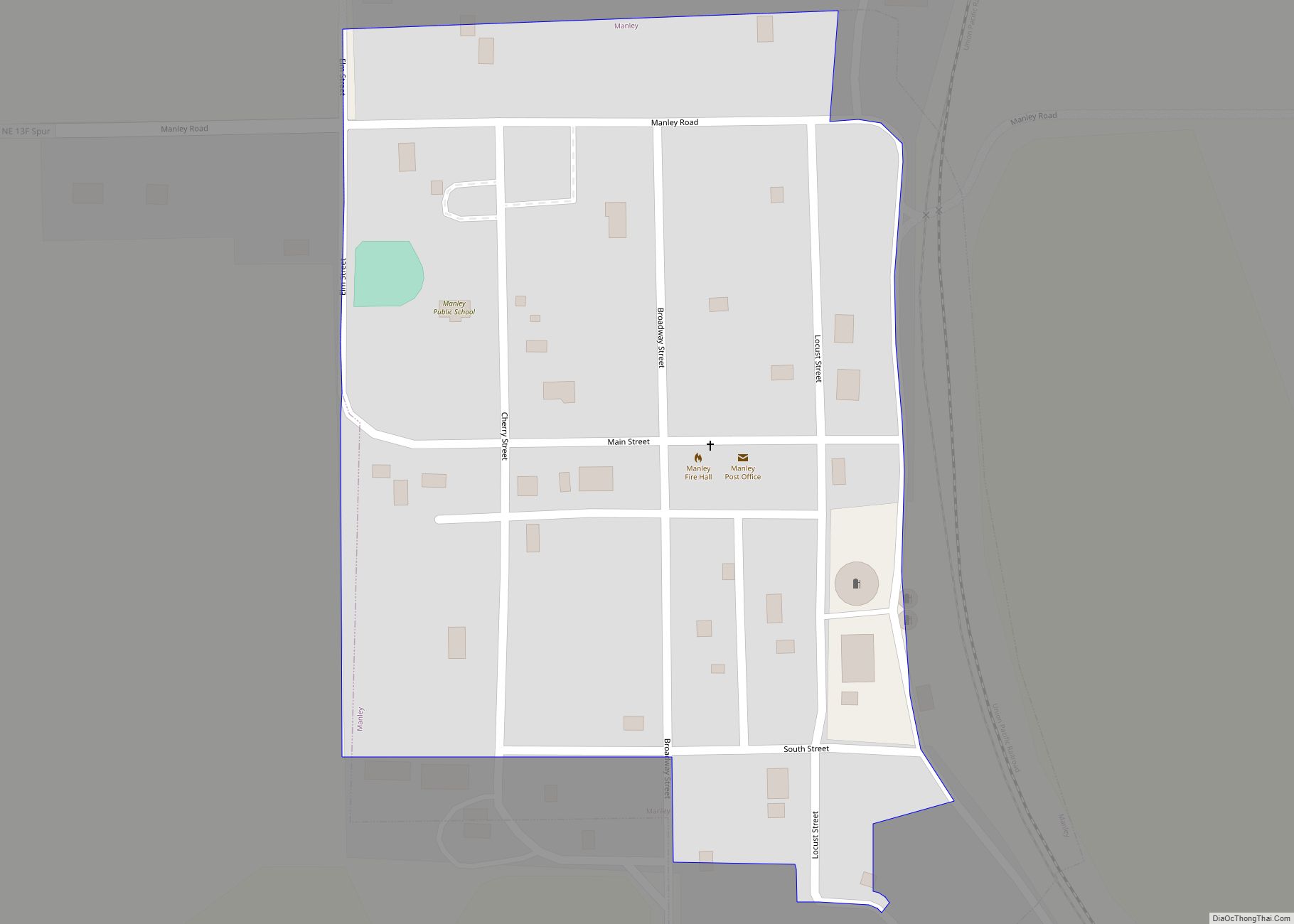
Online Interactive Map
Click on ![]() to view map in "full screen" mode.
to view map in "full screen" mode.
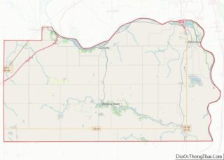
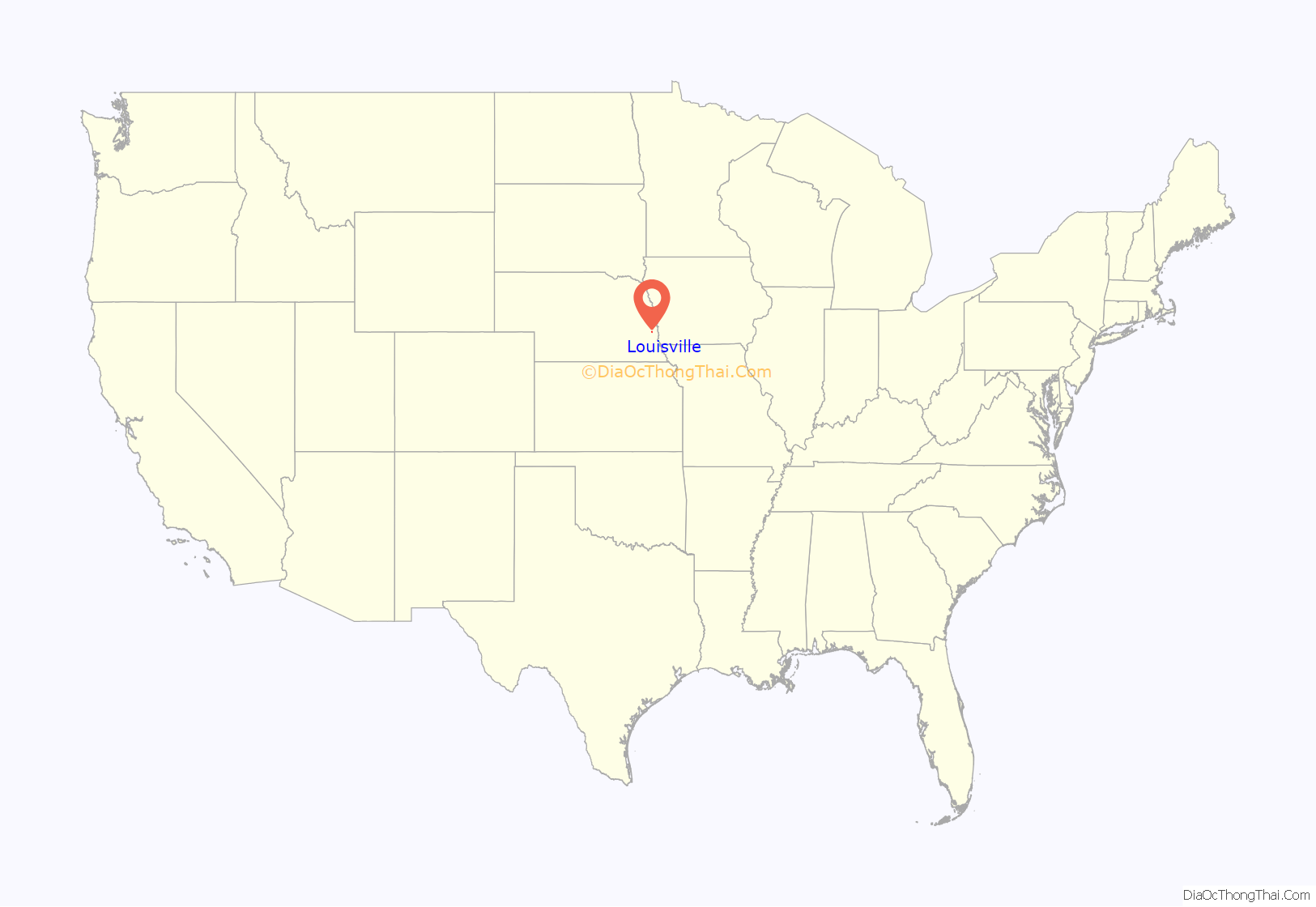
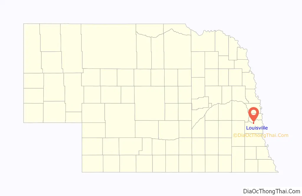
Louisville location map. Where is Louisville city?
History
The first permanent settlement at Louisville was made in 1857. Louisville was platted in about 1870 when the Burlington & Missouri River Railroad was extended to that point. The community was likely named after the city of Louisville, Kentucky. A folk etymology maintains the name Louisville is derived from one Mr. Lois, the proprietor of a local gristmill. The current mayor of Louisville is Rodney Petersen, a lifelong resident of the city.
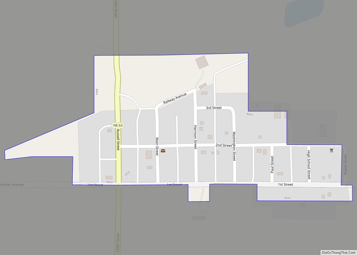
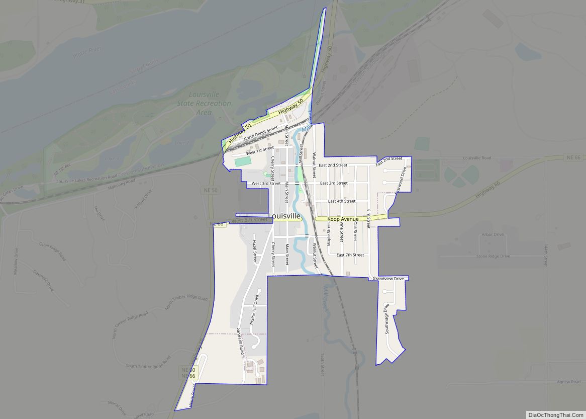
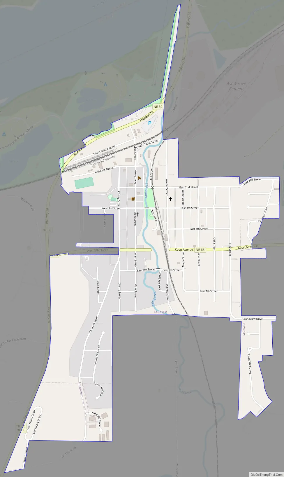
Louisville Road Map
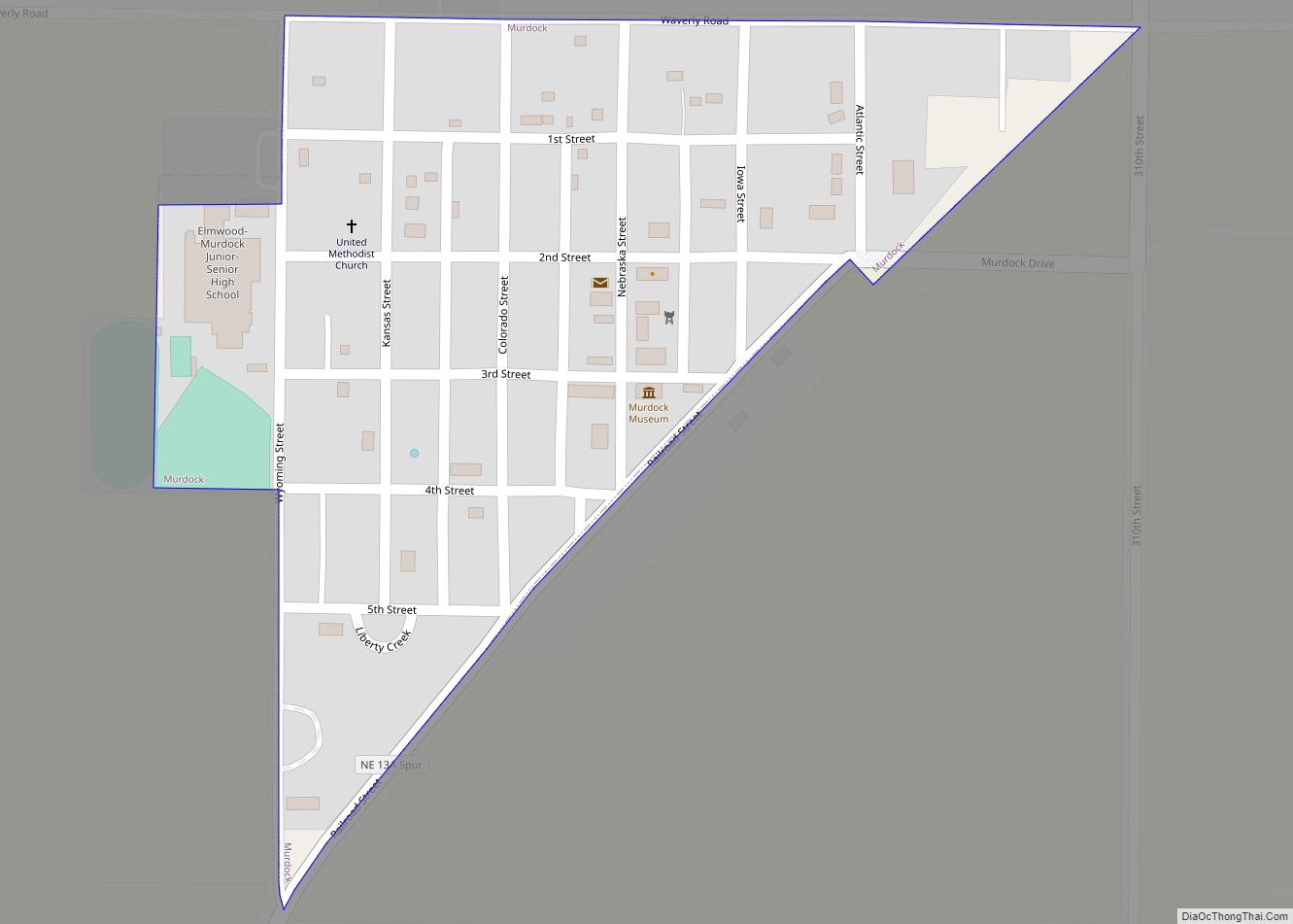
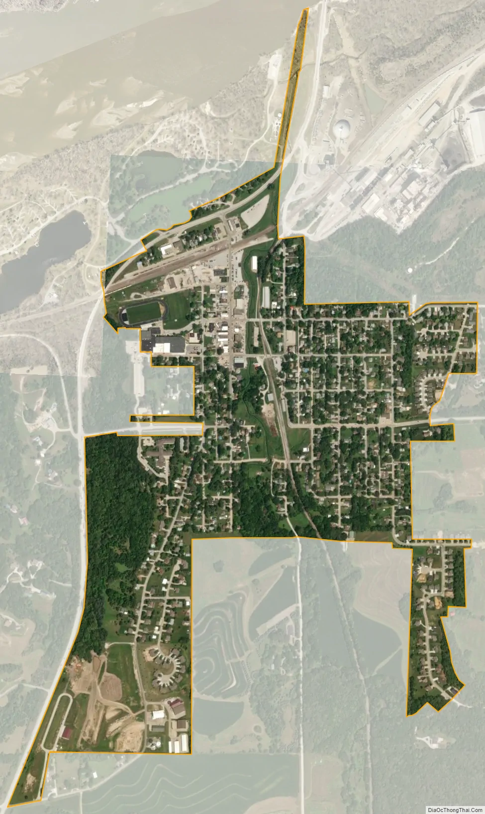
Louisville city Satellite Map
Geography
According to the United States Census Bureau, the city has a total area of 0.57 square miles (1.48 km), all land.
See also
Map of Nebraska State and its subdivision:- Adams
- Antelope
- Arthur
- Banner
- Blaine
- Boone
- Box Butte
- Boyd
- Brown
- Buffalo
- Burt
- Butler
- Cass
- Cedar
- Chase
- Cherry
- Cheyenne
- Clay
- Colfax
- Cuming
- Custer
- Dakota
- Dawes
- Dawson
- Deuel
- Dixon
- Dodge
- Douglas
- Dundy
- Fillmore
- Franklin
- Frontier
- Furnas
- Gage
- Garden
- Garfield
- Gosper
- Grant
- Greeley
- Hall
- Hamilton
- Harlan
- Hayes
- Hitchcock
- Holt
- Hooker
- Howard
- Jefferson
- Johnson
- Kearney
- Keith
- Keya Paha
- Kimball
- Knox
- Lancaster
- Lincoln
- Logan
- Loup
- Madison
- McPherson
- Merrick
- Morrill
- Nance
- Nemaha
- Nuckolls
- Otoe
- Pawnee
- Perkins
- Phelps
- Pierce
- Platte
- Polk
- Red Willow
- Richardson
- Rock
- Saline
- Sarpy
- Saunders
- Scotts Bluff
- Seward
- Sheridan
- Sherman
- Sioux
- Stanton
- Thayer
- Thomas
- Thurston
- Valley
- Washington
- Wayne
- Webster
- Wheeler
- York
- Alabama
- Alaska
- Arizona
- Arkansas
- California
- Colorado
- Connecticut
- Delaware
- District of Columbia
- Florida
- Georgia
- Hawaii
- Idaho
- Illinois
- Indiana
- Iowa
- Kansas
- Kentucky
- Louisiana
- Maine
- Maryland
- Massachusetts
- Michigan
- Minnesota
- Mississippi
- Missouri
- Montana
- Nebraska
- Nevada
- New Hampshire
- New Jersey
- New Mexico
- New York
- North Carolina
- North Dakota
- Ohio
- Oklahoma
- Oregon
- Pennsylvania
- Rhode Island
- South Carolina
- South Dakota
- Tennessee
- Texas
- Utah
- Vermont
- Virginia
- Washington
- West Virginia
- Wisconsin
- Wyoming