Merna is a village in Custer County, Nebraska, United States. The population was 363 at the 2010 census.
| Name: | Merna village |
|---|---|
| LSAD Code: | 47 |
| LSAD Description: | village (suffix) |
| State: | Nebraska |
| County: | Custer County |
| Elevation: | 2,664 ft (812 m) |
| Total Area: | 0.54 sq mi (1.39 km²) |
| Land Area: | 0.54 sq mi (1.39 km²) |
| Water Area: | 0.00 sq mi (0.00 km²) |
| Total Population: | 343 |
| Population Density: | 639.93/sq mi (247.26/km²) |
| ZIP code: | 68856 |
| Area code: | 308 |
| FIPS code: | 3131780 |
| GNISfeature ID: | 0831232 |
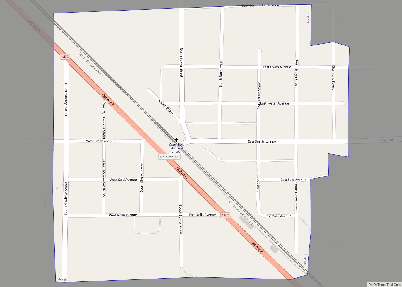
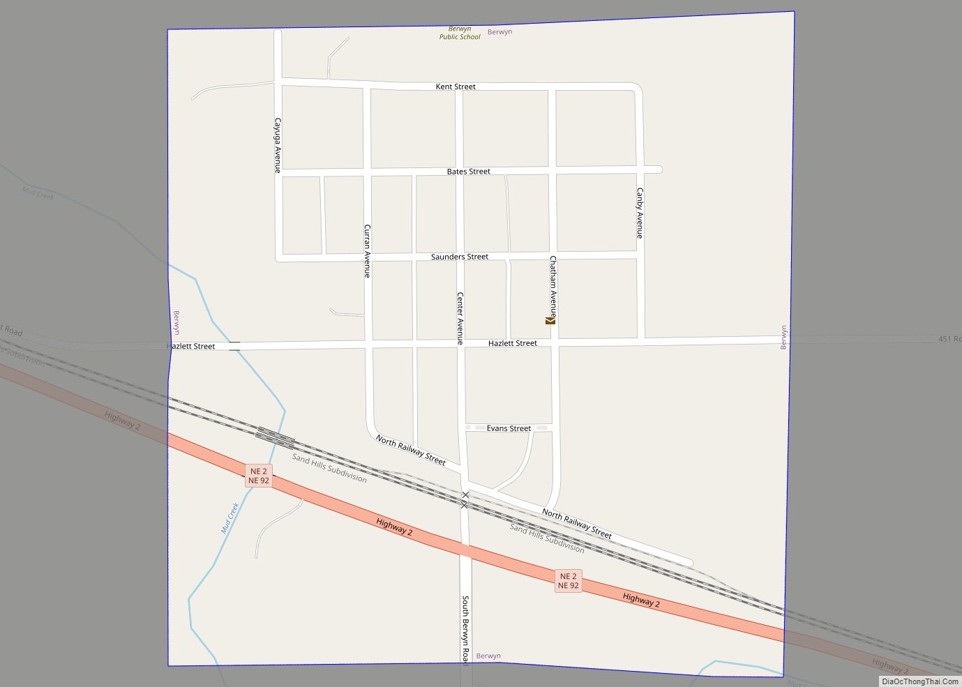
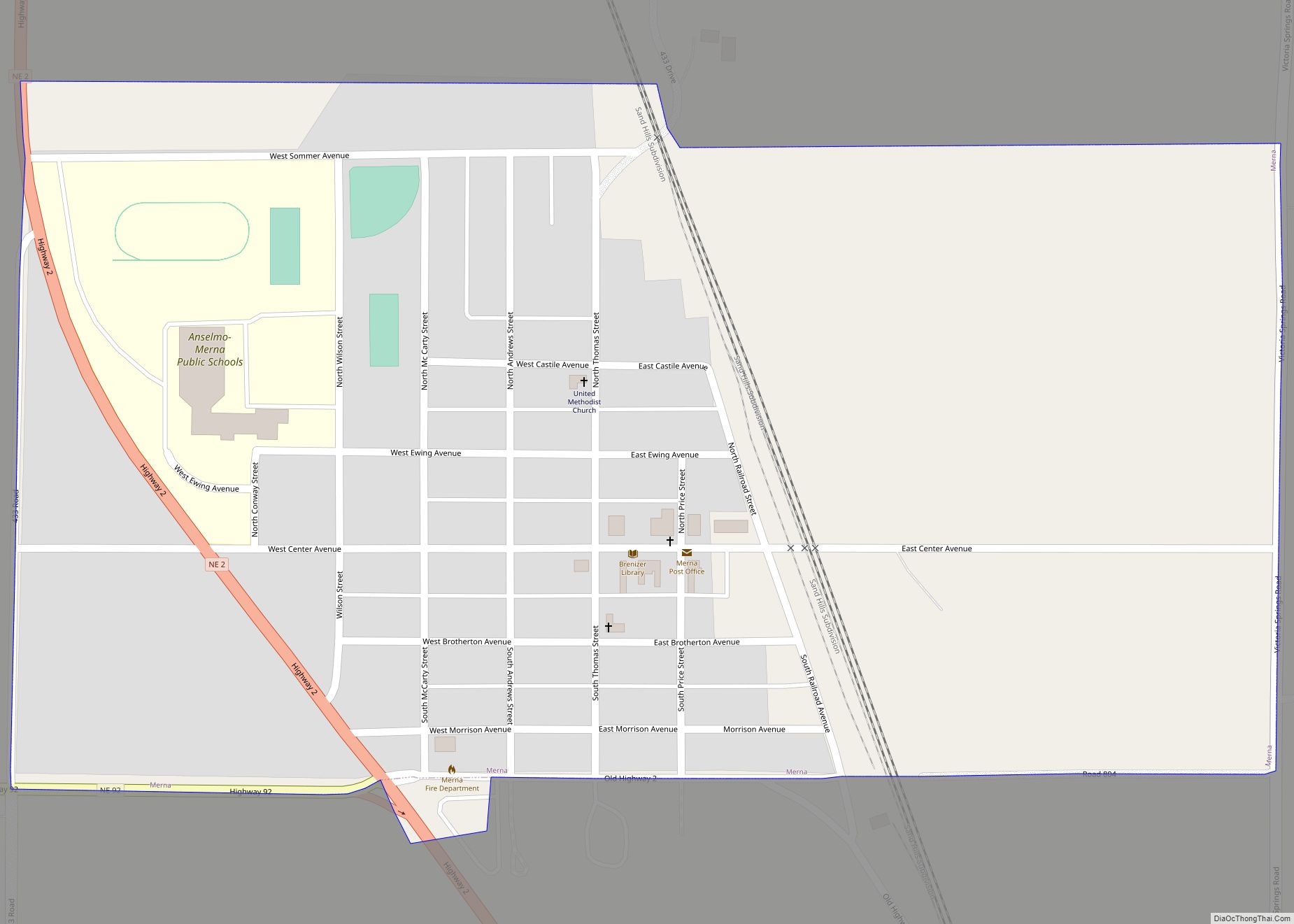
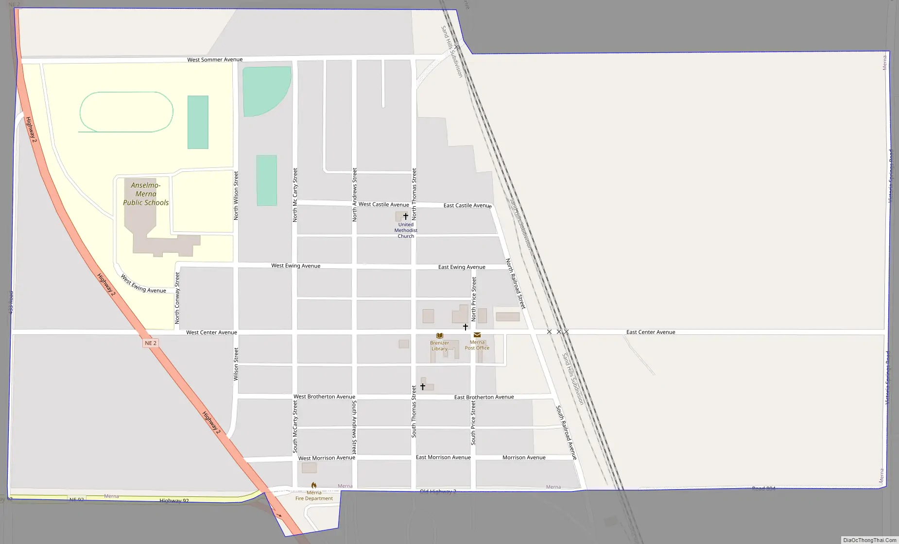
Online Interactive Map
Click on ![]() to view map in "full screen" mode.
to view map in "full screen" mode.
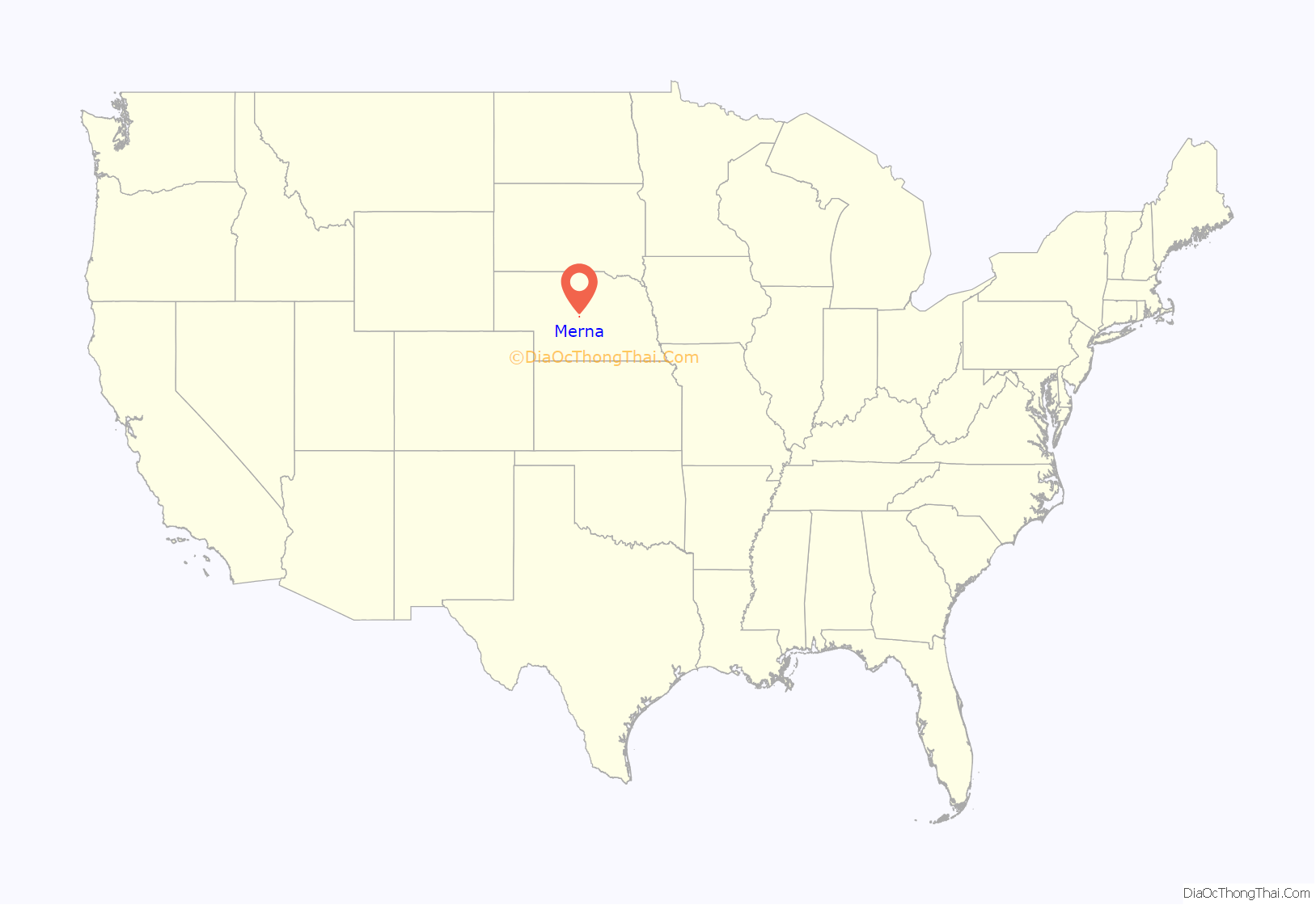
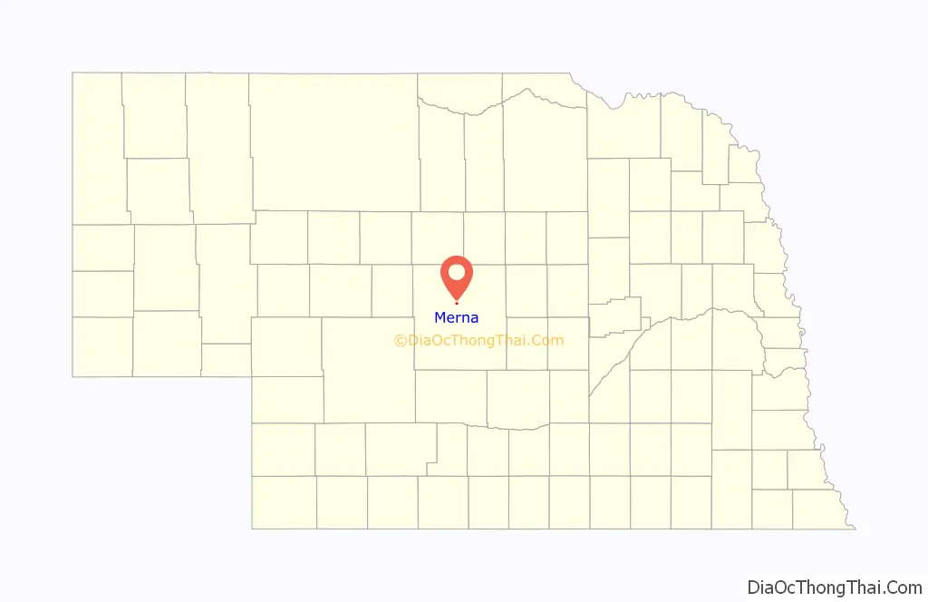
Merna location map. Where is Merna village?
History
Merna was founded in the 1880s about the time the railroad was extended to that point. It was named Merna in honor of the young daughter of the first postmaster.
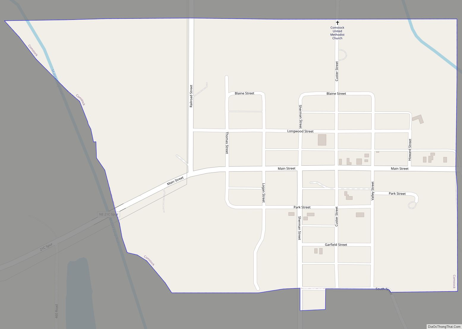
Merna Road Map
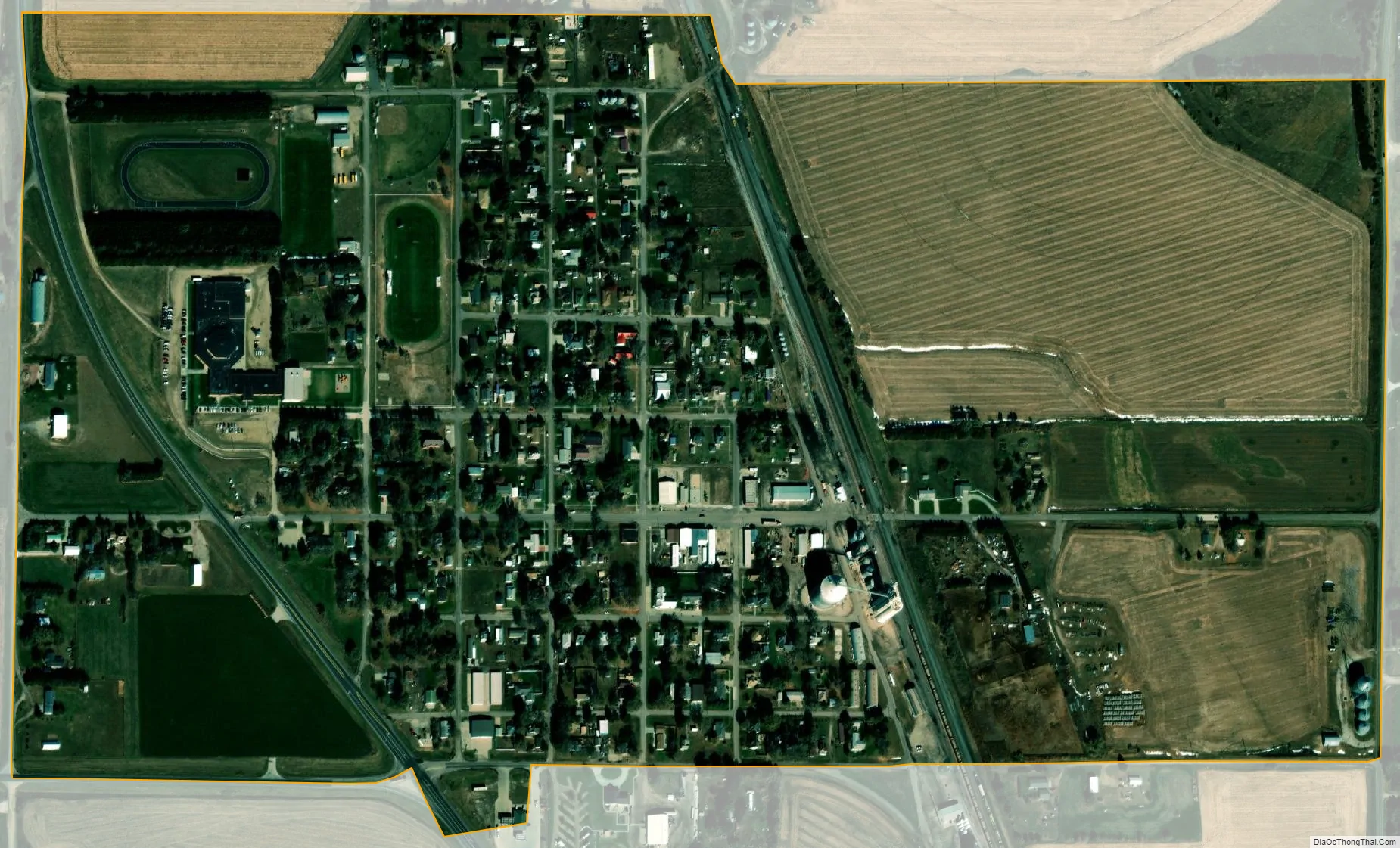
Merna city Satellite Map
Geography
Merna is located at 41°29′5″N 99°45′44″W / 41.48472°N 99.76222°W / 41.48472; -99.76222 (41.484618, -99.762293).
According to the United States Census Bureau, the village has a total area of 0.54 square miles (1.40 km), all land.
Recently, Merna was at the center of a geological controversy regarding a depression in the land several miles west of town in the loess hills. Originally called the Bartak Depression after the owners of the land, it was redubbed the Merna Crater by University of Kansas geology professor Wakefield Dort, Jr. Further research showed the crater to be more likely formed by wind and water erosion, but memories of the flurry of importance in the small town remain.
See also
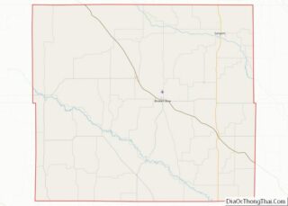
Map of Nebraska State and its subdivision:- Adams
- Antelope
- Arthur
- Banner
- Blaine
- Boone
- Box Butte
- Boyd
- Brown
- Buffalo
- Burt
- Butler
- Cass
- Cedar
- Chase
- Cherry
- Cheyenne
- Clay
- Colfax
- Cuming
- Custer
- Dakota
- Dawes
- Dawson
- Deuel
- Dixon
- Dodge
- Douglas
- Dundy
- Fillmore
- Franklin
- Frontier
- Furnas
- Gage
- Garden
- Garfield
- Gosper
- Grant
- Greeley
- Hall
- Hamilton
- Harlan
- Hayes
- Hitchcock
- Holt
- Hooker
- Howard
- Jefferson
- Johnson
- Kearney
- Keith
- Keya Paha
- Kimball
- Knox
- Lancaster
- Lincoln
- Logan
- Loup
- Madison
- McPherson
- Merrick
- Morrill
- Nance
- Nemaha
- Nuckolls
- Otoe
- Pawnee
- Perkins
- Phelps
- Pierce
- Platte
- Polk
- Red Willow
- Richardson
- Rock
- Saline
- Sarpy
- Saunders
- Scotts Bluff
- Seward
- Sheridan
- Sherman
- Sioux
- Stanton
- Thayer
- Thomas
- Thurston
- Valley
- Washington
- Wayne
- Webster
- Wheeler
- York
- Alabama
- Alaska
- Arizona
- Arkansas
- California
- Colorado
- Connecticut
- Delaware
- District of Columbia
- Florida
- Georgia
- Hawaii
- Idaho
- Illinois
- Indiana
- Iowa
- Kansas
- Kentucky
- Louisiana
- Maine
- Maryland
- Massachusetts
- Michigan
- Minnesota
- Mississippi
- Missouri
- Montana
- Nebraska
- Nevada
- New Hampshire
- New Jersey
- New Mexico
- New York
- North Carolina
- North Dakota
- Ohio
- Oklahoma
- Oregon
- Pennsylvania
- Rhode Island
- South Carolina
- South Dakota
- Tennessee
- Texas
- Utah
- Vermont
- Virginia
- Washington
- West Virginia
- Wisconsin
- Wyoming