Minden is a city in, and the county seat of, Kearney County, Nebraska, United States. The population was 2,923 at the 2010 census. It is home of the Pioneer Village museum complex.
| Name: | Minden city |
|---|---|
| LSAD Code: | 25 |
| LSAD Description: | city (suffix) |
| State: | Nebraska |
| County: | Kearney County |
| Elevation: | 2,172 ft (662 m) |
| Total Area: | 2.20 sq mi (5.71 km²) |
| Land Area: | 2.20 sq mi (5.71 km²) |
| Water Area: | 0.00 sq mi (0.00 km²) |
| Total Population: | 3,118 |
| Population Density: | 1,415.34/sq mi (546.36/km²) |
| ZIP code: | 68959 |
| Area code: | 308 |
| FIPS code: | 3132340 |
| Website: | MindenNebraska.org |
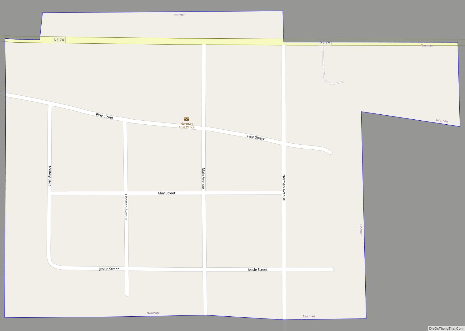
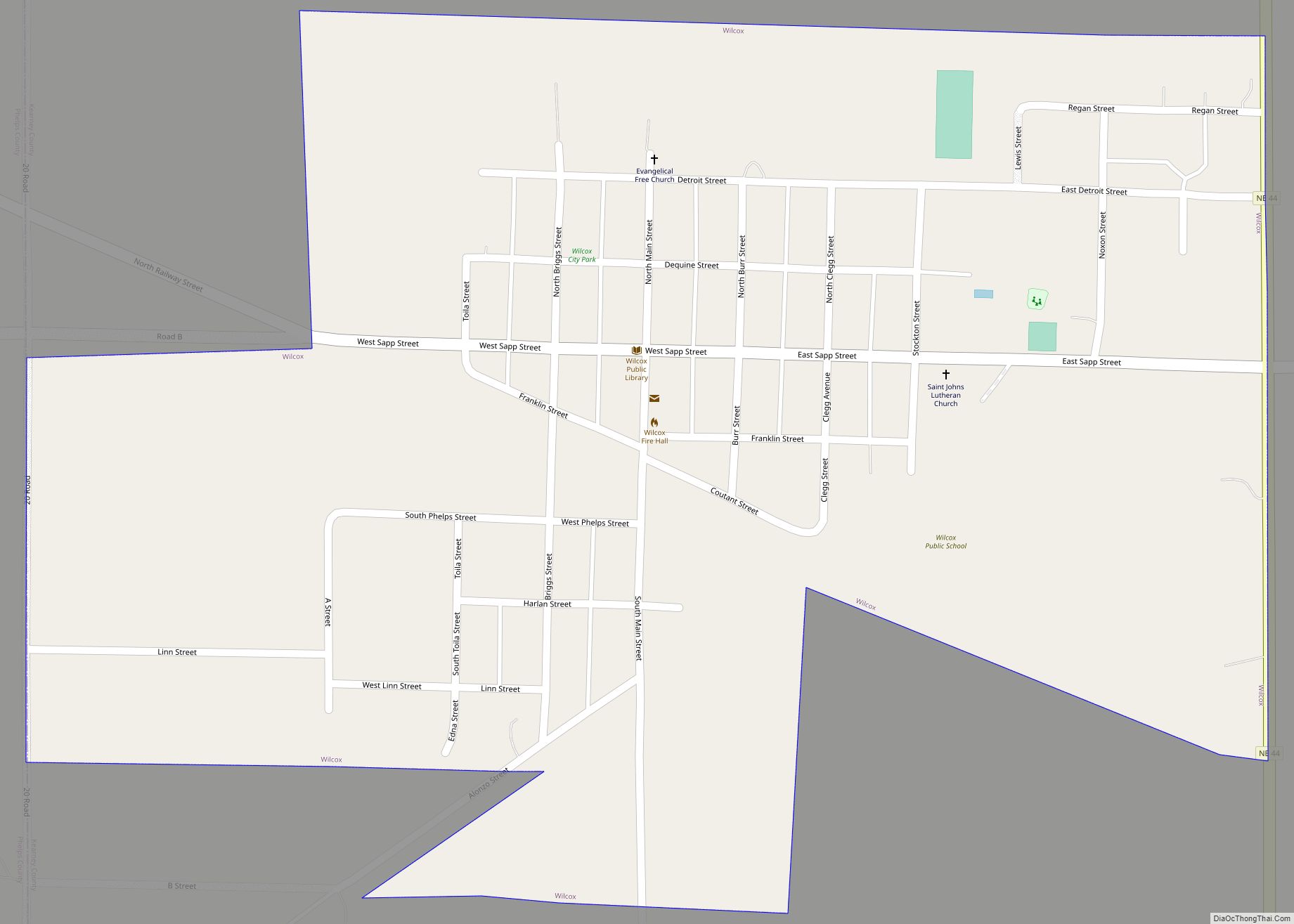
Online Interactive Map
Click on ![]() to view map in "full screen" mode.
to view map in "full screen" mode.
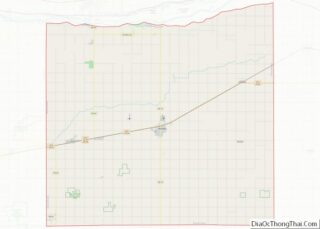
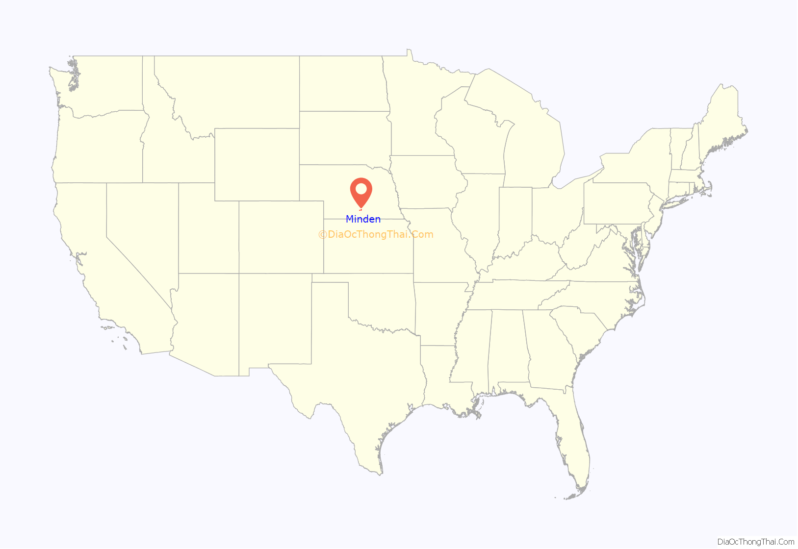
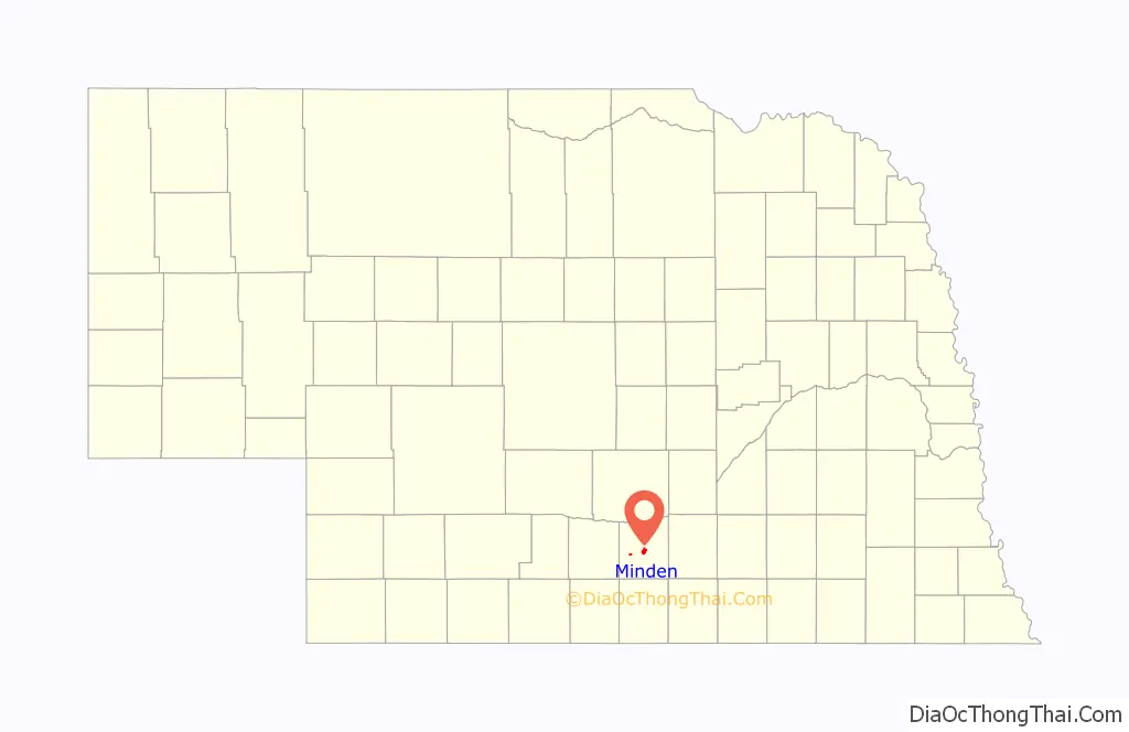
Minden location map. Where is Minden city?
History
Minden was established in 1876. The city was named after Minden, in Germany. Minden was originally built up chiefly by Germans. It has possessed a post office since 1876.
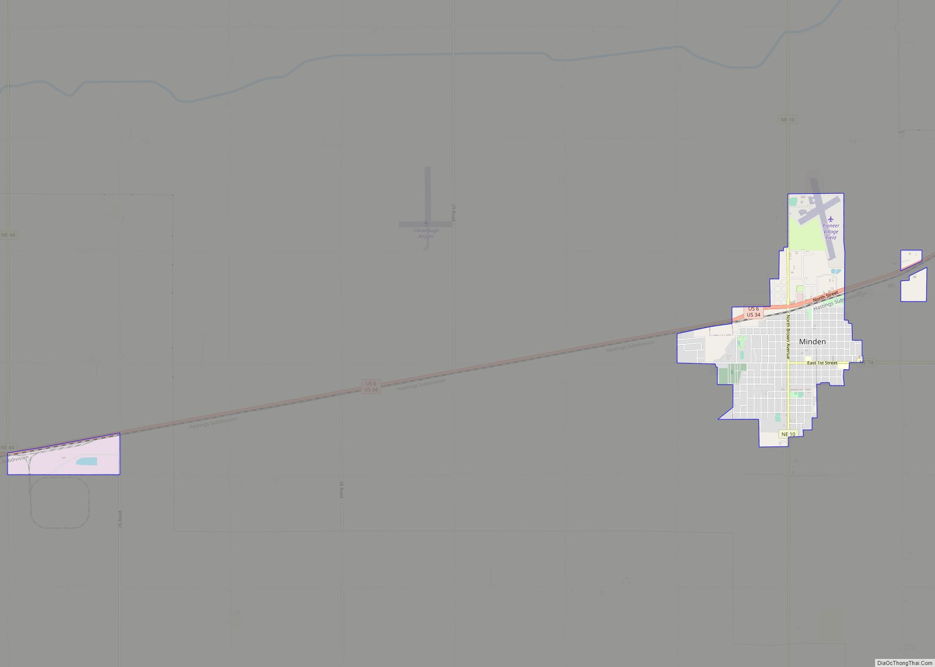
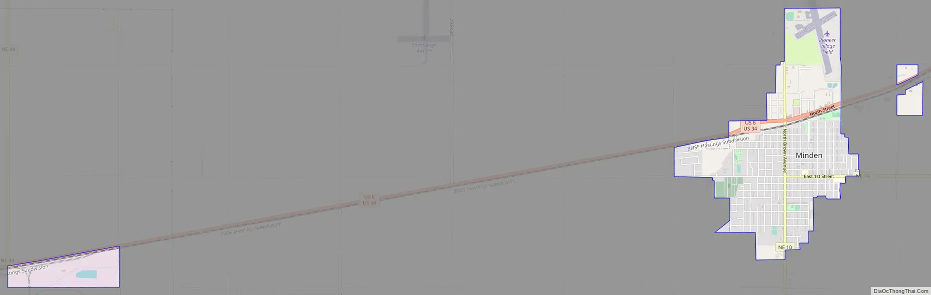
Minden Road Map
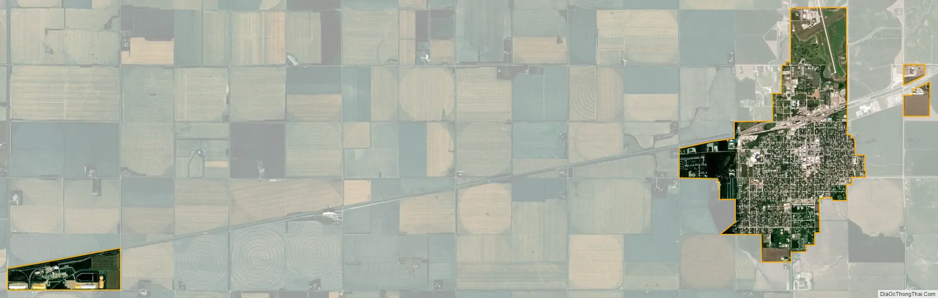
Minden city Satellite Map
Geography
Minden is located at 40°29′53″N 98°57′4″W / 40.49806°N 98.95111°W / 40.49806; -98.95111 (40.498114, -98.951091). According to the United States Census Bureau, the city has a total area of 2.15 square miles (5.57 km), all land.
See also
Map of Nebraska State and its subdivision:- Adams
- Antelope
- Arthur
- Banner
- Blaine
- Boone
- Box Butte
- Boyd
- Brown
- Buffalo
- Burt
- Butler
- Cass
- Cedar
- Chase
- Cherry
- Cheyenne
- Clay
- Colfax
- Cuming
- Custer
- Dakota
- Dawes
- Dawson
- Deuel
- Dixon
- Dodge
- Douglas
- Dundy
- Fillmore
- Franklin
- Frontier
- Furnas
- Gage
- Garden
- Garfield
- Gosper
- Grant
- Greeley
- Hall
- Hamilton
- Harlan
- Hayes
- Hitchcock
- Holt
- Hooker
- Howard
- Jefferson
- Johnson
- Kearney
- Keith
- Keya Paha
- Kimball
- Knox
- Lancaster
- Lincoln
- Logan
- Loup
- Madison
- McPherson
- Merrick
- Morrill
- Nance
- Nemaha
- Nuckolls
- Otoe
- Pawnee
- Perkins
- Phelps
- Pierce
- Platte
- Polk
- Red Willow
- Richardson
- Rock
- Saline
- Sarpy
- Saunders
- Scotts Bluff
- Seward
- Sheridan
- Sherman
- Sioux
- Stanton
- Thayer
- Thomas
- Thurston
- Valley
- Washington
- Wayne
- Webster
- Wheeler
- York
- Alabama
- Alaska
- Arizona
- Arkansas
- California
- Colorado
- Connecticut
- Delaware
- District of Columbia
- Florida
- Georgia
- Hawaii
- Idaho
- Illinois
- Indiana
- Iowa
- Kansas
- Kentucky
- Louisiana
- Maine
- Maryland
- Massachusetts
- Michigan
- Minnesota
- Mississippi
- Missouri
- Montana
- Nebraska
- Nevada
- New Hampshire
- New Jersey
- New Mexico
- New York
- North Carolina
- North Dakota
- Ohio
- Oklahoma
- Oregon
- Pennsylvania
- Rhode Island
- South Carolina
- South Dakota
- Tennessee
- Texas
- Utah
- Vermont
- Virginia
- Washington
- West Virginia
- Wisconsin
- Wyoming